Note: On dirt roads, road conditions can change constantly. Therefore, we strongly recommend that everyone check the road conditions before each trip. Information can be obtained at the BLM Visitor Centers in Big Water and Kanab, or in the Paria Contact Station. Before reported, during or shortly after rain or snowfall, we advise against driving on unpaved roads.
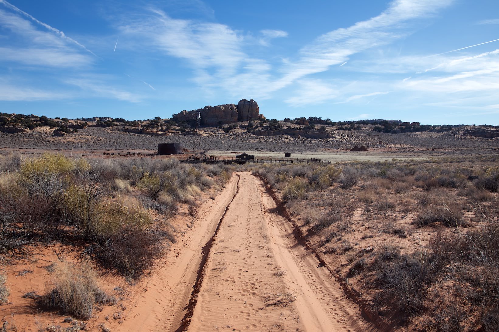
On the way to Pinnacle Valley
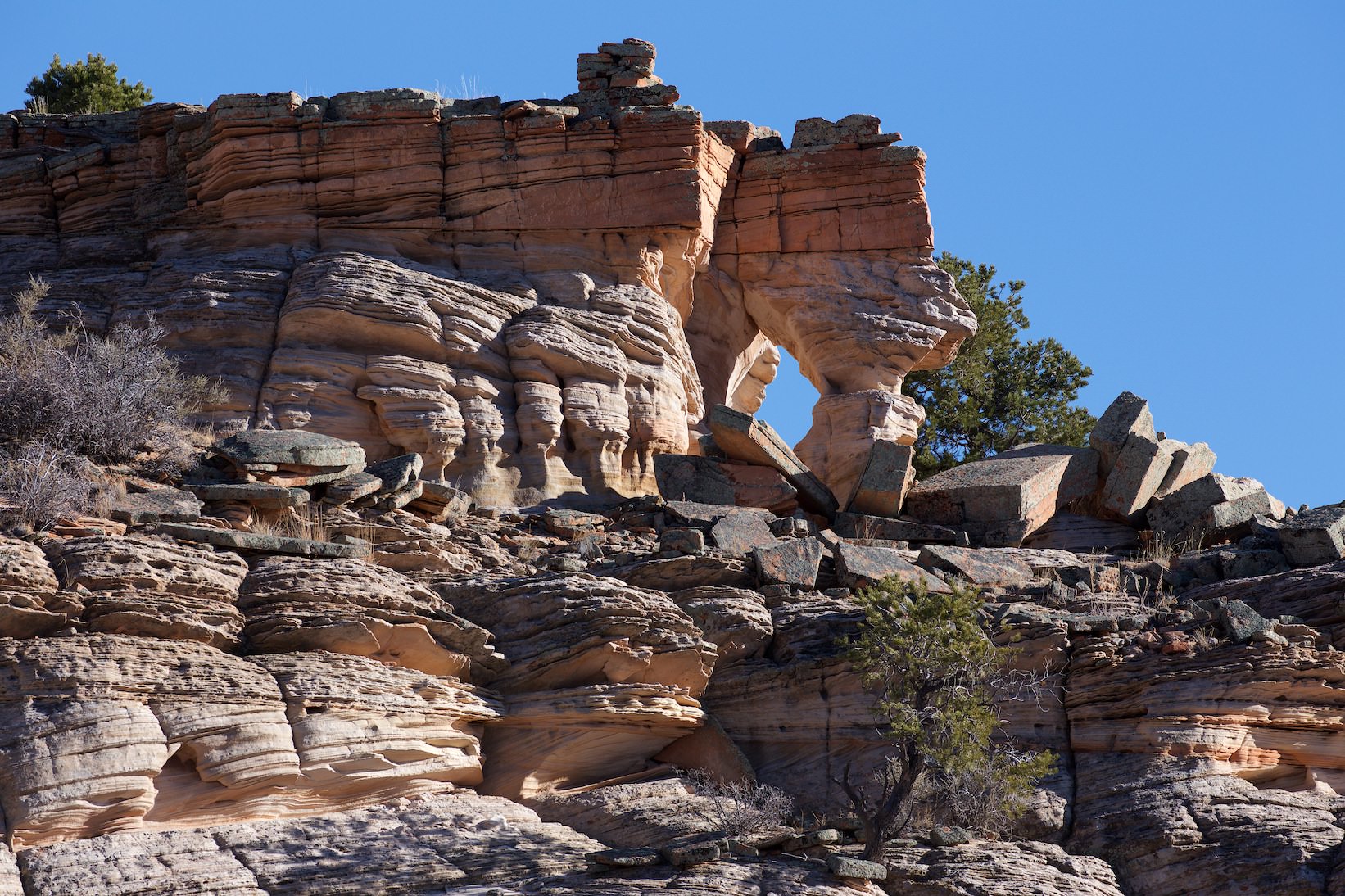
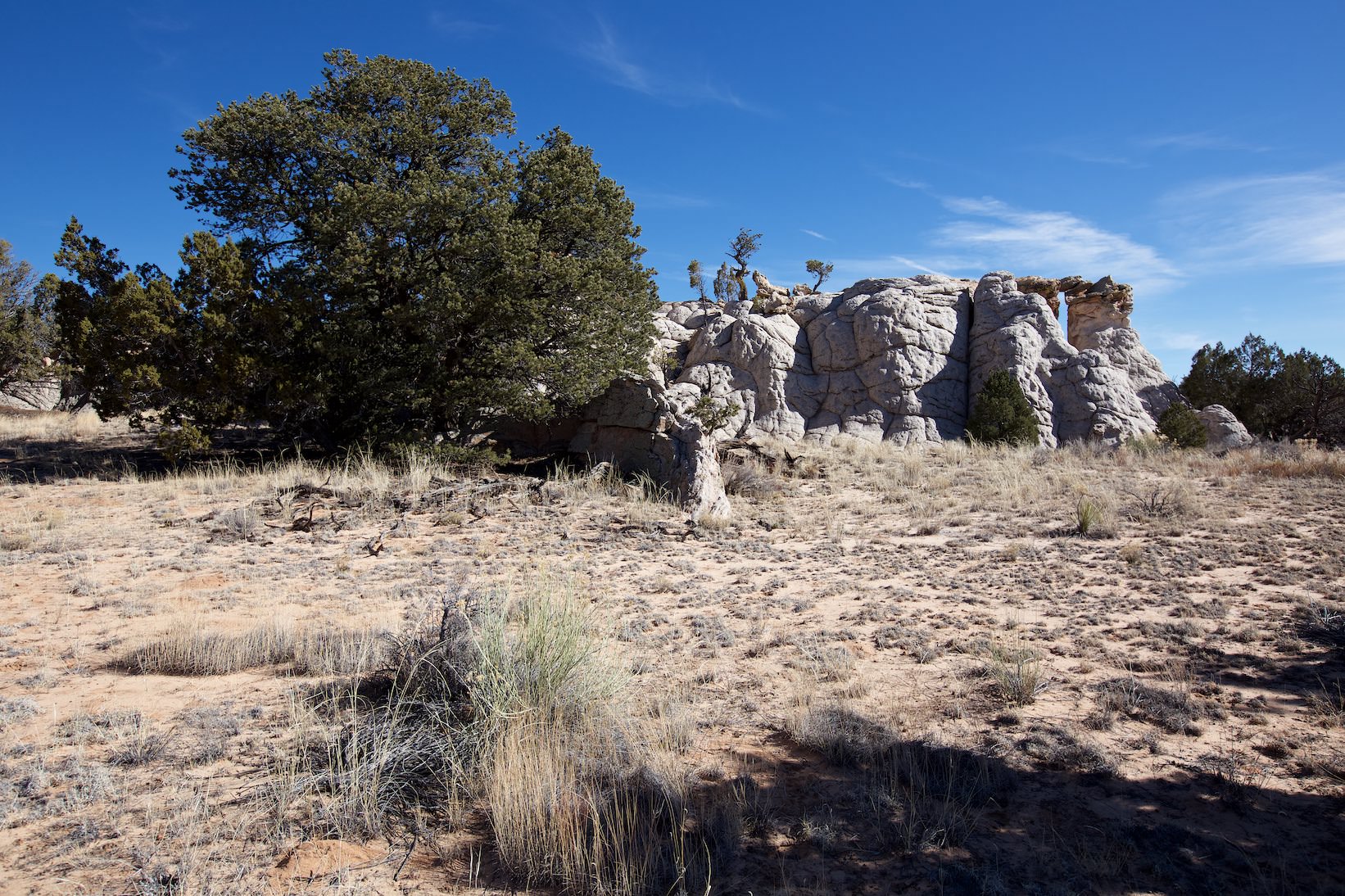
Pinnacle Valley
Pinnacle Valley
Pinnacle Valley
Description of how to get there: The drive is via House Rock Valley Road and then via the dirt road maze of the Vermillion Cliffs. We did the tour with a guide of a commercial provider (Paria Outpost), visited in conjunction with Steve's Secret and Soap Creek. The approach is very long (38.5mi - oneway - to Pinnacle Valley) and leads over various dirt roads in the Vermillion Cliffs. The exact track is linked above. For navigation you need either good local knowledge or a GPS device. And of course a suitable car. At least high ground clearance should be available. A four-wheel drive is not a hindrance, depending on the condition of the roads.
Description: Since Pinnacle Valley was not the main attraction during our visit, we only spent an hour here. Consequently, we didn't really have time for a proper hike. Unfortunately, there was only time for a short stopover.
Trail length: 0.25mi roundtrip Altitude difference: – Time needed: 1/2 hour Difficulty level:easy - There is no fixed trail you can freely walk and climb everywhere.
Our rating: We can't really give a proper rating because we simply spent too little time in the area. What we saw was in any case promising and makes us desire more.
☆☆☆☆☆Bewertet mit 3 von 5
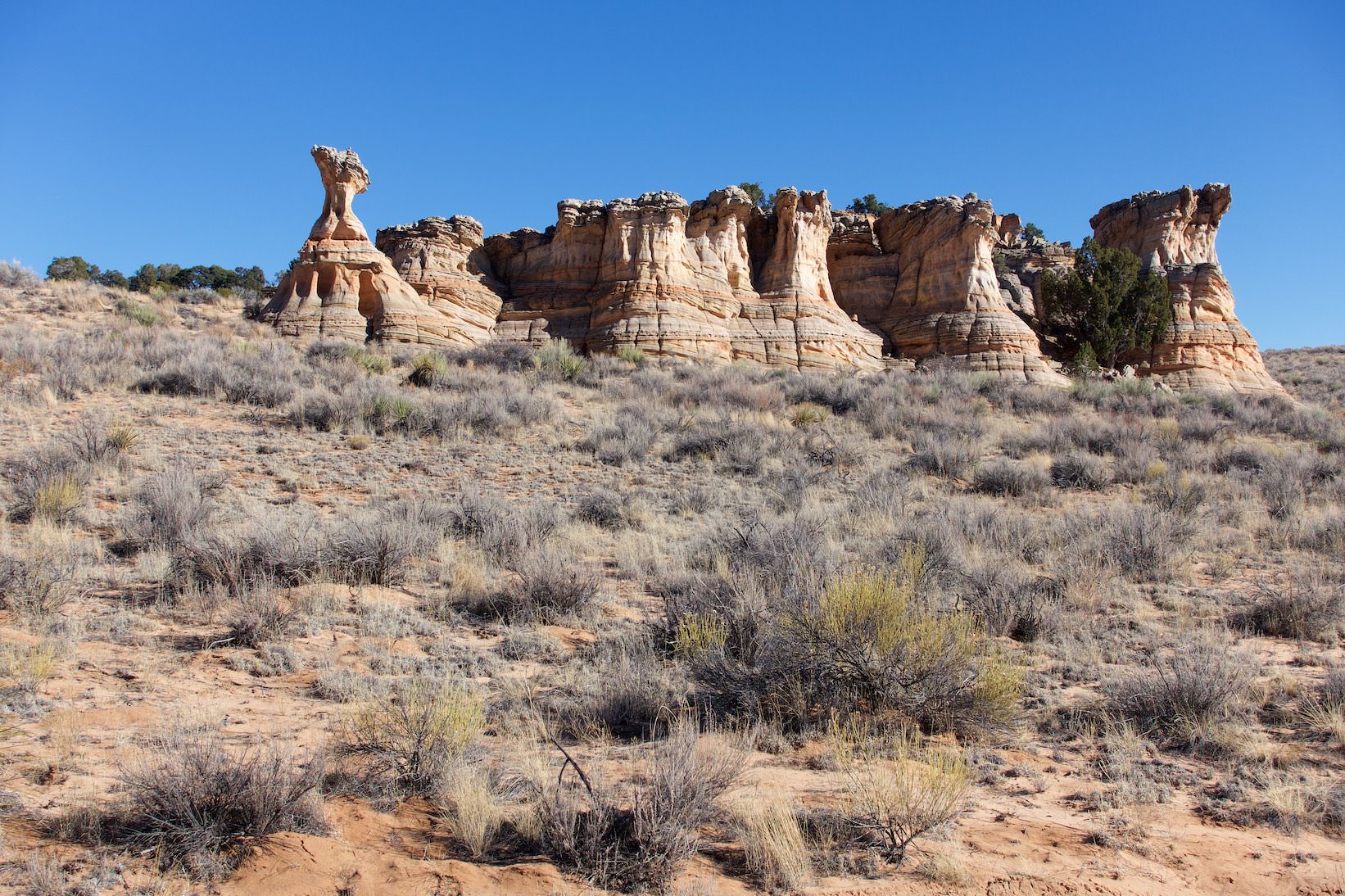
Pinnacle Valley
Pinnacle Valley
Pinnacle Valley
Pinnacle Valley
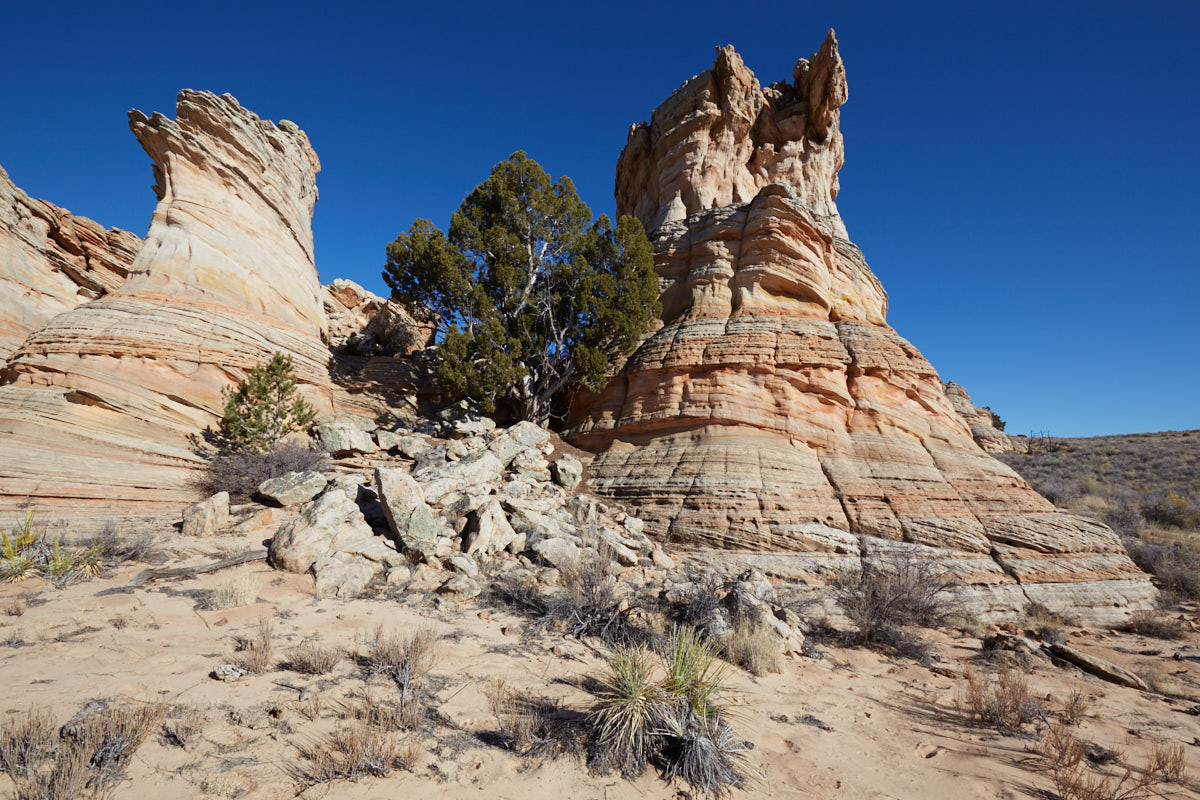
Rock formation at Steve's Secret
Steve´s Secret
Steve´s Secret
Description of how to get there: If you continue on the dirt road that leads to Pinnacle Valley in the direction to Soap Creek, you will reach Steve's Secret. Another small location in the Vermillion Cliffs, where you can stretch your legs during the long drive to Soap Creek.
Description: Steve's Secret is a small rock formation in the middle of nowhere with some nice unusual rock formations.
Trail length: 0.6mi roundtrip Altitude difference: – Time needed: 1/2 hour Difficulty level:easy - There are no trails, you can freely walk around everywhere.
Our rating: Our guide from Paria Outpost showed us this nice little location. It is certainly nothing that you have to have seen, but it was a nice little stopover.