Note: On dirt roads, road conditions can change constantly. Therefore, we strongly recommend that everyone check the road conditions before each trip. We do not recommend driving on unpaved roads before, during or shortly after rain or snowfall.
Description of how to get there: The Pinedale Hoodoos are located northeast of Gallup. First you turn left onto Byway 566. Coordinate: Latitude 35.530359, Longitude -108.607030. After 8.5mi turn right onto Uphill Rd (Indian Rd 11) Coordinate: Latitude 35.628759, Longitude -108.534007. Follow this road for 3.9mi before turning right onto 2nd Canyon Rd (Indian St 7054). Coordinate: Latitude 35.610293, Longitude -108.475285. Here you leave the asphalt. After a total of 9.3mi on the 2nd Canyon Rd. you have pavement under your wheels again and turn back onto the Uphill Rd.
The Pinedale Hoodoos are all located on the south side of Fallen Timber Ridge. This is on the left side during our drive on 2nd Canyon Rd. There are a great many hoodoos standing together in various groups. We visited three of them.
Pinedale Hoodoos - First Group
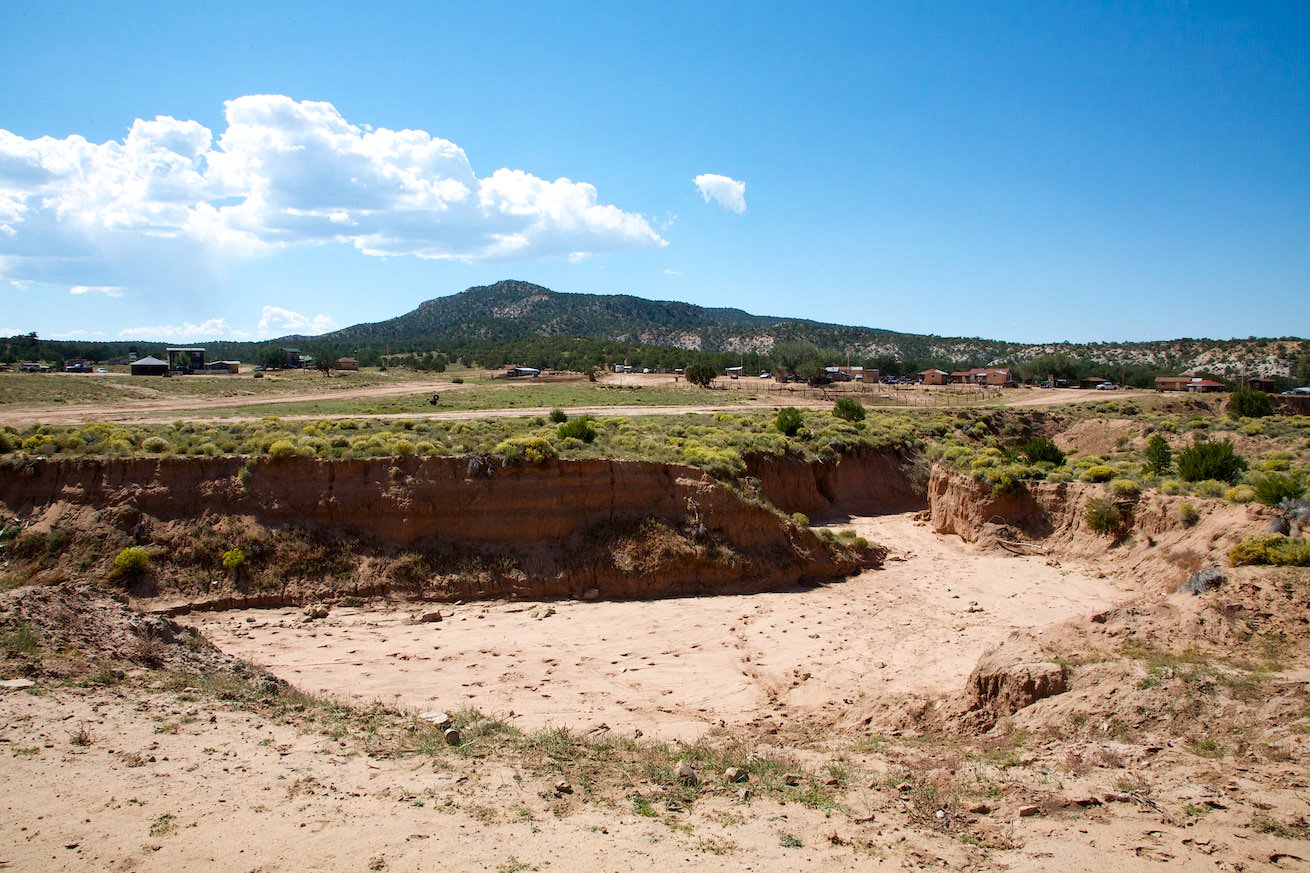
Description: After 2.2mi you reach the first small group of hoodoos. Coordinate: Latitude 35.582397, Longitude -108.467439. Since there are houses here and we didn't want to trample through people's front yards, we photographed the hoodoos in this group only from the road.
Our rating: That was already quite a nice sight. But this could be much better.
☆☆☆☆☆Bewertet mit 2.5 von 5
Pinedale Hoodoos - Second Group
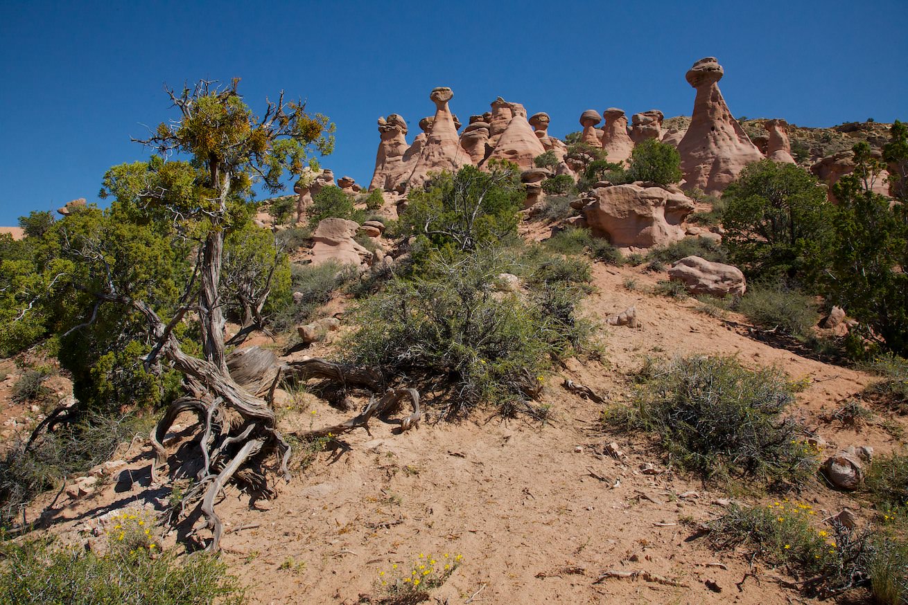
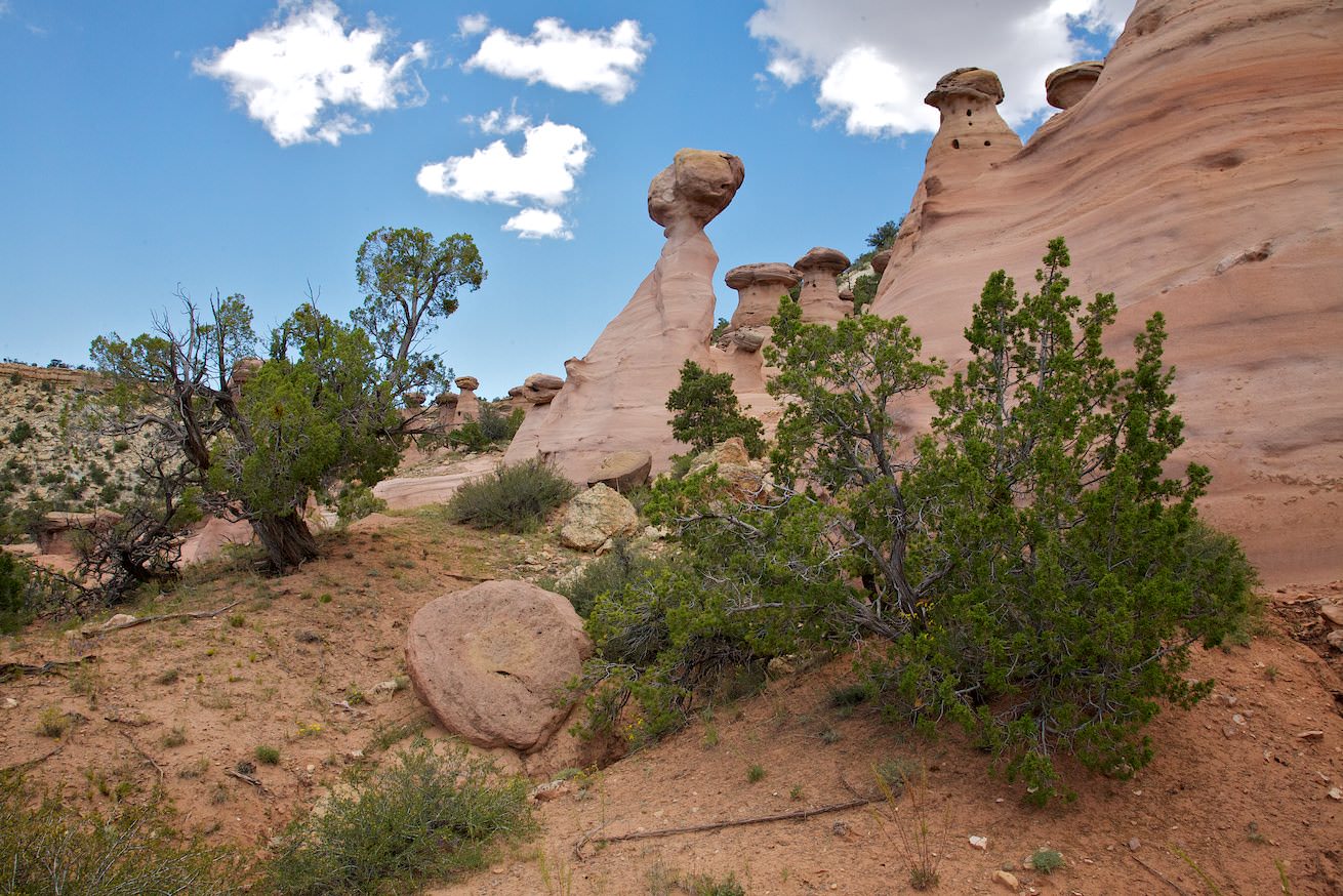
Description: About 1.24mi after the first group you have already reached the parking lot for the second group. There is also a short road that leads closer to the hoodoos. However, since it was in pretty bad shape during our visit in October 2011, we left our car at 2nd Canyon Rd and walked the few hundred yards to the hoodoos. This group is quite a bit larger than the first. If you want to get to the hoodoos, you have to climb up the mountain a bit. There are no paths, you can move freely in the area.
Our rating: The pink hoodoos are much more impressive than in the first group. We like the abundance of the little towers here very much. You can find a lot of beautiful motifs and so we stay here for almost 2 hours.
☆☆☆☆☆Bewertet mit 3.5 von 5
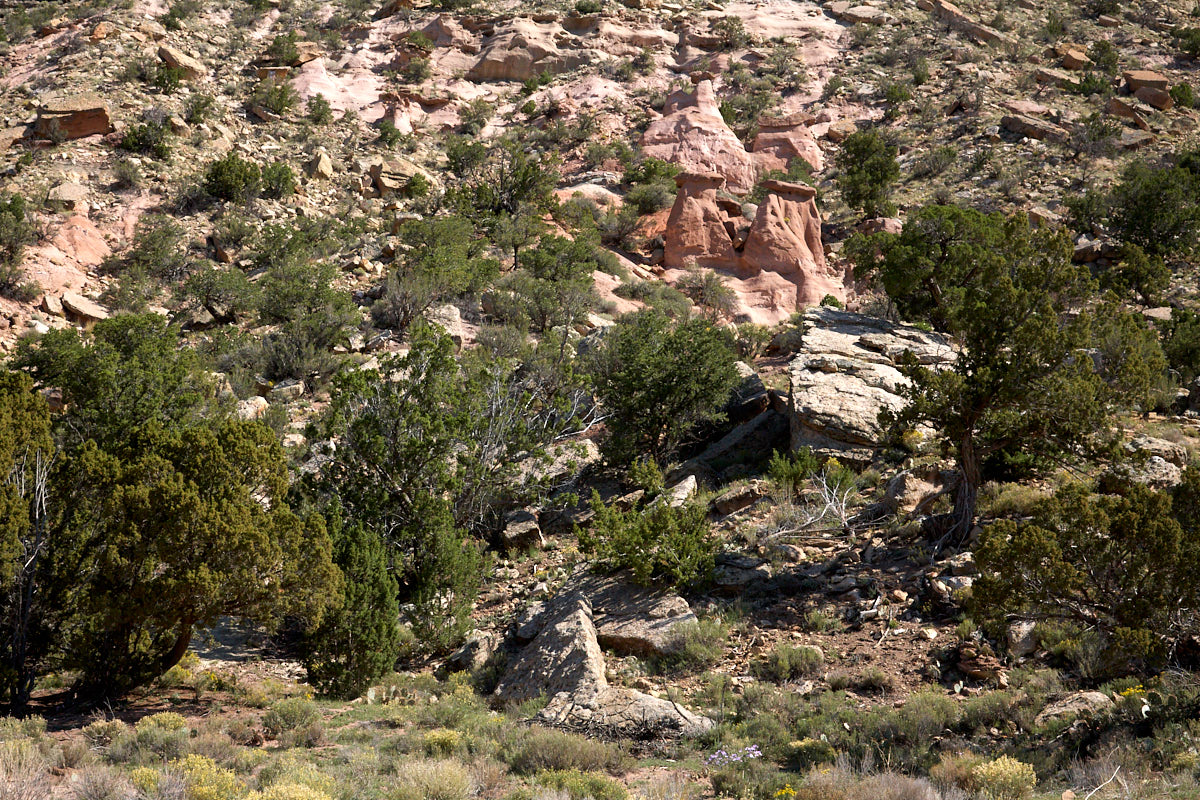
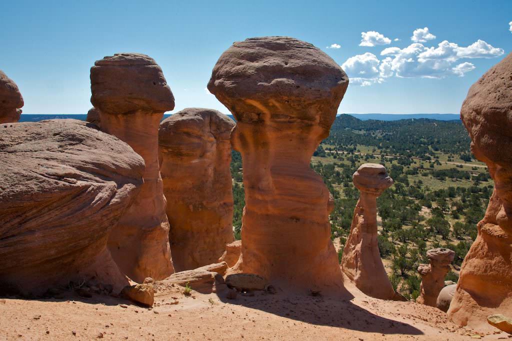
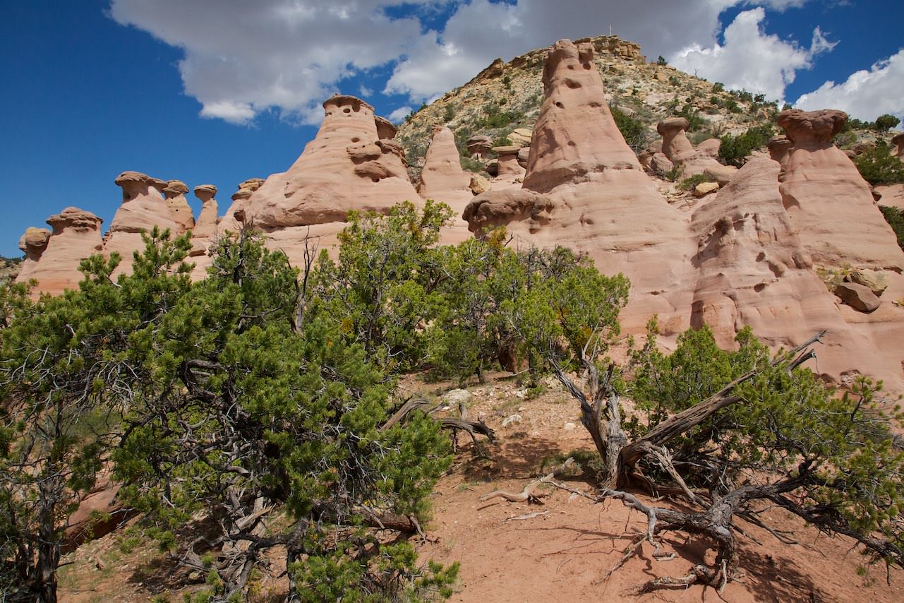
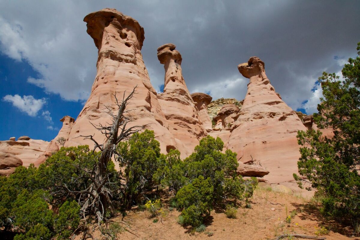
Pinedale Hoodoos
Second group
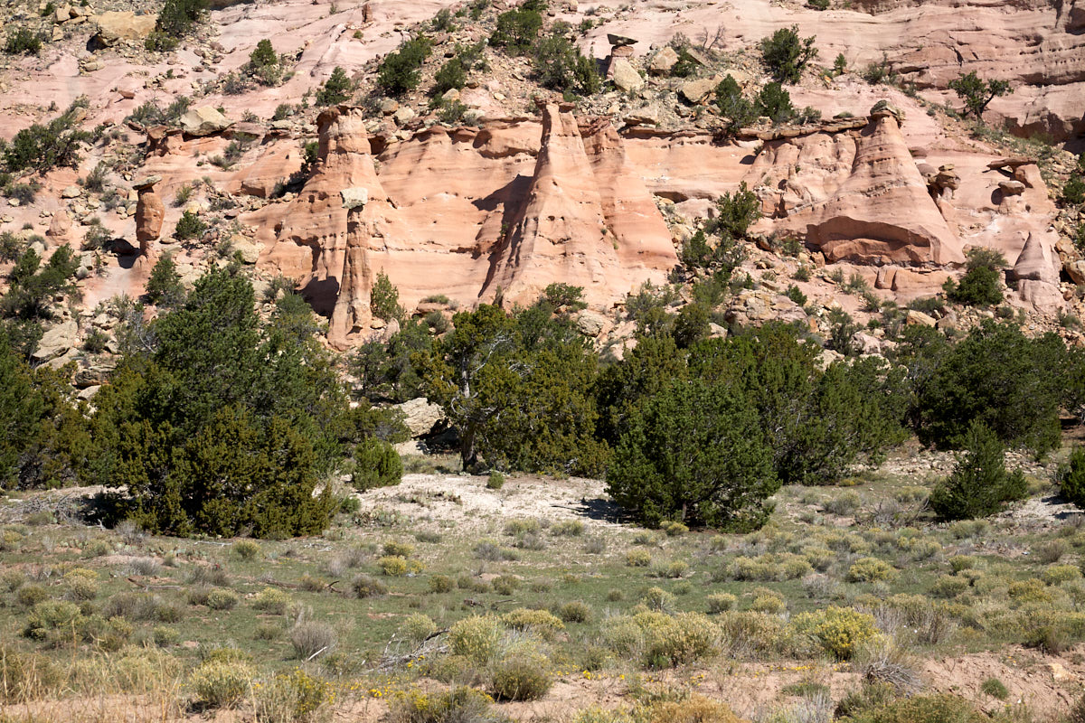
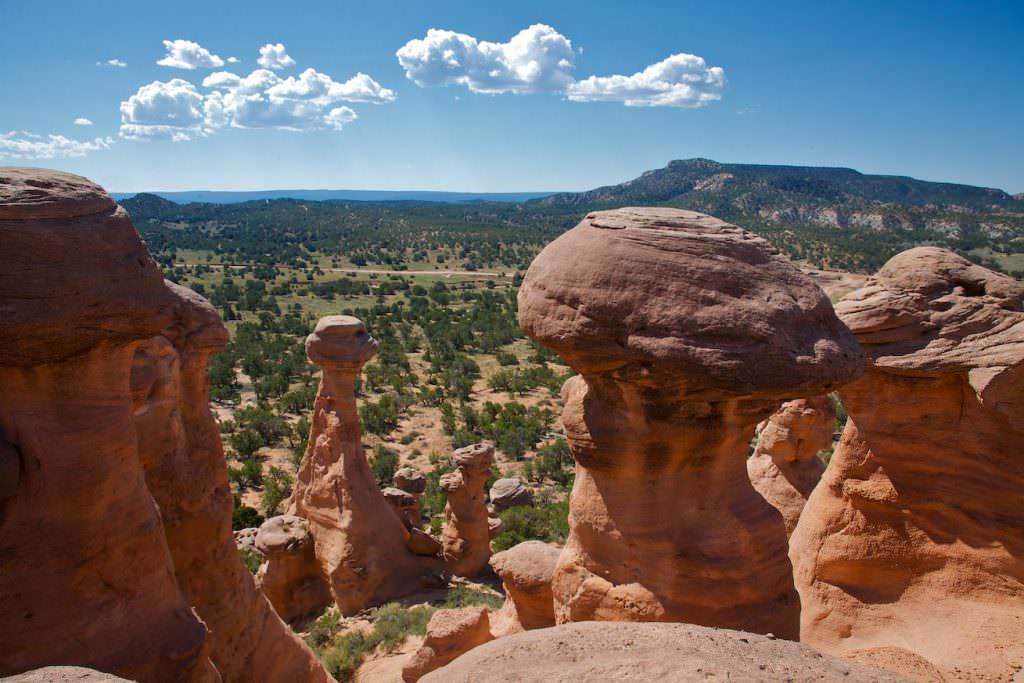
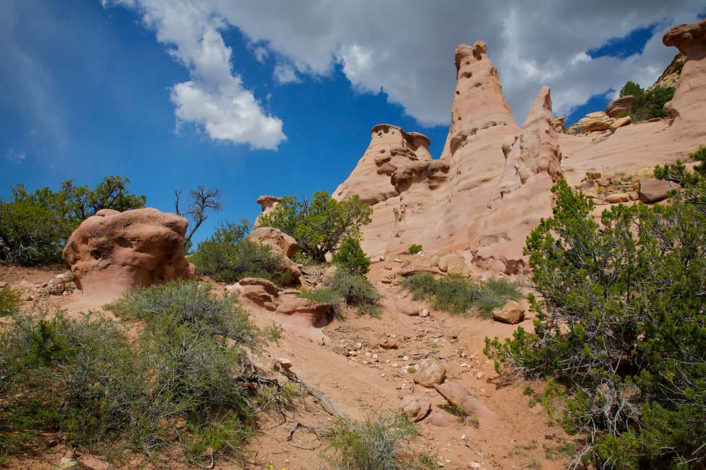
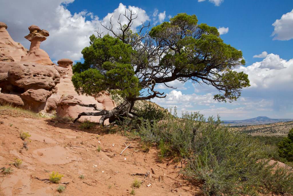
Pinedale Hoodoos
Second group
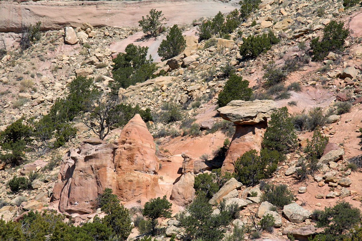
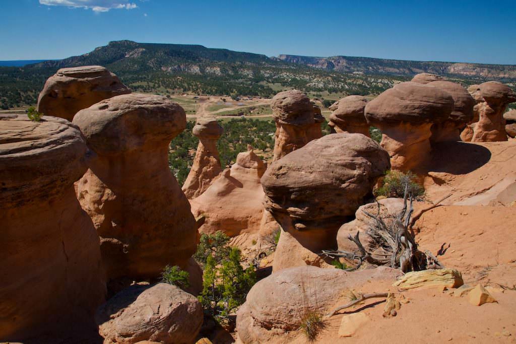
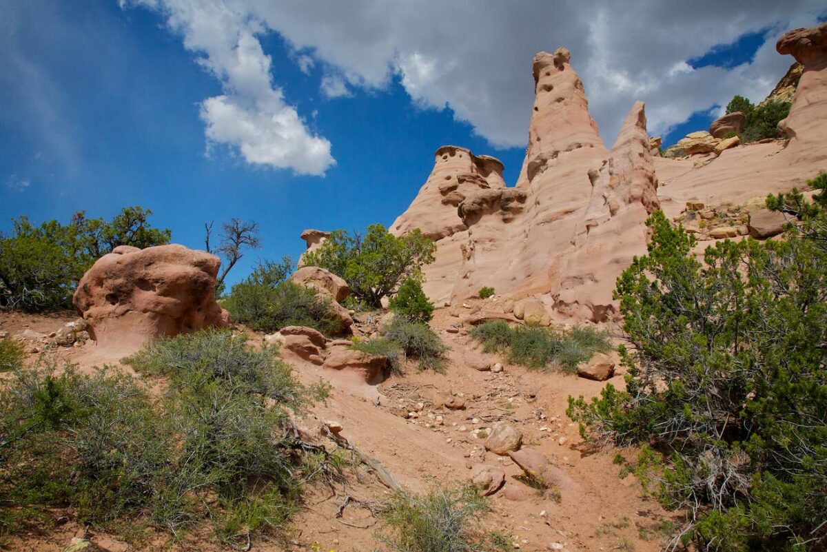
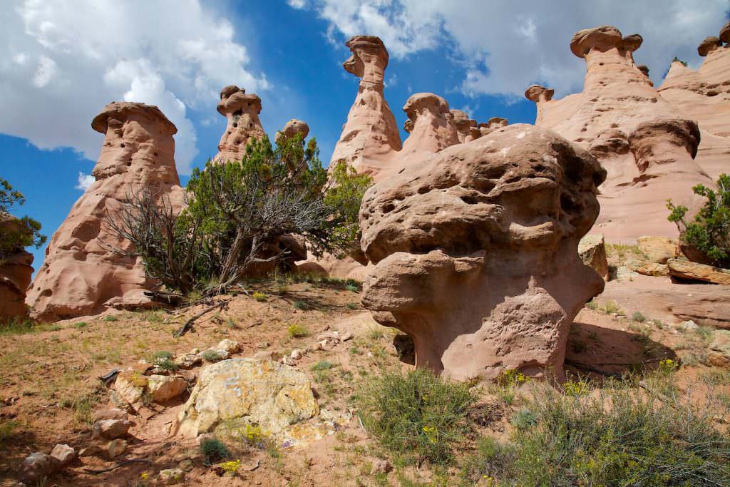
Pinedale Hoodoos
Second group
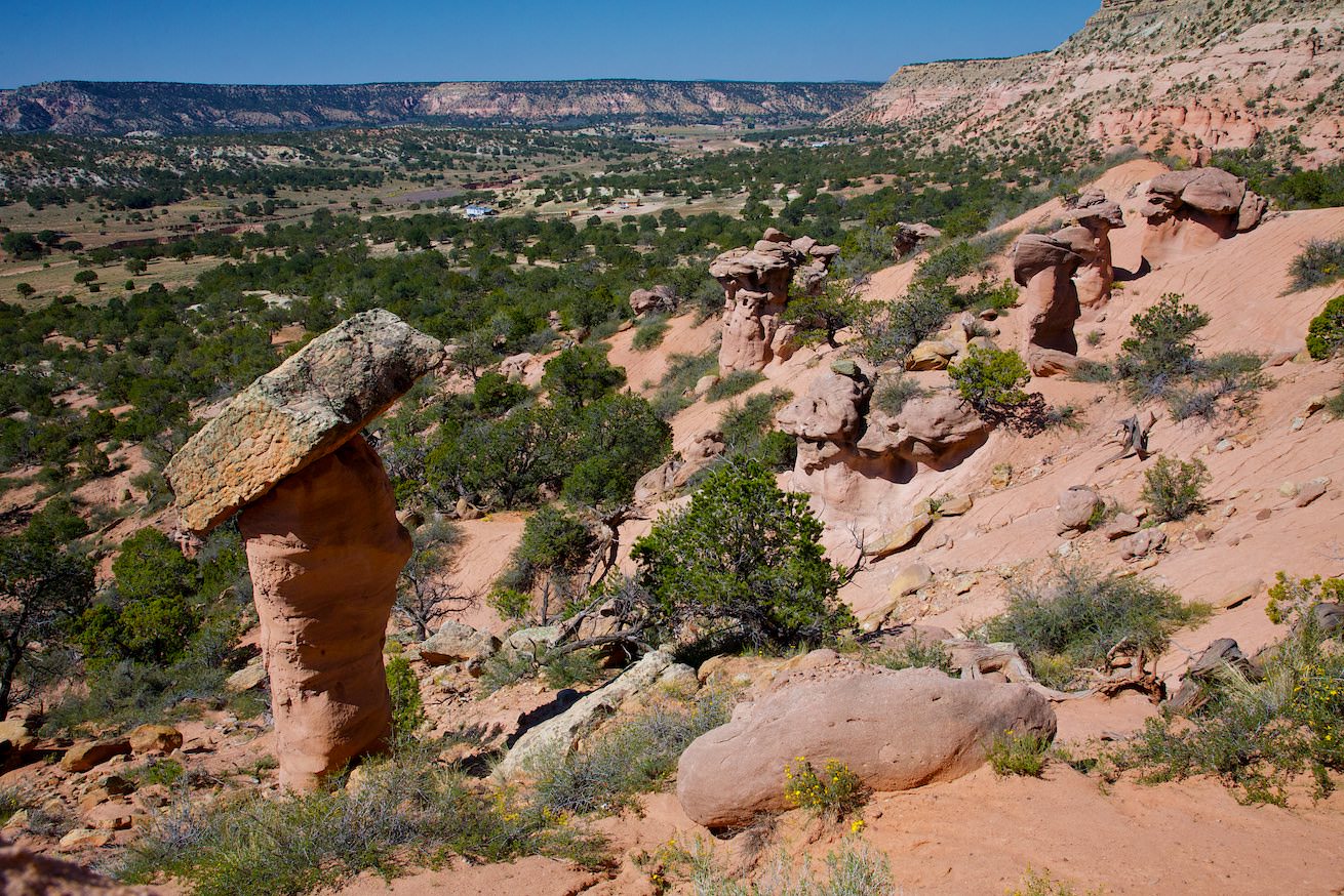
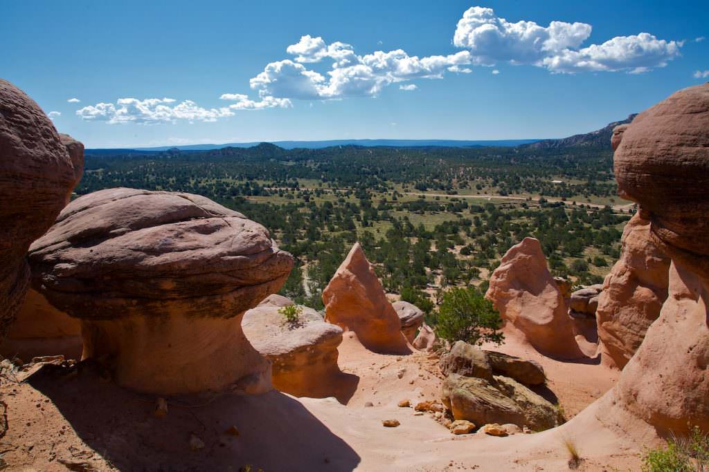
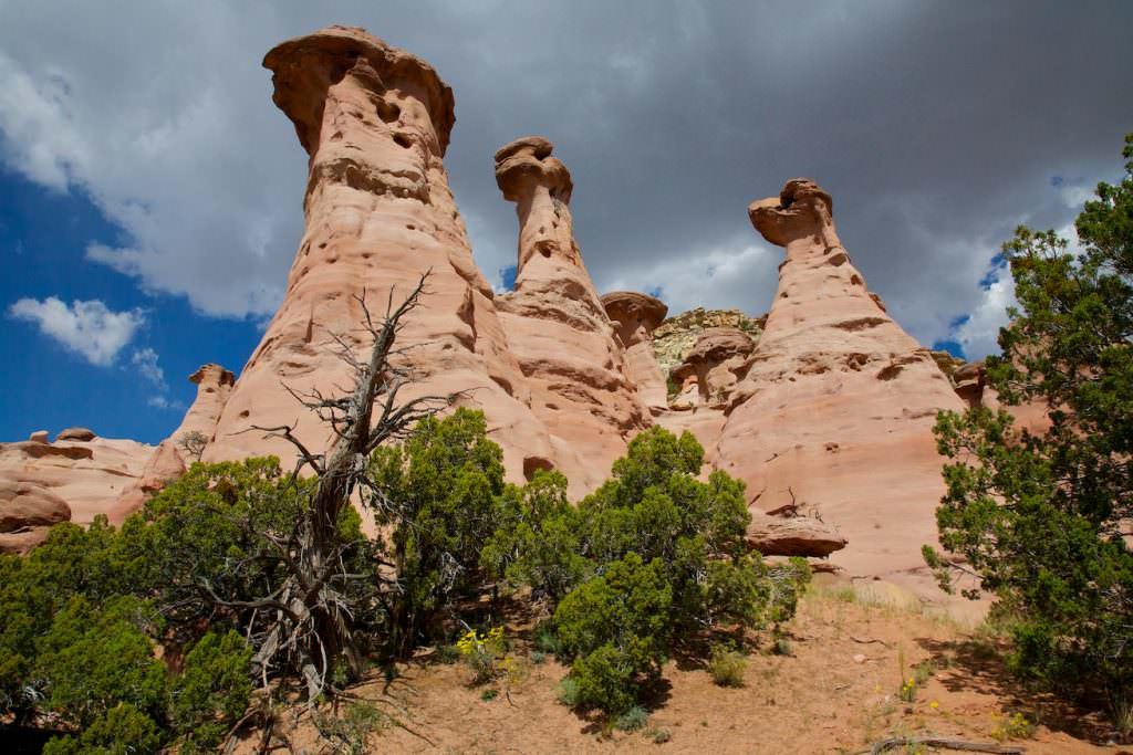
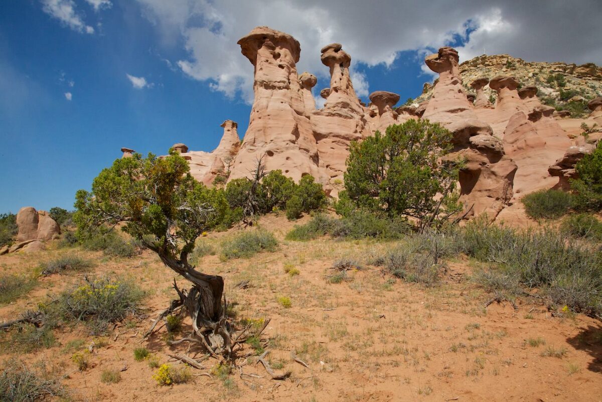
Pinedale Hoodoos
Second group
Pinedale Hoodoos
Second group
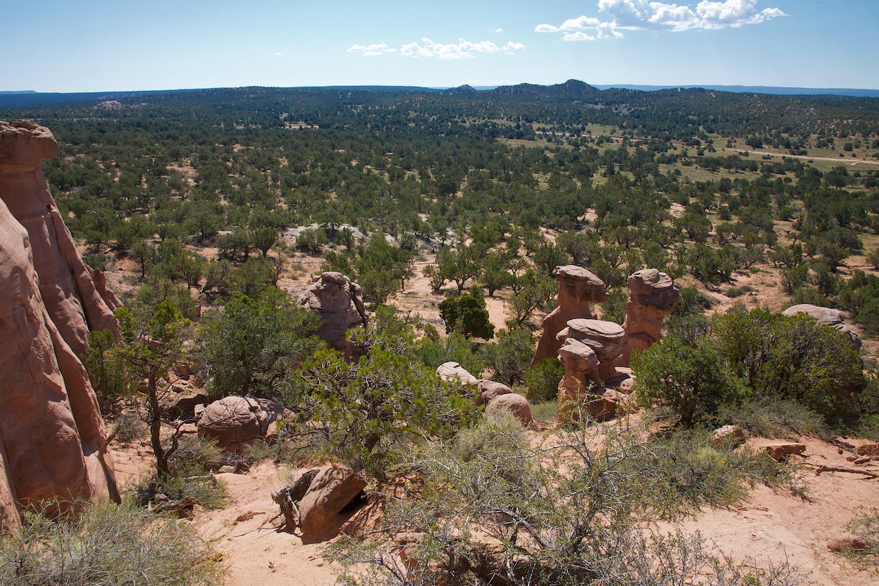
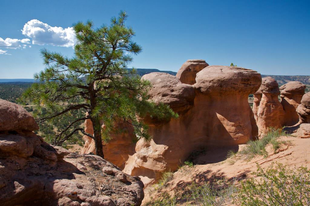
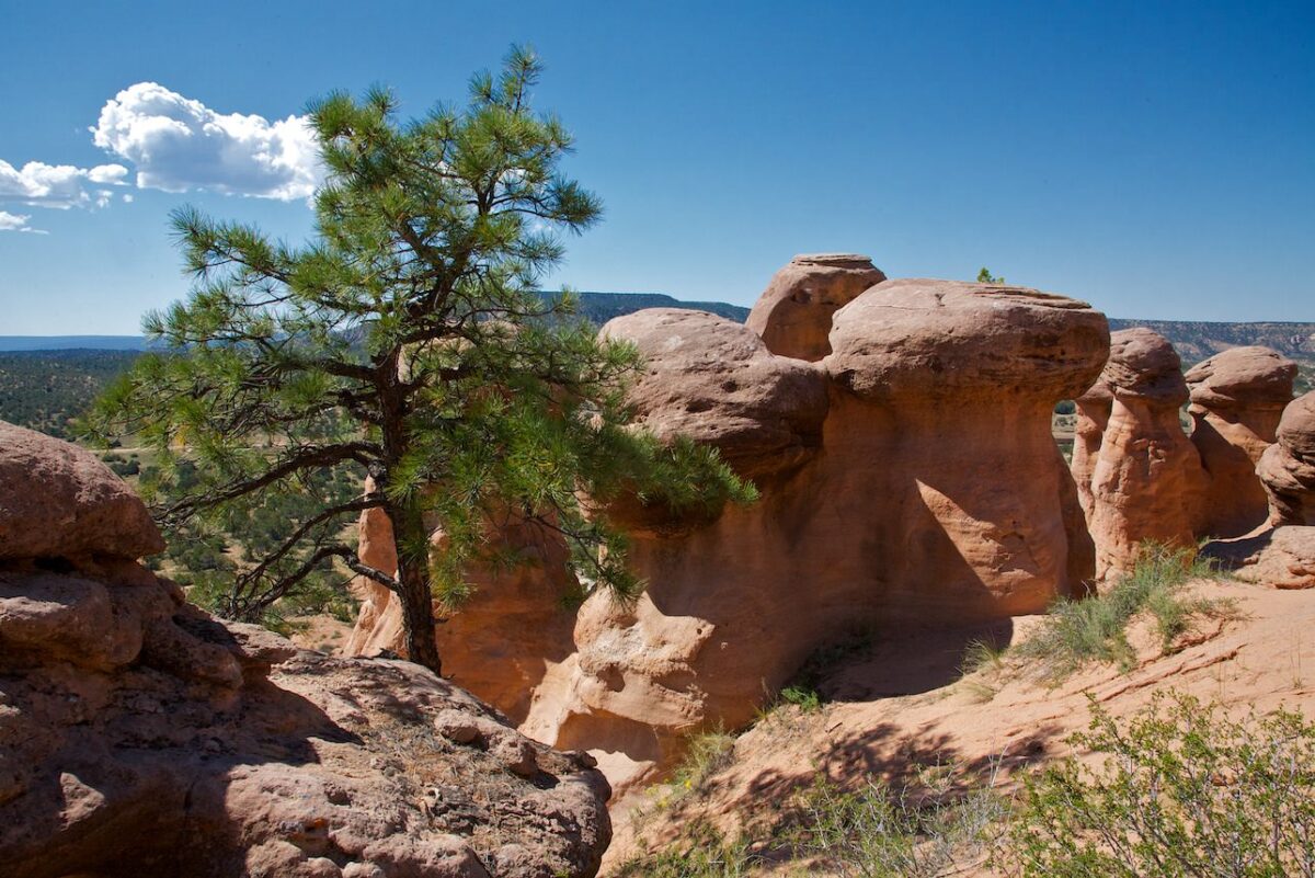
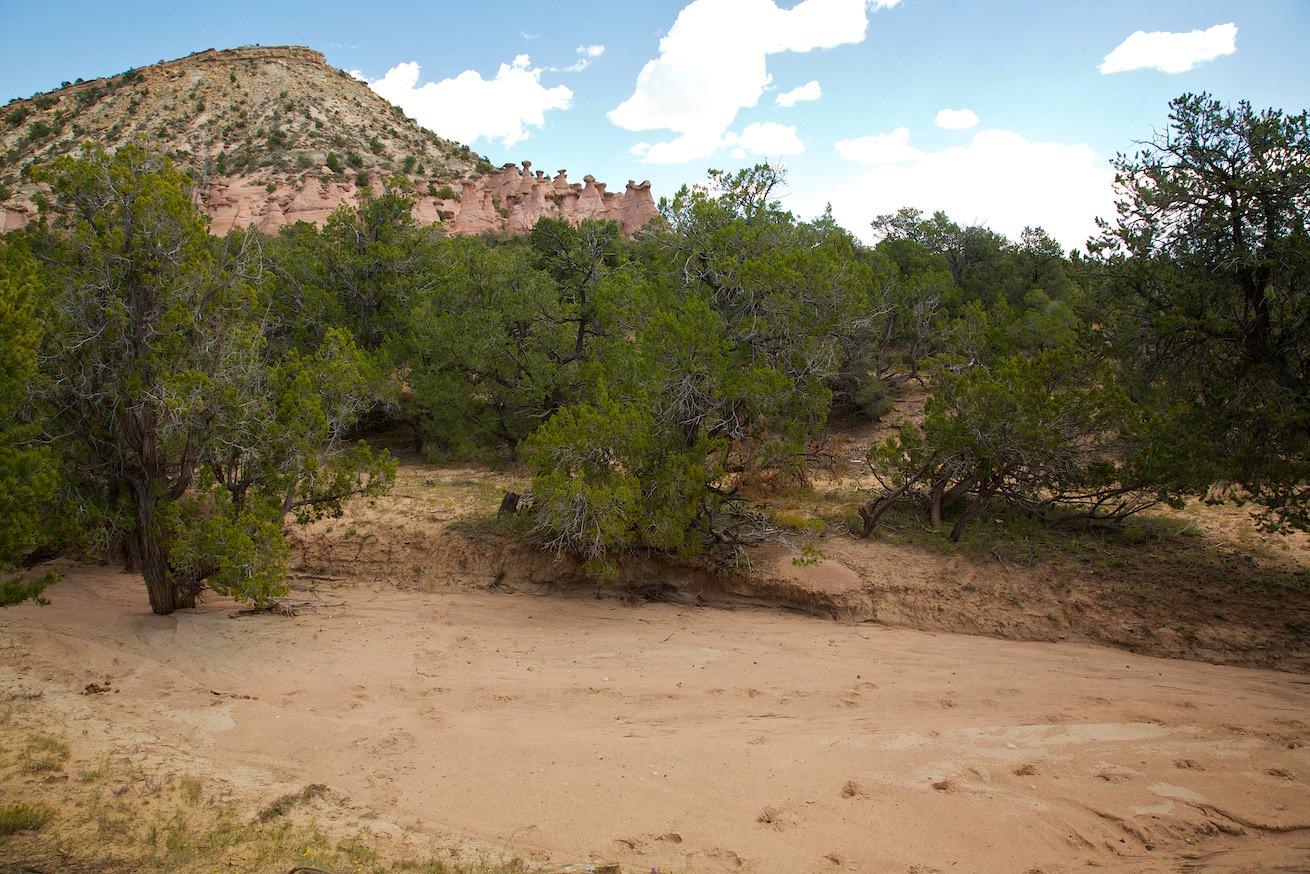
Pinedale Hoodoos - Third Group
Description: About 3km after the second group we reach the parking lot for the third hoodoo group. Again we leave the car at 2nd Canyon Rd. Once again, the spur road is in a pitiful condition. But again the hoodoos are only a few hundred yards away and so it is no problem to walk. The third group is huge. You can see pink hoodoos all along the wall of Fallen Timber Ridge. We didn't hike the whole area for a long time during our visit. You can easily spend twice the time here.
Our rating: We also liked this hoodoo group very much. It was fun to climb around here and explore the hoodoos. Again, there are no predetermined paths. You can move freely.


