Note: On dirt roads, road conditions can change constantly. Therefore, we strongly recommend that everyone check the road conditions before each trip. We do not recommend driving on unpaved roads before, during or shortly after rain or snowfall.
Our visits: So far 2 visits in October 2011 and October 2012
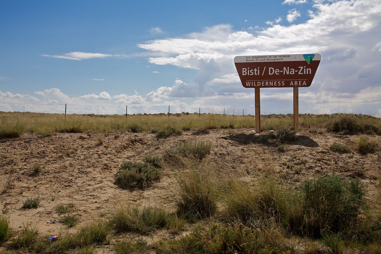
Junction from Highway 371
Bisti Badlands North - Drive
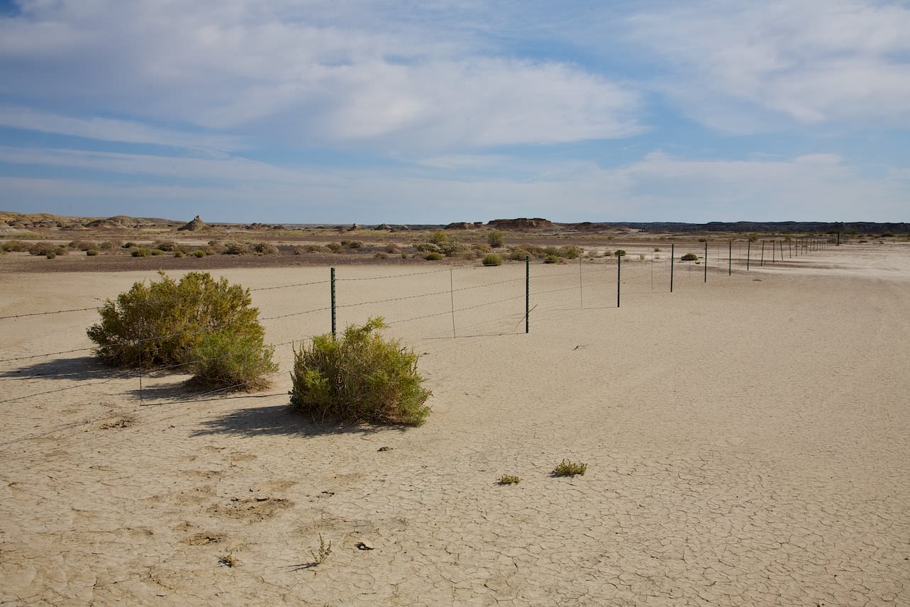
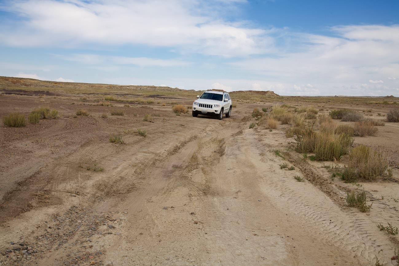
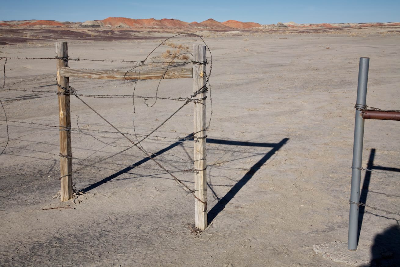
The drive to the tailhead for the Bisti North trailhead is not difficult. Except for the last 1.2mi everything is paved. From Farmington you drive 34.5mi on Highway 371 in southern direction. After that you turn left into a dirt road. Coordinate: Latitude 36.269899, Longitude -108.271487. Follow this road for 1.2mi until you reach a fence. Here you park the car. Coordinate: Latitude 36.278853, Longitude -108.254448. We did the hike in October 2011. The access on the unpaved part was not a problem. The subsoil is clayey. As always on such roads, a higher ground clearance is not a disadvantage.
Our parking lot at the paddock fence
Unpaved part of the drive
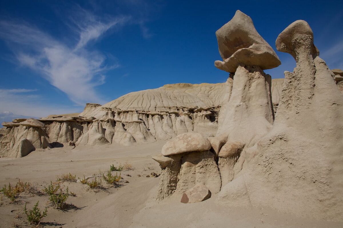
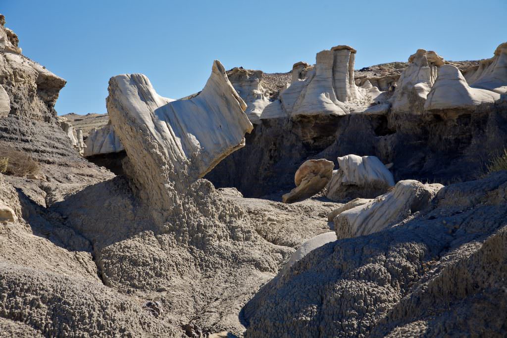
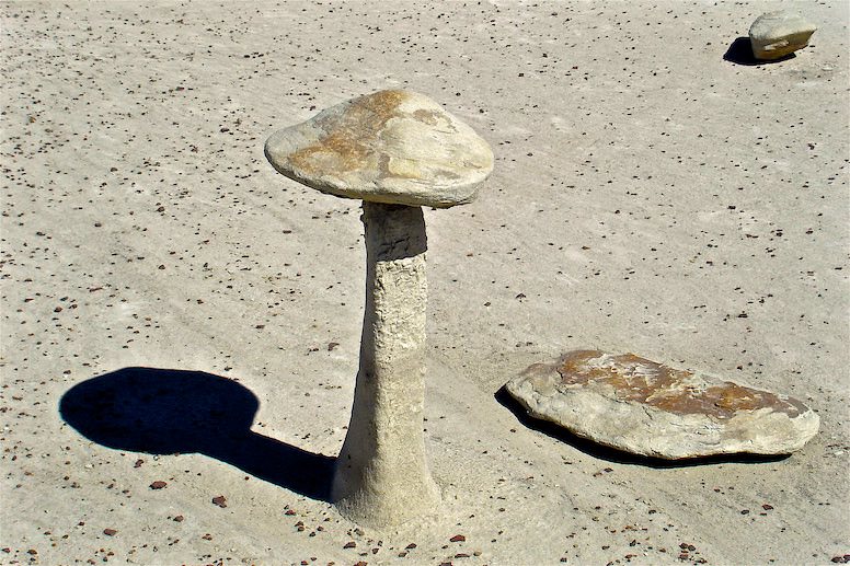
Bisti Badlands North - The hike
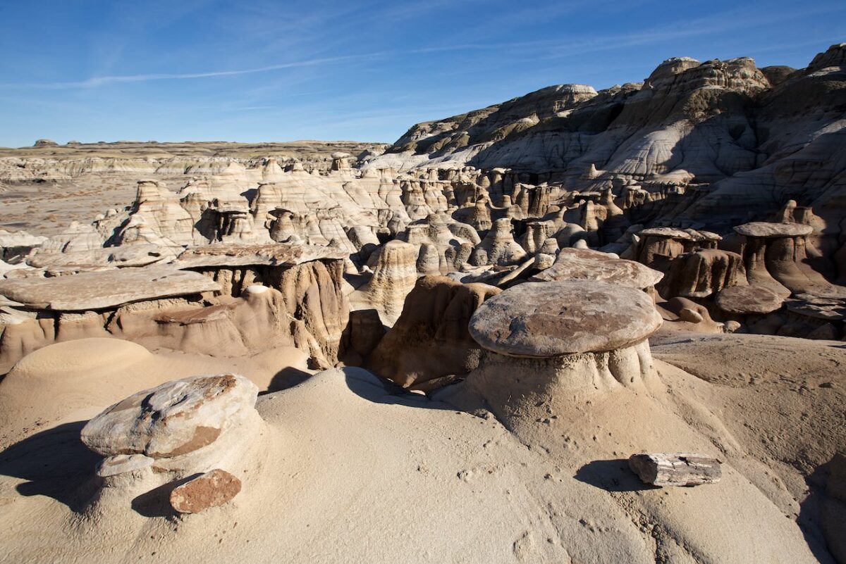
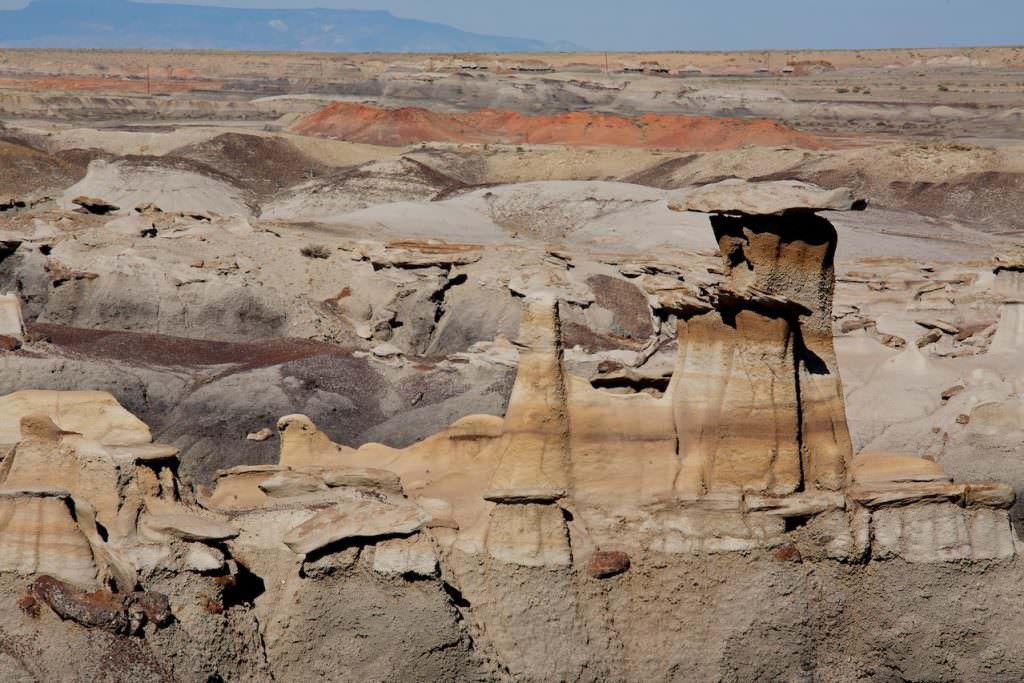
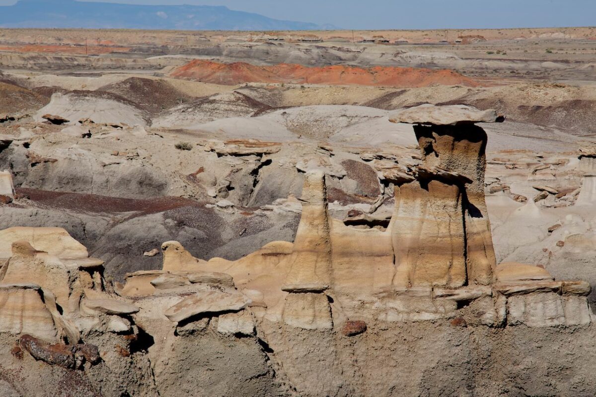
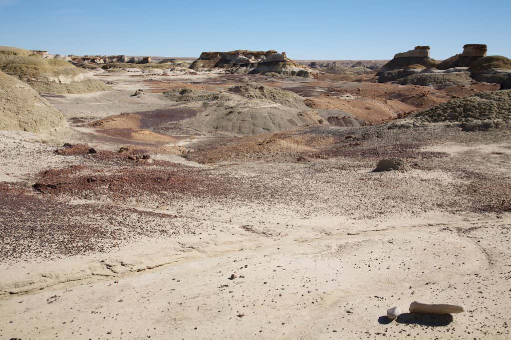
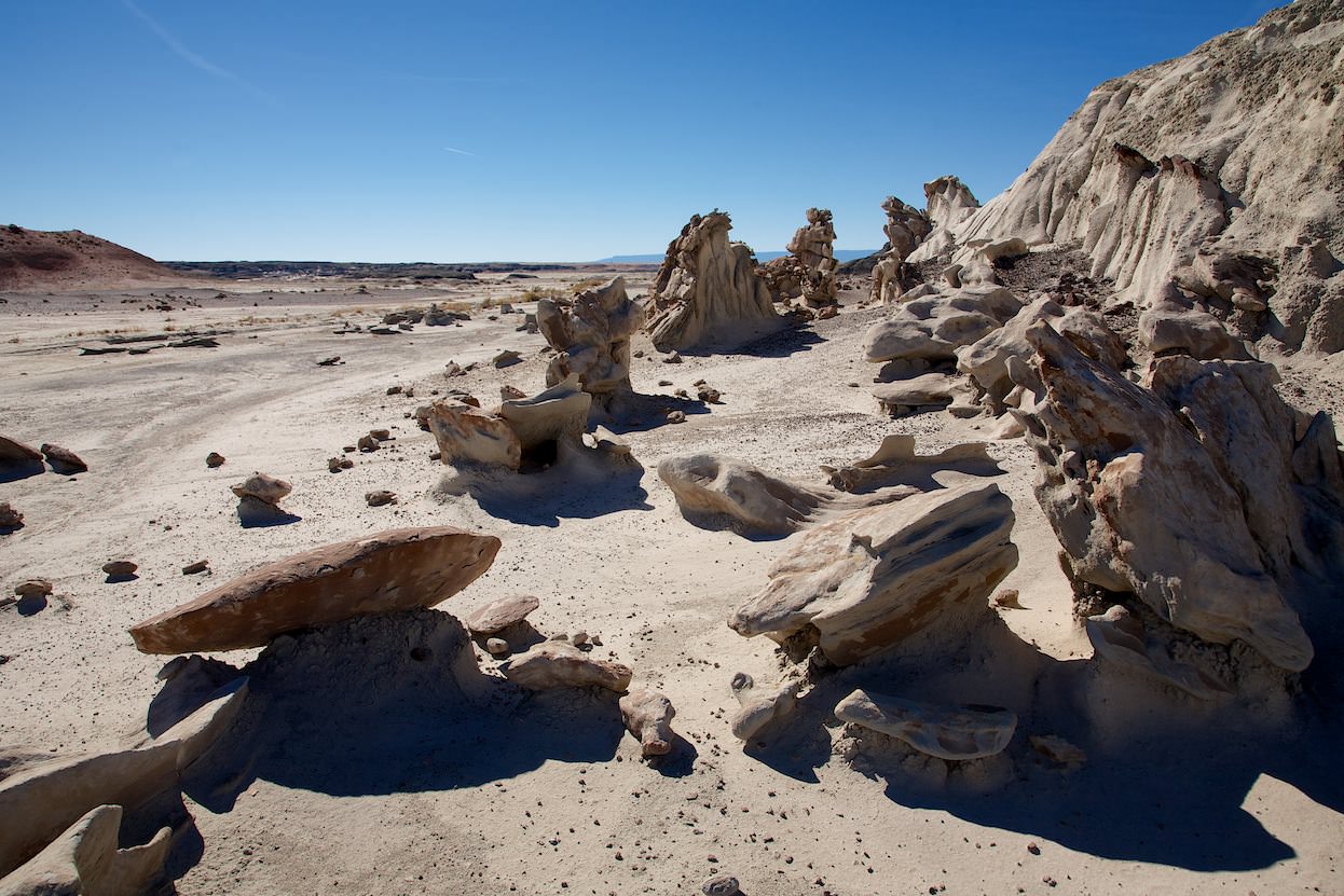
Description: For the hike in the Bisti Badlands North we would like to say one thing in advance: if you want to hike to special formations, such as the Wings, you should definitely have a GPS device with a track. Especially if you have no experience in open, unknown terrain, it is otherwise very difficult to find something specific. The area is huge and you can move freely, there are no predetermined paths, so orientation is not trivial. After all, you also have to find your way back to the car.
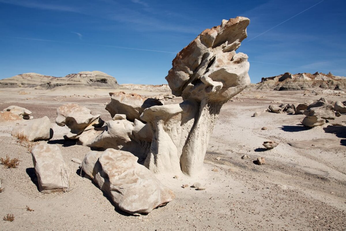
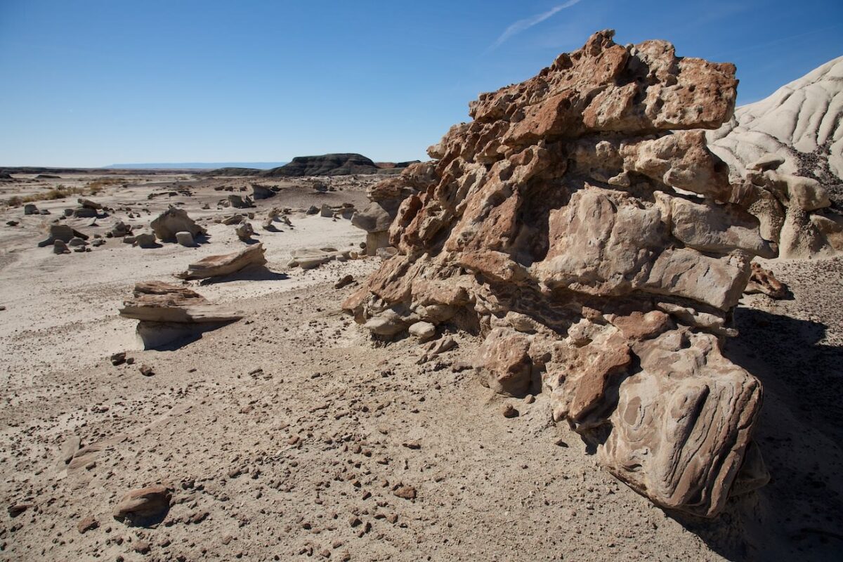
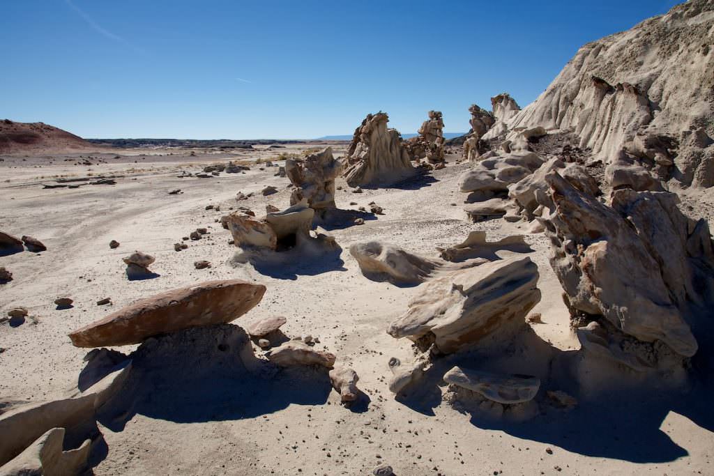
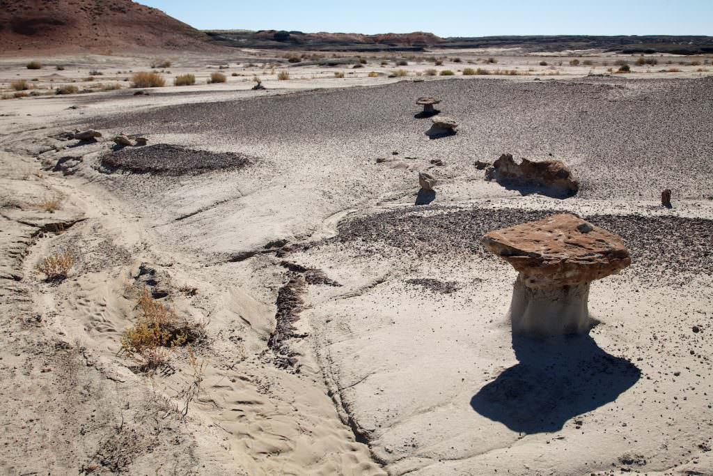
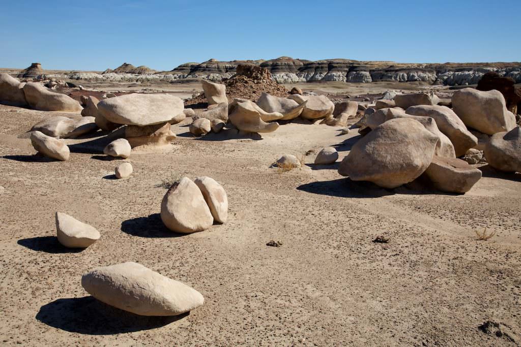
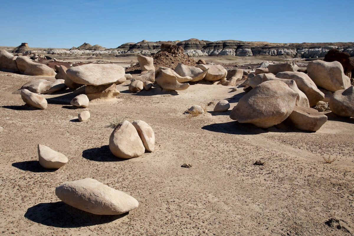
If you keep this in mind, nothing gets in the way of a great and exciting hike. You hike through a wonderland of badlands, hoodoos, petrified wood and lots of bizarrely shaped rocks. The elevation gain on our hike comes mainly from climbing up the hills. You can also hike without any elevation gain at all. The GPX data of our hike can be found above, next to the map!!!
Trail length: 4mi Altitude difference: 387ft Time needed: 3 hours Difficulty level:easy - Hiking in the badlands is very easy because the ground is mostly level and easy to walk on.
Our rating: We enjoyed the hike through the Badlands. Around every corner you can find a bizarrely shaped stone and the best part is that you have it all to yourself. So if you have a little spirit of discovery and enjoy nature in total silence, you will love it here.
☆☆☆☆☆Rated 4 out of 5
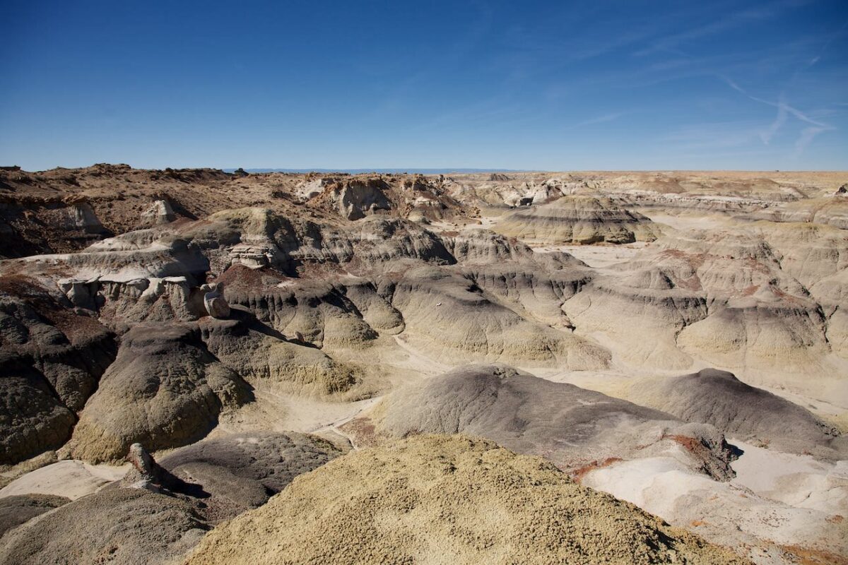
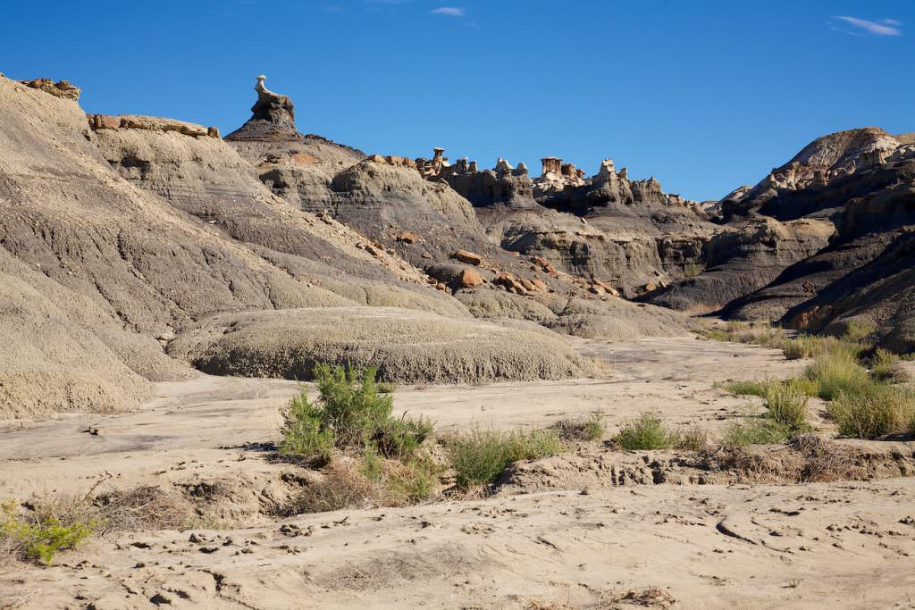
Bisti Badlands North
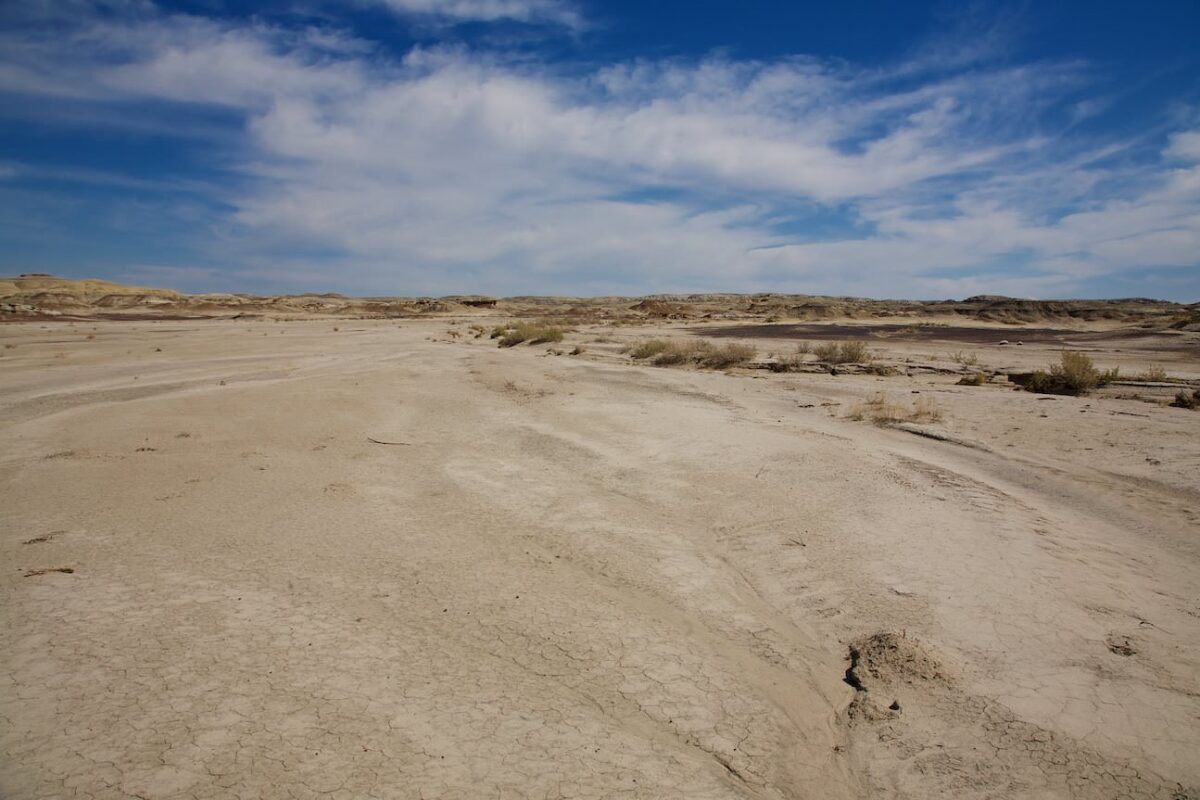
At the start the hike is not very spectacular
Bisti Badlands North
Bisti Badlands North
Bisti Badlands North
Bisti Badlands North
Bisti Badlands North
Bisti Badlands North
Bisti Badlands North
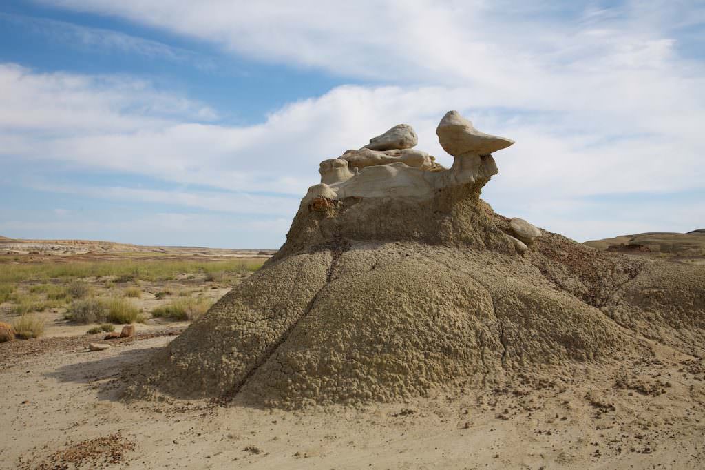
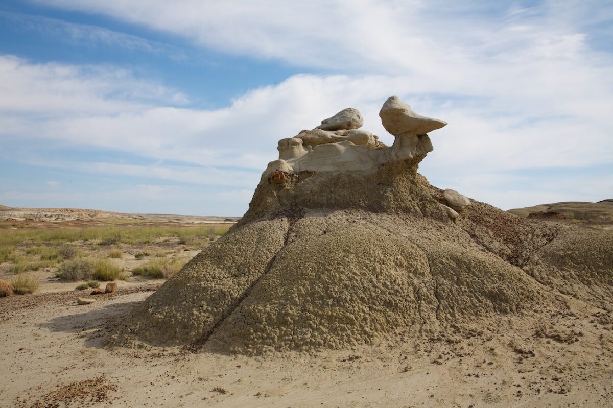
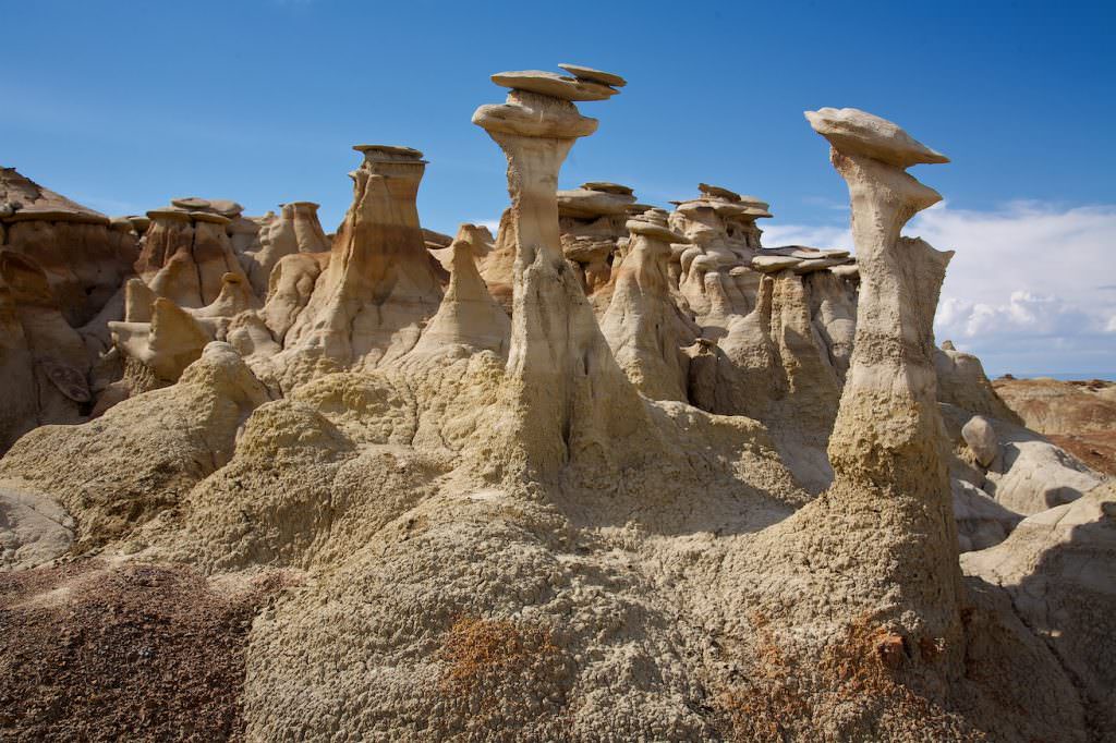
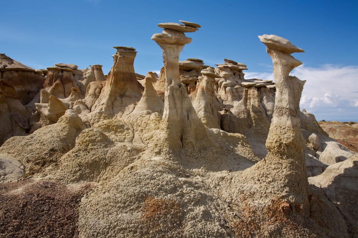
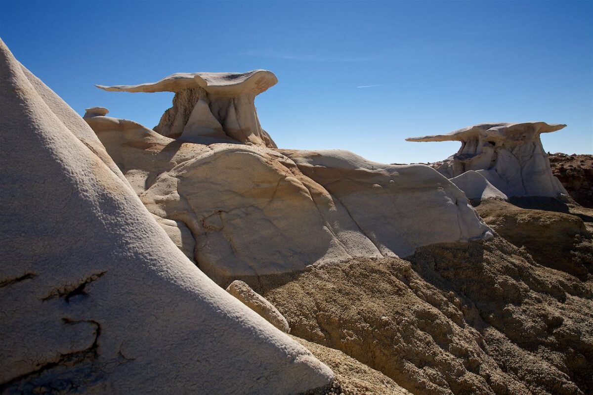
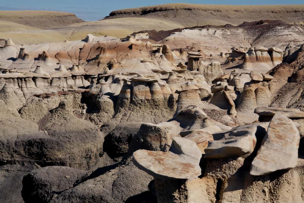
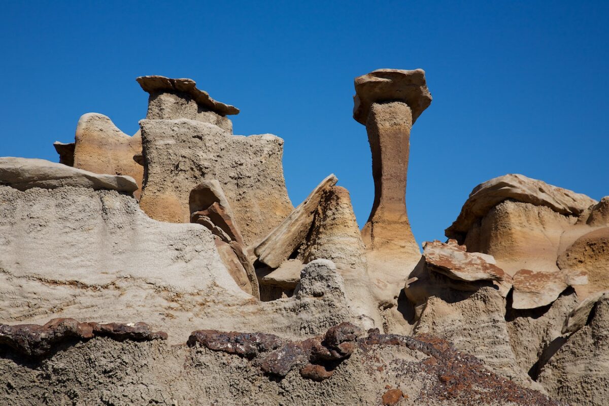
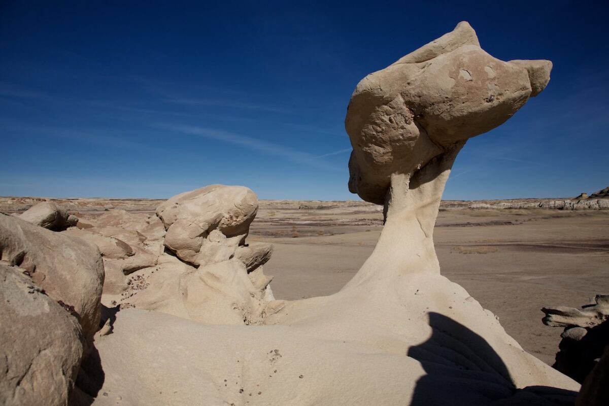
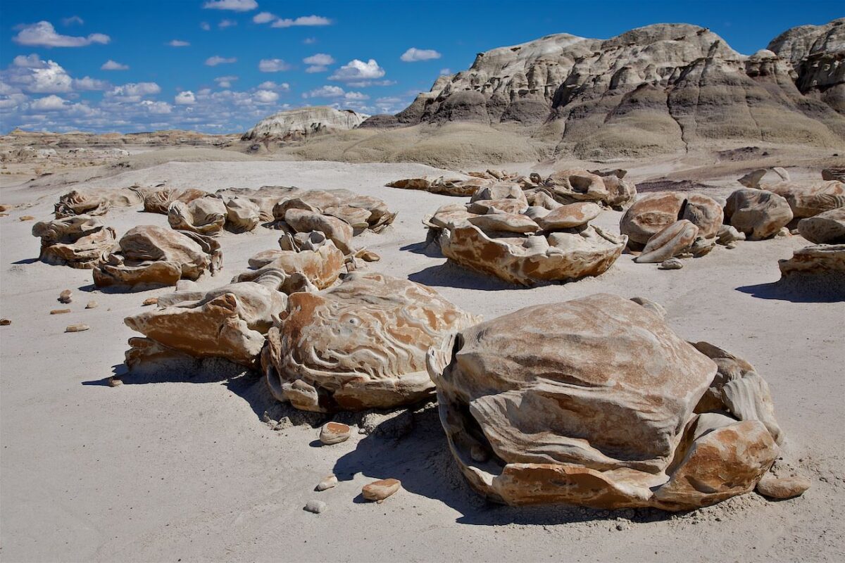
Bisti North Hoodoos
Bisti Badlands North
Bisti Badlands North
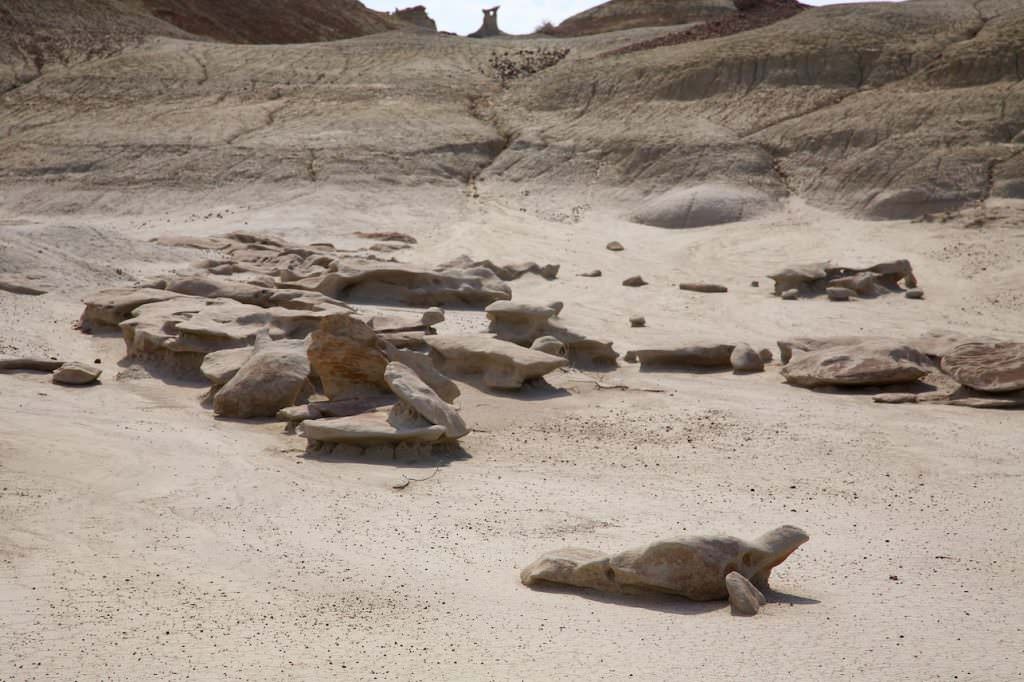
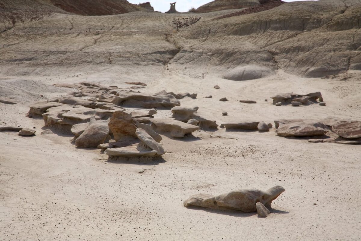
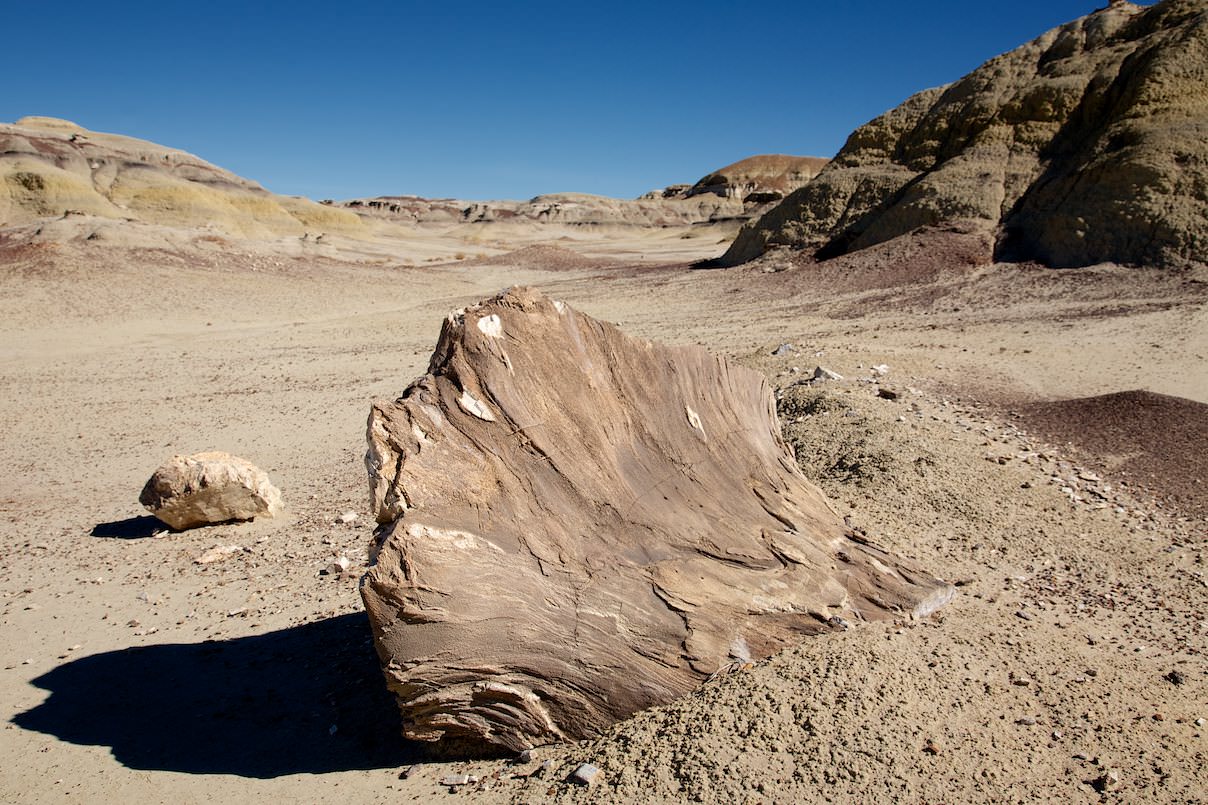
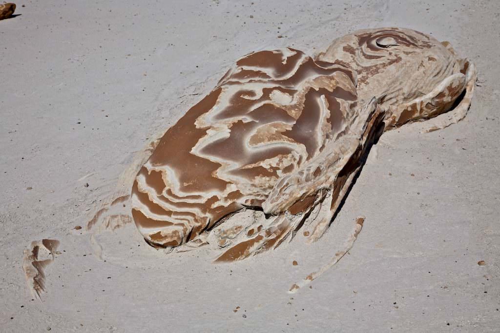
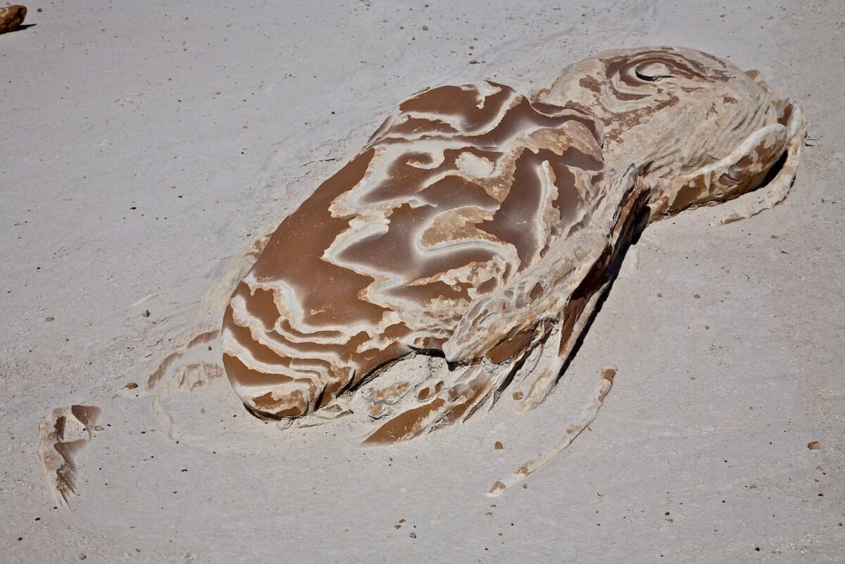
Even petrified wood is lying around all over the place
Bisti Badlands North
Bisti Badlands North
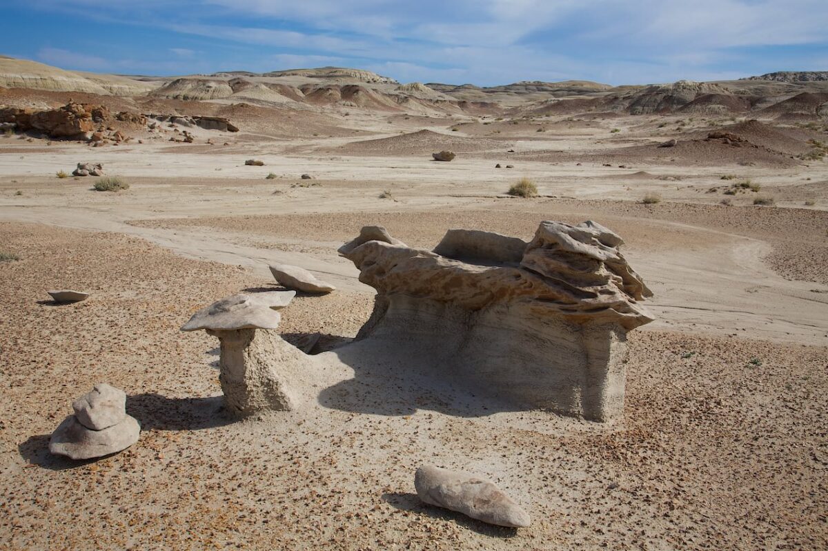
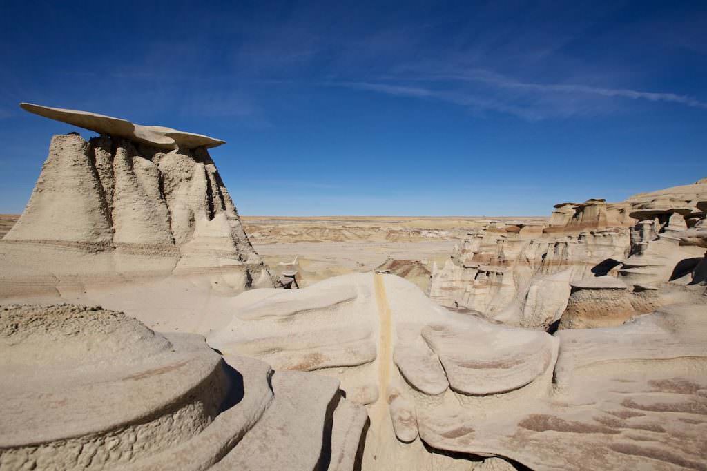
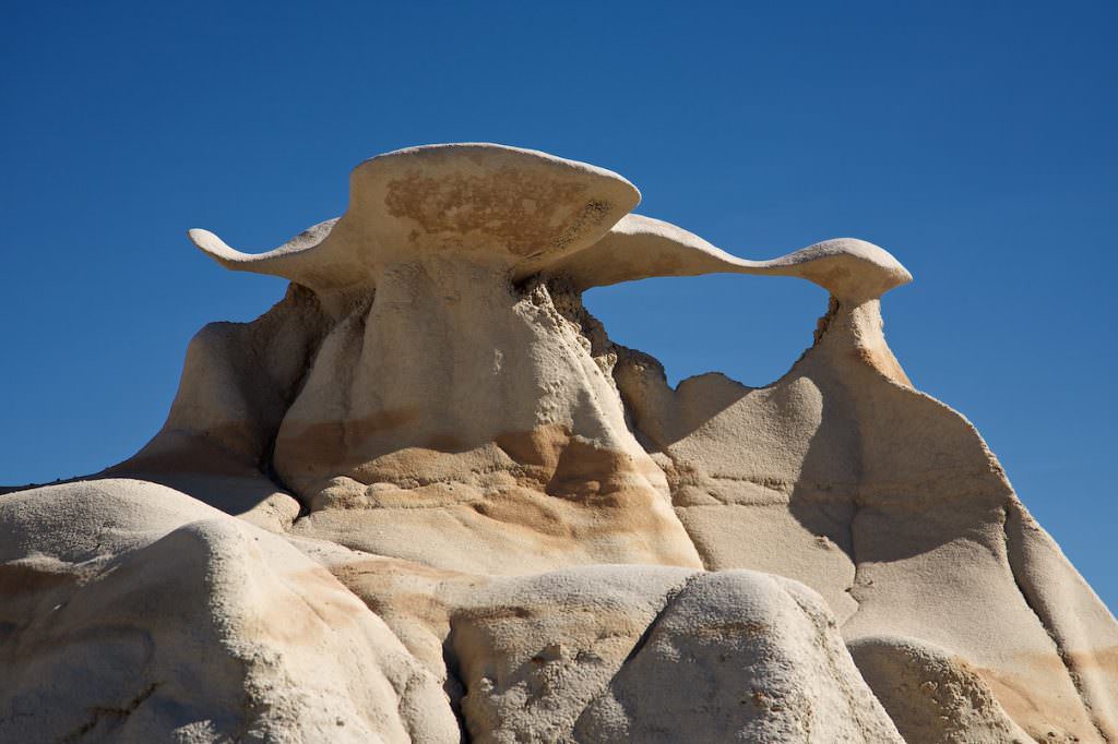
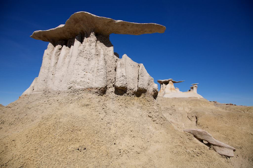
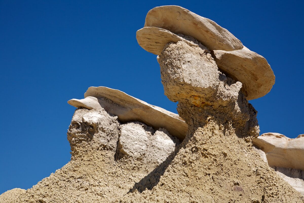
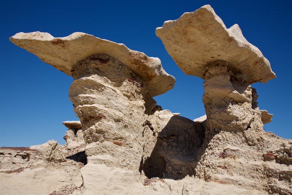
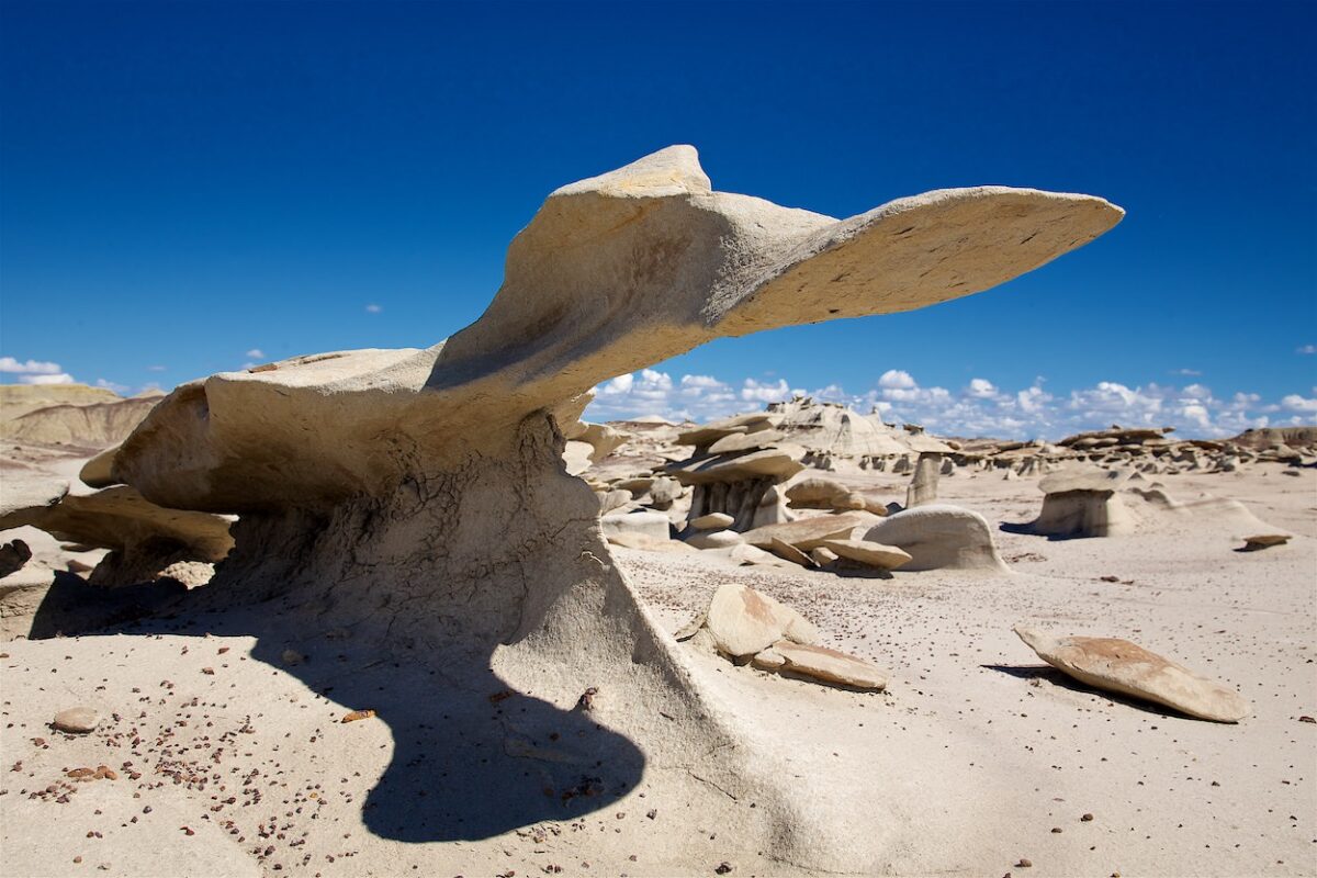
Bisti North Wings
Bisti Badlands North
Bisti North Wings
Bisti Badlands North
Bisti North Wings
Bisti Badlands North
Junction from Highway 371
Bist Badlands South - drive
The drive to the trailhead in the Bisti Badlands South is also unproblematic. Since the unpaved part of the drive is also graveled throughout, you can drive here even if it rains. Whether you still want to do the hike then is another matter. Here, too, you first drive from Farmington, on Highway 371, in a southerly direction. After 36mi you turn left onto a dirt road. Coordinate: Latitude 36.231884, Longitude -108.271504. Since this is the official road to the Bisti Badlands, this junction is also signposted accordingly (picture on the left). After another 1.2mi you reach a T-junction where you turn left. Now it is only a few hundred yards and you have reached the trailhead. Coordinate: Latitude 36.259255, Longitude -108.251373.
Trailhead for the hike at Bisti Badlands South
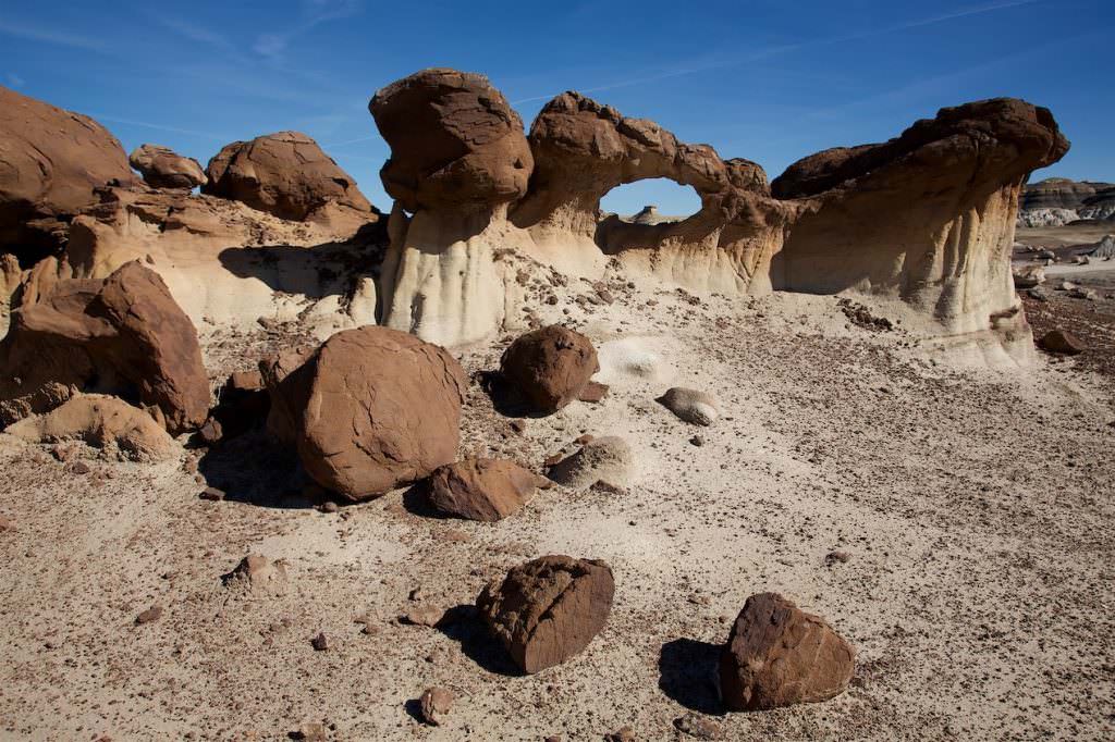
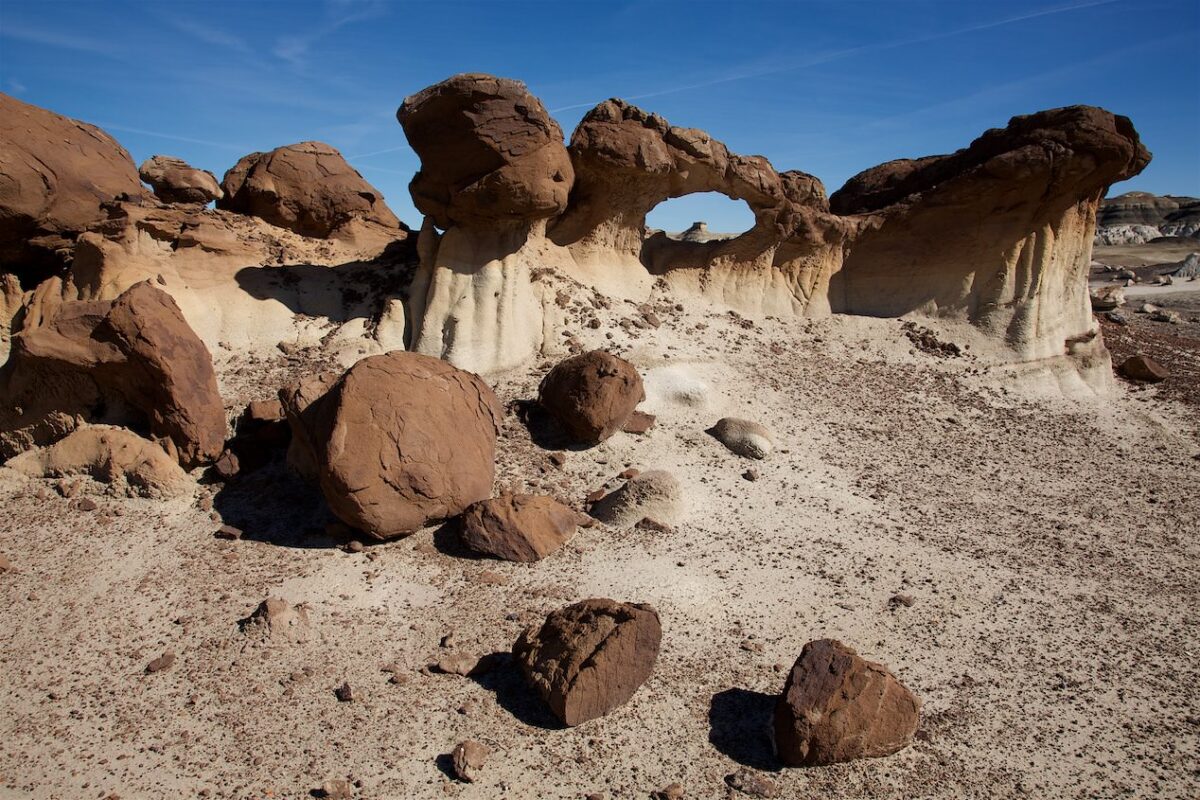
Bist Badlands Süd - Die Wanderung
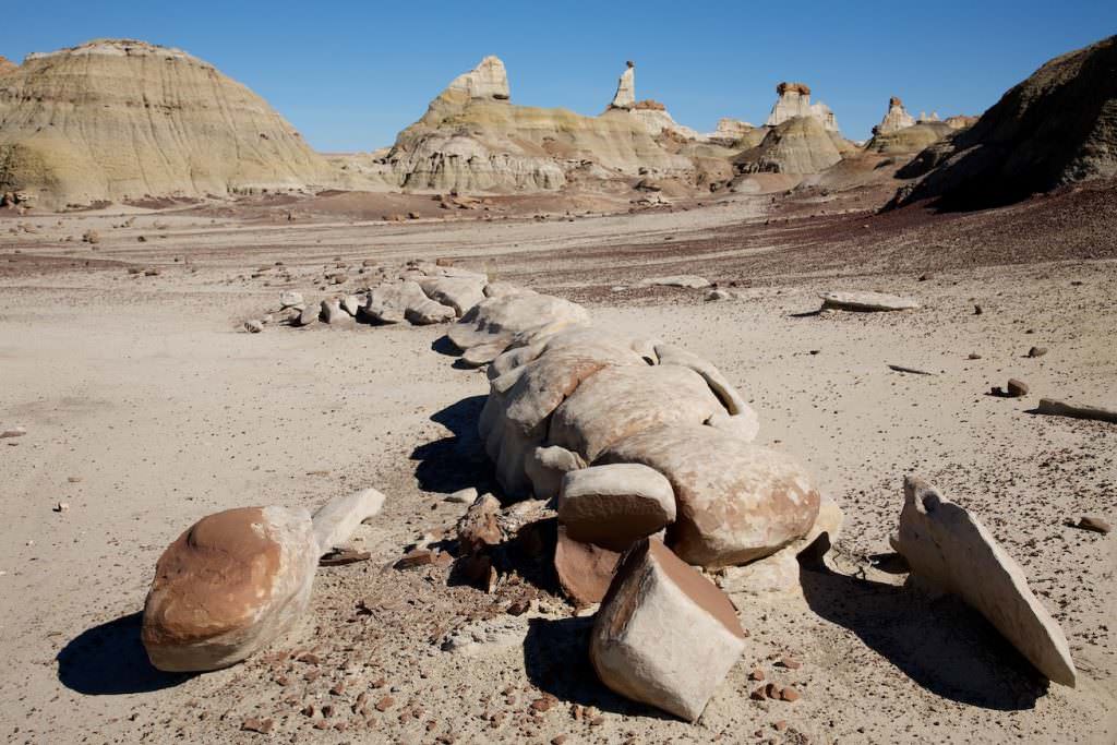
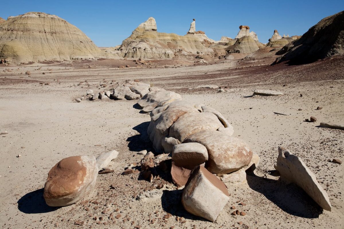
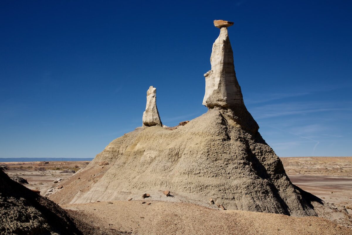
Description: Basically, the same can be said about the hike in the Bisti South as about the hike in the northern part. Therefore also for this hike: if you want to hike to special formations, like the Cracked Eggs, you should have a GPS device with a track. Especially if you have no experience in open, unknown terrain, it is otherwise very difficult to find something specific. The area is huge and you can move freely, there are no predetermined paths, so orientation is not trivial.
If you keep this in mind, nothing gets in the way of a great and exciting hike. You hike through a wonderland of badlands, hoodoos, petrified wood and lots of bizarrely shaped rocks. The elevation gain on our hike comes mainly from climbing up the hills. You can also hike without any elevation gain at all.
It is popular to spend the sunset at the Cracked Eggs. Here we would recommend to take a flashlight for the way back. The path to the parking lot is not short and the ground is very uneven, so it might be difficult in the dark. The GPX data of our hike can be found above, next to the map!!!
Trail length: 7mi Altitude difference: 541ft Time needed: 5 hours Difficulty level:easy - Hiking in the badlands is very easy because the ground is mostly level and easy to walk on.
Current: The Bisti Arch is unfortunately history. Sometime in early 2020 it sadly collapsed.
Our rating: We found the hike through the Badlands great. Around every corner you can find a bizarrely shaped stone and the best part is that you have it all to yourself. So if you have a little spirit of discovery and enjoy nature in total silence, you will like it here. However, it must be mentioned that in the southern part you are more likely to meet other people than in the north.
☆☆☆☆☆Rated 4 out of 5
Bisti Badlands South
Bisti Badlands South
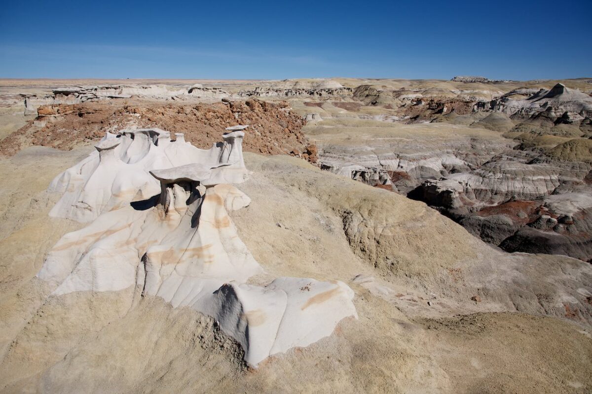
The trail to the Chocolate Hoodoos
Bisti Badlands South
Chocolate Hoodoos
Bisti Badlands South
Chocolate Hoodoos
Bisti Badlands South
Chocolate Hoodoos
Bisti Badlands South
Bisti Badlands South
Bisti Badlands South
Bisti Badlands South
Bisti Arch
Early 2020 unfortunately collapsed!!!
Bisti Badlands South
Bisti Badlands South
Bisti Badlands South
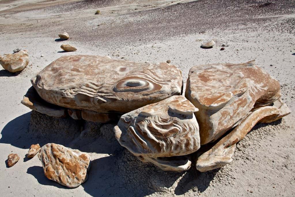
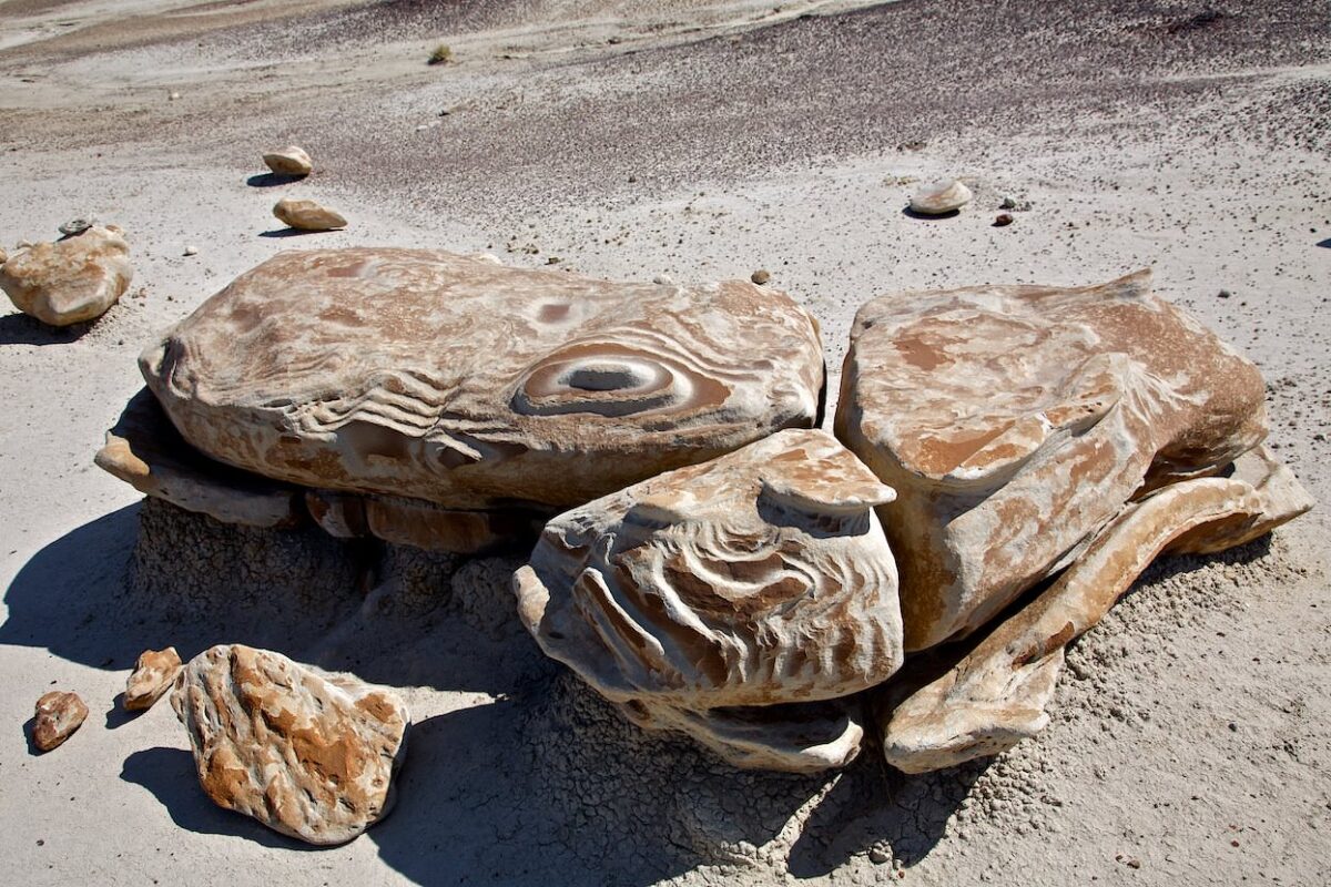
Cracked Eggs
Bisti Badlands South
Cracked Eggs
Bisti Badlands South
Cracked Eggs
Bisti Badlands South
Bist Badlands North/South - The Hike
Description: After doing the two Bisti hikes separately in 2011, we wanted to combine them in 2012. This is basically no problem. We parked at the trailhead to the southern part and hiked from there first to the northern part up to the Wings and then in a big arc, past the Cracked Eggs in the southern part, back to the car.
Again, the elevation gain comes more from climbing the hills. The terrain in the Badlands is basically totally flat. The GPX data of our hike can be found above, next to the map!!!
Trail length: 7mi Altitude difference: 466ft Time needed: 5 hours Difficulty level:easy - Hiking in the badlands is very easy because the ground is mostly level and easy to walk on.
Our rating: We liked this hike because you are able to discover all the attractions throughout one trip. Of course, you can extend the round infinitely, but these 7mi still belong to our comfort zone, where we can still enjoy a hike to the fullest. We can only recommend anyone who wants to invest the time to connect the two parts of the Bisti Badlands. It is a great hike.


