Note: On unpaved roads, road conditions can change constantly. Therefore we strongly recommend to check the road conditions before each trip. Information is available at the Colorado NM Visitor Center. Before reported, during or shortly after rain or snowfall, we advise against driving on unpaved roads.
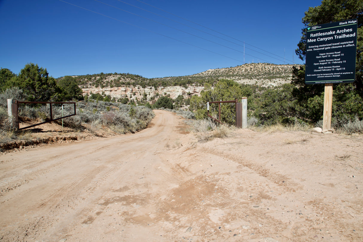
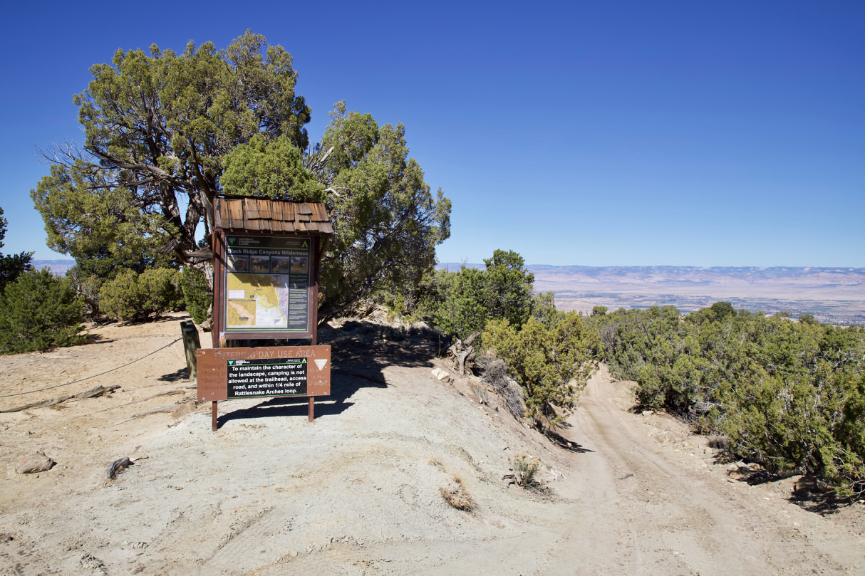
Rattlesnake Canyon is located in the McInnis Canyon National Conservation Area. This is part of the Black Ridge Canyons Wilderness, right next to Colorado NM. Next to Arches NP, Rattlesnake Canyon is home to the largest density of rock arches in the US.
Distance: From the junction off Rim Rock Rd in Colorado NM, it is a 10.7mi drive to the trailhead where the hike begins.
Except for the first 328ft the complete road is not paved. The road is in large parts, in dry weather!!! quite well passable, however, the last few miles are such that you should start only with a suitable car, if you do not want to extend the hike involuntarily by a few miles. In any case, you should only drive on the road when it is dry. It is very clayey in large parts and this turns into soft soap almost immediately during rain. The rangers in Colorado NM usually know the condition of the road. However, since it is not in their jurisdiction, they usually do not drive the roads. Therefore, they rely on reports from the people who have driven the route.
Junction Black Ridge Rd into Radio Tower Rd
Lower Access Road
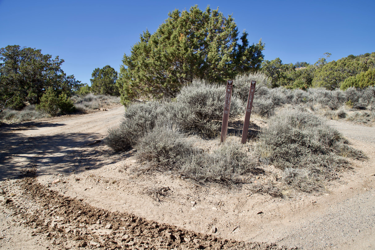
Junction of Upper and Lower Access Road
Lower Access Road
Lower Access Road
Lower Access Road
Junction of Upper and Lower Access Rd
The drive in detail:
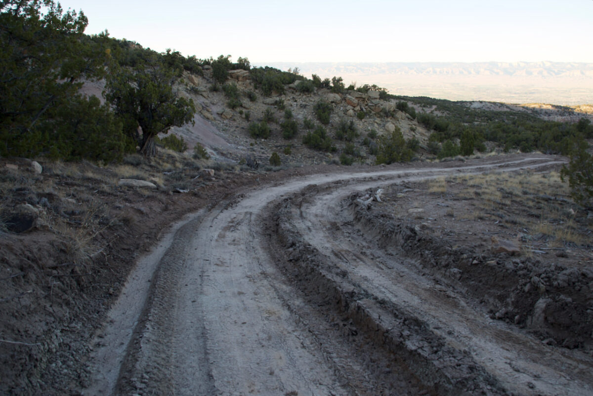
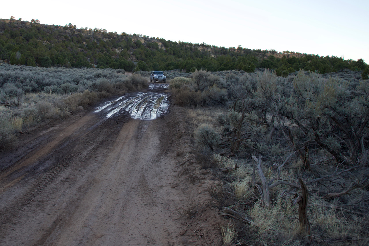
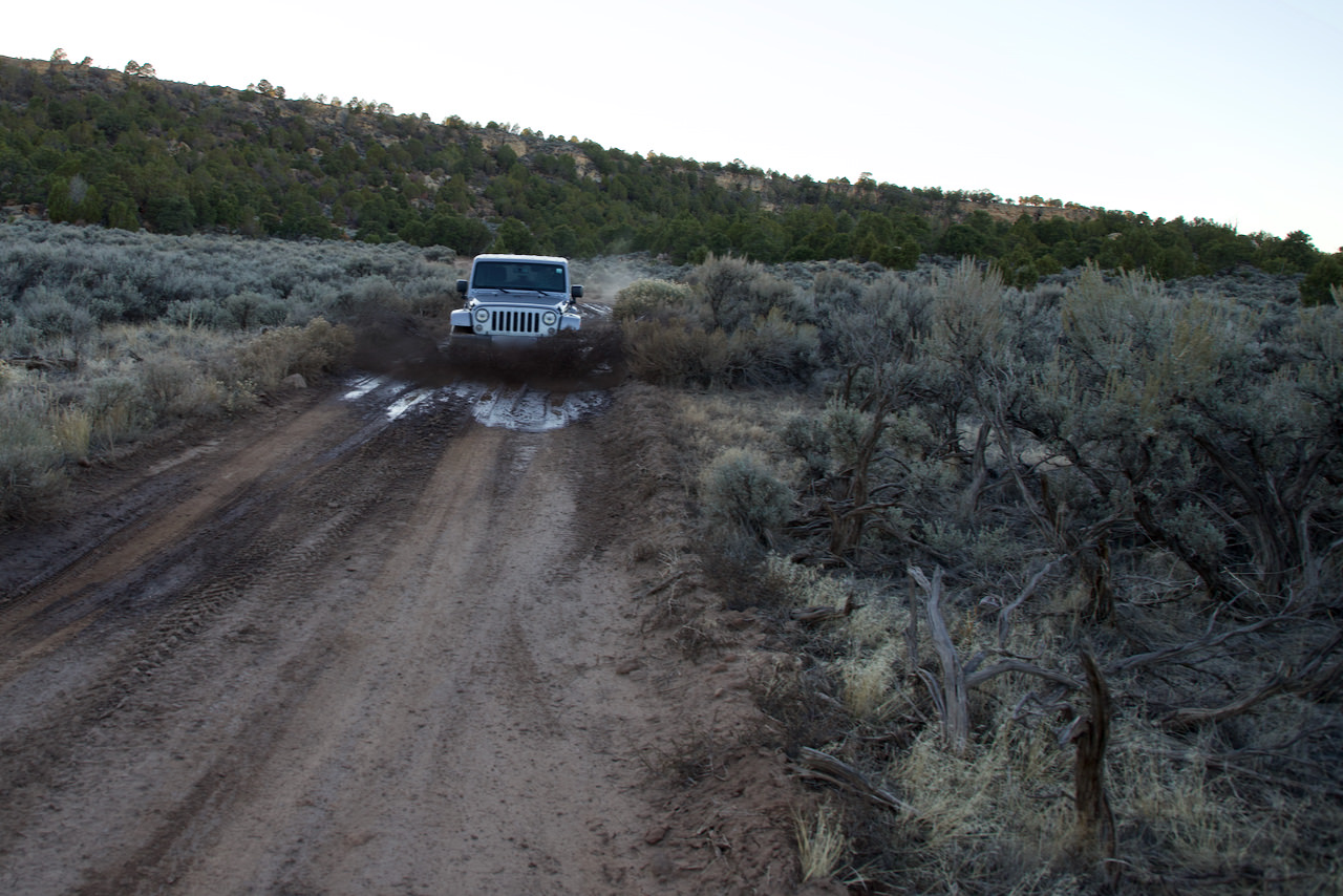
The access is via the Rim Rock Road at the Colorado NM. If you are entering from the west entrance, turn onto N16 1/2 Rd. after about 11mi. Coordinate: Latitude 39.060979, Longitude -108.741498. Only about 820ft after the junction you reach the next turnoff, which is easy to miss. Here you turn right from the paved N16 1/2 Rd into Black Ridge Rd. From here on the road is unpaved. Coordinate: Latitude 39.054858, Longitude-108.744693. The road now leads uphill in switchbacks. The road is relatively stony and clayey. After rain, you will probably have the first difficulties to get up here. After about 1.4mi you reach a T-junction. You turn right into Radio Tower Rd. Coordinate: Latitude 39.055251, Longitude -108.761240. This is sort of the connector to the Upper and Lower Access Rd. There are basically two accesses to Rattlesnake Canyon. From April 15 - August 14 one drives on the Upper Access Rd, from August 15 - February 14 accordingly on the Lower Access Rd. In October 2018 we were driving therefore on the Lower Access Rd. The road is in a quite good condition. It passes through forest and over meadows. The surface is sometimes a little rocky but mostly clay. This section should be quite passable with any SUV. High ground clearance is an advantage. Two weeks before our visit it rained heavily for several days in the McInnis Canyons area. Therefore, there were still several, partly very large and longer puddles on the route. Without four-wheel drive we would probably have turned back here.Partly the road was also very rough (see picture above). Should it be dry for a longer time, there will probably not be these problems here. The "problems" start when Upper and Lover Access Rd meet again.
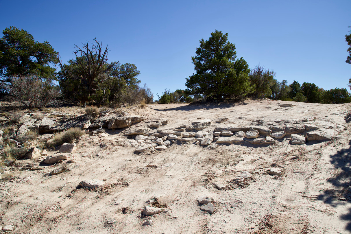
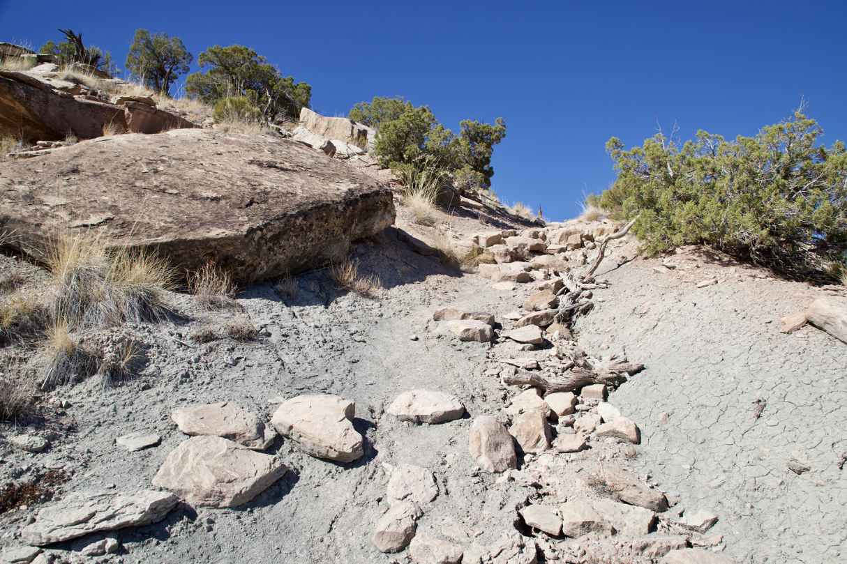
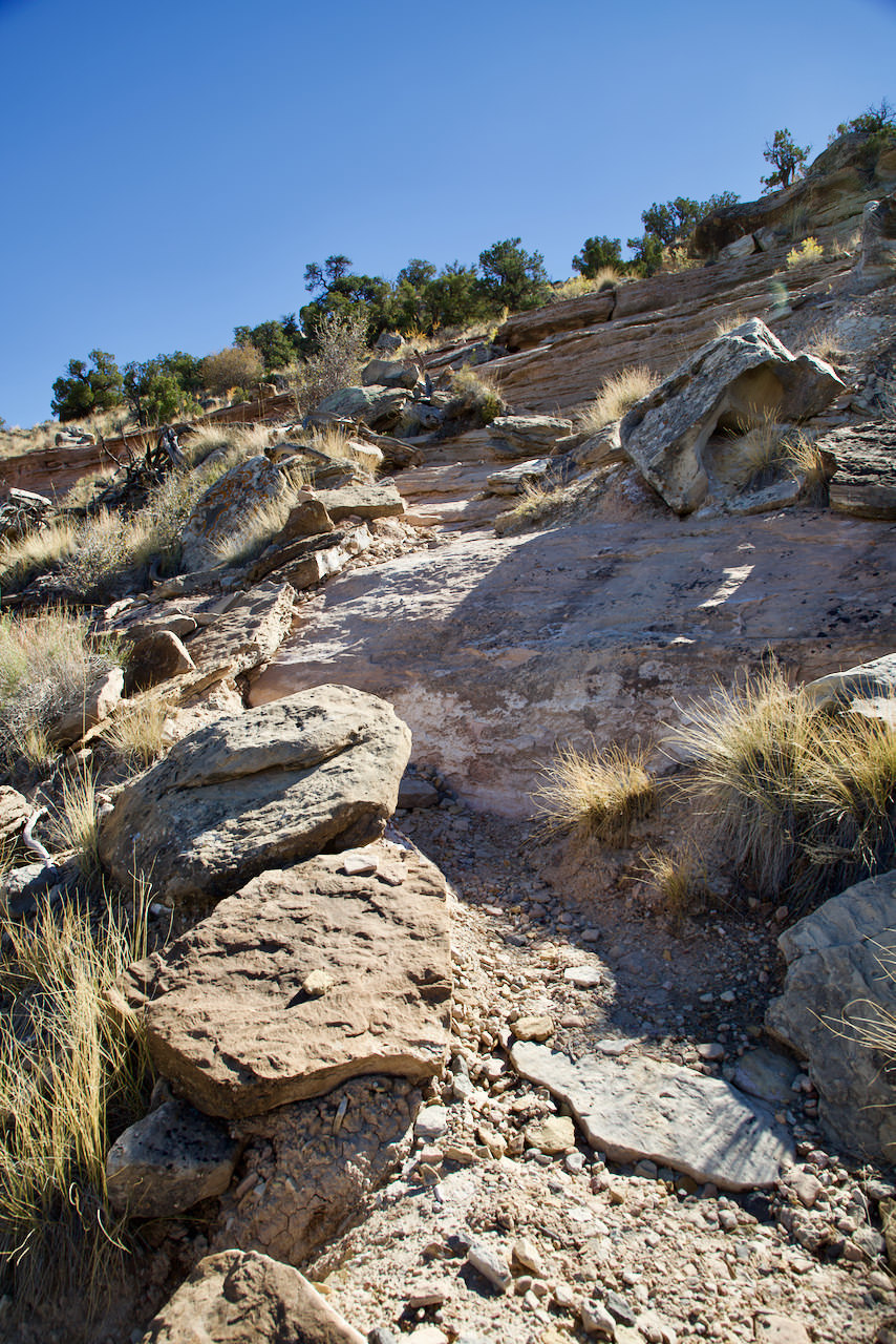
Stone step about 1 mile before reaching the trailhead
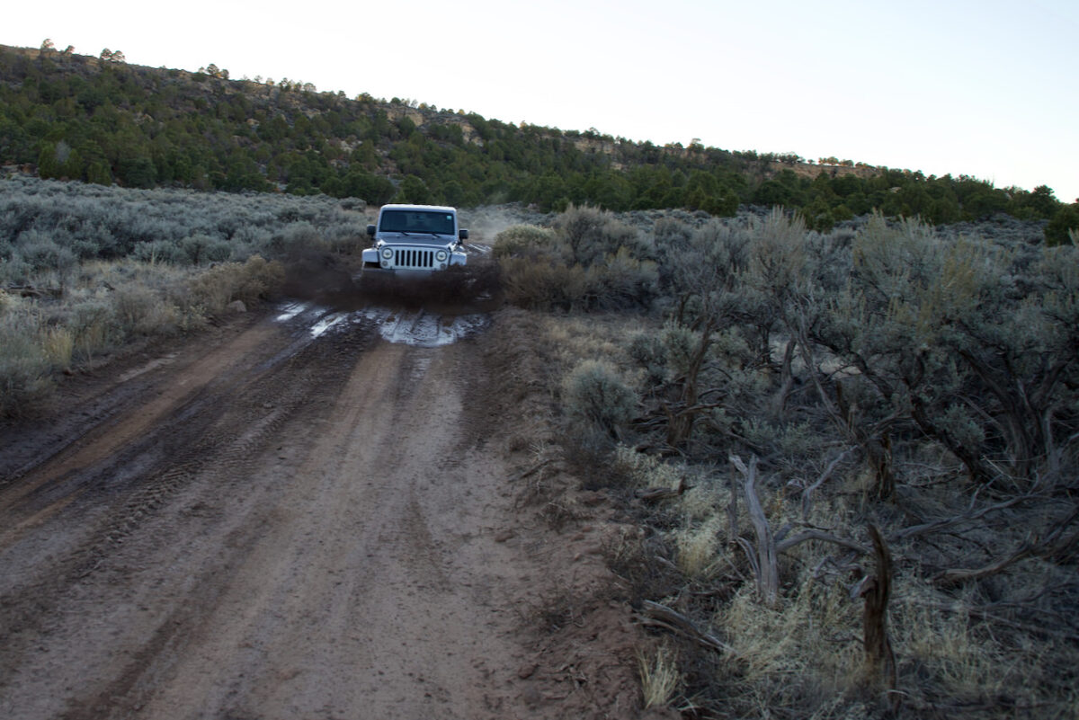
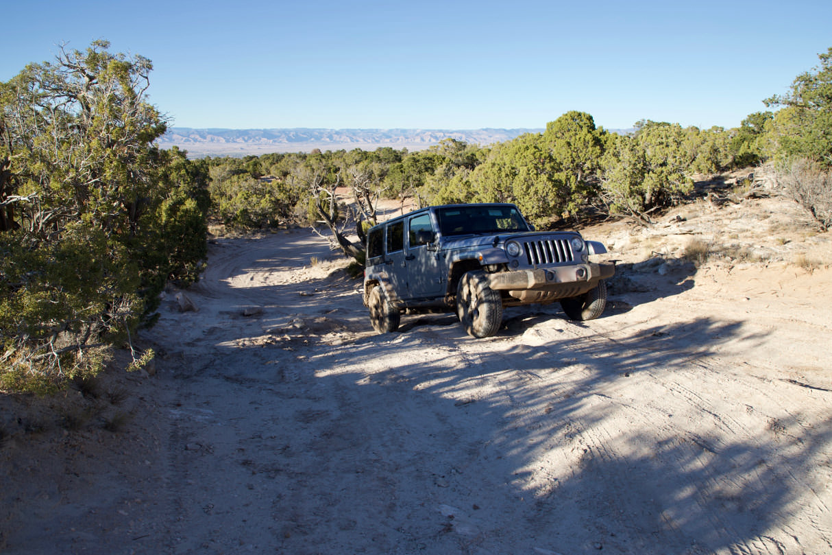
Coordinate: Latitude 39.107315, Longitude -108.839239. From here the road becomes very very stony and rough. It leads partly steeply downhill and also there is still the one or other mud hole. Most SUV' s are probably finished at the latest at the stone step (picture on the left). From here it is still 1 mile to the trailhead. We had a Jeep Wrangler at our disposal, which had a lot of ground clearance. So it was no problem to drive down here and afterwards up again (picture on the right). We wouldn't put up with one of the common rental SUV's on this route out of pity. This is always very subjective, but these last two and a half miles are definitely among the worst stretches we have ever driven in the USA. After a good 10.7mi and a 1 hour and 15 minute drive, you've made the drive. I have to admit that I wondered several times during our drive what would happen if our car got stuck here. Because apart from us, there was only one other car on the road.
Stone step on the way back
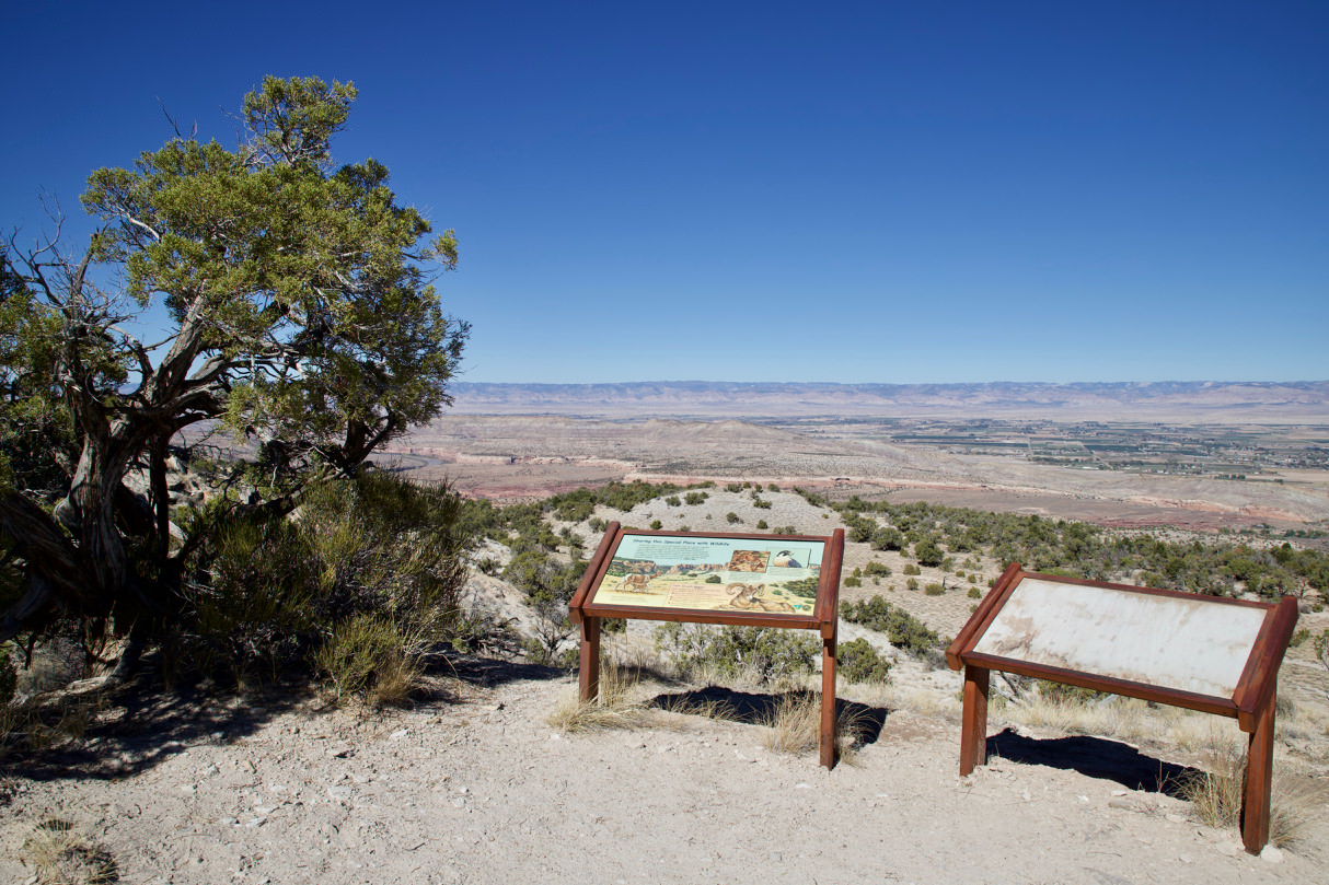
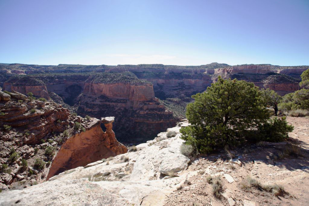
View from the trailhead towards the Colorado River
First small descent to an intermediate plateau
The hike
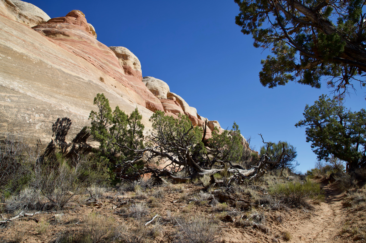
Description: The hike begins with the descent to a smaller intermediate plateau. At first I thought we were already at the bottom but the actual descent is only after you have covered about 0.3mi on this intermediate plateau, relatively flat. The descent is steep and partly rough, but generally quite good to master. Once at the bottom, you hike about 1mi relatively level. To get to the Rattlesnake Canyons you have to walk around the cliff. The Arches are all on the other side. If you hike around the corner , the stone arches come into view relatively quickly. You now hike along the cliff wall, basically on the other side, back towards the trailhead. The easy way to the last arch is about 1.4mi long. Here you have the option to climb up through the arch, or hike back the same way. Since the ascent through the arch was much too steep for us, we decided for the second option. If you climb up through the arch, you shorten the way back almost 2mi.
Trail length: 5.8mi roundtrip Altitude difference: 1286ft Time needed: 3 hours Difficulty level:moderate - The trail is generally well maintained. On the descent into the canyon it is rough and steep.
Our rating: Apart from the difficult drive, we liked the trail very much. In addition to the numerous, great arches, it offers spectacular views and, above all, peace. You certainly not meet crowds of people here and you will have nature much for yourself. There are not so many of these places left in the southwest. To all who have a suitable vehicle, we can highly recommend this trail.
If you don't want to make the drive, but like to hike, you can also discover the Arches via Pollock Bench Trailhead. However, the trail is over 12.5mi long and overcomes more than 2297ft in altitude.
☆☆☆☆☆Rated 4 out of 5
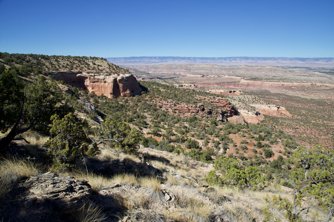
View into the valley. You descend about to the foot of the big red rocks, on the left in the picture
This is how the descent looks
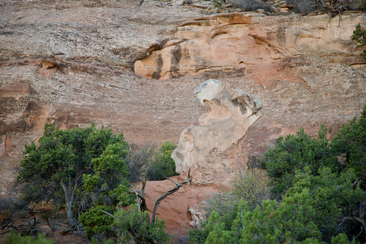
Rattlesnake Canyon Trail
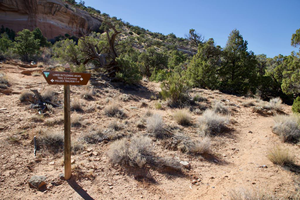
Junction with Pollock Bench Trail
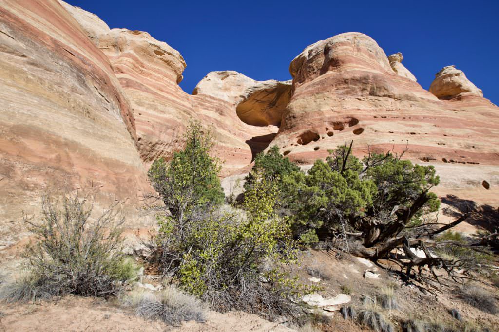
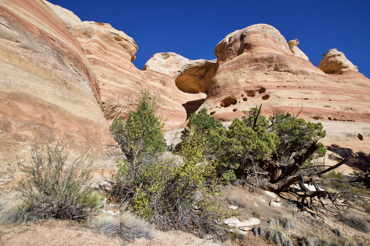
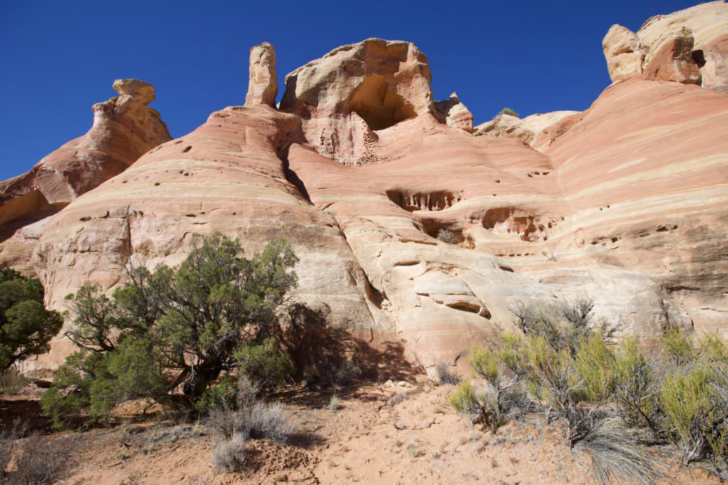
Rattlesnake Canyon Trail
Rattlesnake Canyon Trail
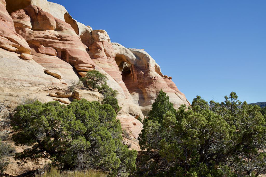
Here you are at the "corner".
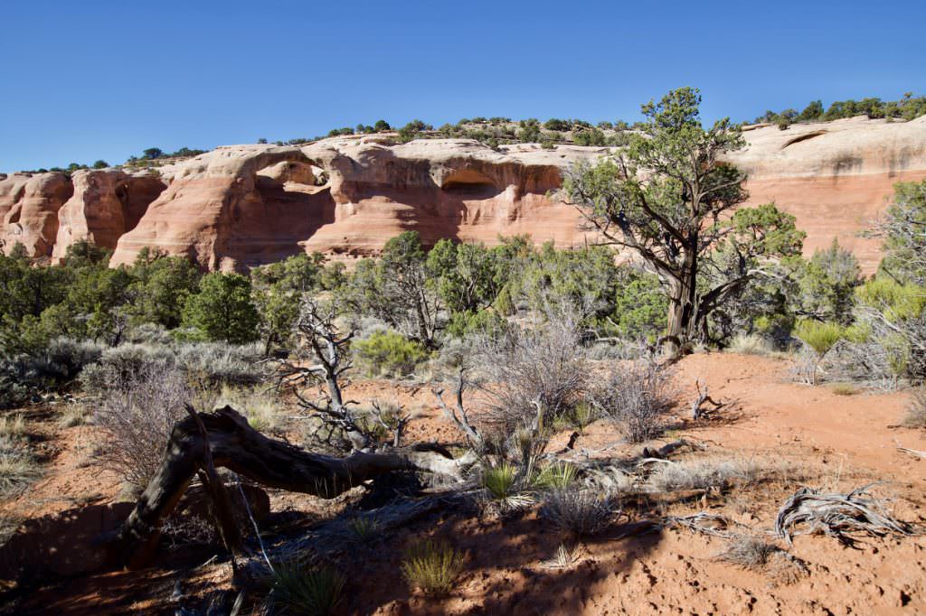
Rattlesnake Canyon Trail
Rattlesnake Canyon Trail
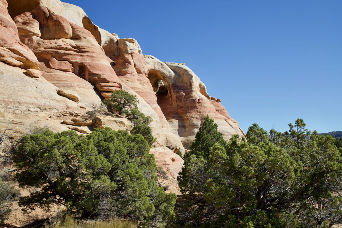
Rattlesnake Canyon Trail
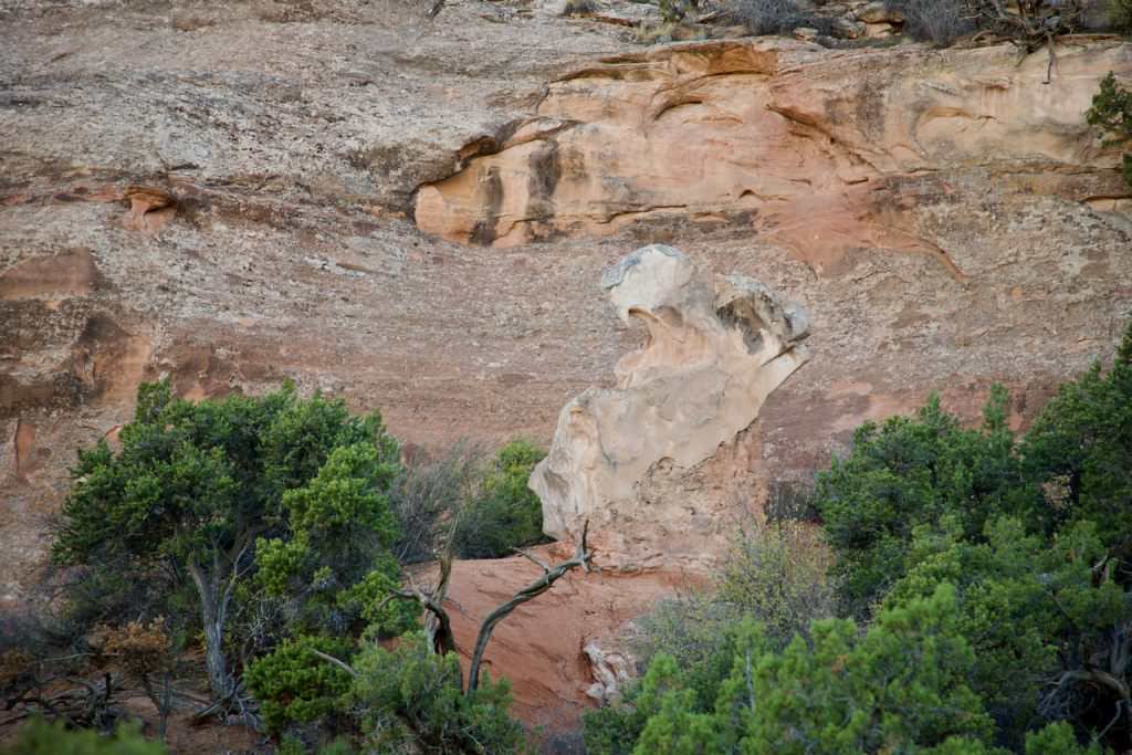
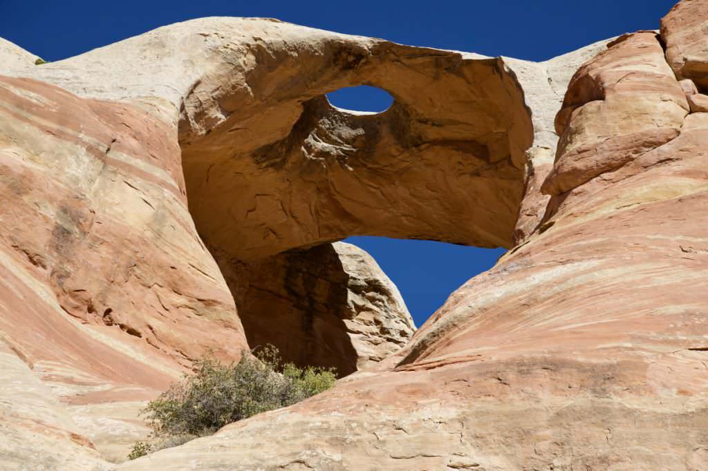
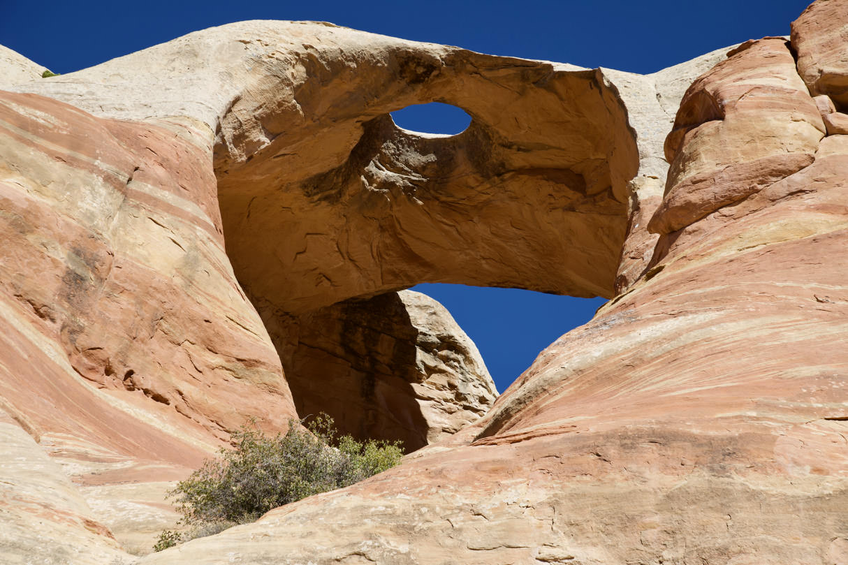
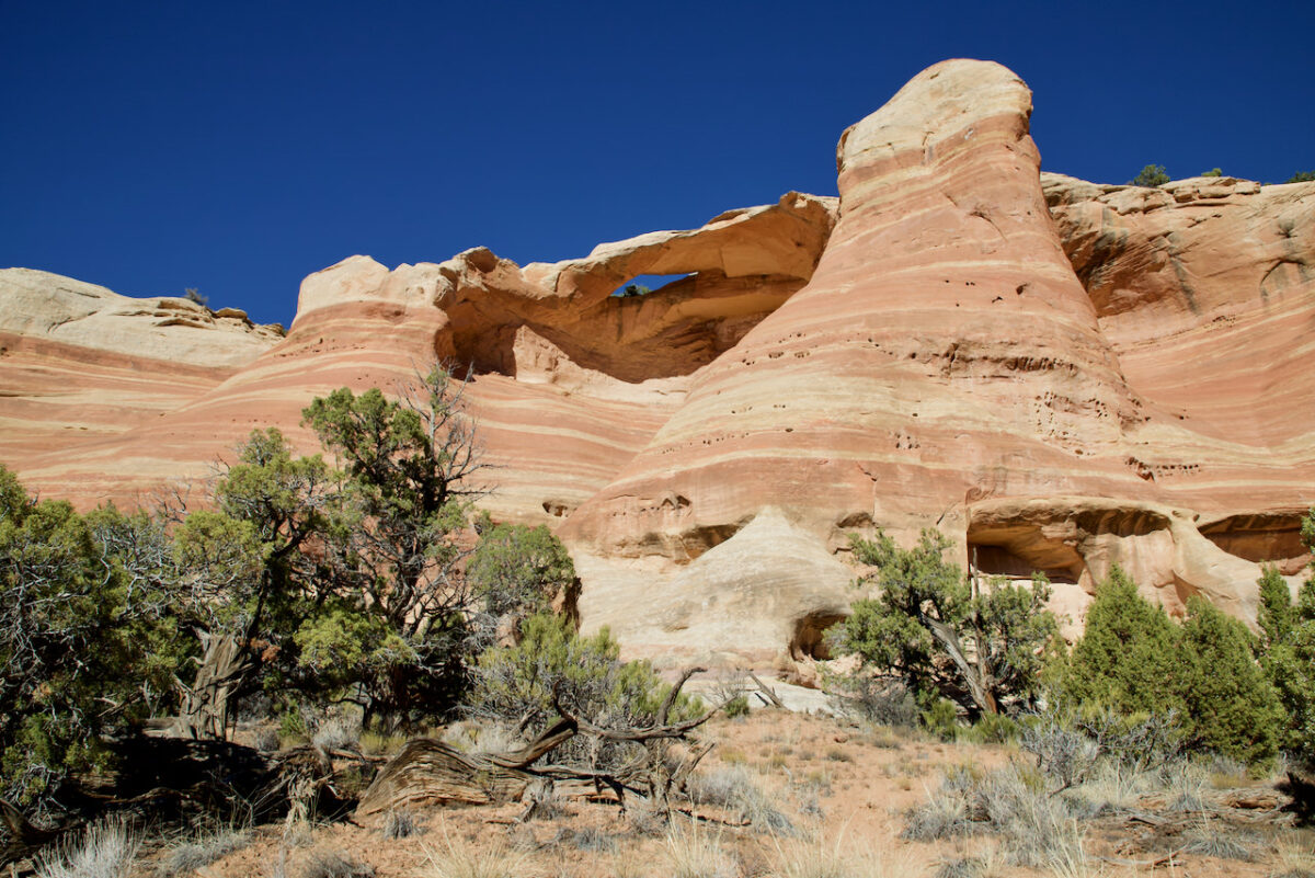
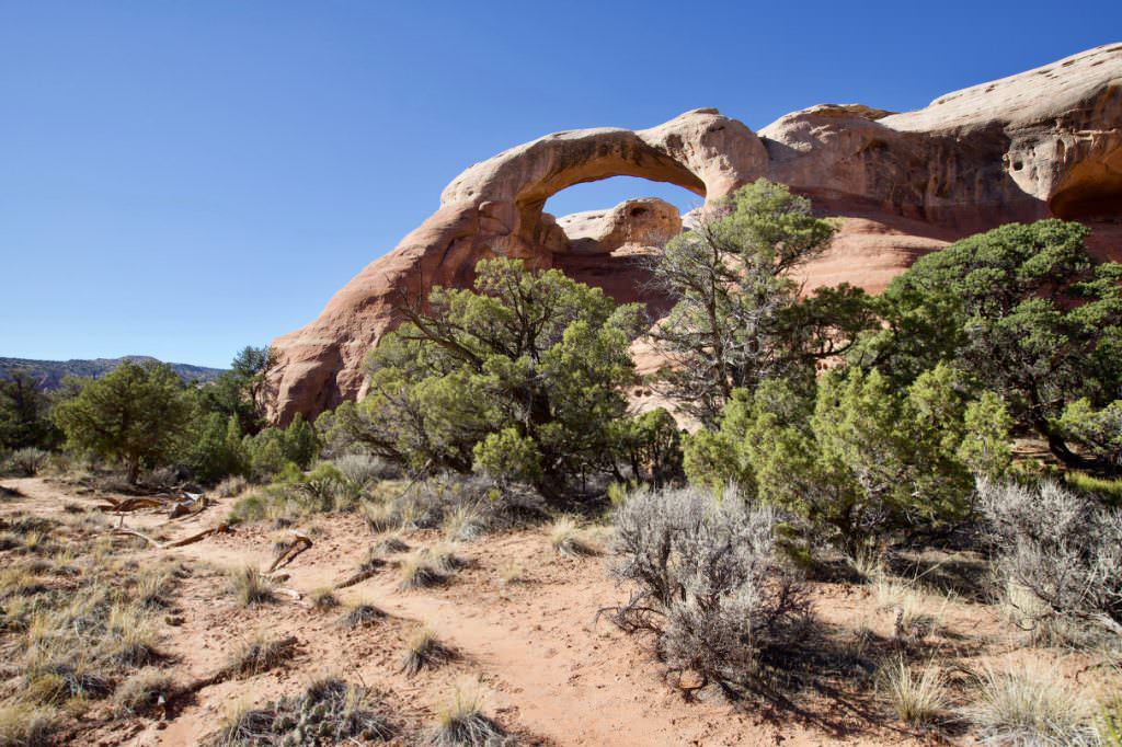
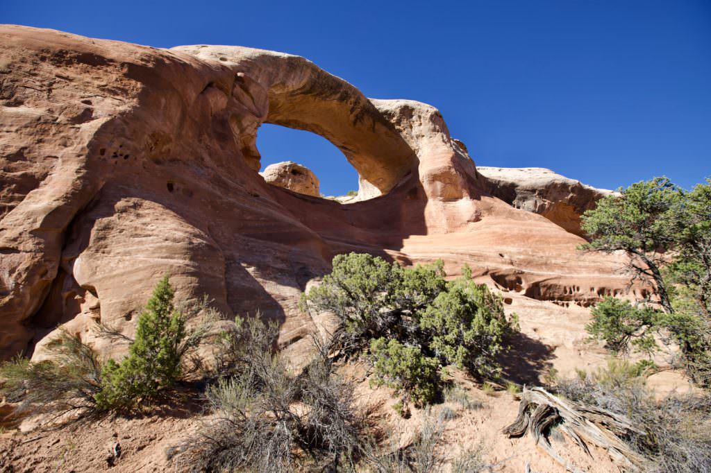
Hole in the Bridge Arch
Rattlesnake Canyon Trail
Rattlesnake Canyon Trail
Rattlesnake Canyon Trail
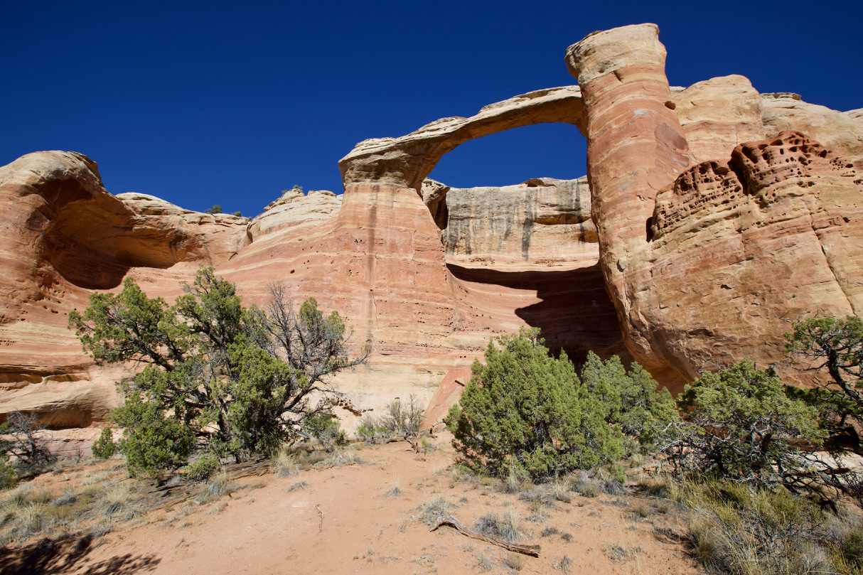
Centennial Arch
Rattlesnake Canyon Trail
Rattlesnake Canyon Trail
View into the valley
Rattlesnake Canyon Trail
Rattlesnake Canyon Trail
Rattlesnake Canyon Trail
Rattlesnake Canyon Trail
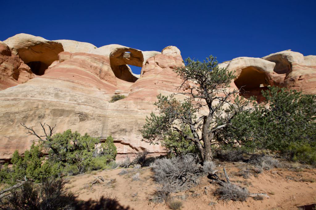
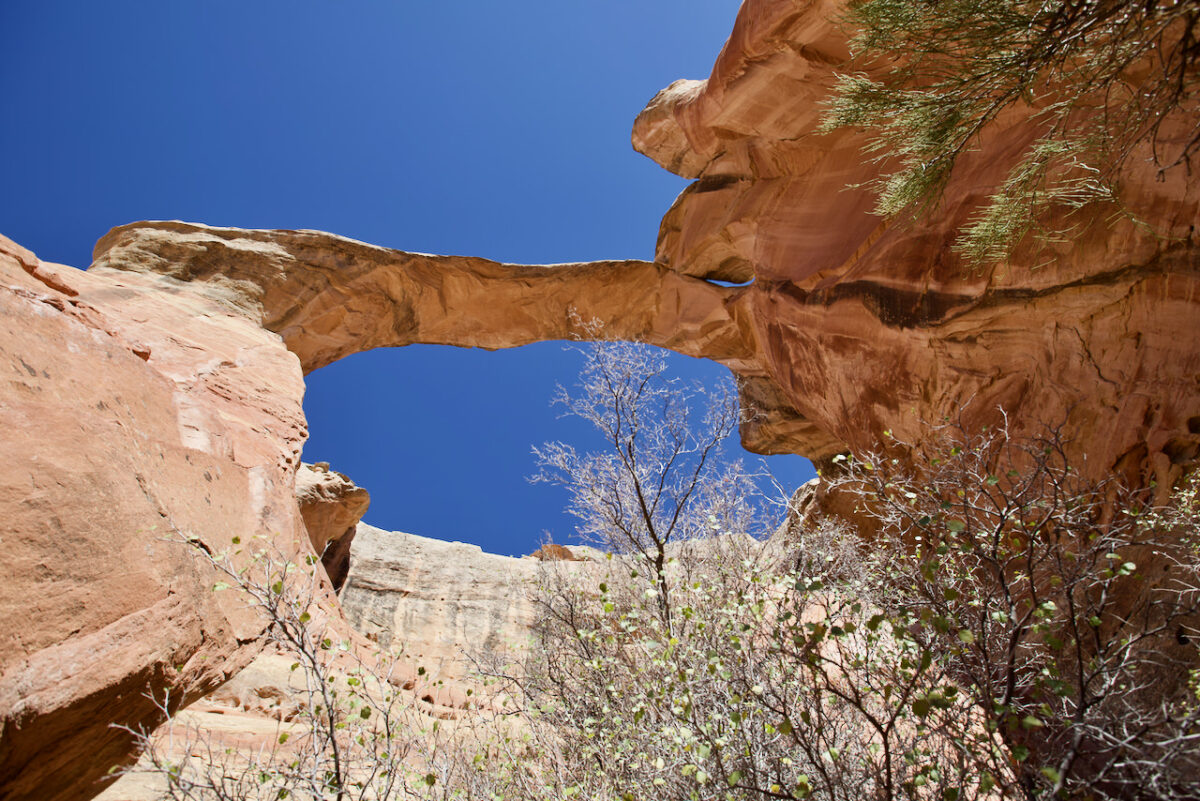
Cedar Tree Arch, you can climb up here to shorten the trail by almost 2 miles.
Rattlesnake Canyon Trail
Hole in the Bridge Arch
Rattlesnake Canyon Trail
Rattlesnake Canyon Trail
Rattlesnake Canyon Trail
Centennial Arch
Rattlesnake Canyon Trail
Rattlesnake Canyon Trail
View into the valley
Rattlesnake Canyon Trail
Rattlesnake Canyon Trail
Rattlesnake Canyon Trail
Rattlesnake Canyon Trail
Cedar Tree Arch, you can climb up here to shorten the trail by almost 2 miles.


