Canyonlands NP is divided into three major sections. Island in the Sky in the northern part, is probably the most visited part, The Needles in the southern part and The Maze in the western part. Because of its difficult accessibility, in the latter you are usually alone and alone with yourself and nature.
Visitor number 2000
0
Visitor number 2010
0
Number of visitors
In 2025, Canyonlands NP ranked 29th in the visitor statistics for the most visited national parks. Best time to visit:Spring and fall Our visits: So far 5 visits: April 1997, October 2011, October 2014, February 2016, April 2022
Open 24h all year round. Some facilities are closed in winter.
*The America the Beatiful pass is so to speak the "flat rate" for all Parks managed by the National Park Service. The pass costs a one-time fee of $250 and can be purchased at the entrance to each National Park, National Monument, etc. The pass is valid for 13 months.
Here are the GPX files of our hike in Chesler Park
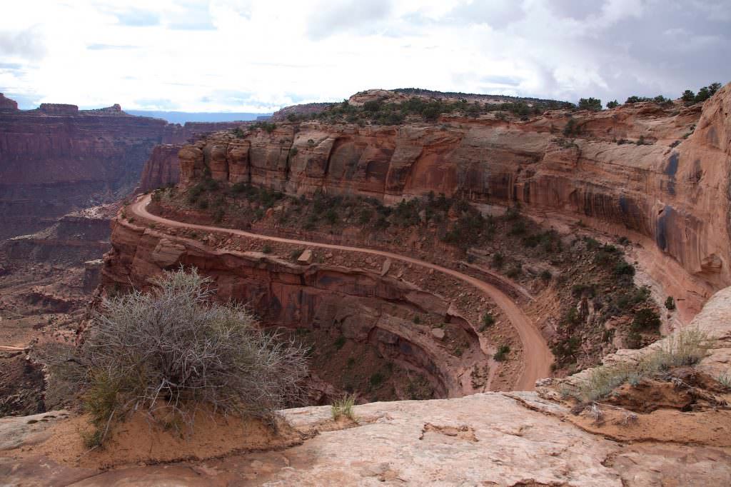
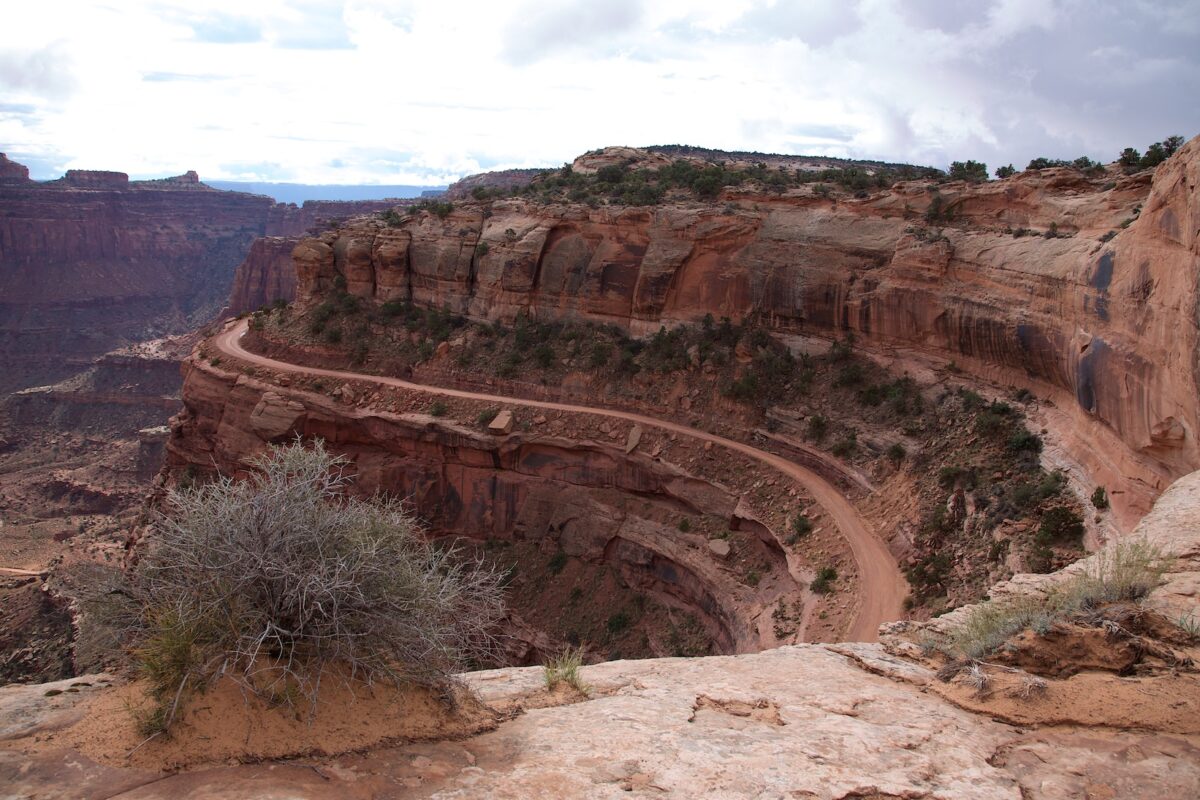
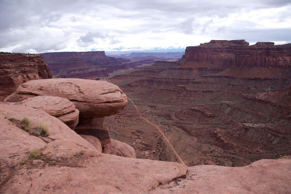
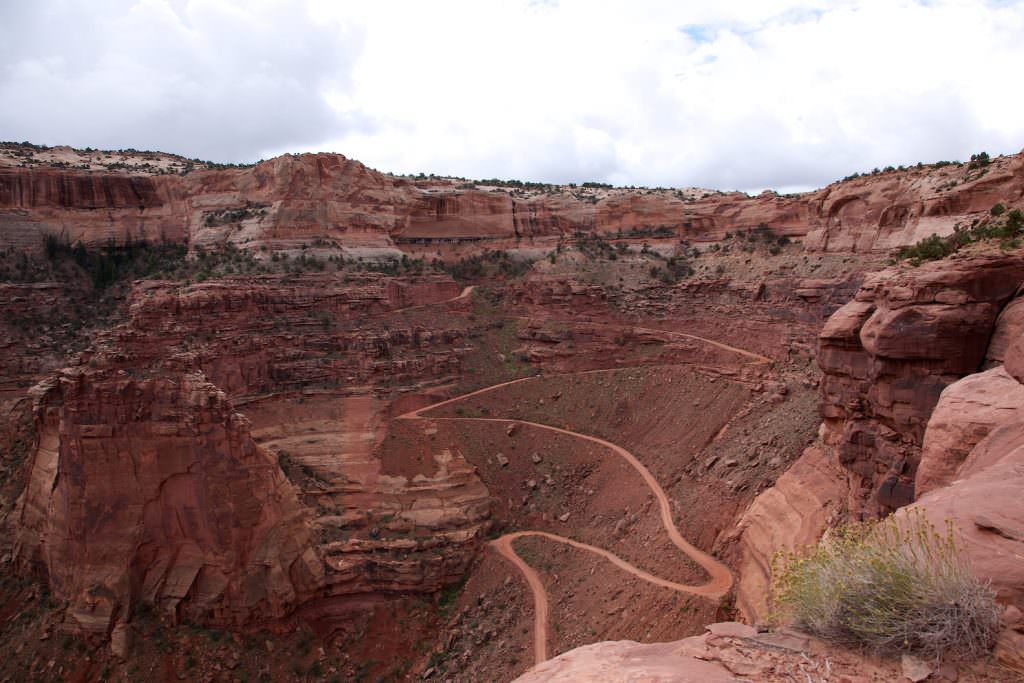
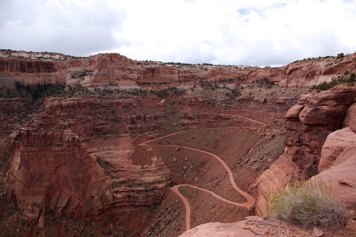
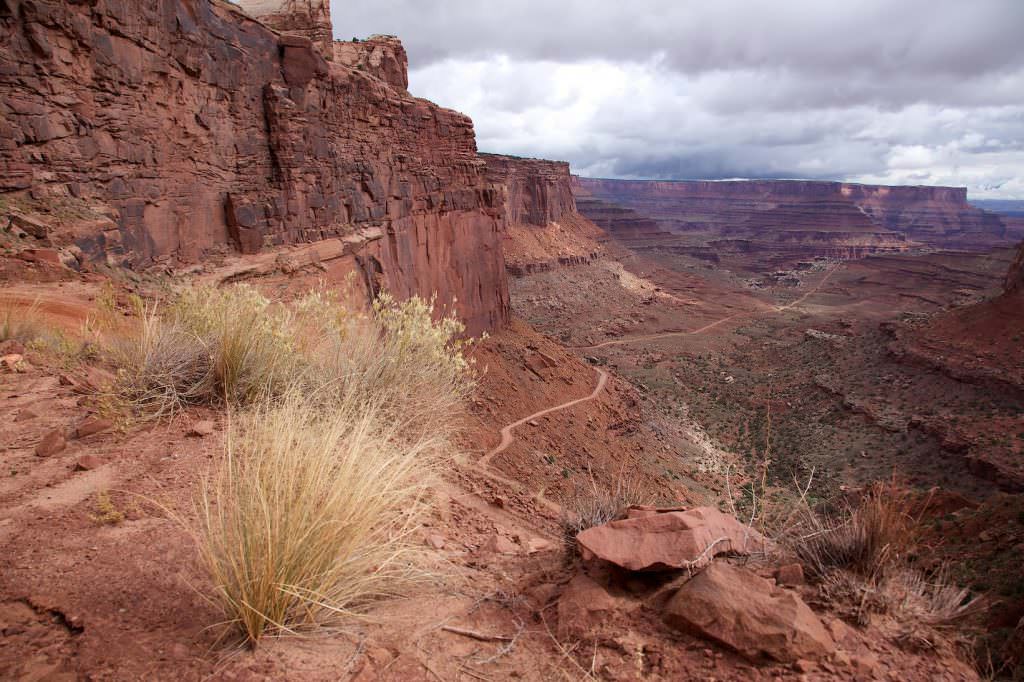
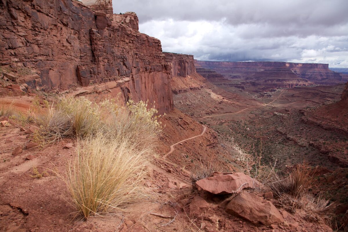
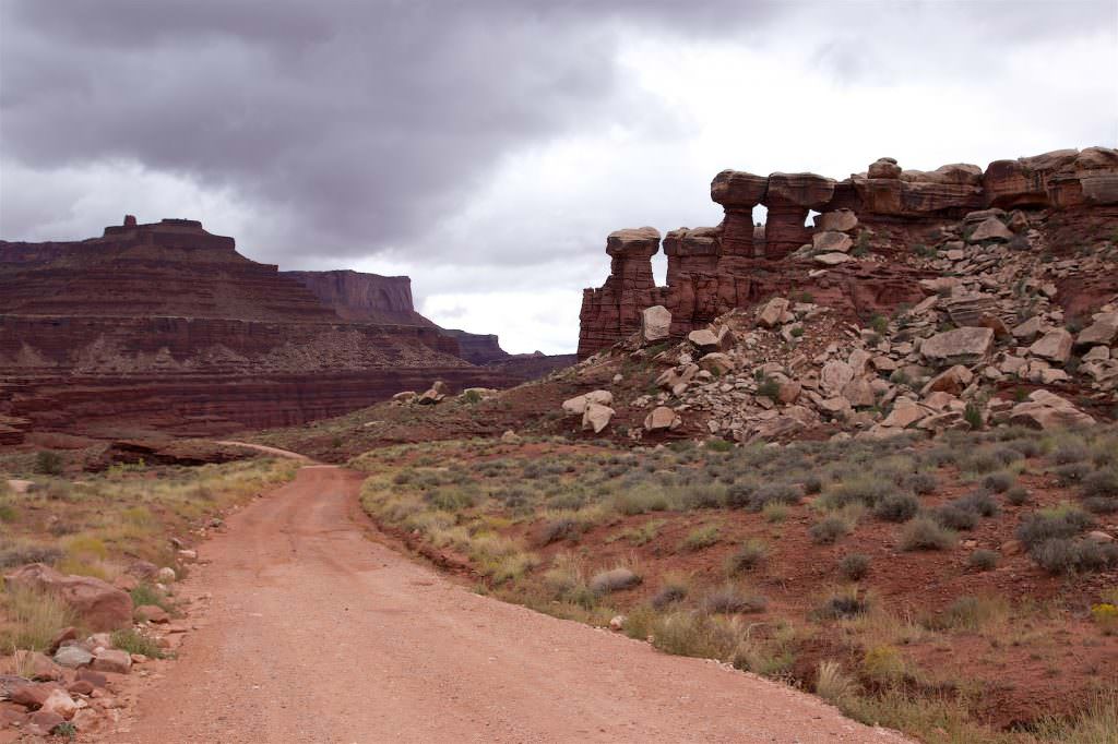
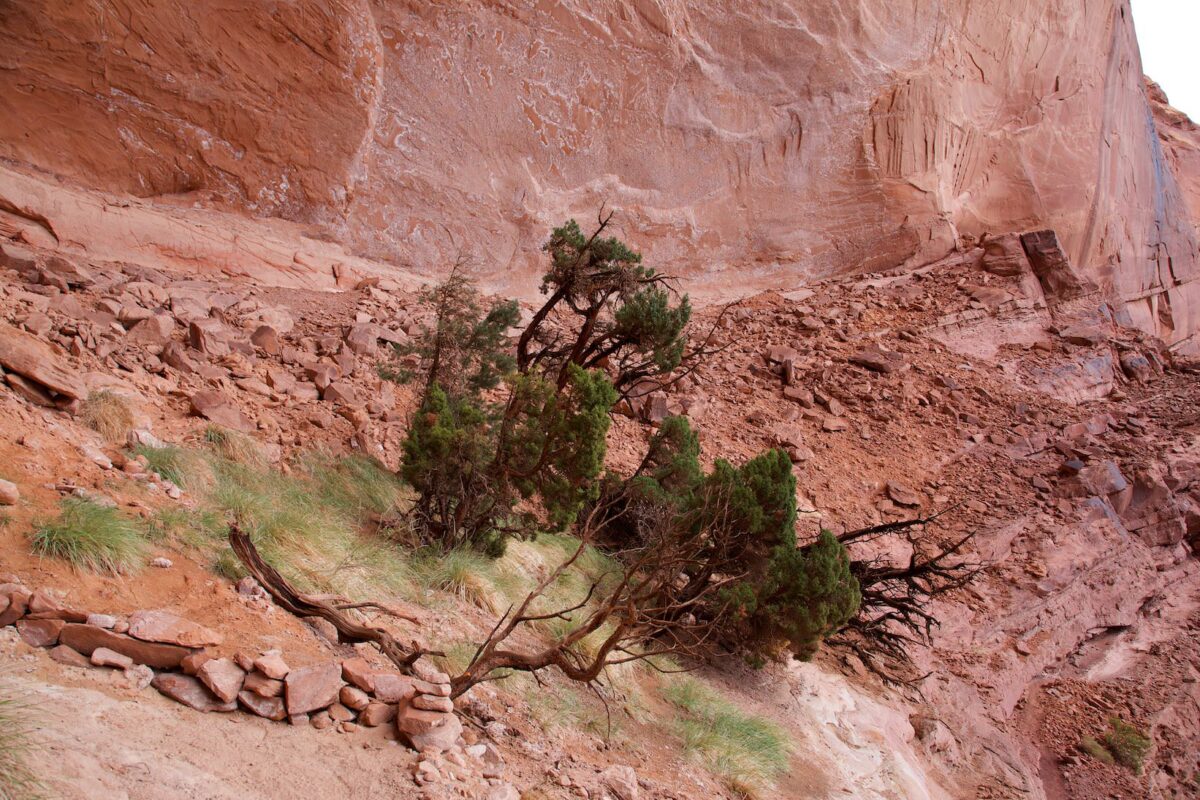
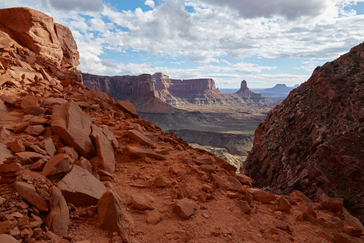
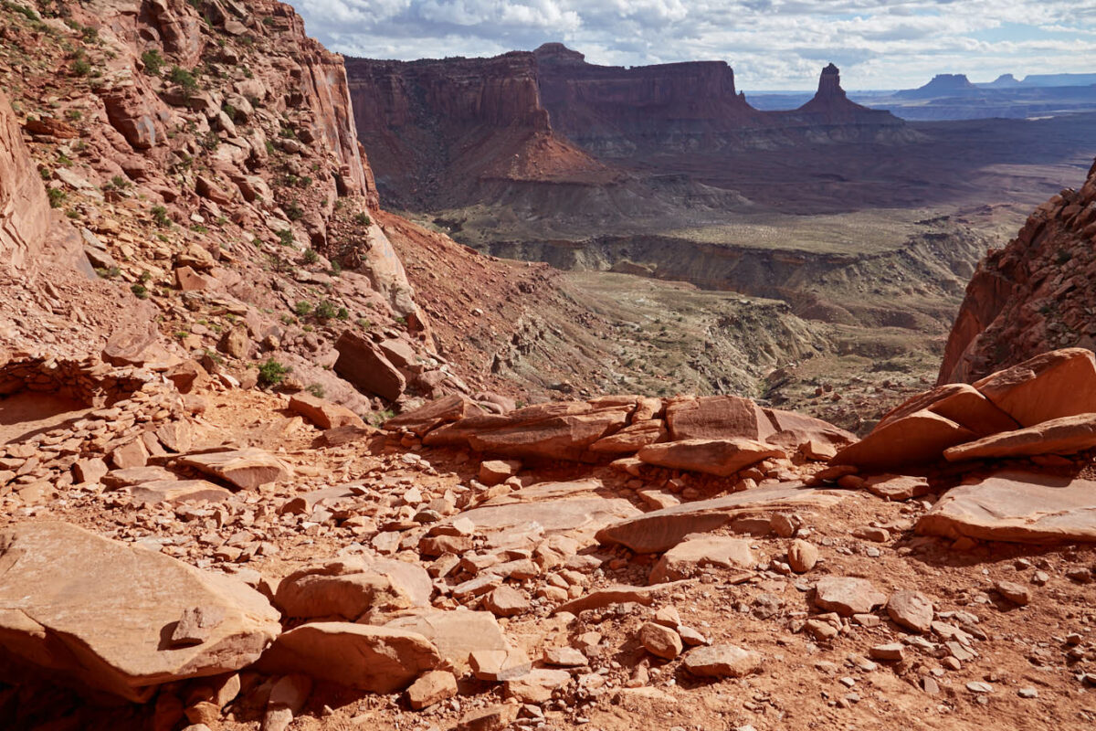
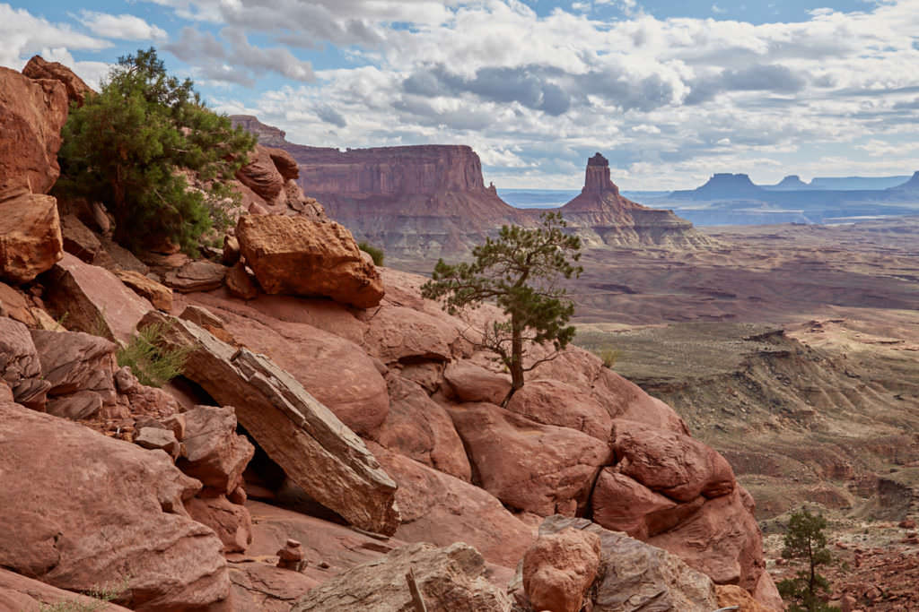
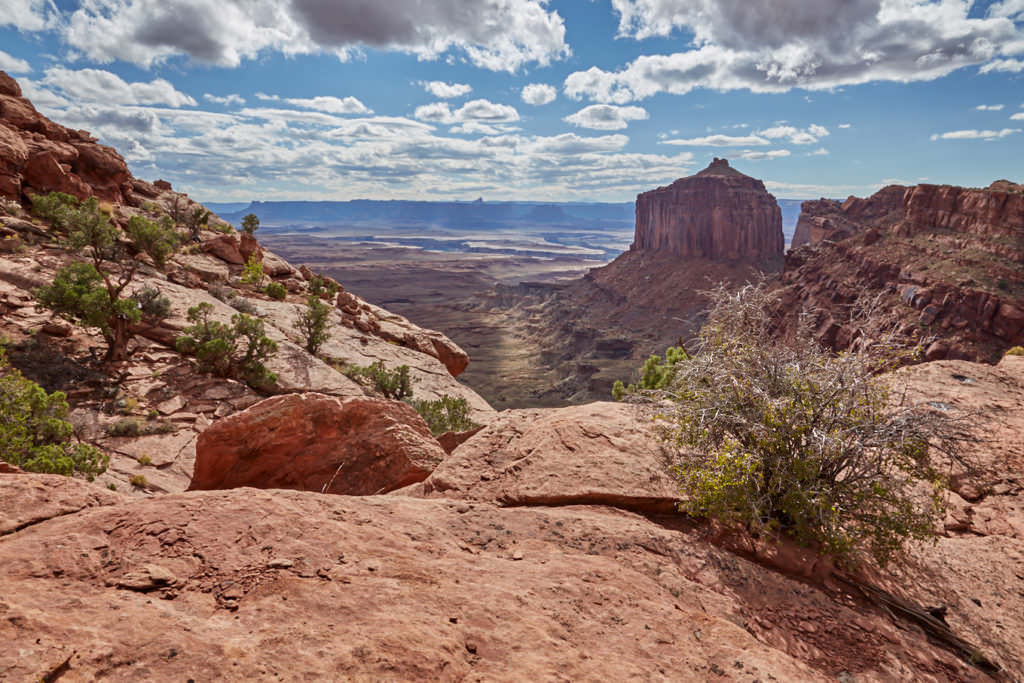
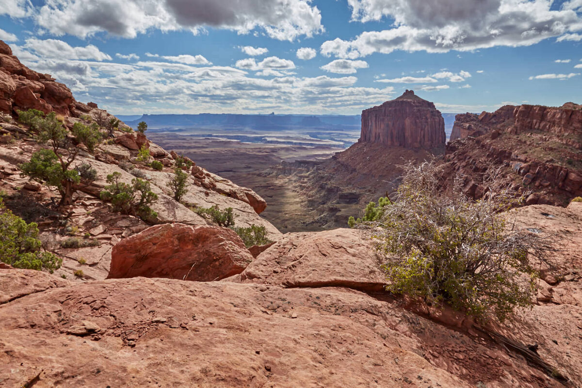
Description: The Shafer Trail is an unpaved scenic road within Canyonlands NP, on which you descend along a canyon wall into Shafer Canyon. Since it is a dirt road, the condition can vary almost hourly. You can find out about the current condition at the Visitor Center of the National Park. The Shafer Trail in connection with the Potash Road leads from Canyonlands NP to Moab.
Trail length: about 8.7mi - one way to the junction with the Potash Road Altitude difference: 1502ft Time needed: 1-2 hours Difficulty level: easy
Our rating:Due to the fact that the road conditions are very dependent on the weather, we have not yet managed to drive the entire Shafer Trail and Potash Road connection. In October 2014, we drove the Shafer Trail and a short section of the Potash Road from Canyonlands NP. Unfortunately, we had to turn back due to a thunderstorm. With the right weather, road conditions and car, this is a really great route that you should definitely have driven at least once. Magnificent views, huge canyon walls and a bit of adventure thrown in for free. An absolute recommendation. Update 2022: In spring 2022, we were finally able to catch up on the Potash Road in combination with the Shafer Trail. Compared to Potash Road, Shafer Trail is a highway, at least when we were on the road.
☆☆☆☆☆Bewertet mit 4 von 5
Potash Road
View into Shafer Canyon
Potash Road
Shafer Canyon Road
Shafer Trail
Shafer Trail
Shafer Trail
Potash Road
Shortly after the junction from the Shafer Trail.
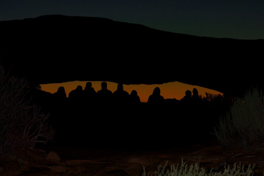
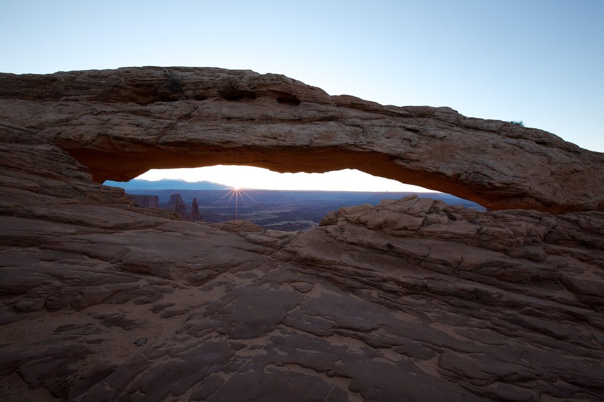
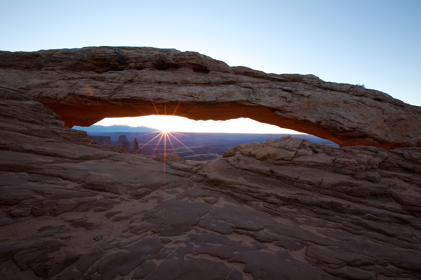
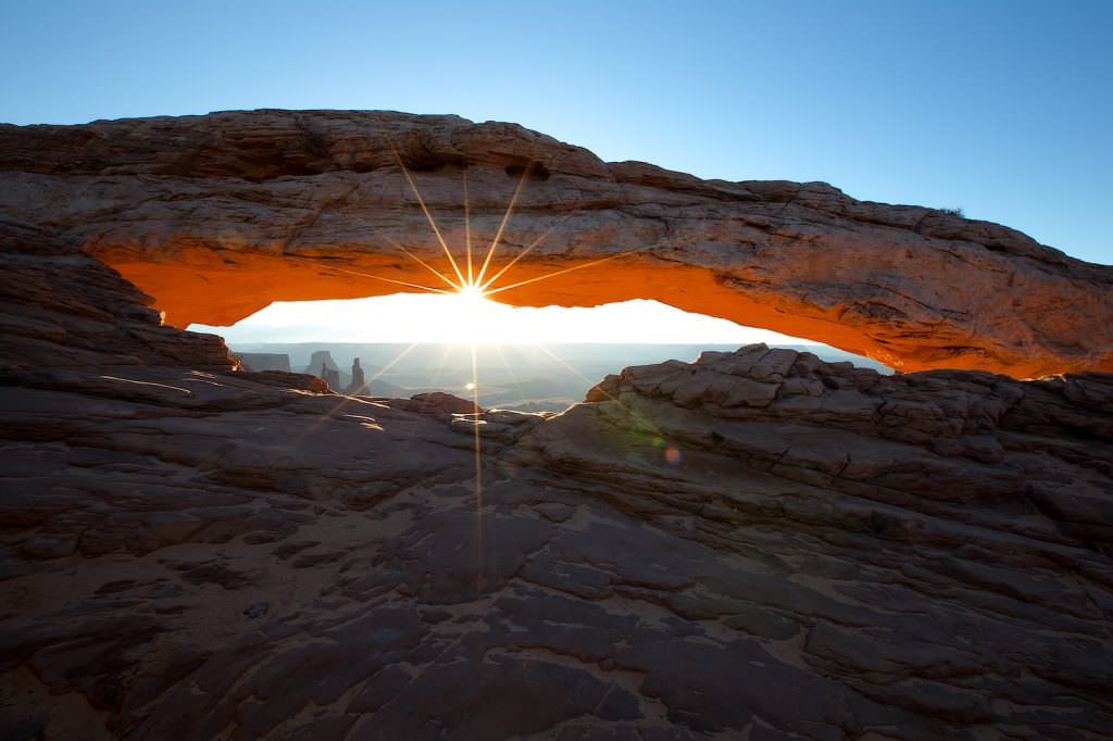
Mesa Arch - Island in the Sky
Description: A classic sunrise location. The short hike is very easy to hike and leads to the rim of the canyon where you can look down into the canyon through the Mesa Arch. If you want to be there for sunrise, you hike the trail while it is still dark. For better navigation a flashlight is an advantage.
Trail length: 0.5mi roundtrip Höhenmeter: – Time needed: 1/2 hour walking time Difficulty level:easy
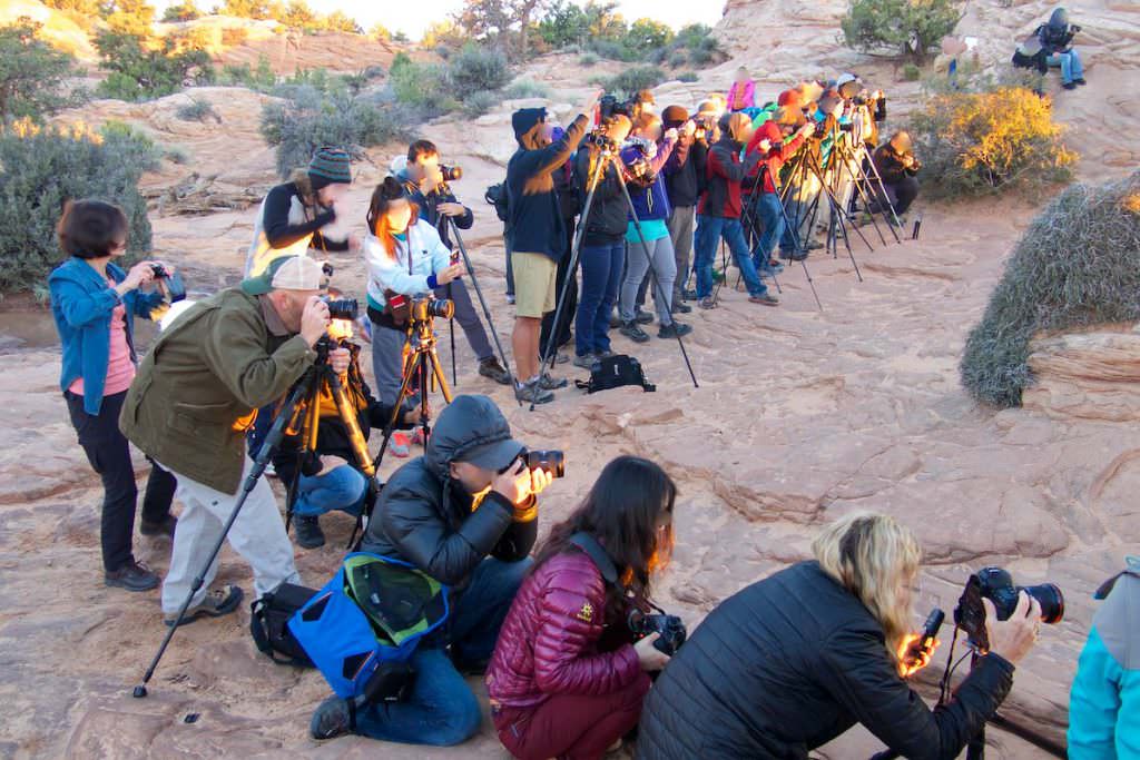
Our rating:Standing at Mesa Arch at sunrise and seeing the orange-red glowing rocks is definitely an experience worth getting up early for. However, you are not alone here. If you want a certain photo spot, you should be there very early. The masses of people that gather here every morning unfortunately cloud the nature experience a bit. This is not everyone's cup of tea. But since that doesn't bother us, we've been there a few times. We really enjoy it, despite the crowds.
☆☆☆☆☆Bewertet mit 5 von 5
Mesa Arch
Die Meute versammelt sich.
Mesa Arch
Here comes the sun.
Mesa Arch
Mesa Arch
Mesa Arch
Almost every morning it looks like this at sunrise. This was in October 2014.
Mesa Arch
A true spectacle.
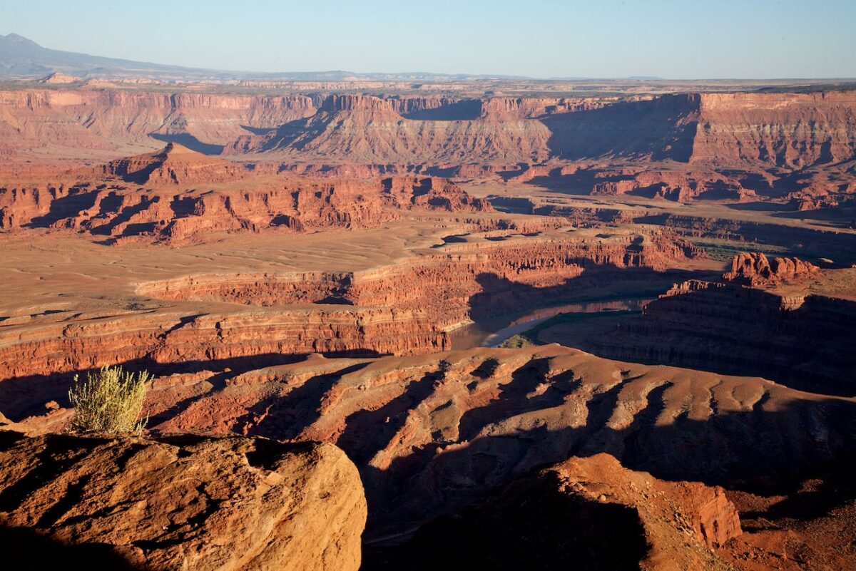
Mesa Arch - Island in the Sky
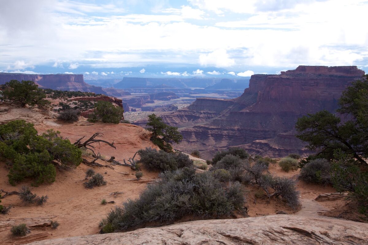
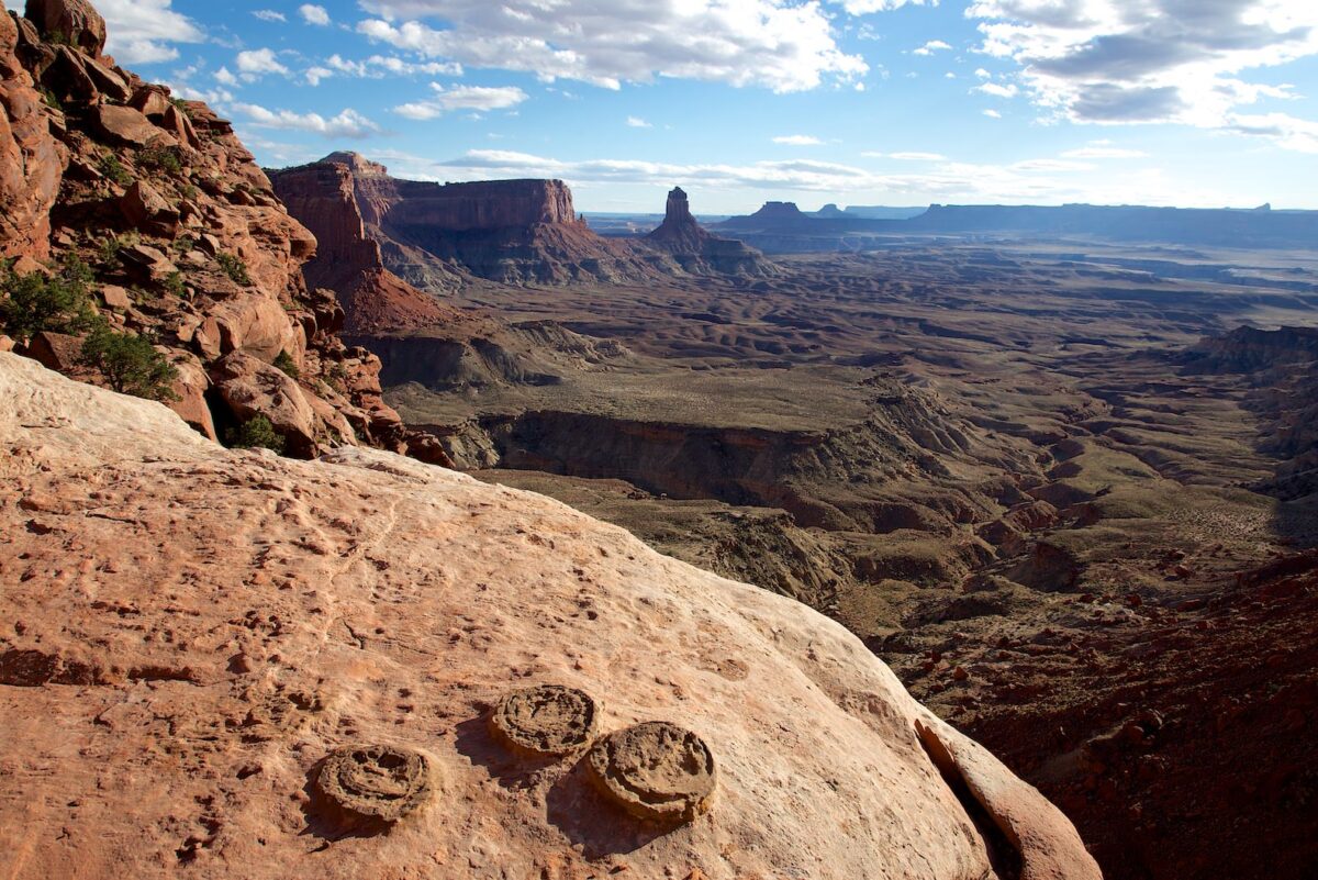
Description: As the name suggests, you have a great view into Canyonlands NP from this overlook at the end of the park road.
Our rating:In any case, the viewpoint is worth a look. We especially liked it here at sunset.
☆☆☆☆☆Bewertet mit 3.5 von 5
Grand View Point - Island in the Sky
Grand View Point - Island in the Sky
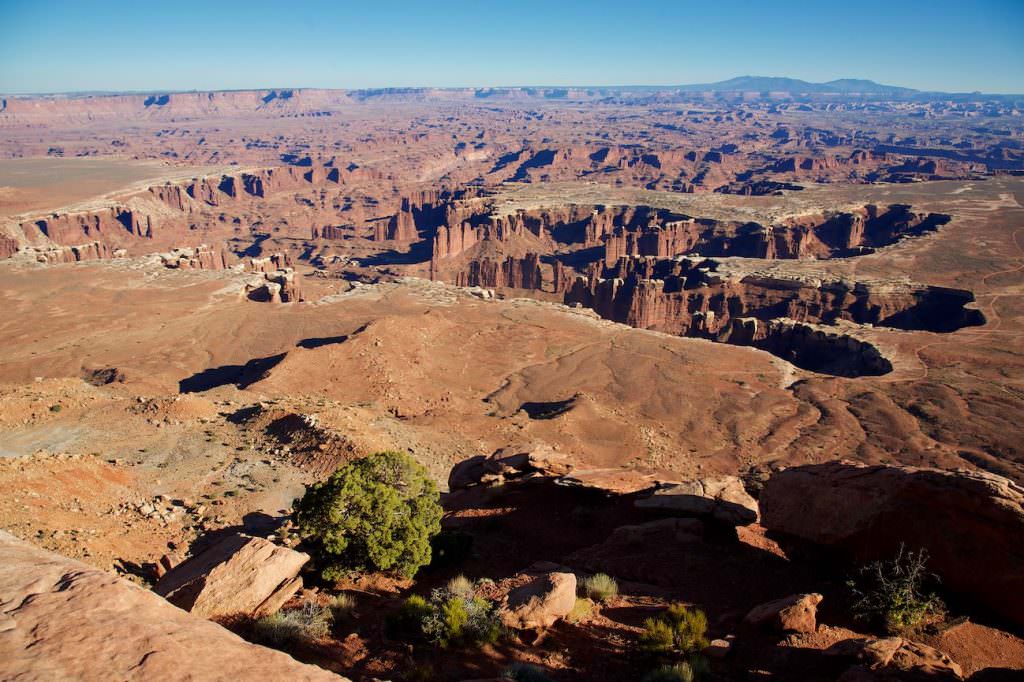
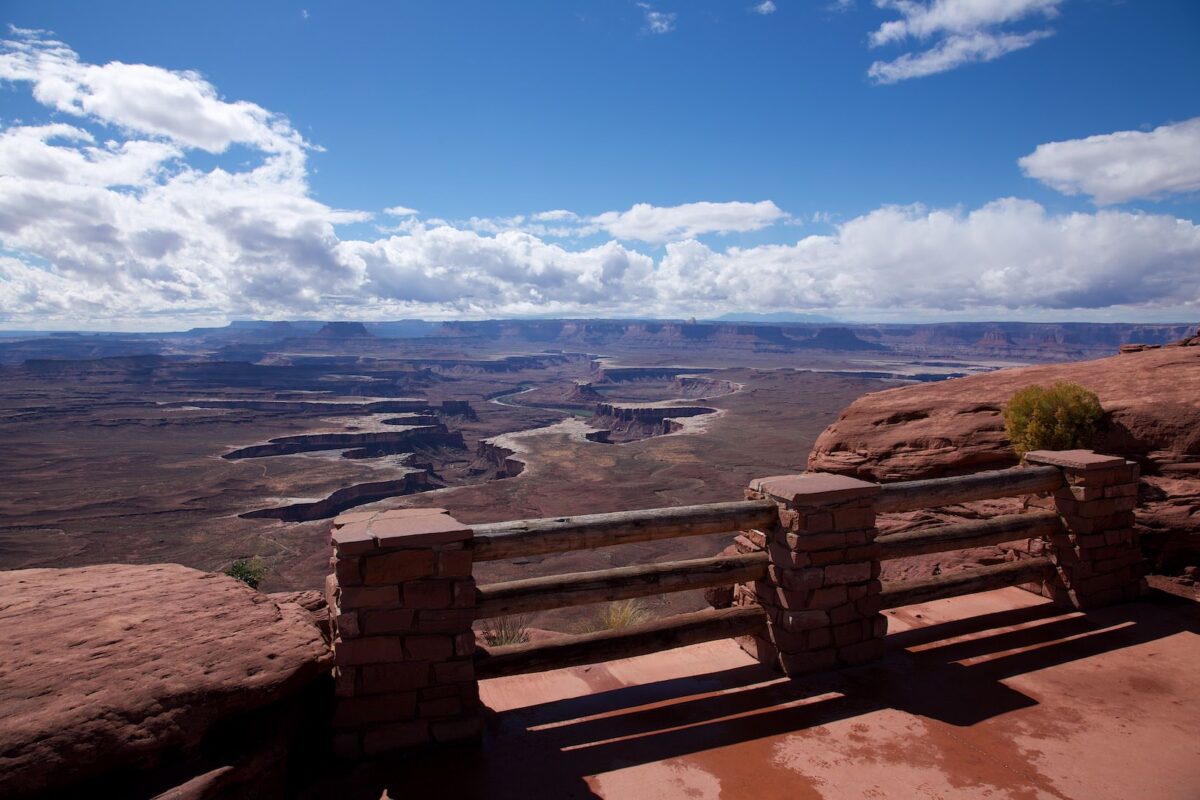
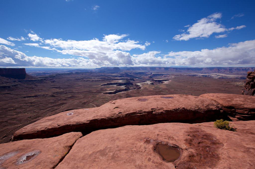
Green River Overlook - Island in the Sky
Description: Also at the Green River Overlook the name says it all because here you have a great view of the many meanders and the canyon that the Green River forms.
Our rating:This great viewpoint is also definitely worth a stop.
☆☆☆☆☆Bewertet mit 3.5 von 5
Green River Overlook - Island in the Sky
Green River Overlook - Island in the Sky
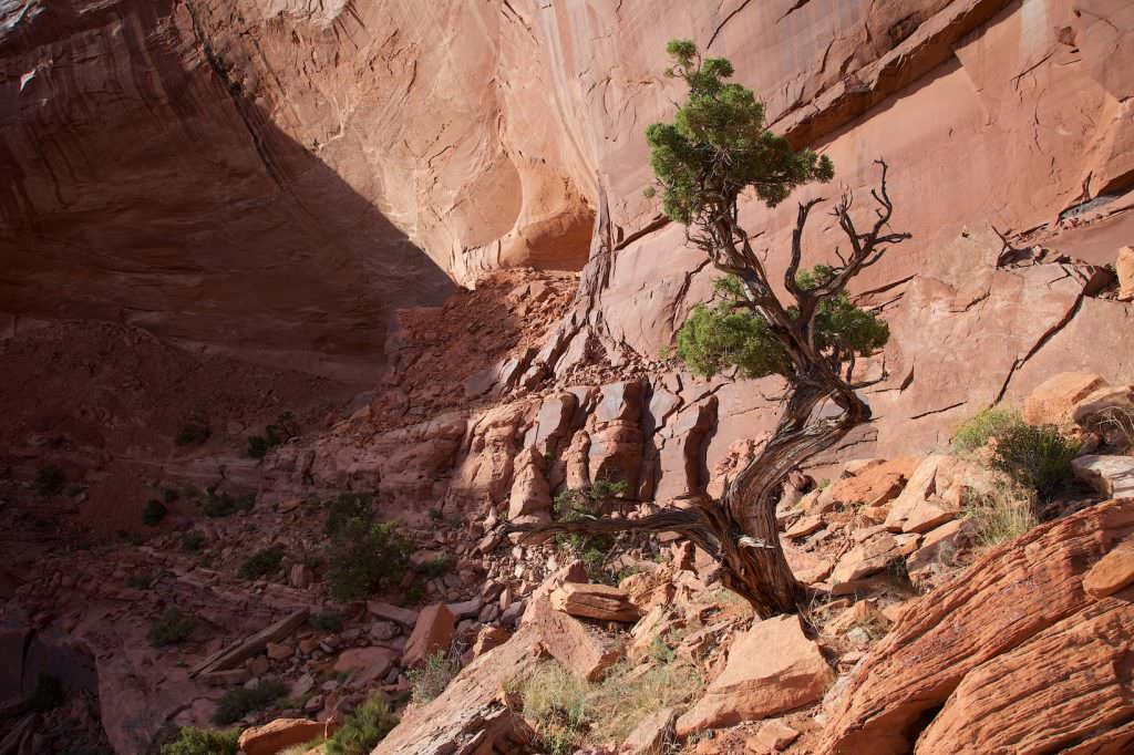
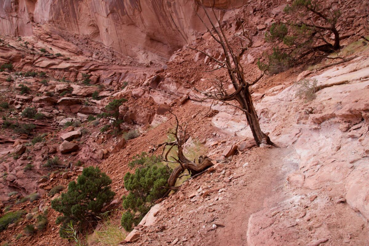
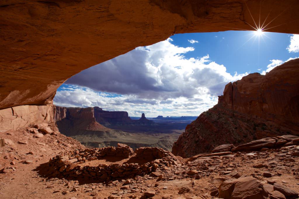
False Kiva - Island in the Sky
Description: You can't park directly at the trailhead, but have to park the car a few hundred meters ahead in a parking bay. The trail leads mostly slightly downhill over a plain to the canyon rim. From here on it becomes rugged and steeper. When you have climbed down the slope you can already guess the False Kiva above you. Because the direct way would be too steep, you hike almost level below the kiva and climb it over another gravel slope.
The path to the False Kiva does not appear in the official descriptions of the national park. This is to prevent that too many people visit the kiva and destroy it. But if you ask at the visitor center, you will get information about it.
Trail length: 2mi roundtrip Altitude difference: approx. 394ft Time needed: 2-3 hours Difficulty level:moderate to strenuous - The trail is partly rough and steep. Therefore, surefootedness and good knees are an advantage.
Our rating:The trail is quite unspectacular until you reach the canyon rim, but then it offers great views into the canyon. The hike is perhaps a little challenging if you suffer from fear of heights. We enjoyed the hike very much. With a little fitness and surefootedness it should not make so much trouble to enjoy the great views, especially since the path is not so far.
Attention!!! Due to vandalism, the trail is currently closed (as of March 2025). In order not to encourage anyone to try it anyway, we will post the GPS track of the hike here only when the trail is officially open again.
☆☆☆☆☆Bewertet mit 4 von 5
False Kiva Trail
False Kiva Trail
Trail to the canyon rim
False Kiva Trail
Looking back at the first slope you have to go down from the canyon rim.
False Kiva Trail
View to the top. The kiva is located in an alcove in the middle of the cliff.
False Kiva Trail
View of the path below the kiva.
False Kiva Trail
At this tree you turn around and climb up the gravel slope.
False Kiva Trail
This is what the underground of the gravel slope beneath the kiva looks like.
False Kiva Trail
False Kiva Trail
False Kiva Trail
False Kiva Trail
False Kiva Trail
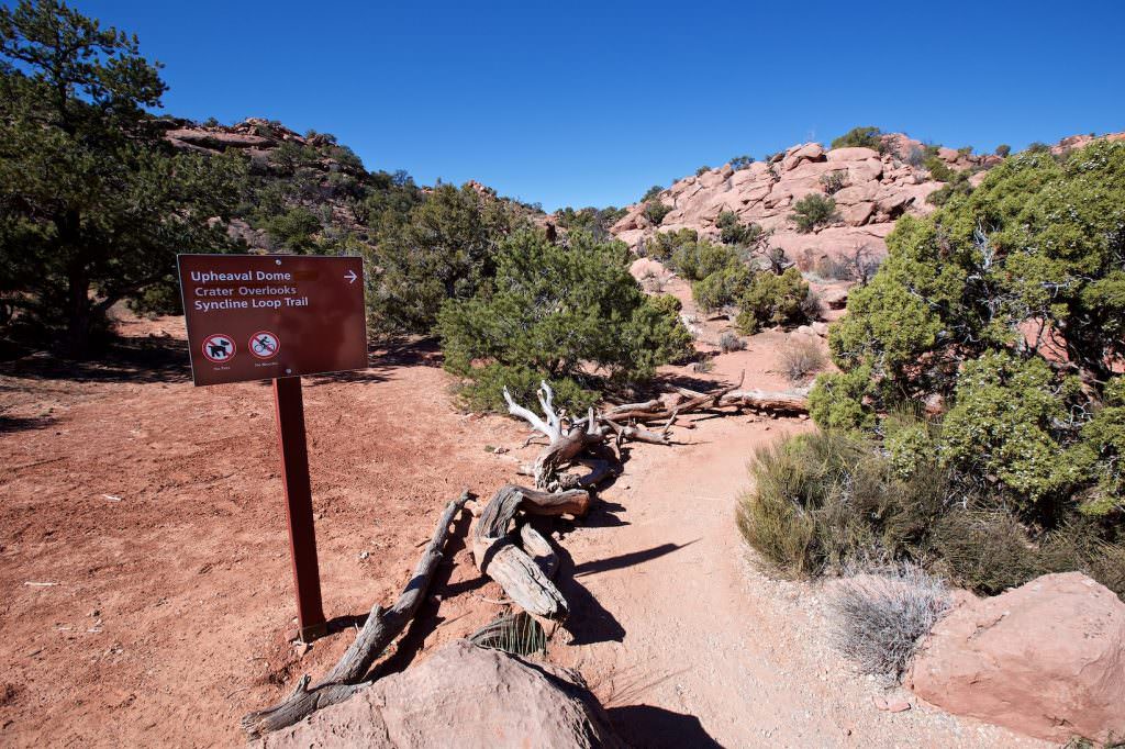
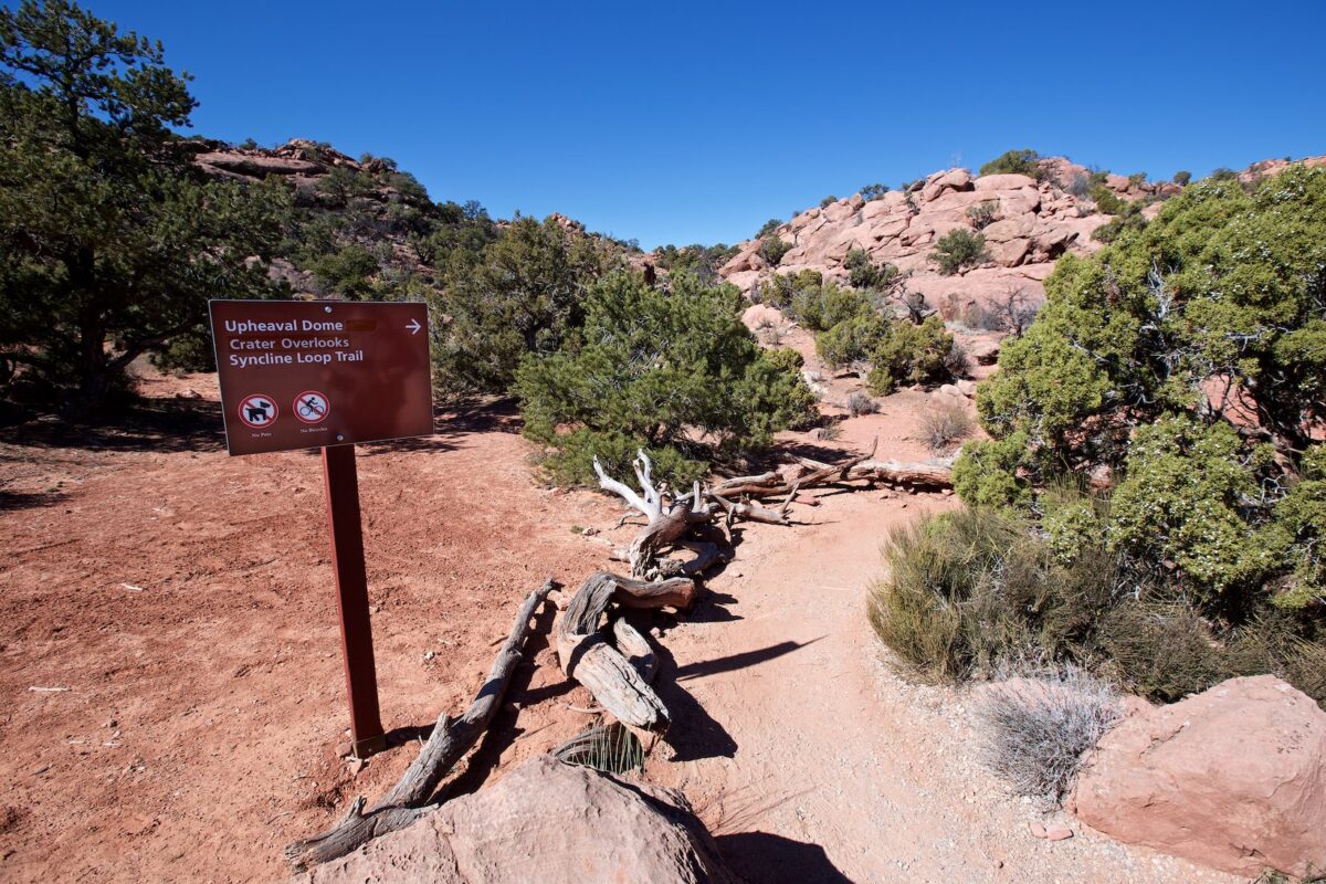
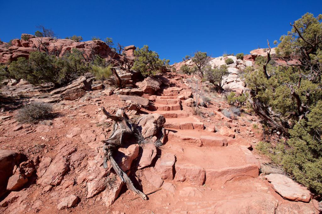
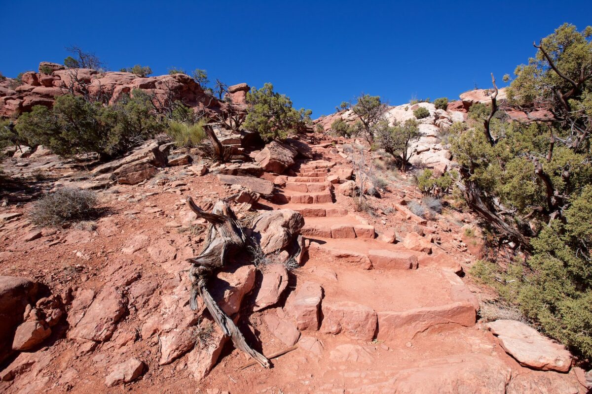
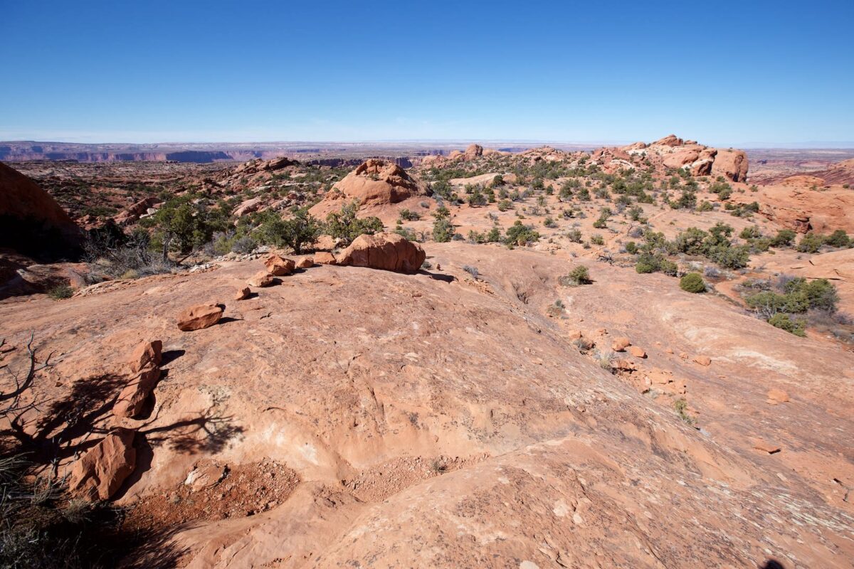
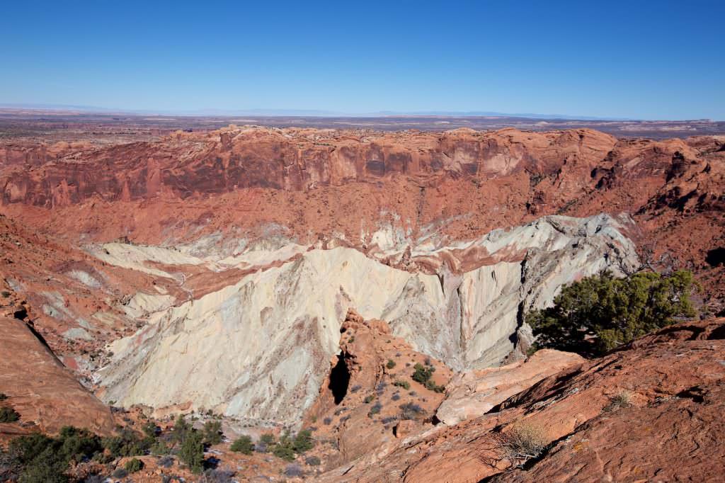
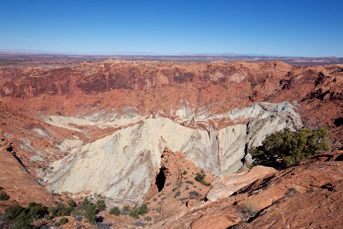
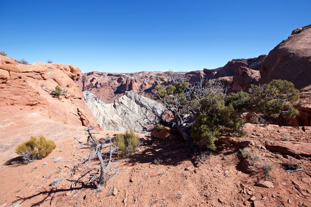
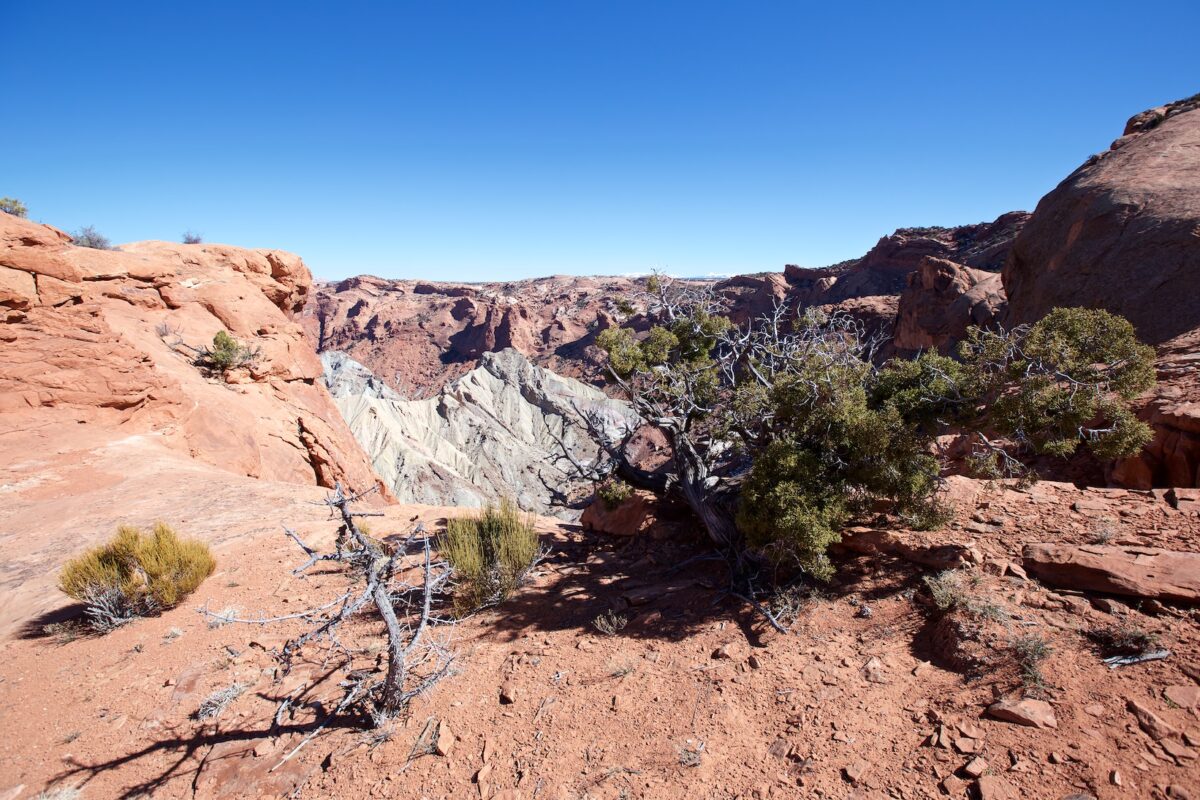
Upheaval Dome - Island in the Sky
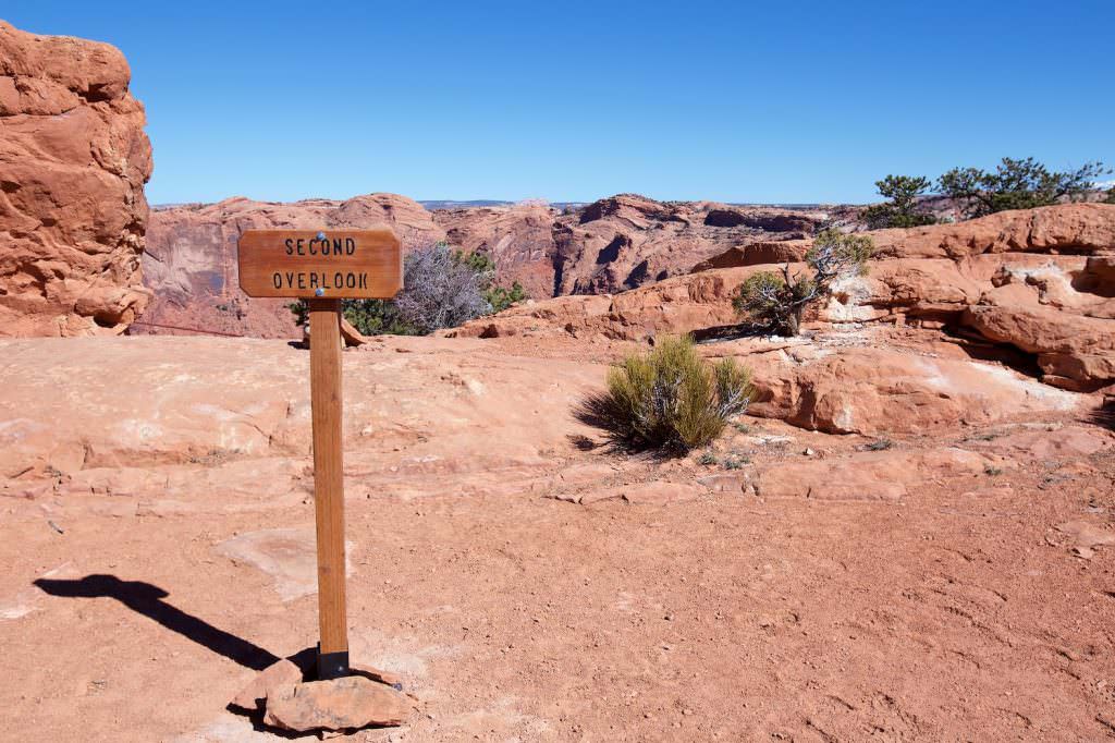
Description: On the Syncline Loop you can walk around the crater for about 14 km. During our visit in February 2016, we hiked to the Second Overlook and back the same way. The trail climbs up and down from time to time, but is otherwise not technically challenging. You hike in principle through a stone landscape from the parking lot to the crater rim.
Trail length: 0.8mi roundtrip – First Overlook; 1.8mi roundtrip – Second Overlook Altitude difference: approx. 328ft Time needed: 2 hours Difficulty level: easy
Our rating:The trail is not very spectacular but quite pleasant to hike. The views at the top of the crater rim are quite nice and worth seeing. For us not the greatest trail in the park, but well worth a detour.
☆☆☆☆☆Bewertet mit 3 von 5
Upheval Dome Tail
Trailhead
Upheaval Dome Tail
Upheaval Dome Tail
Upheval Dome
First Overlook
Upheval Dome Tail
Upheval Dome Tail
Second Overlook
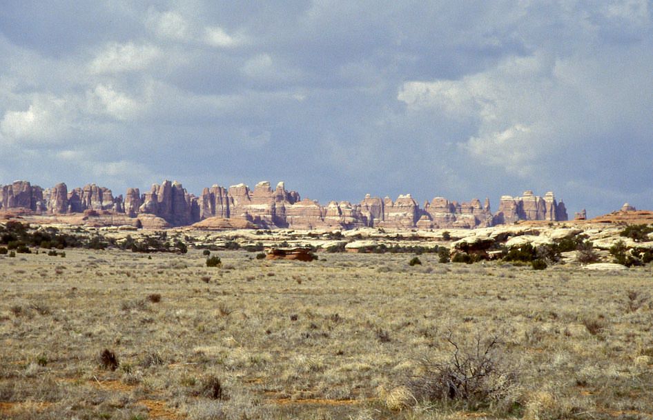
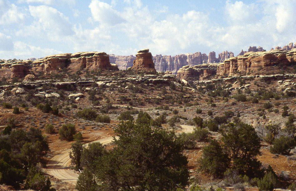
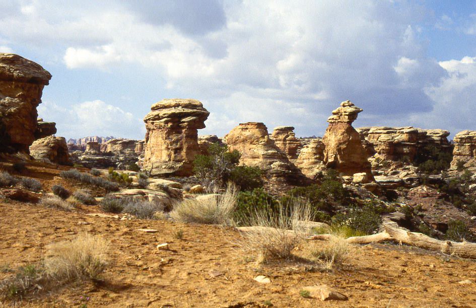
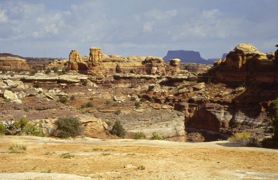
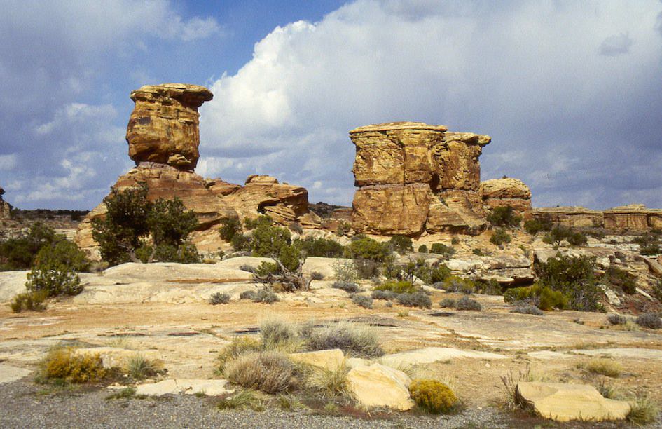
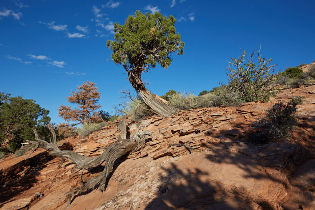
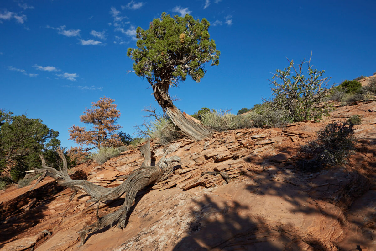
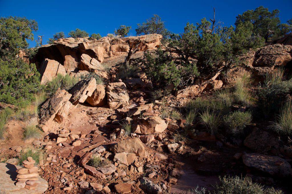
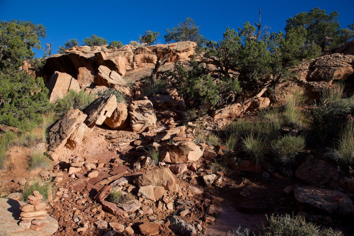
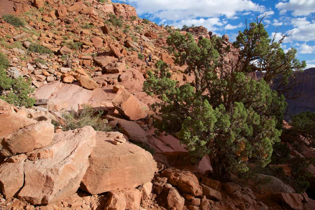
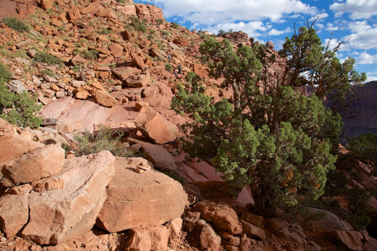
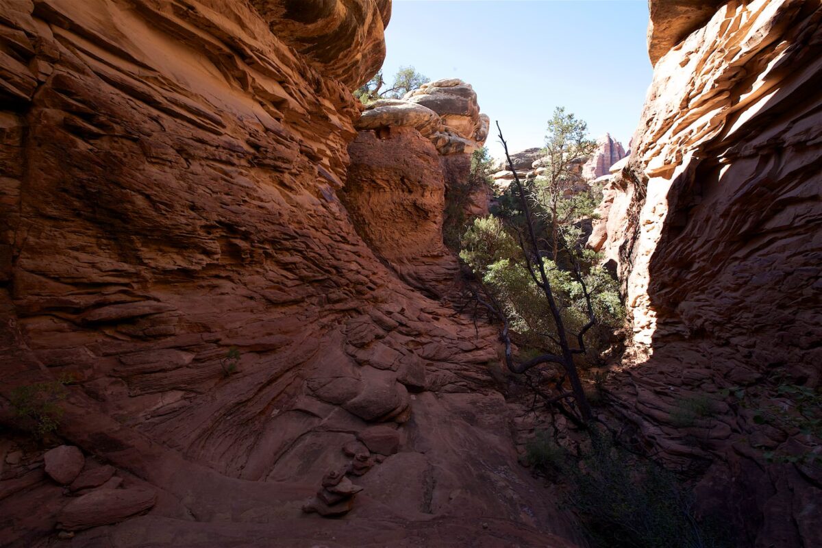
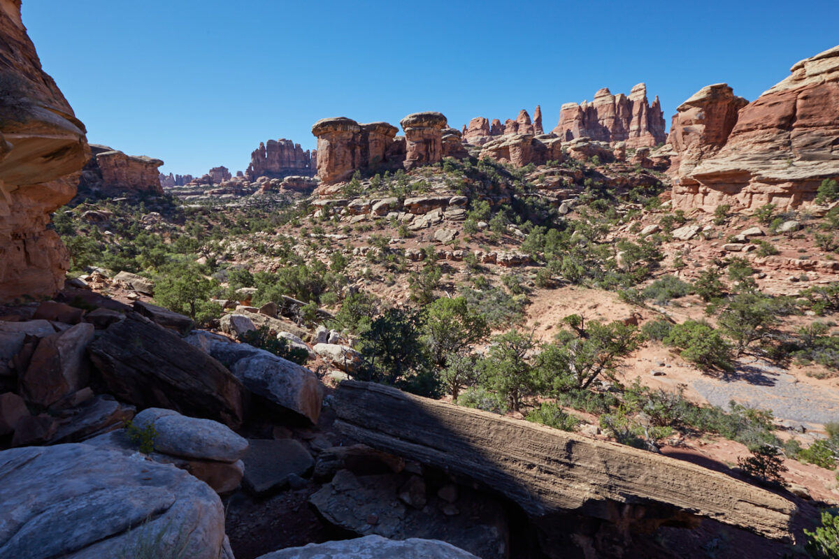
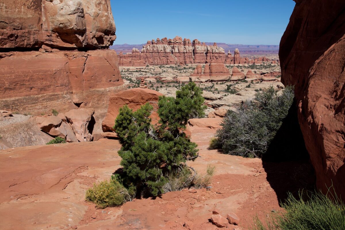
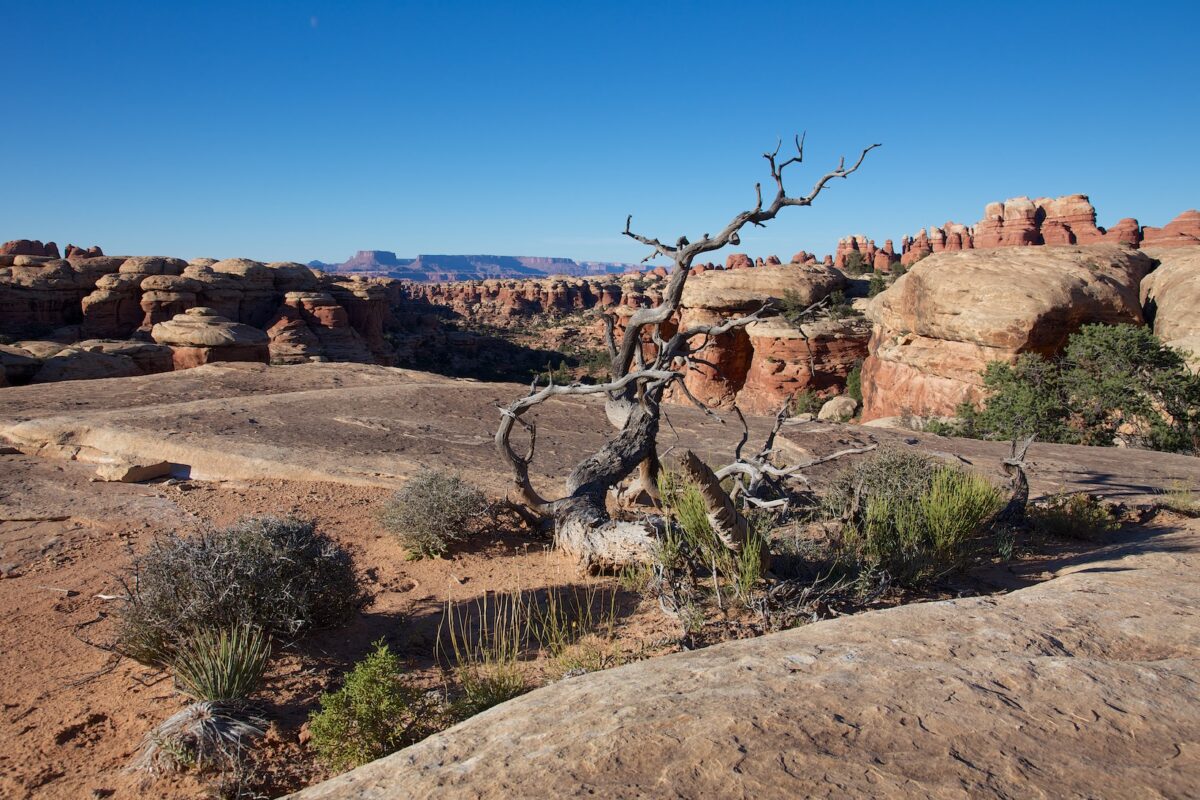
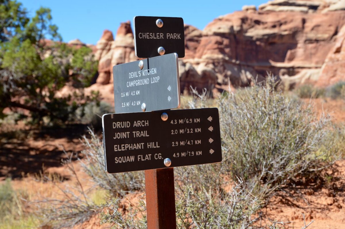
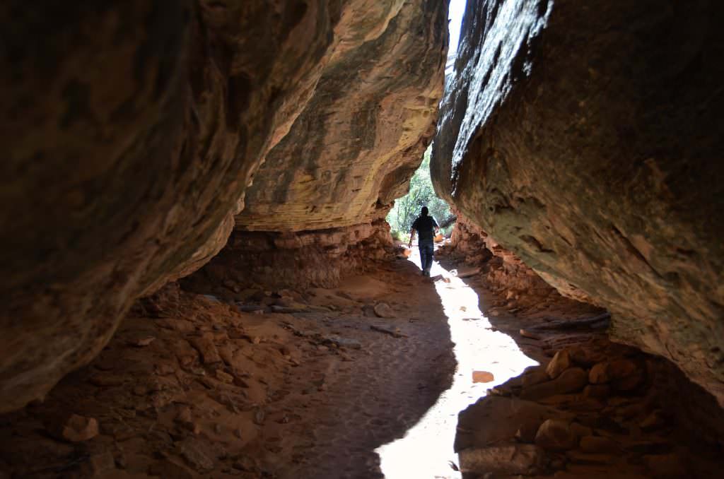
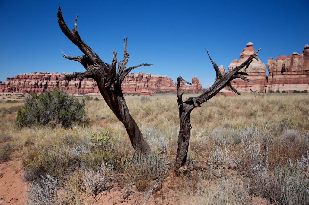
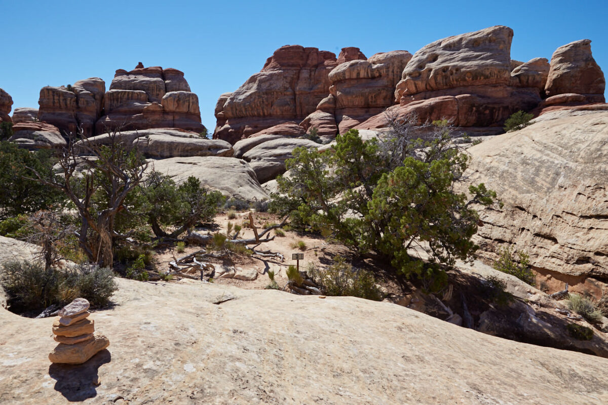
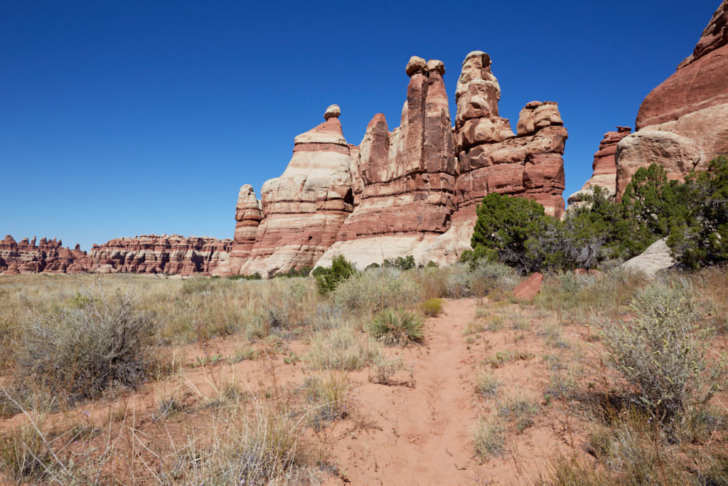
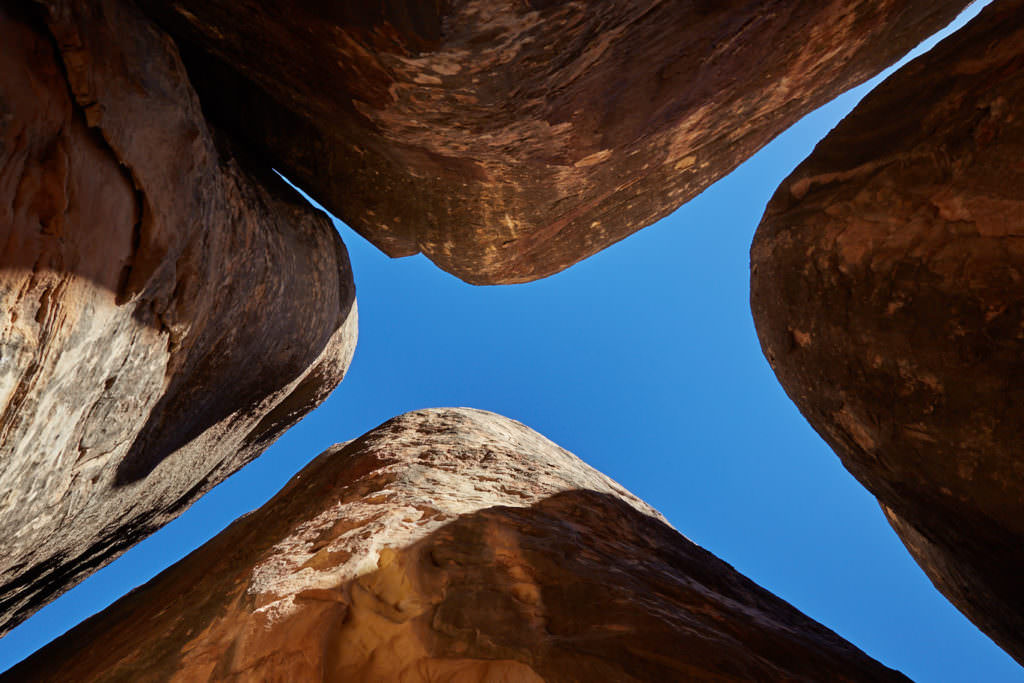
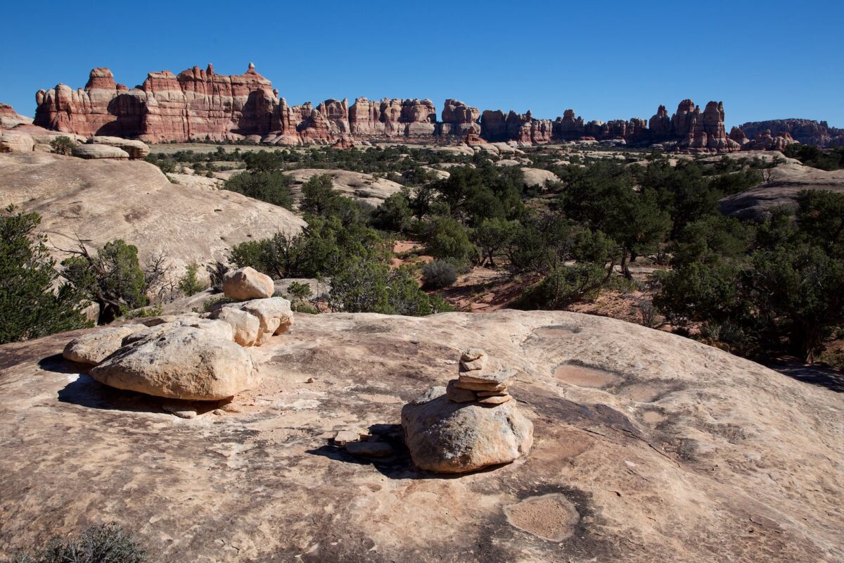
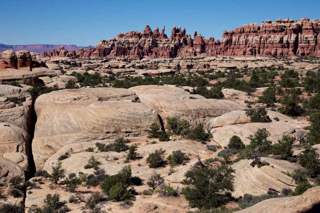
Chesler Park - The Needles
Description: Starting at the Elephant Hill Trailhead, you have a lot of options to hike Chesler Park. There are numerous trails that you can connect in various combinations. We hiked from the trailhead to the Chesler Park Overlook (about 5km). Then a loop via the Joint Trail back to the Overlook and from there via the same trail back to the trailhead. (Track of our hike is linked above).
Trail length: 12mi roundtrip Altitude difference: 2713ft Time needed: 8 hours Difficulty level:moderate (to the Overlook) to strenuous (if you hike the whole round) - The trail includes every now and then smaller climbing units, hills that you have to go down and up. Because of the length of the trail and the elevation gain, the hike is strenuous.
Our rating:The hike is very varied and interesting. It is definitely one of our top 5 hikes in the southwest. It is always uphill and downhill from the beginning. You have to climb in parts, it's exhausting - but the views you have along the way are worth every drop of sweat. Even if you only hike as far as the Chesler Park Overlook, the hike is worth it. Absolutely recommend!!!
☆☆☆☆☆Bewertet mit 5 von 5
Chesler Park Trail
Chesler Park Trail
Chesler Park Trail
Chesler Park Overlook
Chesler Park Trail
Chesler Park Trail
Everything super signed.
Chesler Park Trail
Joint Trail
Chesler Park Trail
Chesler Park Trail
Chesler Park Trail
Chesler Park Trail
Chesler Park Trail
Chesler Park Trail
Big Spring Canyon - The Needles
Description: Overlook at the end of the park road. Should you have a suitable vehicle, you can continue on unpaved roads.
Our rating:Great views of Chesler Park and the surrounding canyon landscape. If you've taken the long drive to the Needles District, this is a viewpoint not to be missed.


