Note: On dirt roads, road conditions can change constantly. Therefore, we strongly recommend that everyone check the road conditions before each trip. We do not recommend driving on unpaved roads before, during or shortly after rain or snowfall.
Description of how to get there: To get there, take Highway 160 and in Tuba City turn south on Highway 264. After 7.15mi you reach a junction (Coordinate: Latitude 36.036930, Longitude -111.185218) . From here you drive on dirt roads. First turn right and then immediately left onto Indian Route 6710. The road continues in southern direction. After another 1.24mi you turn right. The road from now on can at best be described as a field path (Coordinate: Latitude 36.019145, Longitude -111.185156) . From here on, at the latest, you need a higher ground clearance for your vehicle. But it is not far. After another almost 0.5mi you turn left again and drive about 0.2mi to the parking lot (Coordinate: Latitude 36.021476, Longitude -111.191750). The entire drive from Tuba City is 8.9mi long.
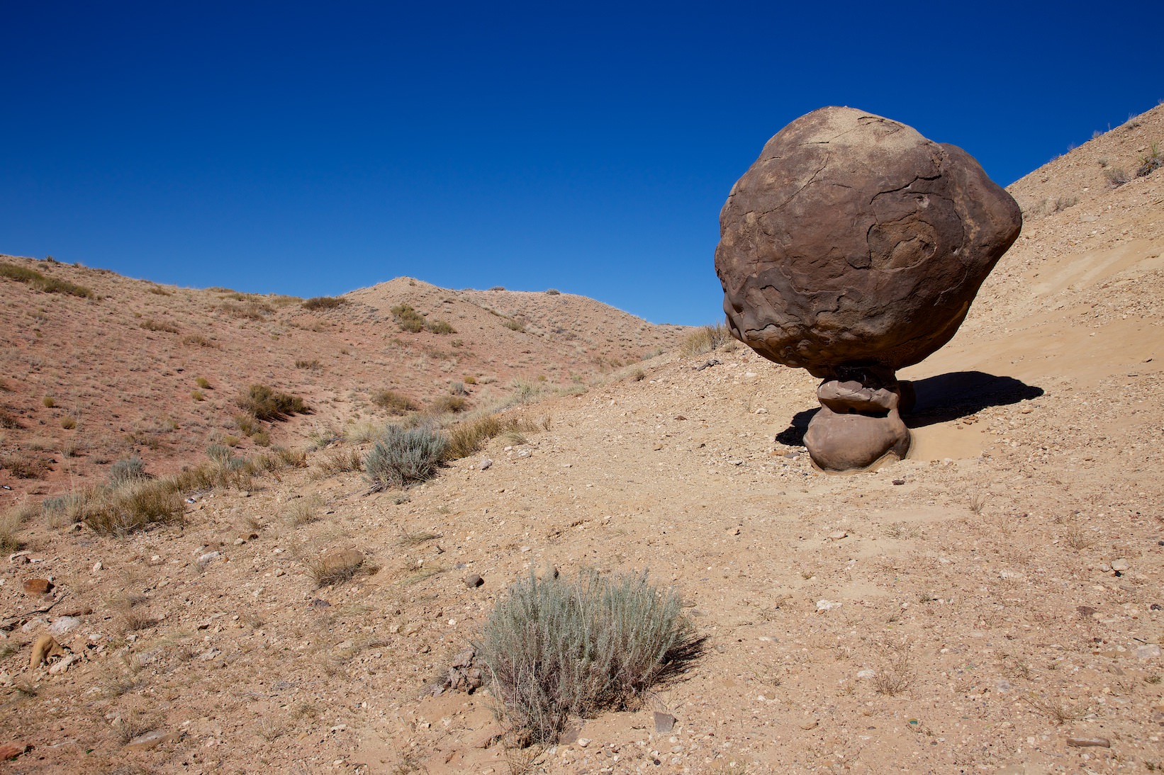
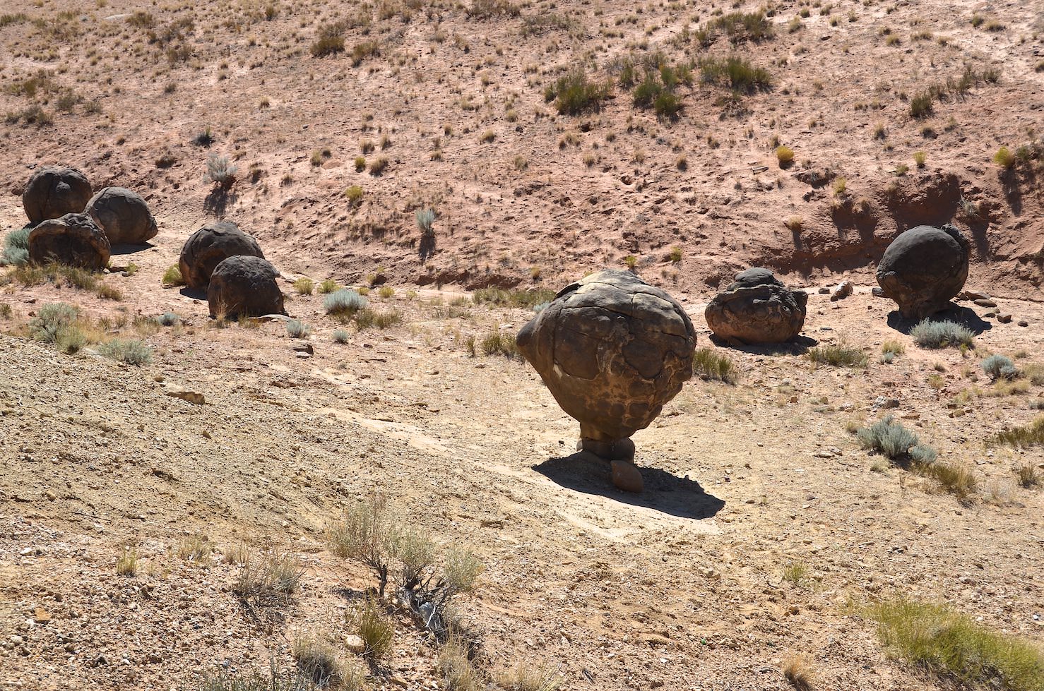
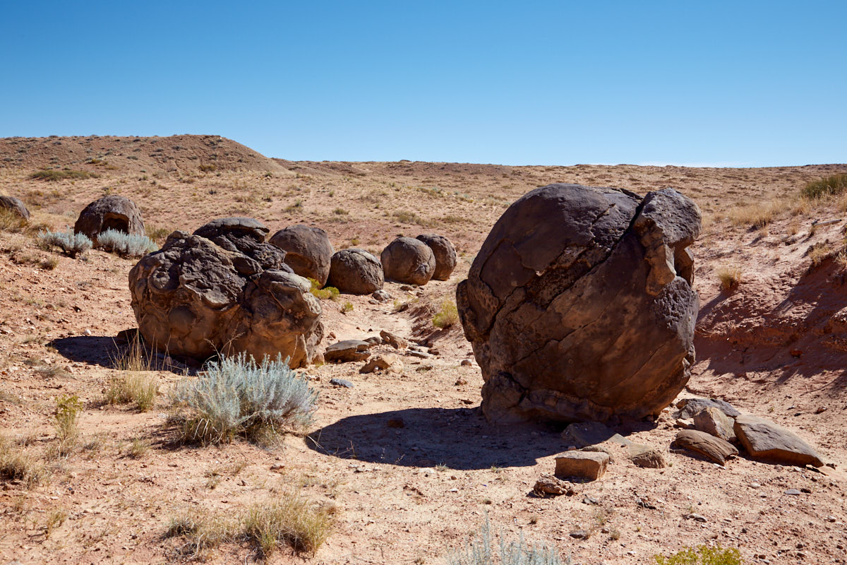
Description: From the parking lot you can't see anything at first. To get to the Concretions, you first have to climb down a short but steep slope. The area is very small. There are no trails, you just hike where you like. You will probably be alone here.
Trail length: a few 100feet Altitude difference: – Time needed: 1 hour Difficulty level:easy
Our rating: Nice, small location with unusual stone formations. The detour was worth it for us. We liked it and can recommend the location - with the appropriate car.