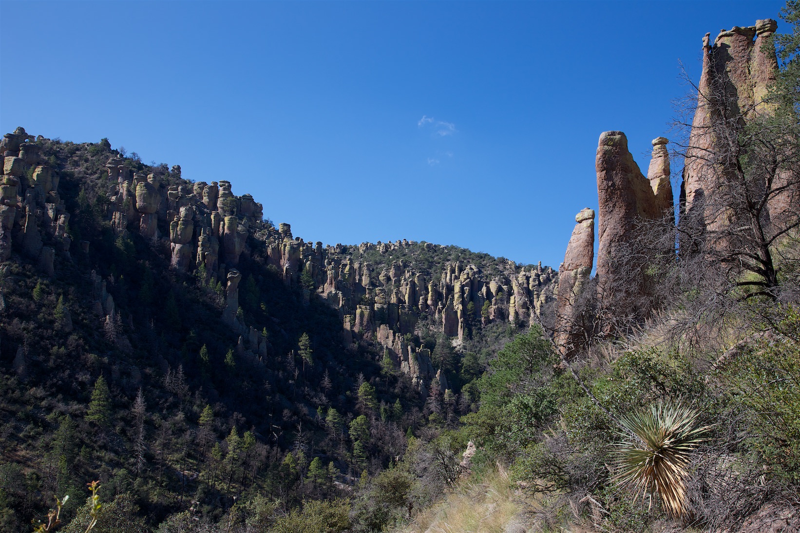
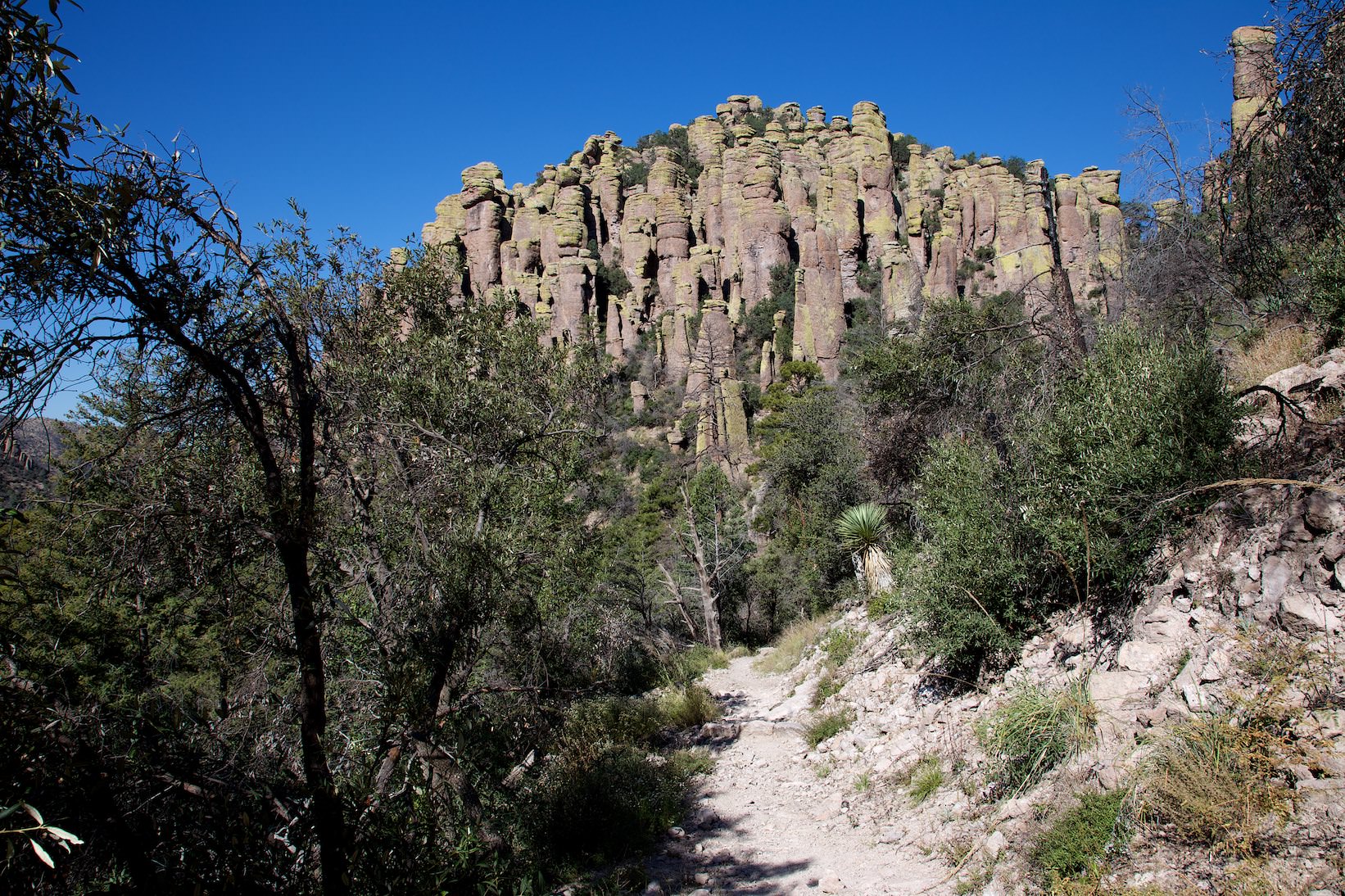
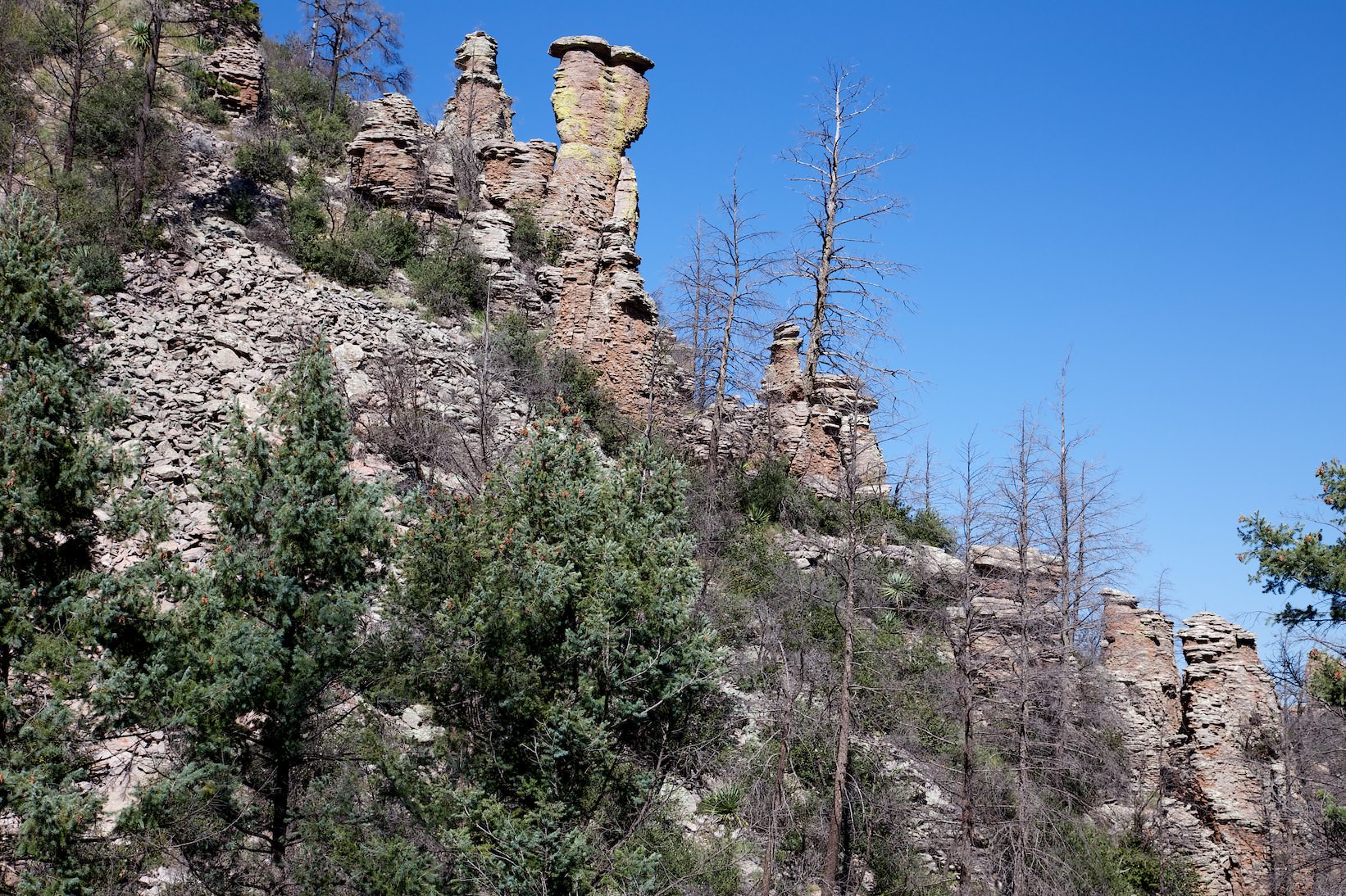
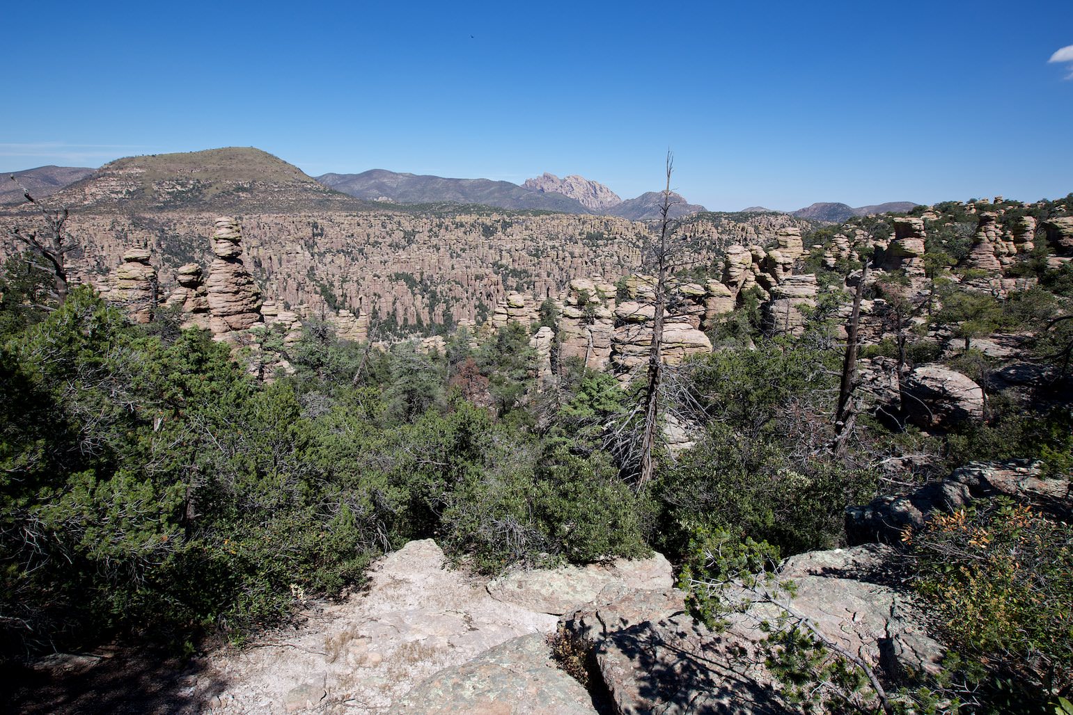
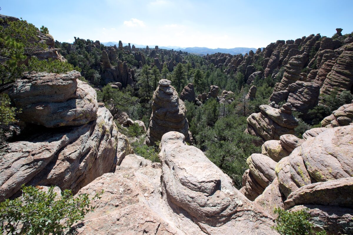
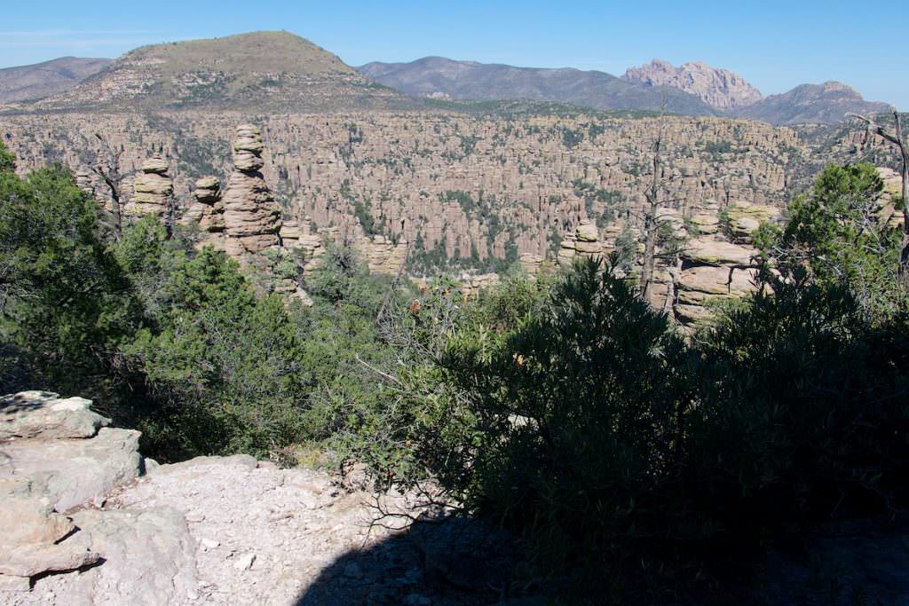
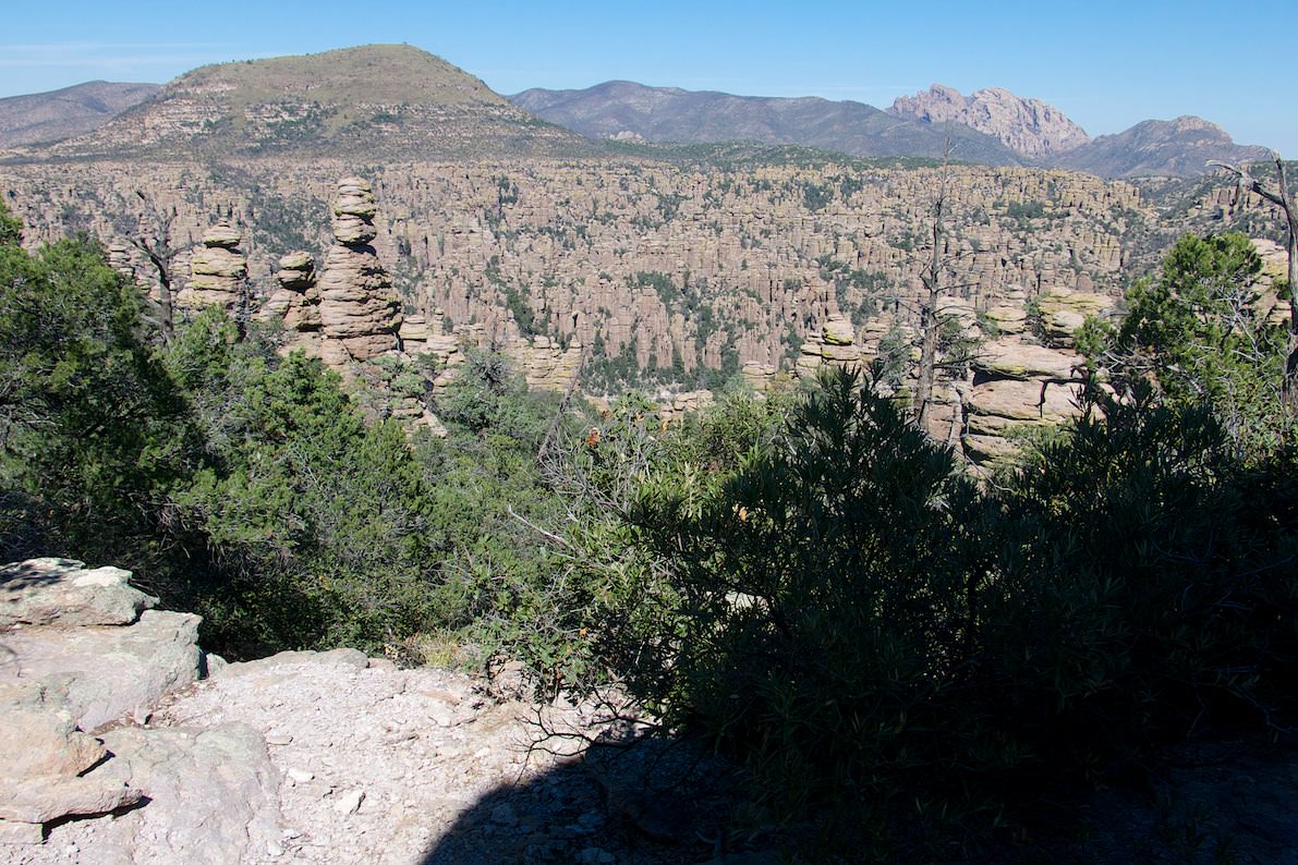
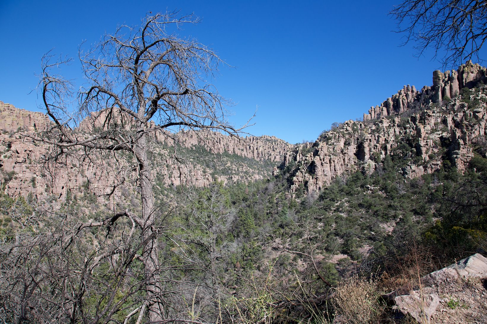
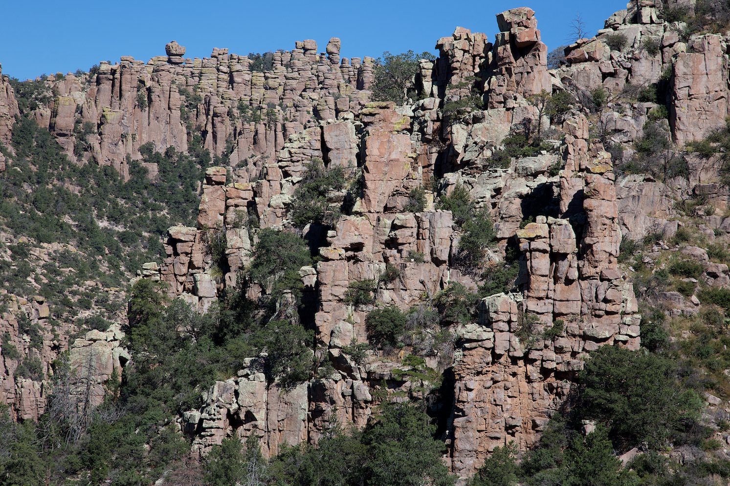
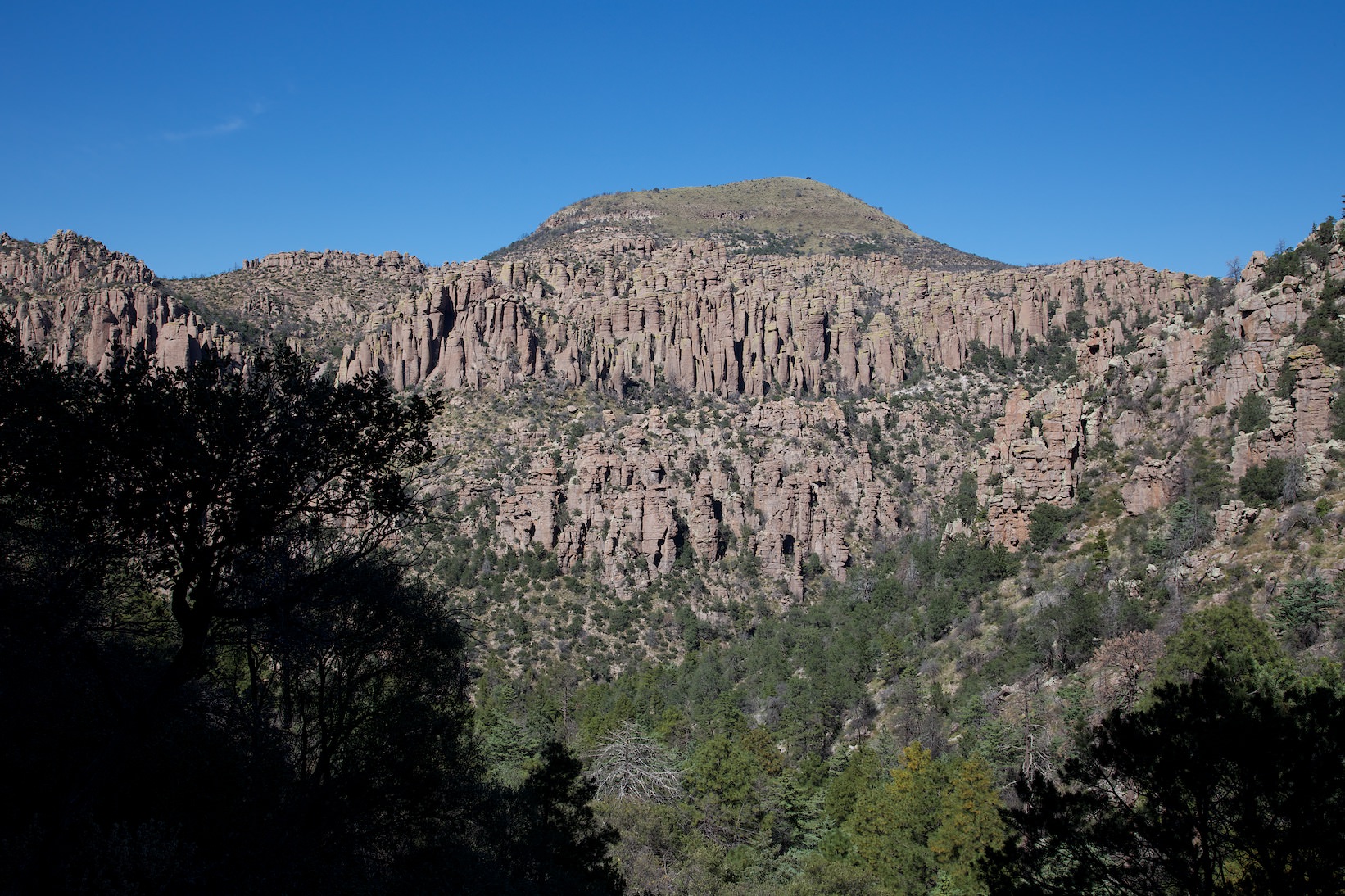
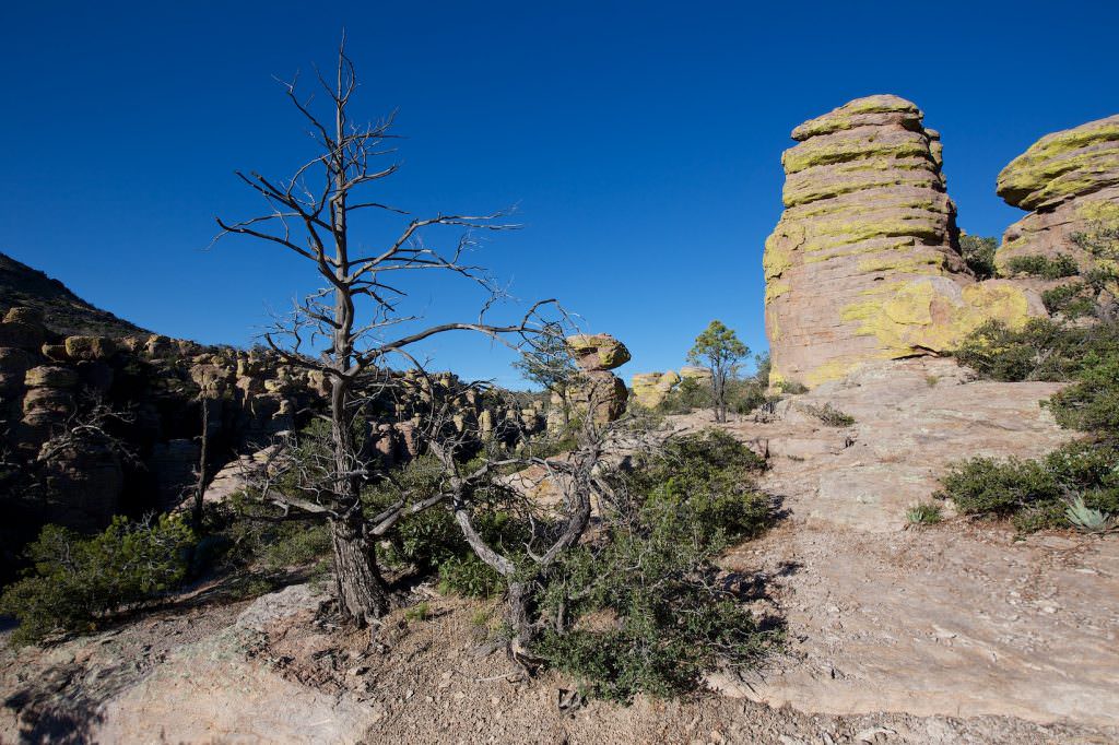
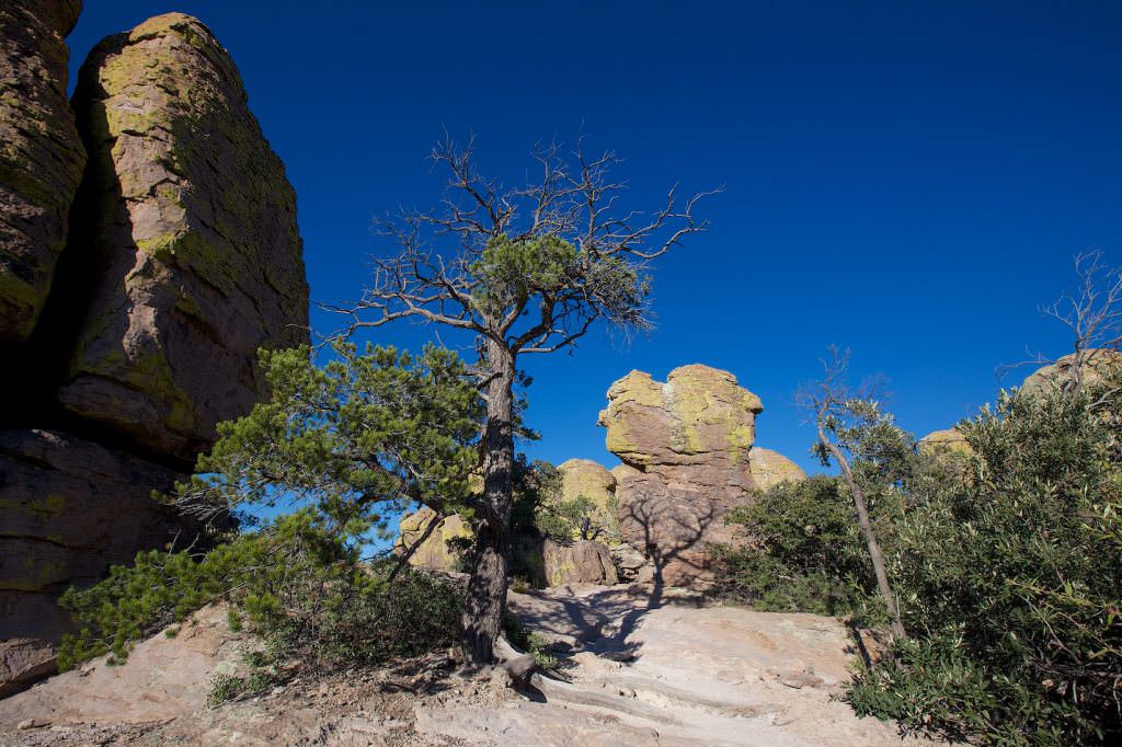
The National Monument protects an area with whimsically shaped tuff formations. These were formed over millions of years by erosion of volcanic rock. The National Monument was established in 1924.
Visitor number 2000
0
Visitor number 2010
0
Number of visitors
Best time to visit:Spring and fall Our visits: So far 1 visit: October 2014
*The Anual Pass is so to speak the "flat rate" for all Parks managed by the National Park Service. The pass costs a one-time fee of $80 and can be purchased at the entrance to each National Park, National Monument, etc. The pass is valid for 13 months.
On our October 2014 trip, we hiked a combination of all the trails listed above. It is The Big Loop, without the Inspiration Point. We covered 8.8mi and 3186ft of elevation gain.
Our rating: Perhaps a little spoiled by the red stones of Utah, this hike, or the Chiricahua NM, has not really blown us away. Maybe it was because we had already been on the road for three weeks and one highlight followed the other. But maybe it was also because we didn't hike the trail in the right direction. The most amazing section of the trail, Echo Canyon is in our direction at the end. But because the trail was already long and strenuous by then, we couldn't really appreciate the canyon at all. So we started with the moderately spectacular parts of the trail and were therefore only moderately enthusiastic. For this reason, we would also advise anyone who wants to tackle this trail to hike it in the opposite direction than we did. What I liked was that the trail was divided into different sections. After each section there were signs with distances, so you always knew where you were or how far you had hiked. For a longer trail like this, where there are no shortcuts, I personally thought that was very helpful.
☆☆☆☆☆Rated 3.5 out of 5
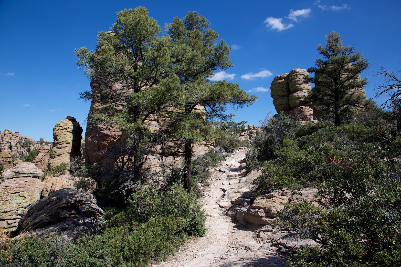
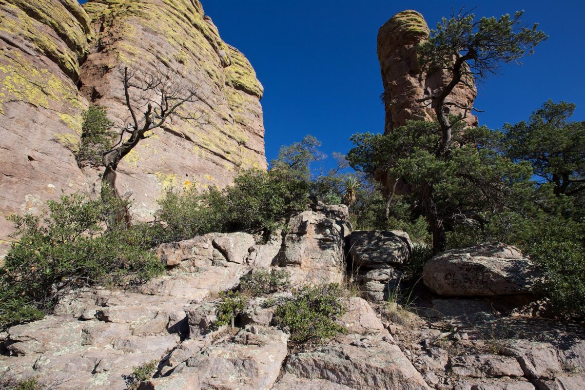
Ed Riggs Trail
Ed Riggs Trail
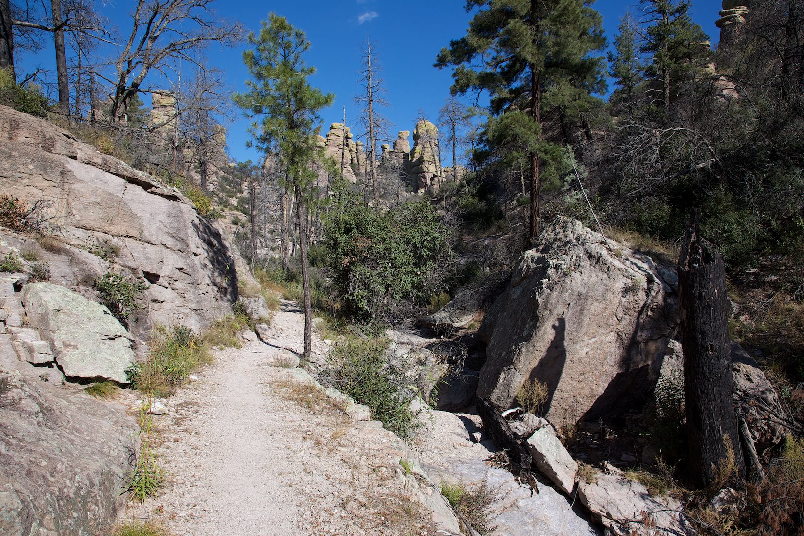
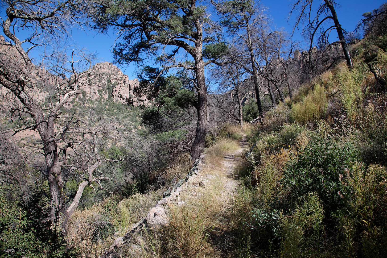
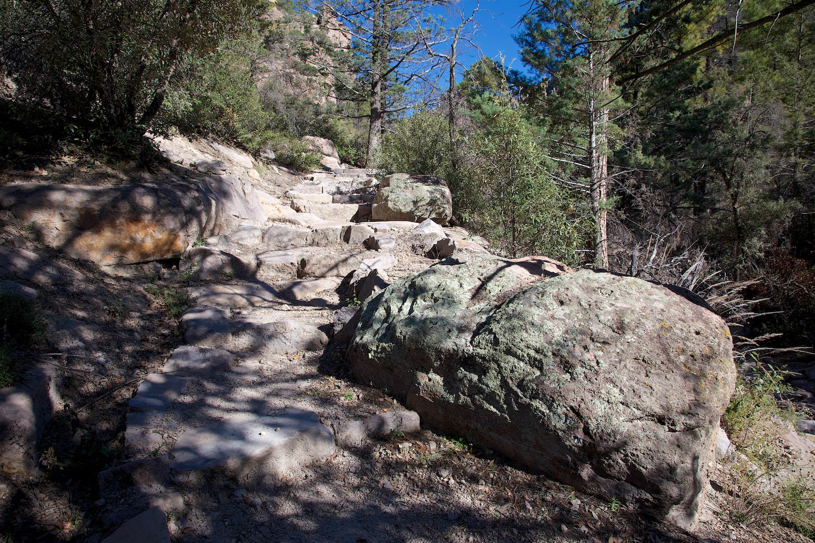
Description: From the Echo Canyon parking lot, a short connector trail leads to the Ed Riggs Trail. The trail is 1.1km long and leads down into the canyon. The trail is well developed and quite easy to walk and you already get a good impression of the rocks and canyons that await you on the way.
Ed Riggs Trail
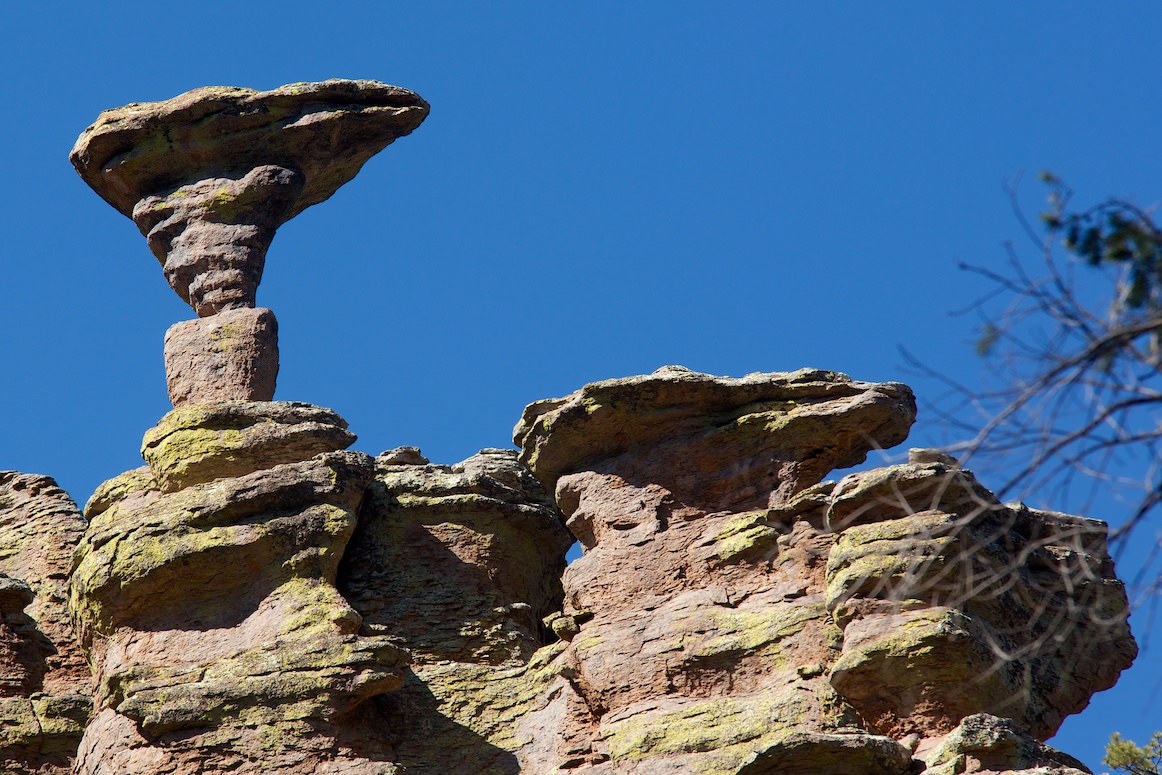
Mushroom Rock Trail
Mushroom Rock Trail
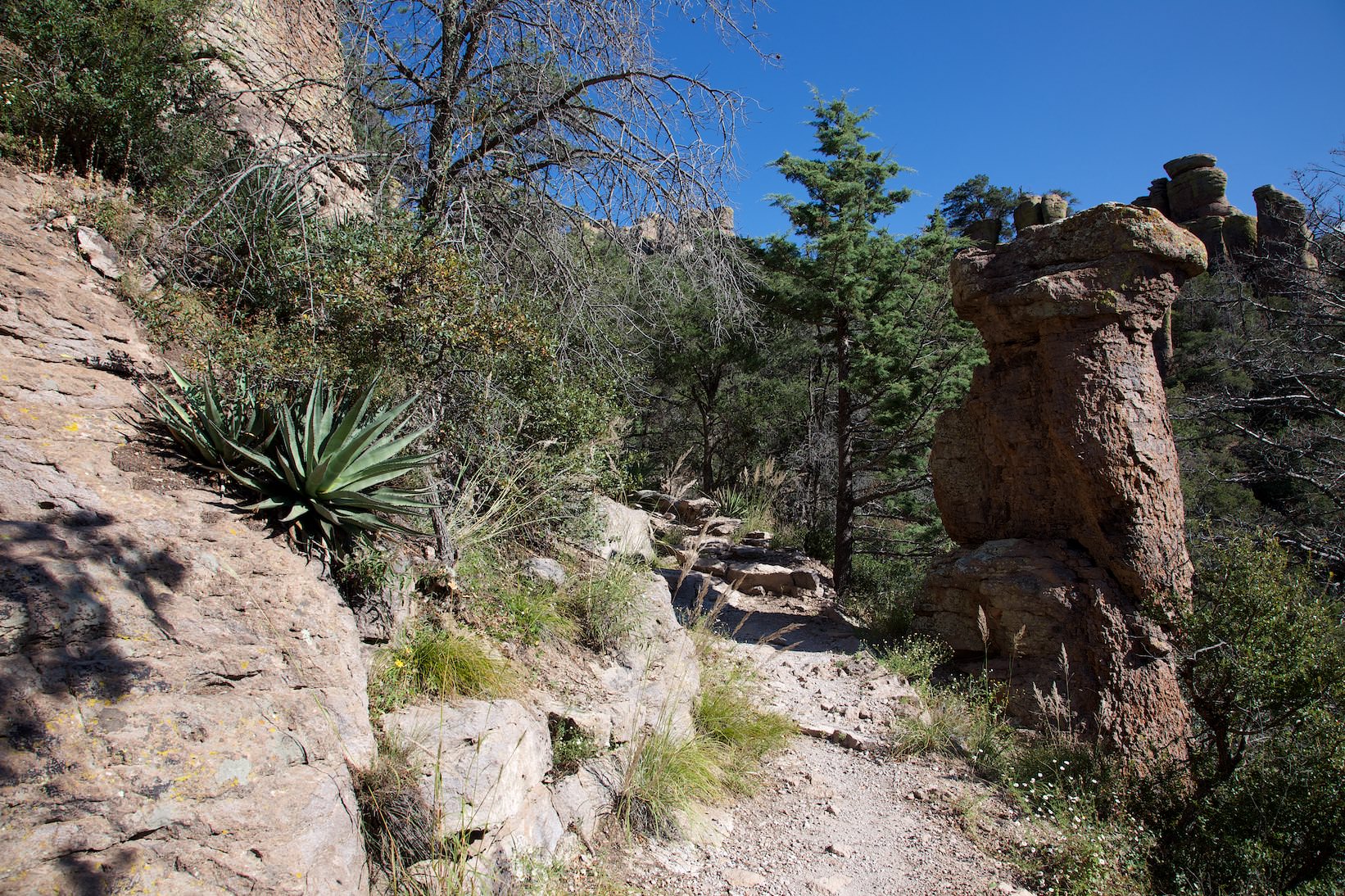
Description: The Mushroom Trail is 1.2mi long and leads back up the canyon. At first the trail is quite interesting, but mostly you hike in a forest with a lot of burned trees. Not a very spectacular section.
Mushroom Rock
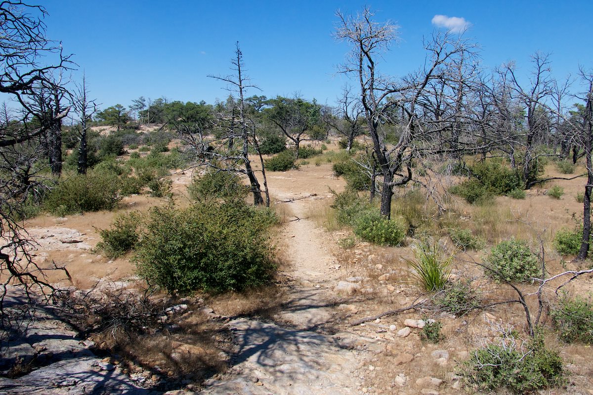
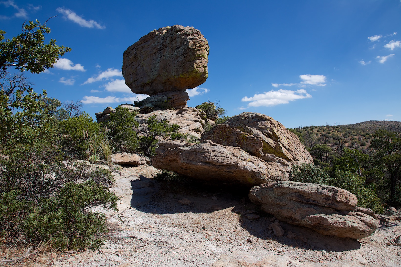
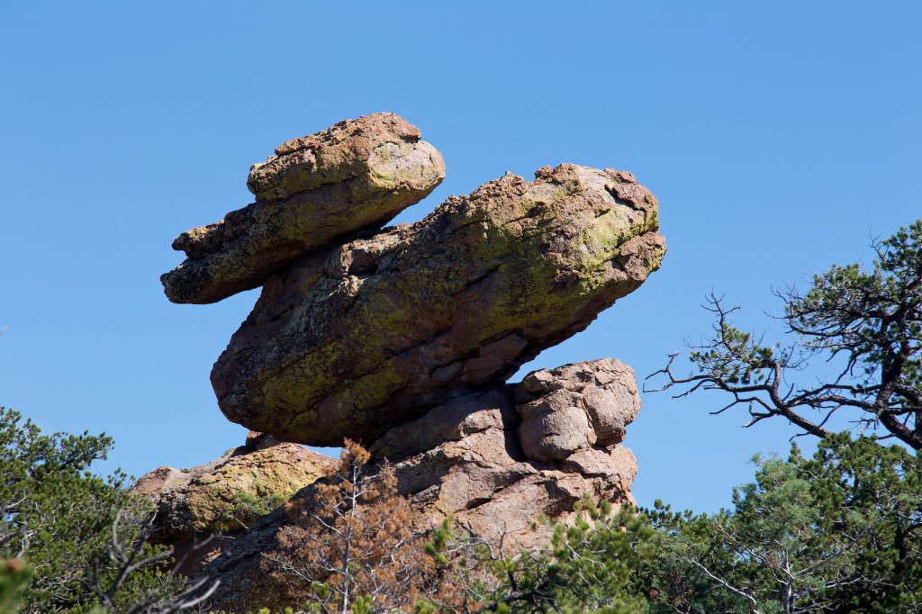
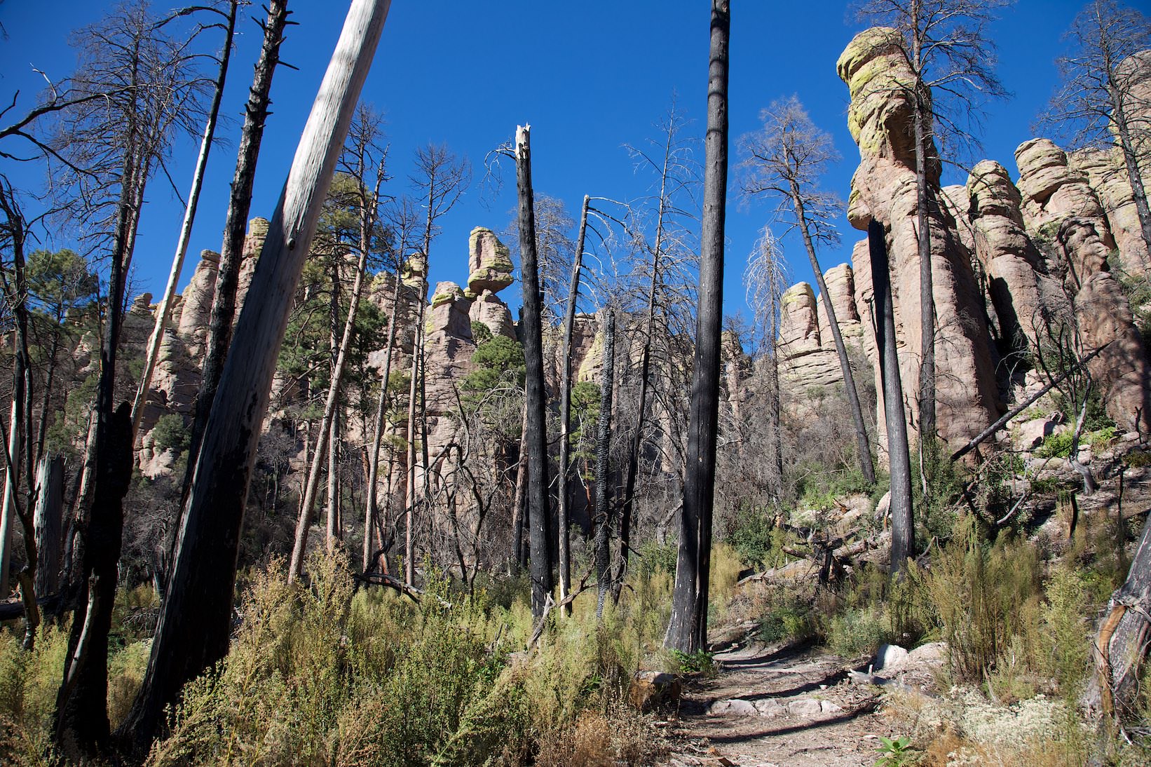
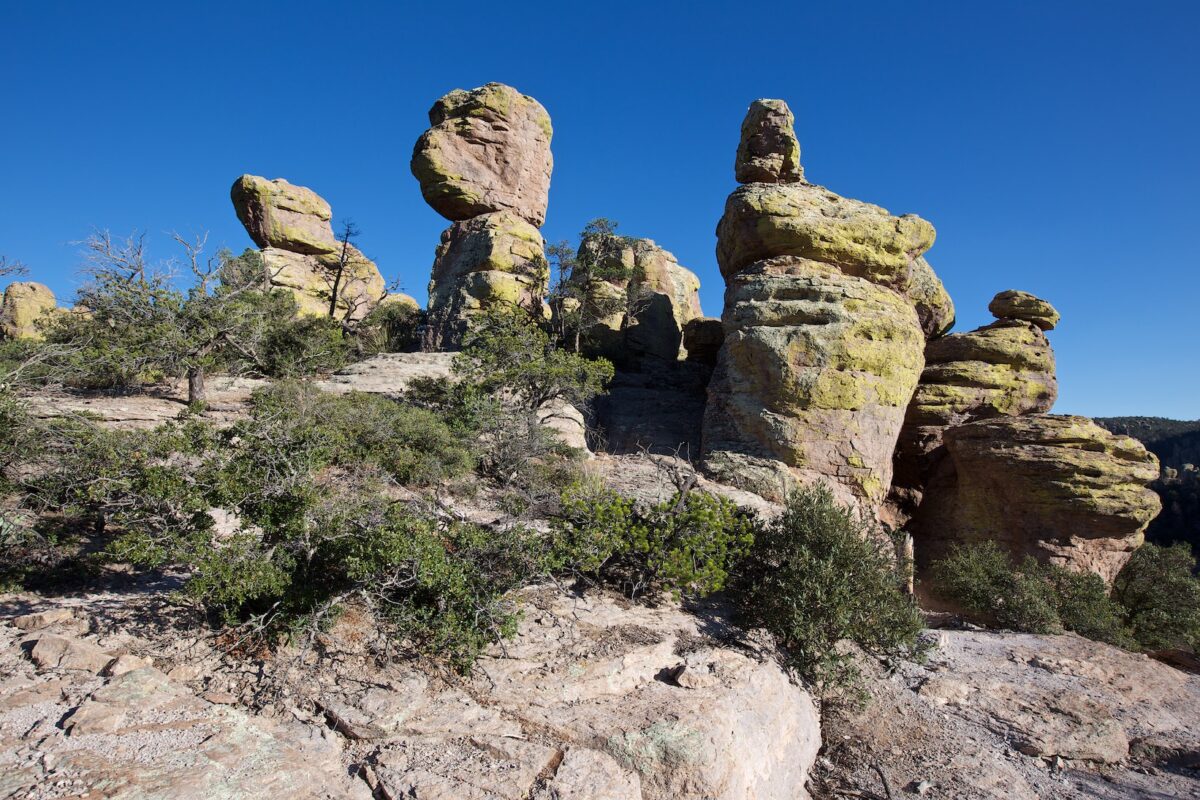
Big Balanced Rock Trail
Big Balanced Rock Trail
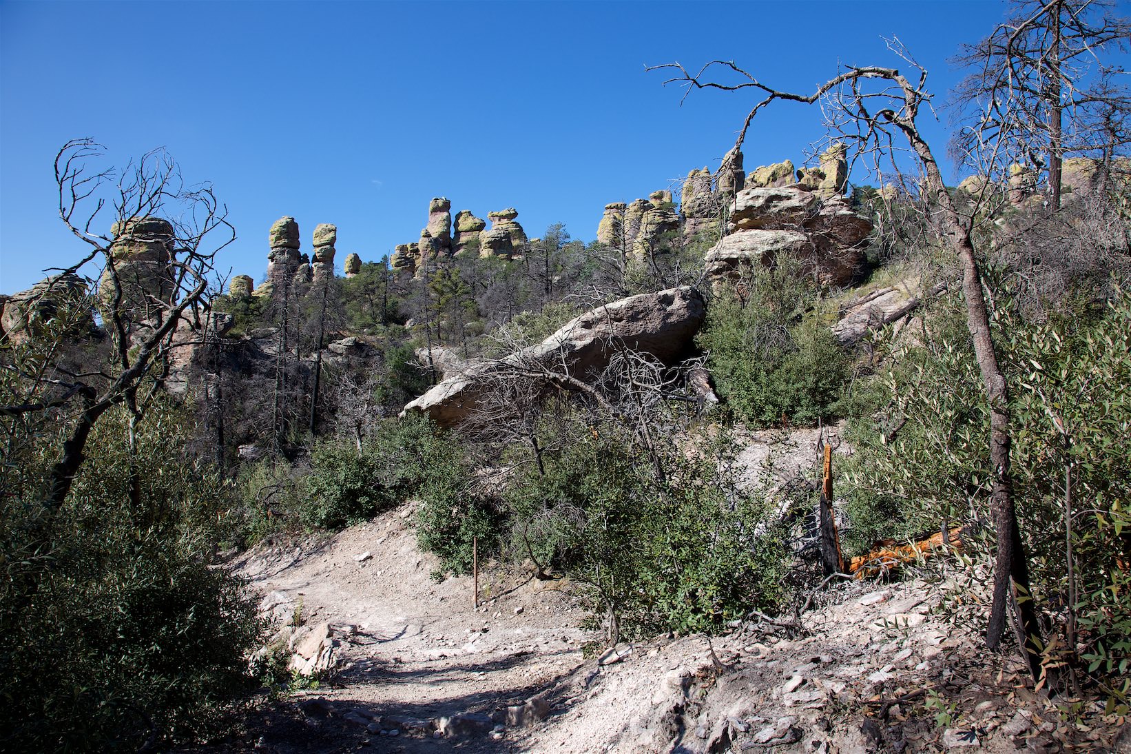
Description: The Big Balanced Rock Trail is 1mi long and is essentially level along the rim. Most of the trail is hiking across a plain of burned trees. The interesting Balanced Rocks don't appear until the last third of the way.
Big Balanced Rock Trail
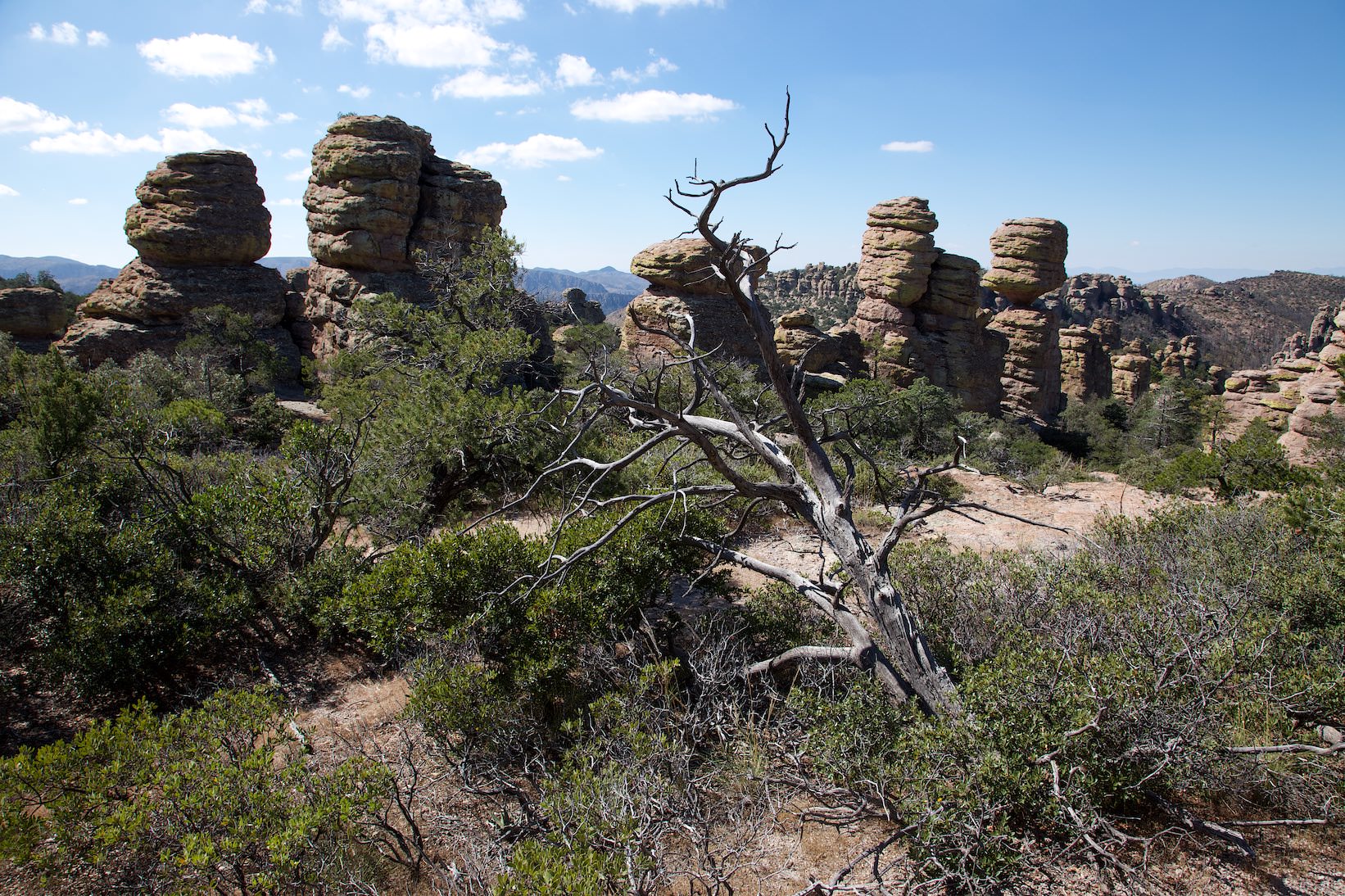
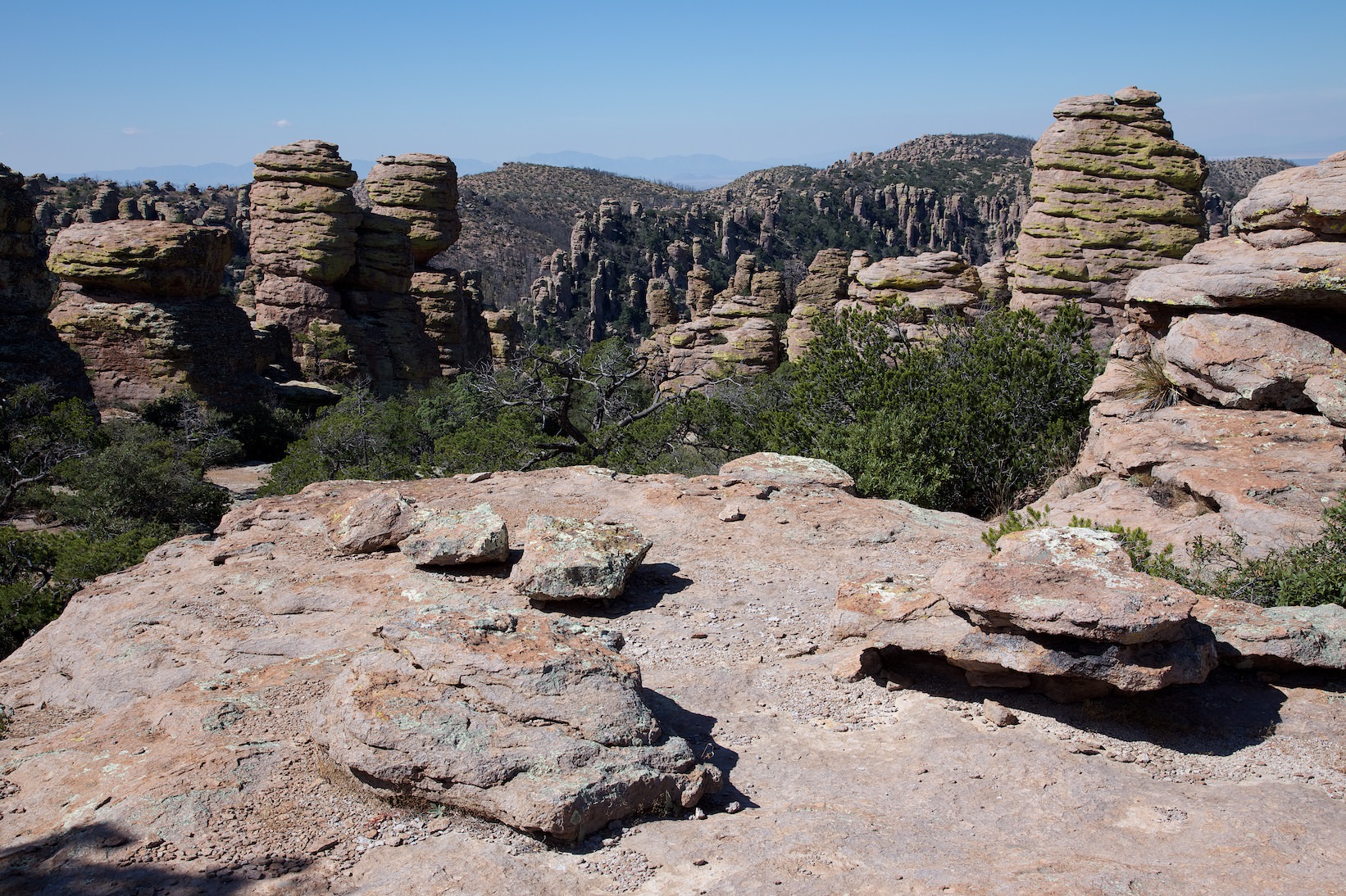
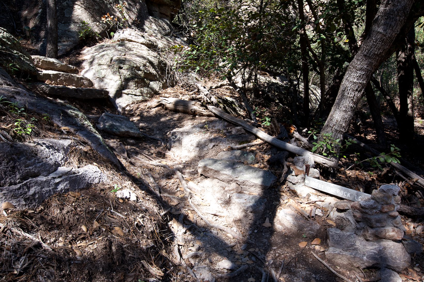
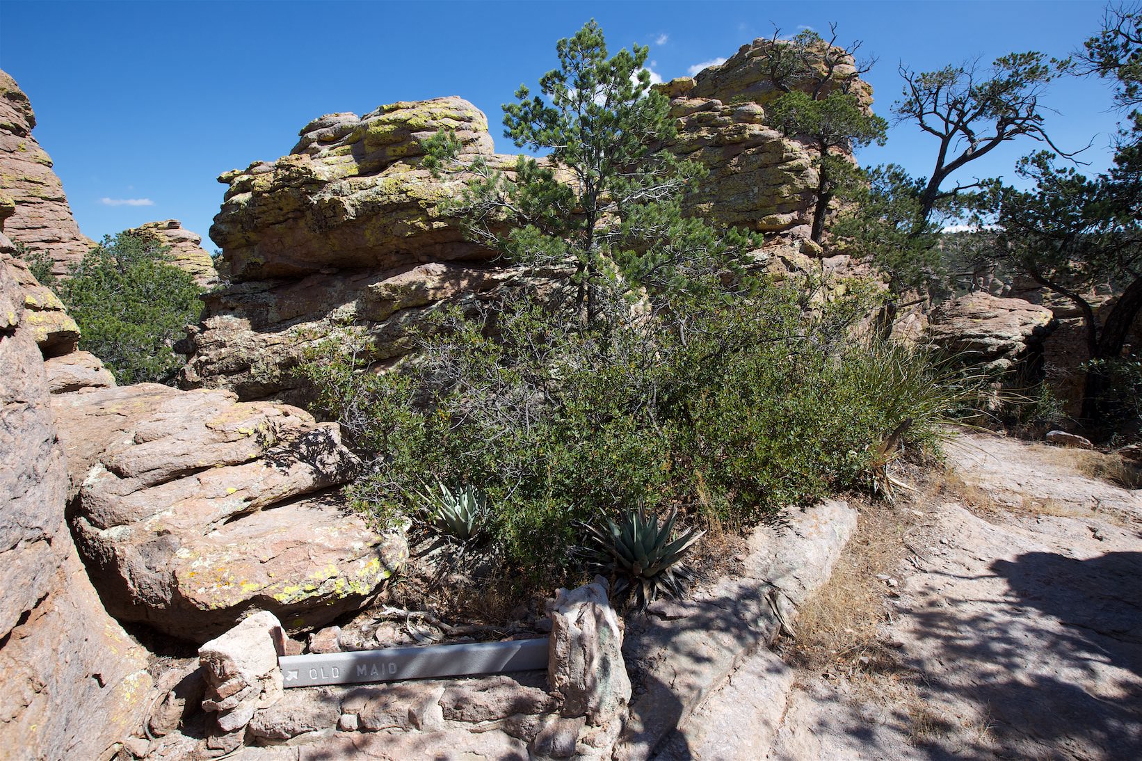
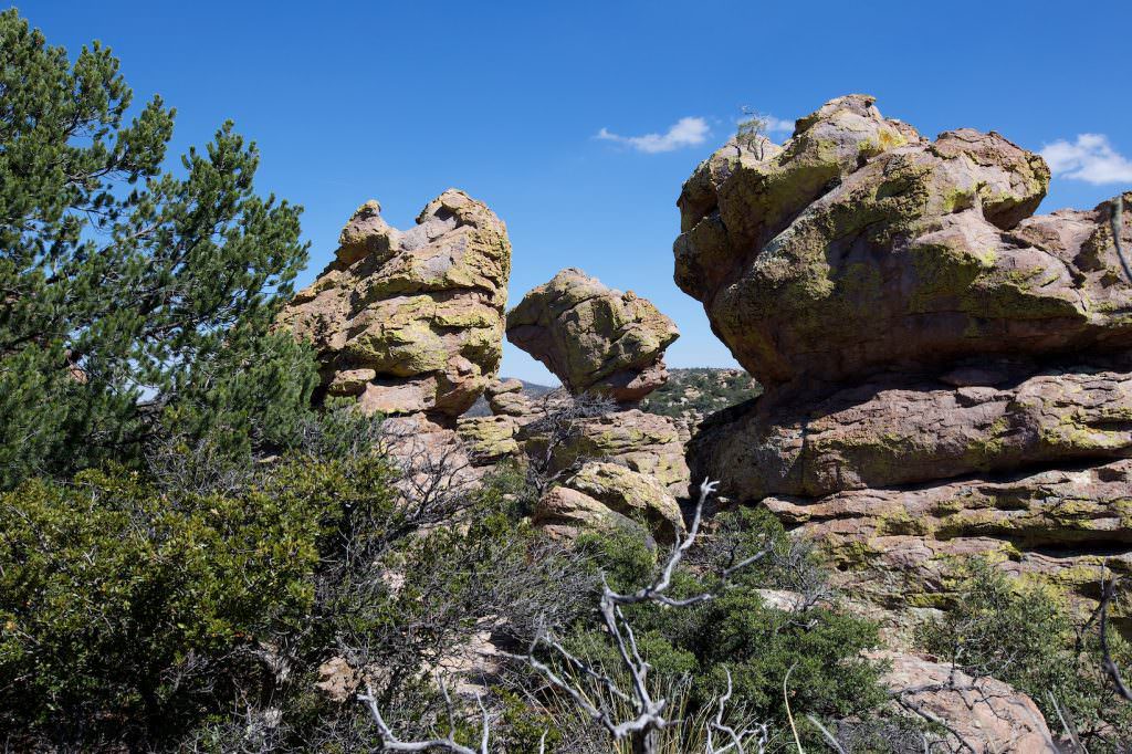
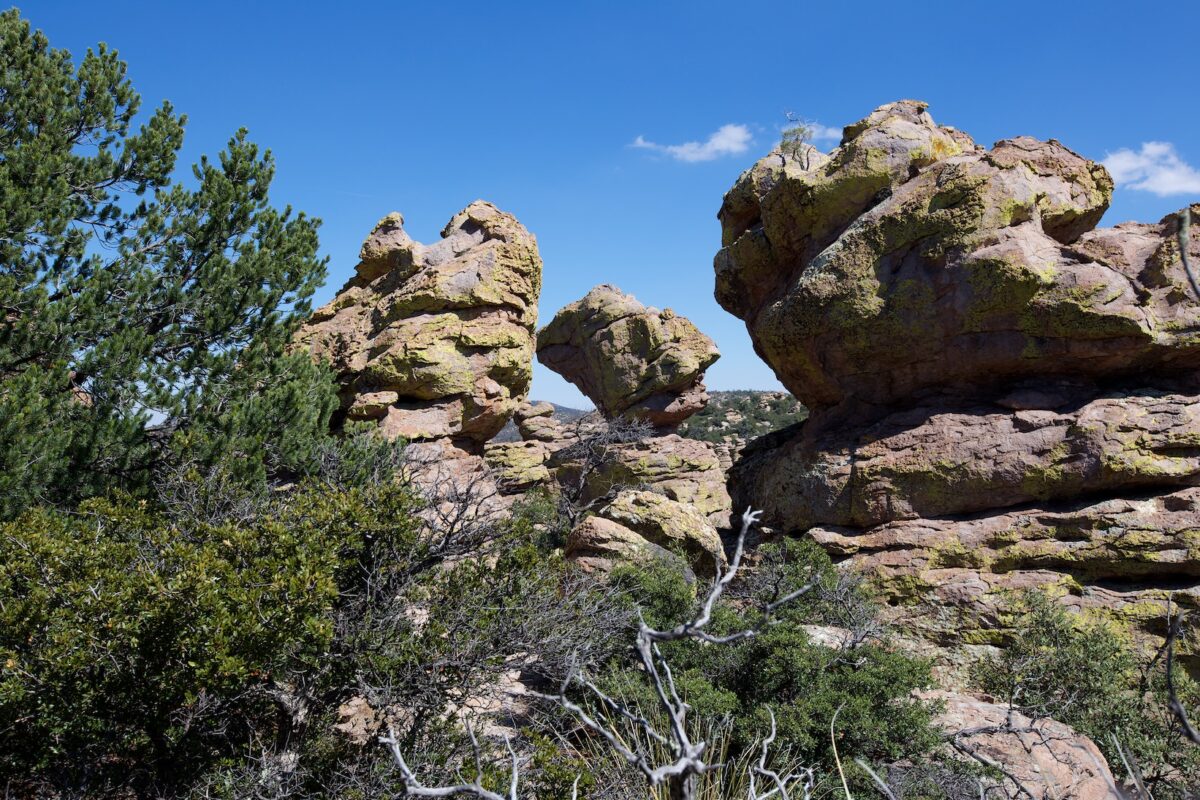
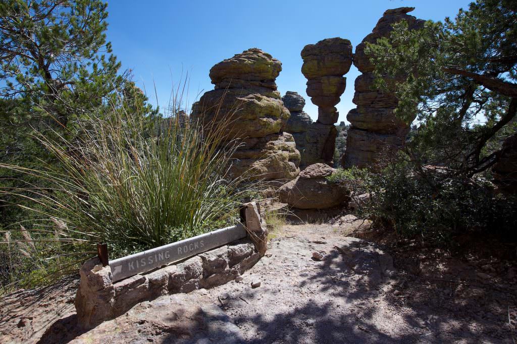
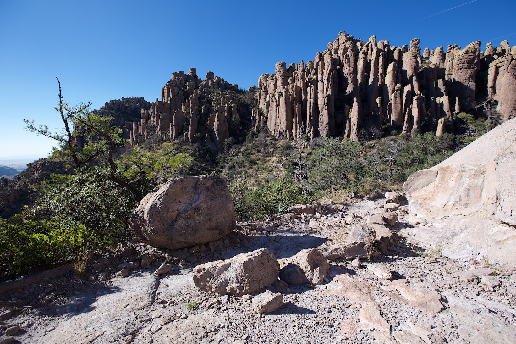
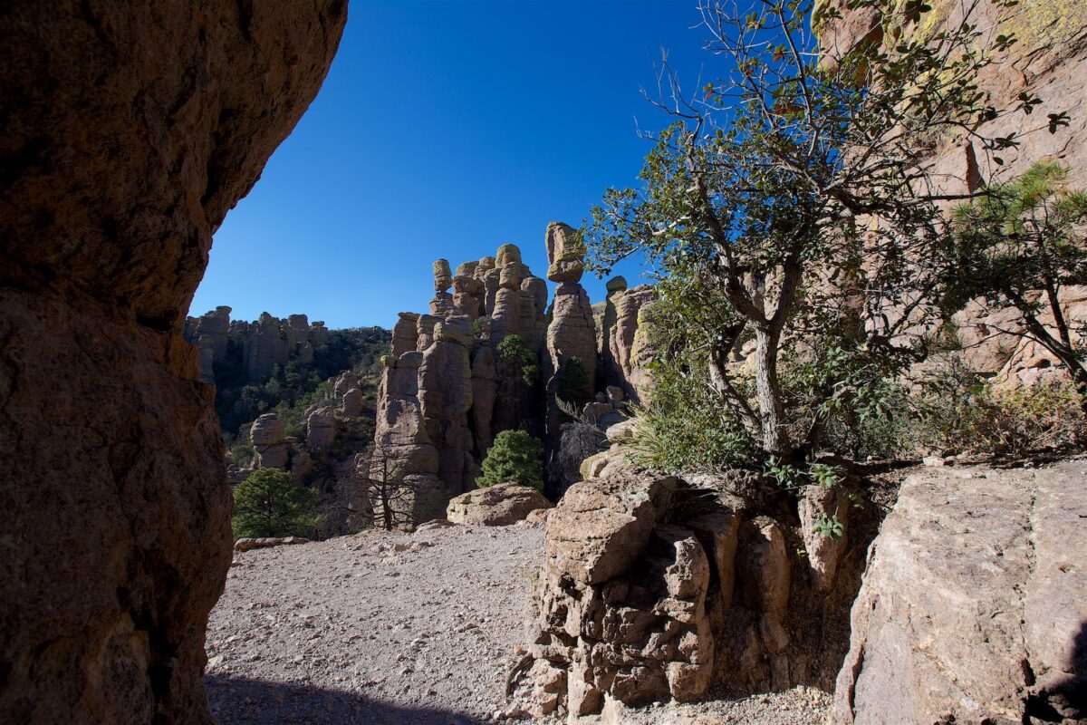
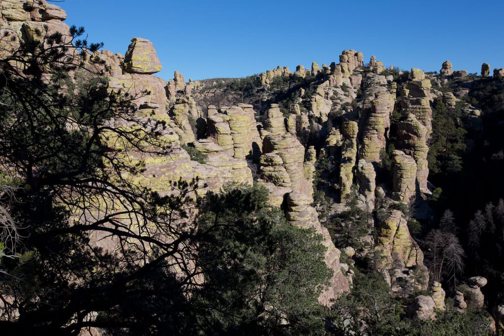
Heart of Rocks Trail
Heart of Rocks Loop
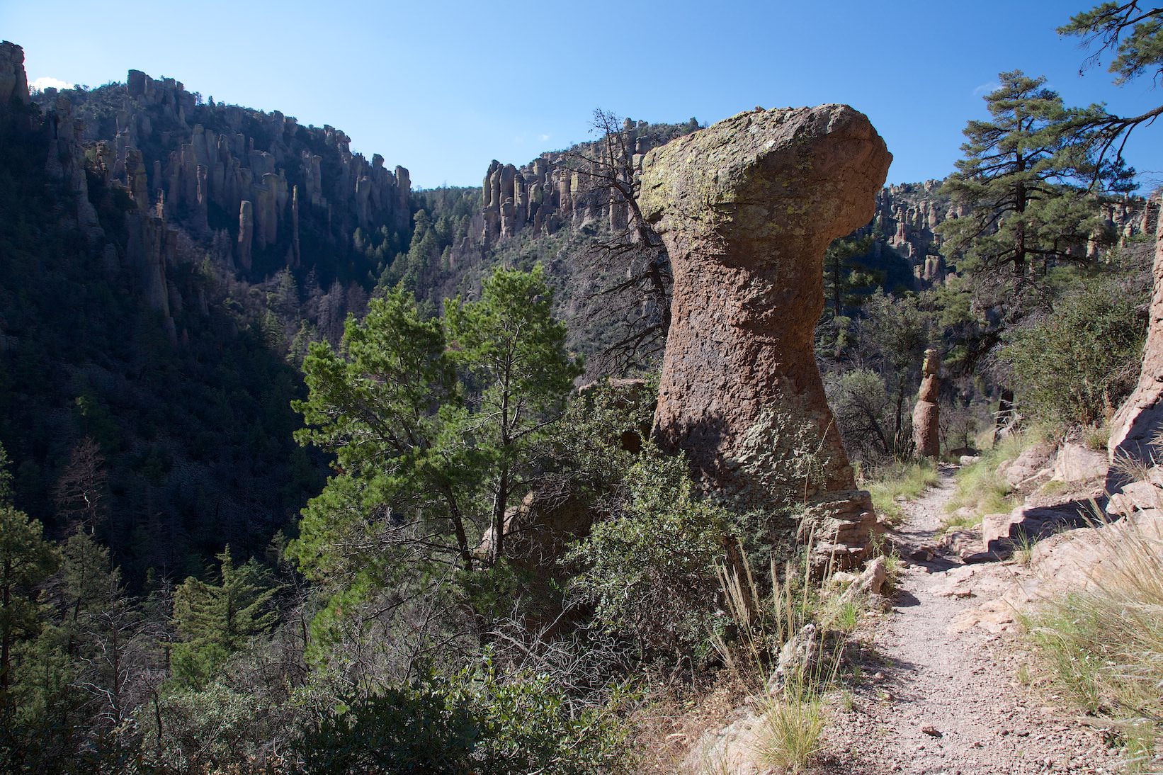
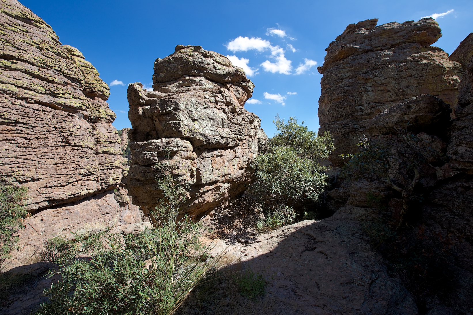
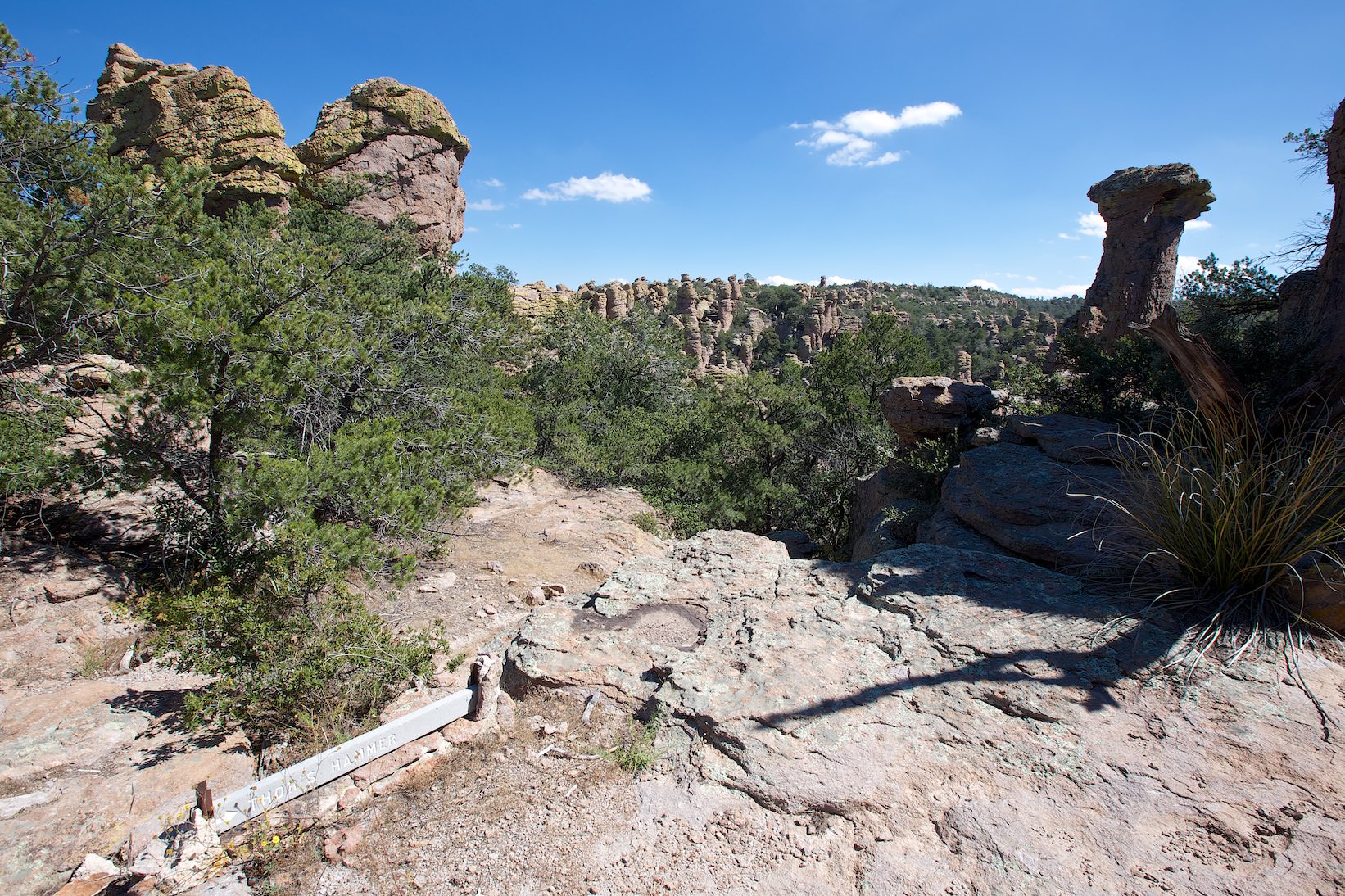
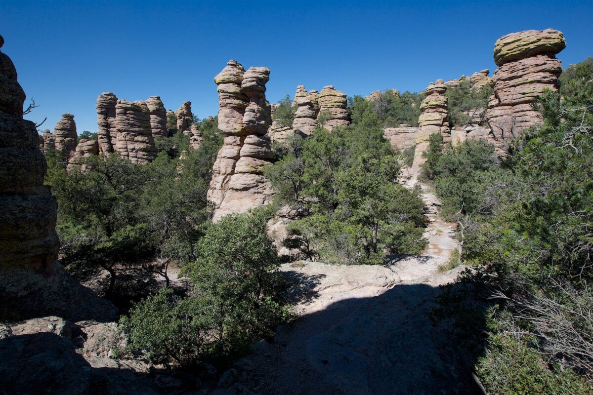
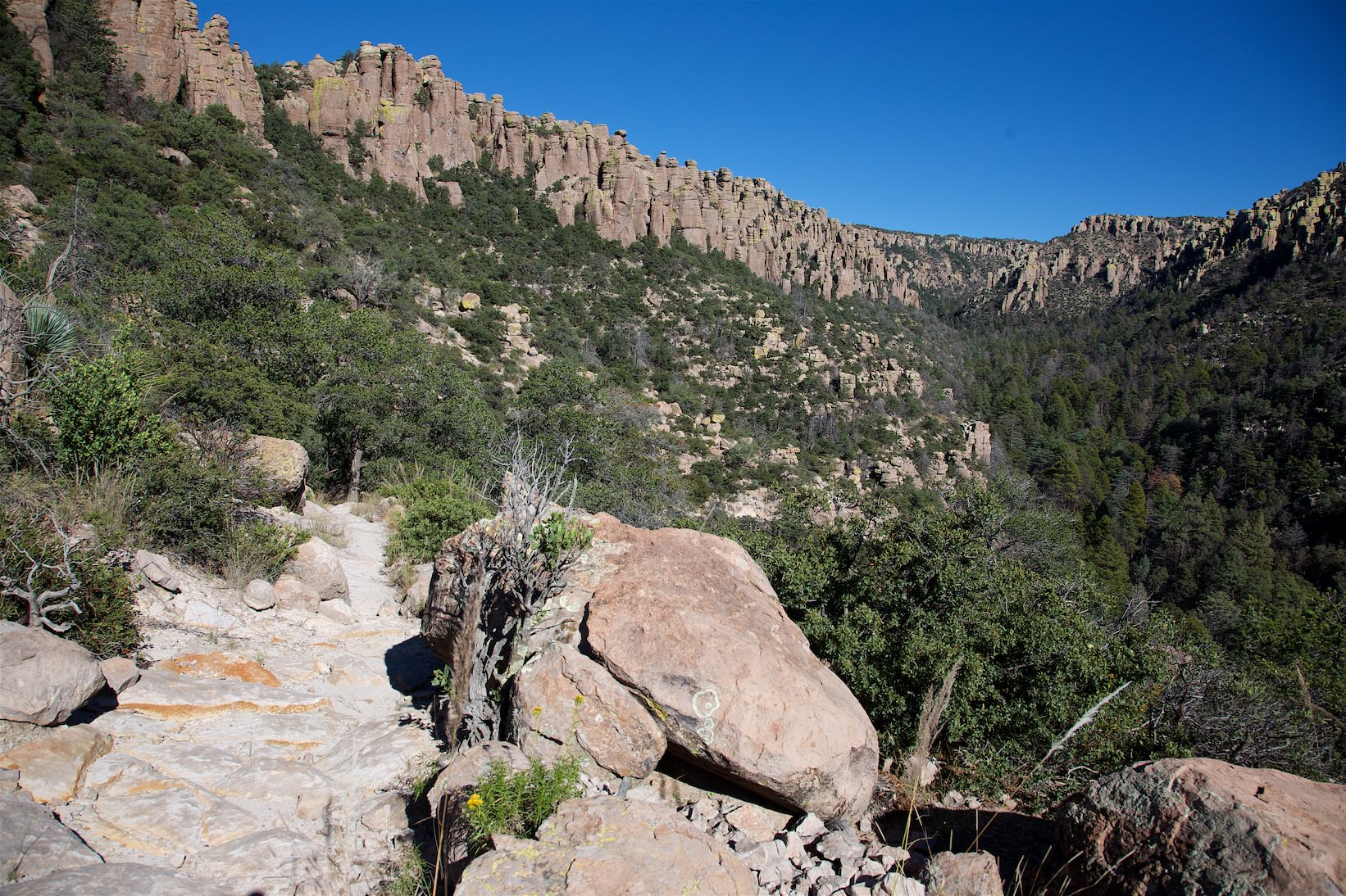
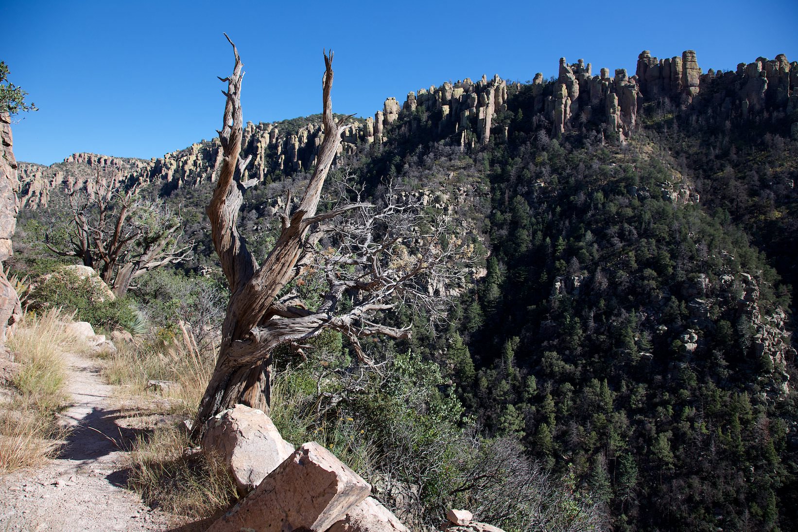
Description: The Heart of Rocks Trail is a 1.12mi loop. It is a junction from the actual loop hike. But since this is, next to Echo Canyon, the real highlight of the hike, you should not leave it out. The Heart of Loop Trail can only be reached by a longer hike, but it is worth it. The trail is a little rougher than the rest of the trail, you have to climb over rocks, it climbs up and down and the many unusual looking rock formations add variety. Some have names and you find yourself recognizing new formations in each of the stones.
Heart of Rocks Trail
Heart of Rocks Trail
Heart of Rocks Trail
Heart of Rocks Trail
Heart of Rocks Trail
Heart of Rocks Trail
Sarah Deming Trail
Sarah Deming Trail
Description: The Sarah Deming Trail is 1.63mi long and is basically always downhill into the canyon. It is steep in places, but mostly the trail is very easy to hike. Often you hike in the forest, but every now and then you have nice views of the canyon and the bizarre rock world of Chiricahua NM.
Sarah Deming Trail
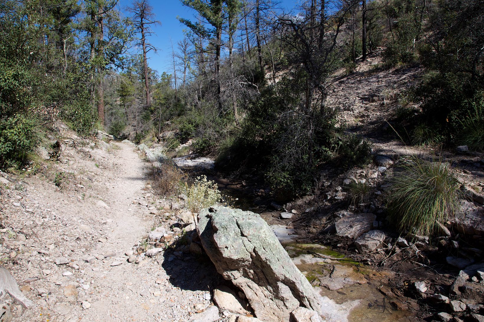
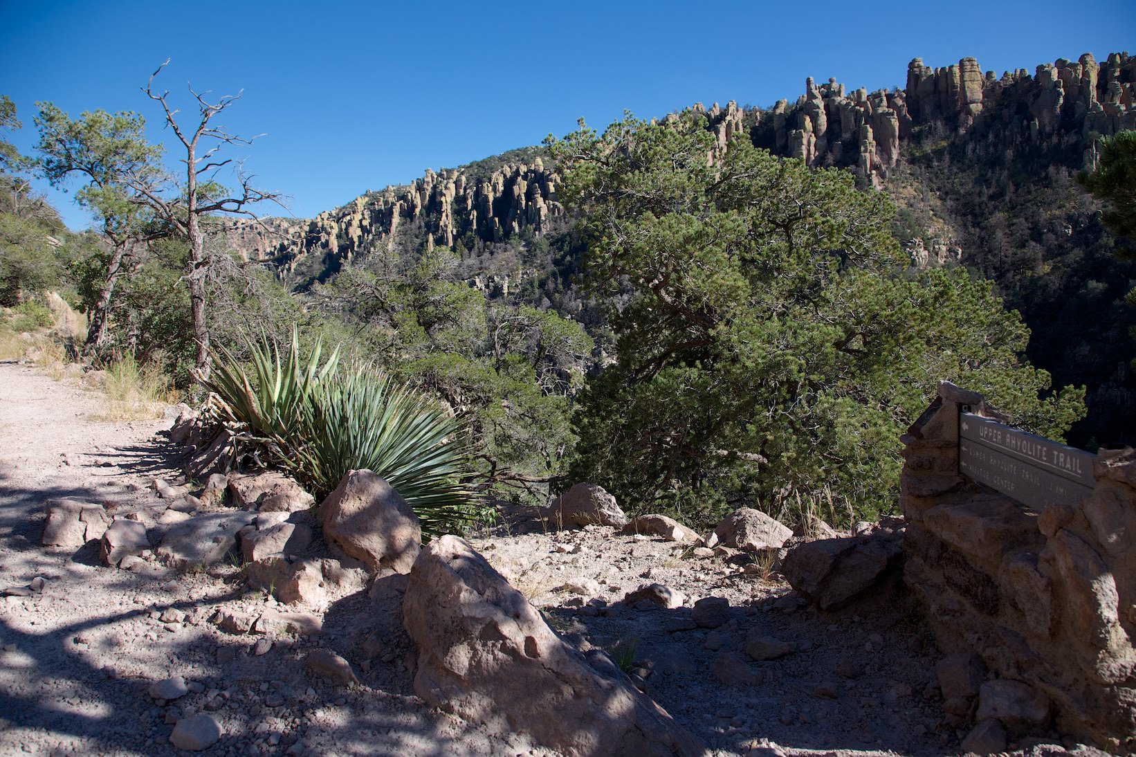
Upper Rhyolite Canyon
Upper Rhyolite Canyon
Description: At the junction of Sarah Deming and Upper Rhyolite Canyon you have the option to hike back to the Visitor Center via Lower Rhyolite Canyon (downhill) or hike back up to the Echo Canyon Trailhead.
Small inset: Every morning a National Park Service shuttle runs from the Visitor Center to the Echo Canyon Trailhead. So you have the possibility to take a shortcut and don't have to climb up the whole canyon again. To use this shuttle you have to reserve a place the day before, because the places are limited. In the morning you may not get a seat without a reservation.
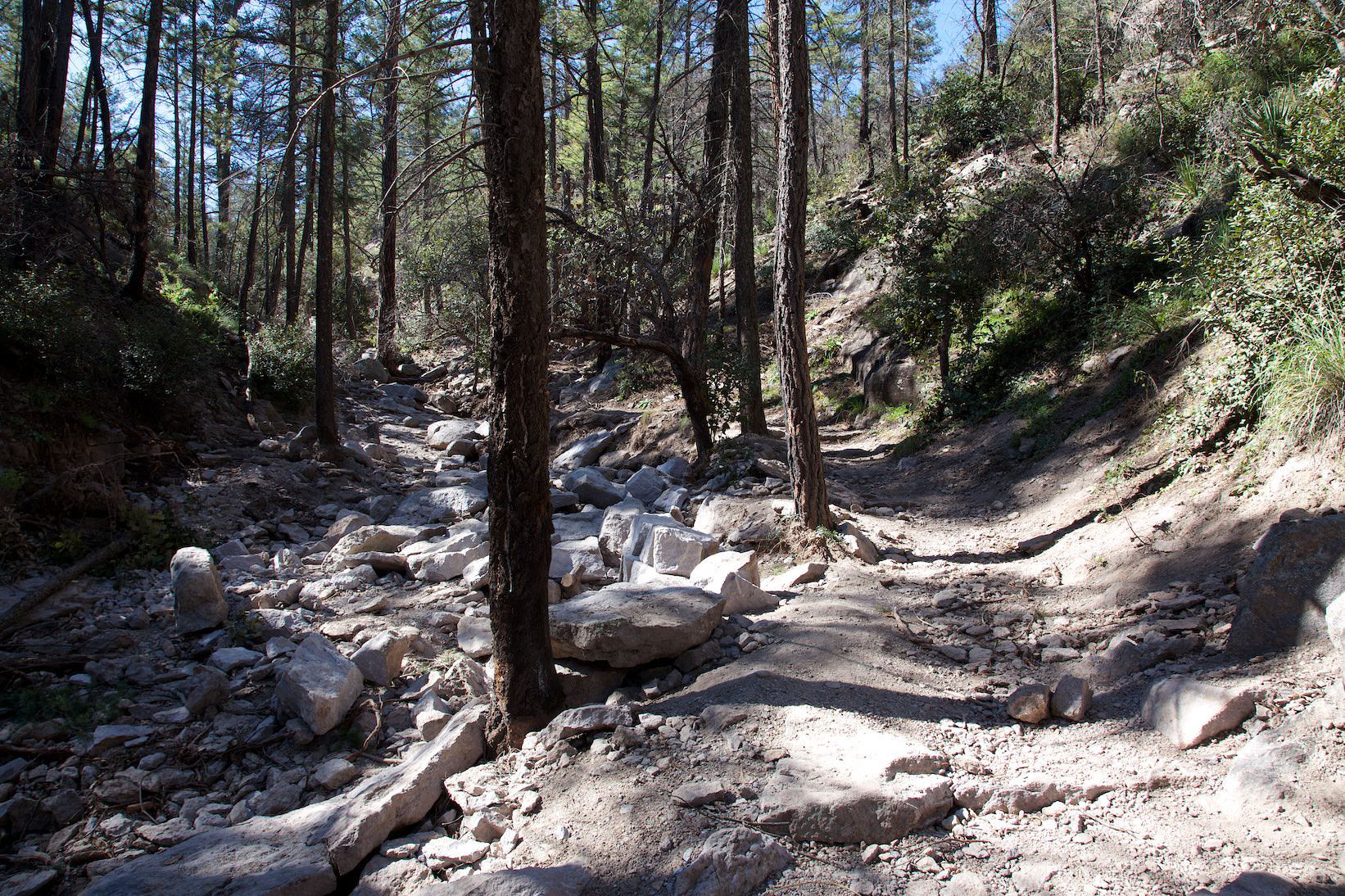
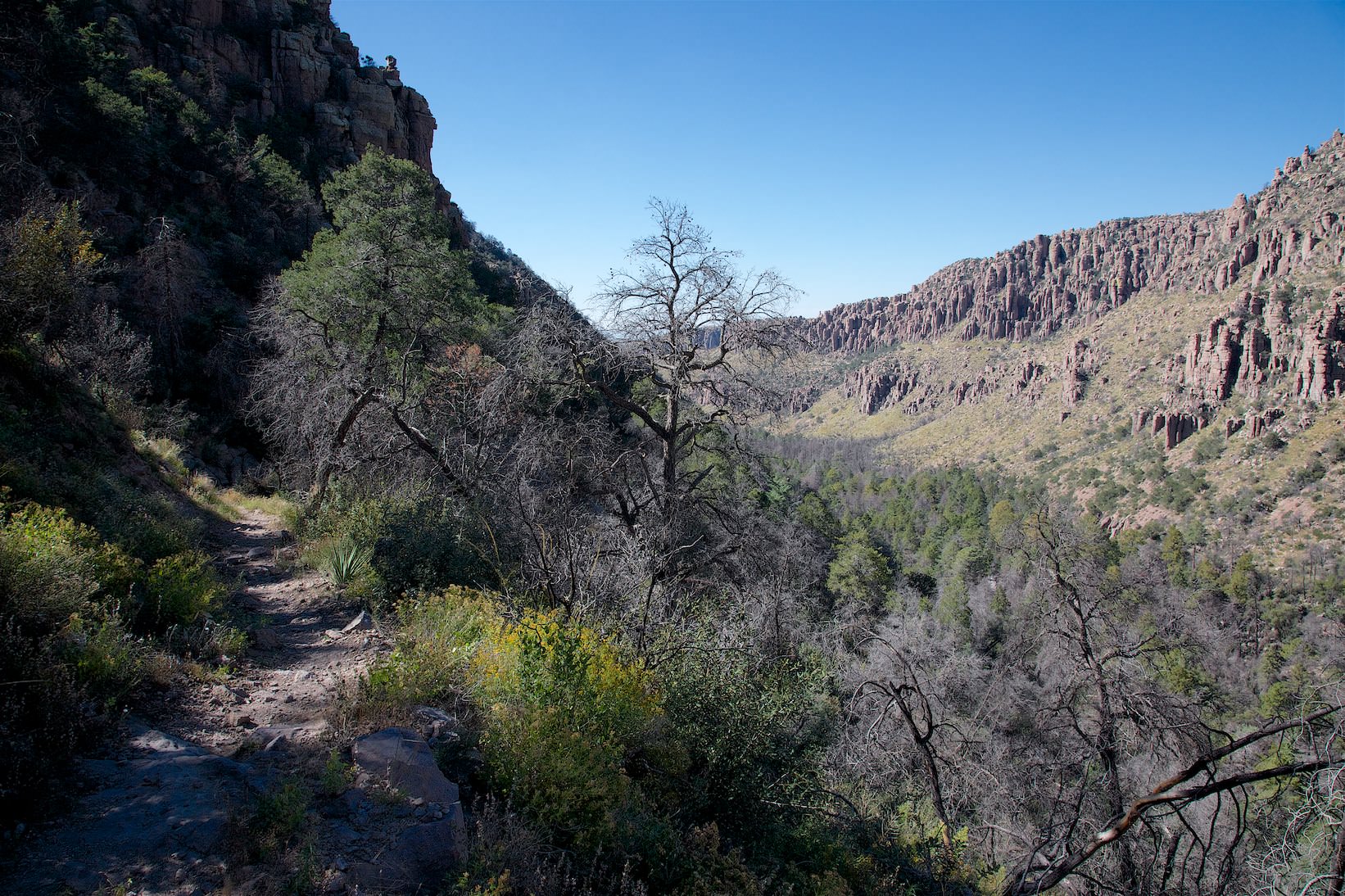
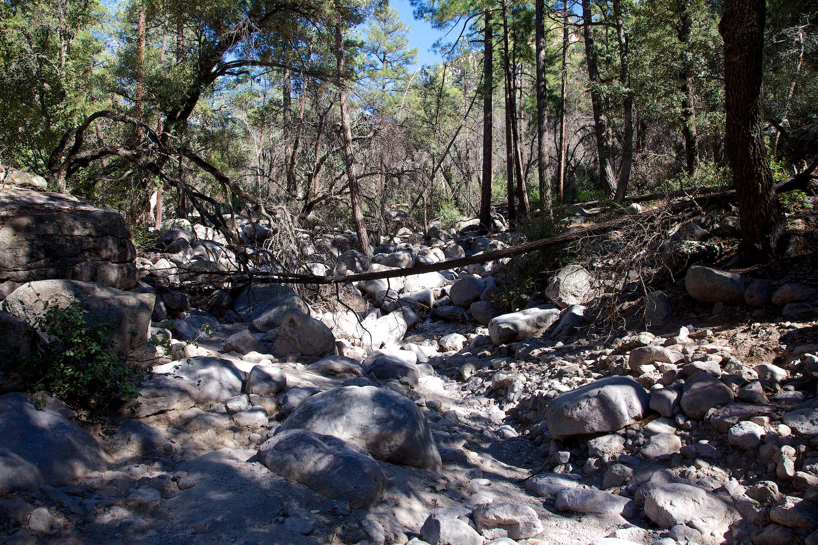
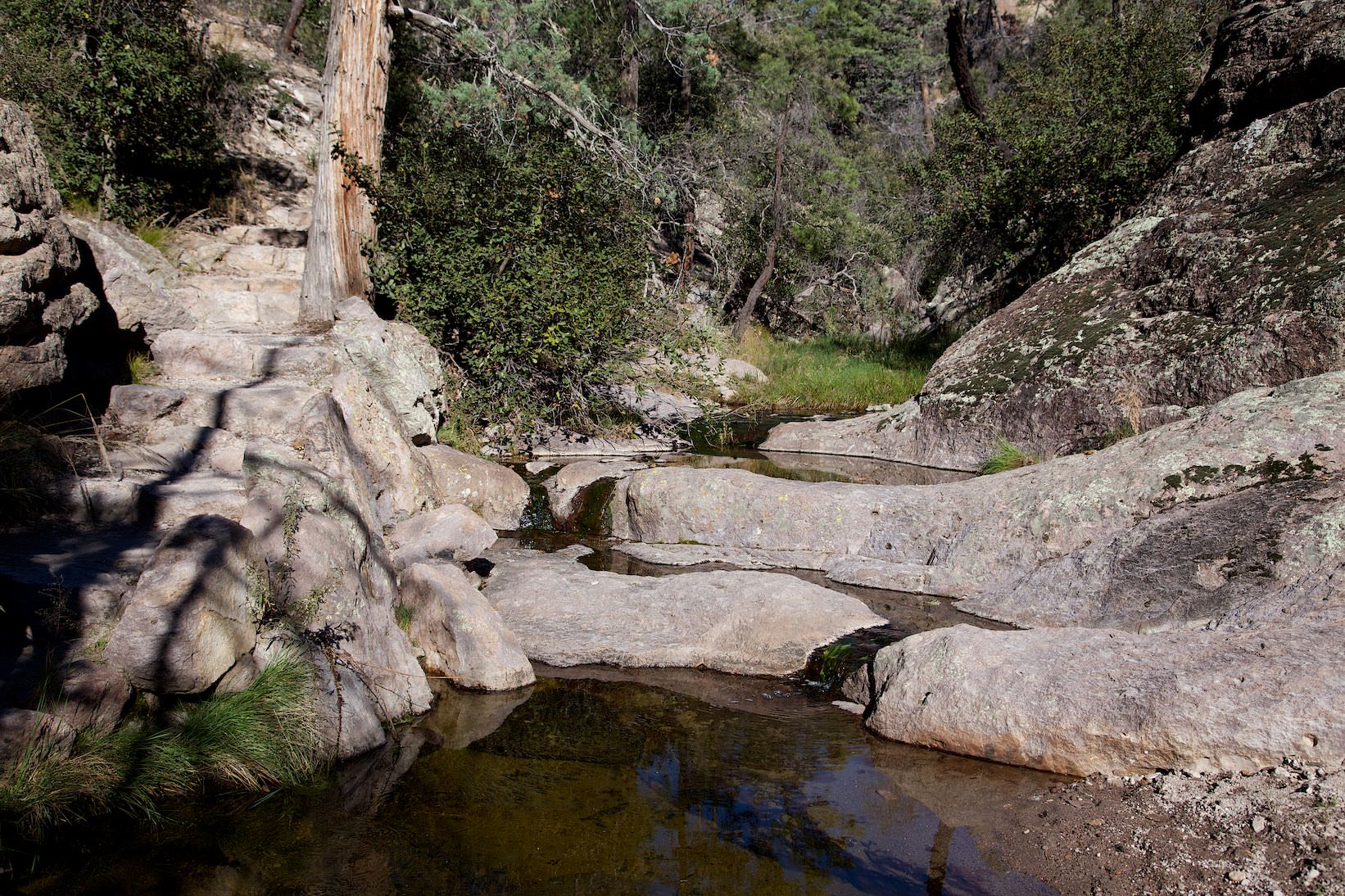
Upper Rhyolite Canyon is 1.12mi long and leads back up towards Echo Canyon. First you hike in the forest and have to cross a dry creek a few times. Here you have to climb sometimes, because the rocks in the creek are sometimes quite huge. After a while the forest stops and you have a clear view of the canyon and the surrounding rocks. The path becomes so much more interesting.
Upper Rhyolite Canyon
Echo Canyon Trail
Echo Canyon Trail
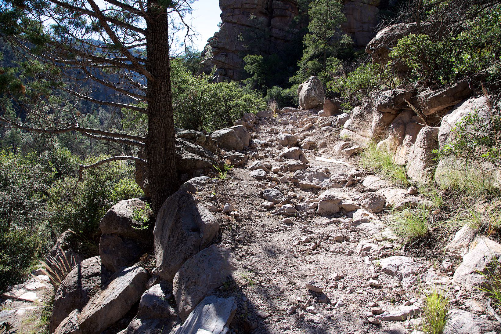
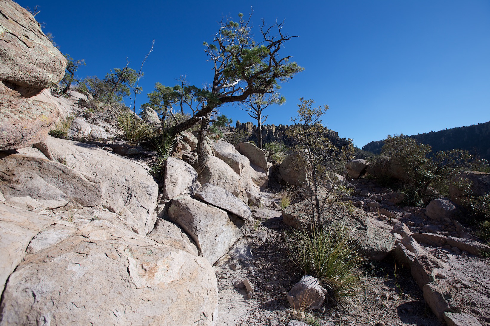
Description: The Echo Canyon Trail is 1.63mi long and leads back up through Echo Canyon to the trailhead. At first, the trail continues exactly as it did in the upper part of Rhyolite Canyon. Soon you reach Echo Canyon and the scenery changes again. Now you climb back up through a relatively narrow canyon. It's exhausting because you already have a few km in your legs, but since the surroundings are very beautiful, you almost forget the effort.
If you don't feel like or don't have time for the whole loop, you can also hike just here in Echo Canyon. There are also several other options. You could, for example, hike the Hailstone Trail in conjunction with the Ed Riggs Trail back to the parking lot, or just hike the same way back up.


