Lassen Volcanic National Park protects the area around the southernmost volcano of the Cascade Range, 10463ft Lassen Peak.
Visitor number 2000
0
Visitor number 2010
0
Number of visitors
In 2023, Lassen Volcanic NP ranked 43th in the visitor statistics of the most visited national parks. Best time to visit:In the summer months you have the best chance to find everything free of snow. Our visits: So far 2 visits: June 1998, September 2019
Open 24h all year round. However, parts of the park are closed in winter.
*The Anual Pass is so to speak the "flat rate" for all Parks managed by the National Park Service. The pass costs a one-time fee of $80 and can be purchased at the entrance to each National Park, National Monument, etc. The pass is valid for 13 months.
Description: We visited Lassen Volcanic NP for the first time on July 04, 1998. Unfortunately, the road through the national park was not yet passable. In 1998 there was so much snow in winter that the plowing work was not finished in July. Nothing unusual for Lassen Volcanic NP, but we know nothing about that in pre-internet times. You could visit as good as nothing in the park, so we just walked a bit along the park road .
Our rating:We liked the southernmost volcano of the Cascade Range very much and we had firmly planned to visit the national park again. This revisit took exactly 21 years, as in September 2019 our way led us again to the park.
☆☆☆☆☆Rated 4 out of 5
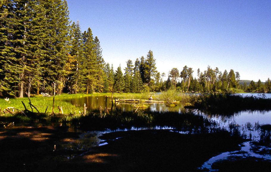
At Manzanita Lake we had a private and interesting ranger guided tour around the lake
Lassen Volcanic NP
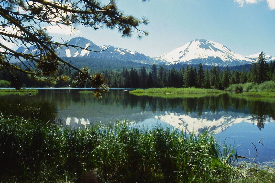
Manzanita Lake - 2019
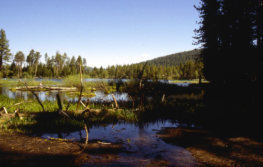
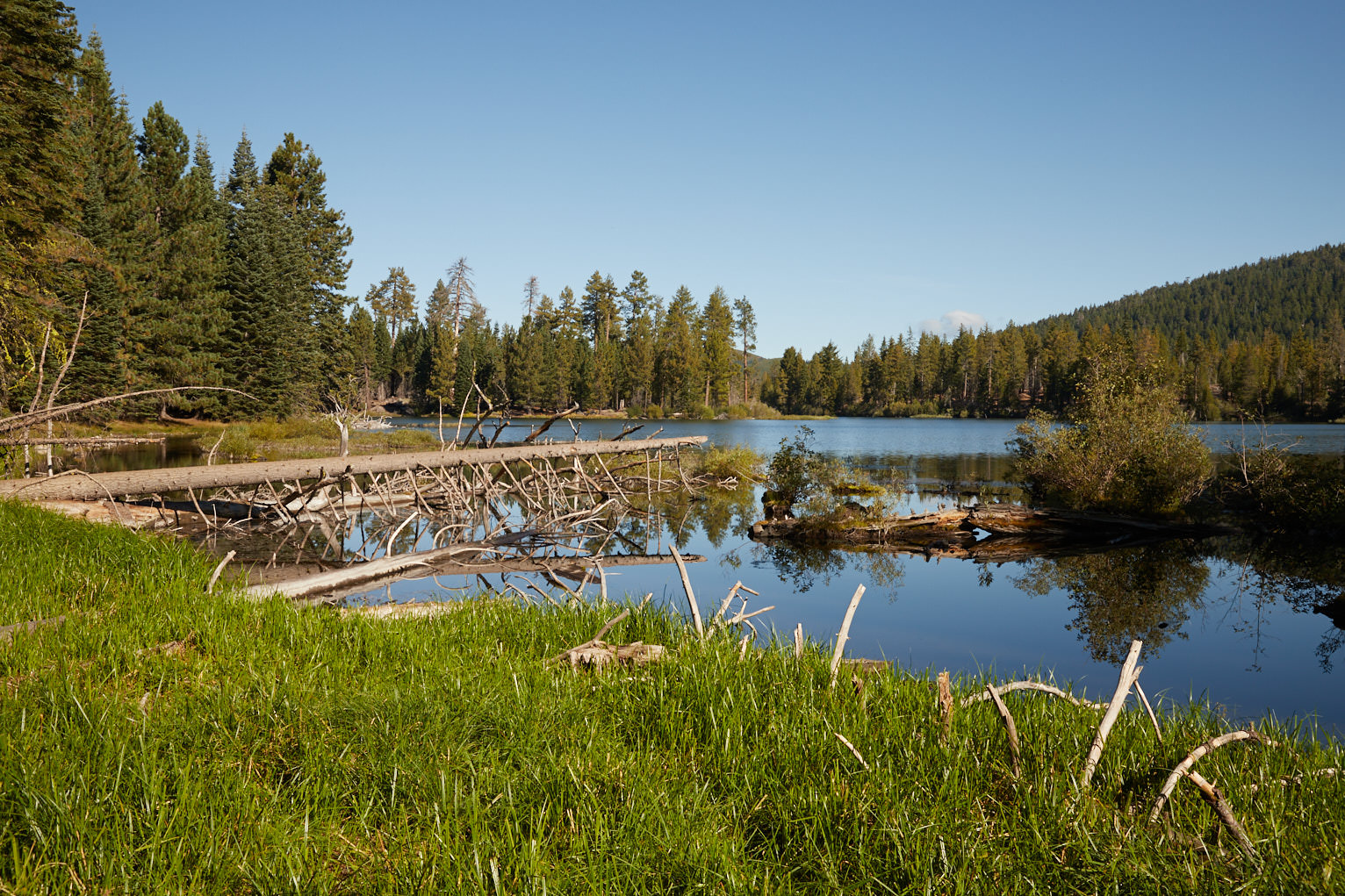
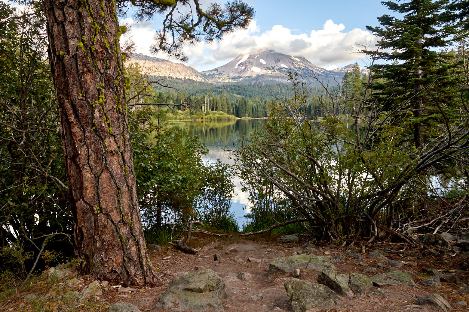
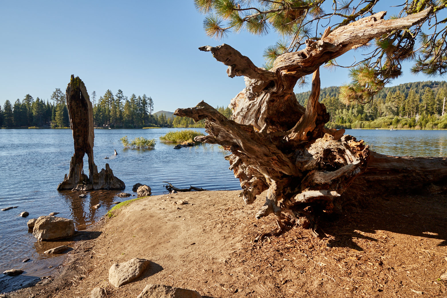
Description: The small lake is located directly at the northern entrance of the national park. On an easy, flat path you can walk around it and have great views of Mt. Lassen. If you are lucky and there is no wind, you can see beautiful reflections in the water.
Trail length: 1.55mi Altitude difference: – Time needed: 1-2 hours Difficulty level:easy - The trail is very well developed and easy to hike
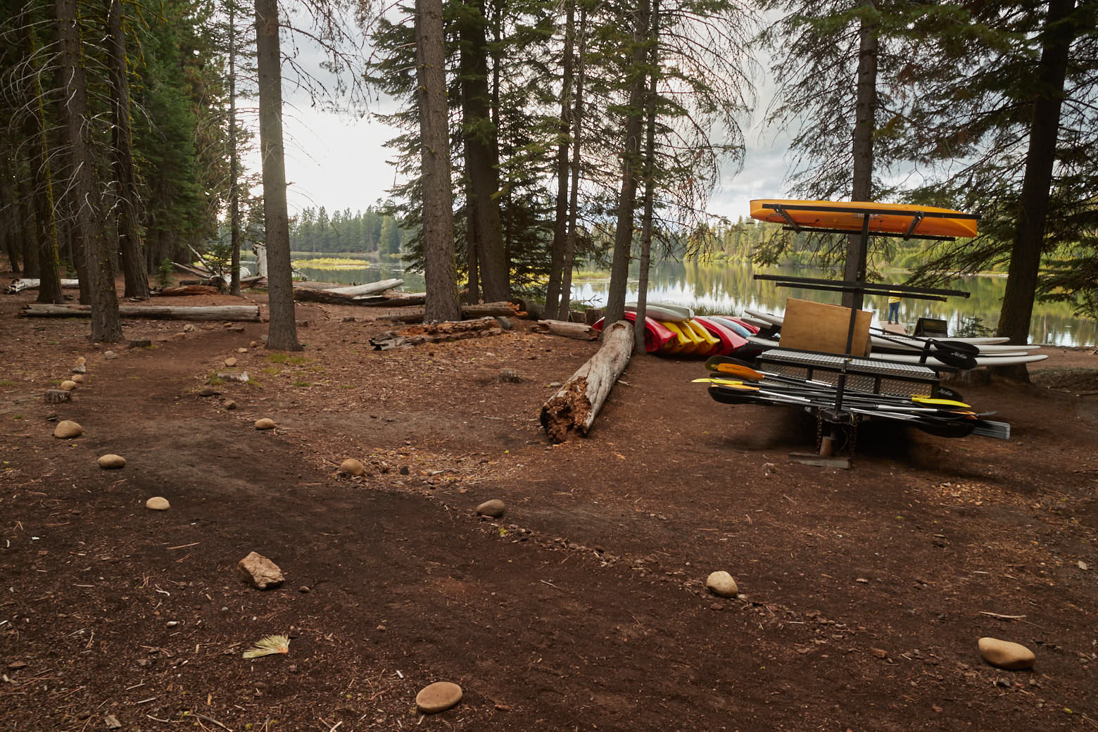
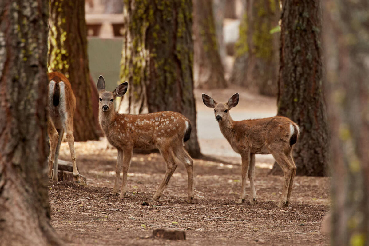
Almost all of the infrastructure in the north of the park is located around the lake. There is a visitor center, the Loomis Museum, a large campground also with camping cabins, a store and a gas station.
Our rating:On our two visits so far, we have stayed at the campground at Manzanita Lake. Both times we have felt very comfortable here. The park is not overcrowded and so you can enjoy everything in peace and quiet. The lake seems almost idyllic. It's just great to experience nature here.
☆☆☆☆☆Rated 3.5 out of 5
Altitude above sea level Manzanita Lake - Lassen Volcanic NP
5873ft
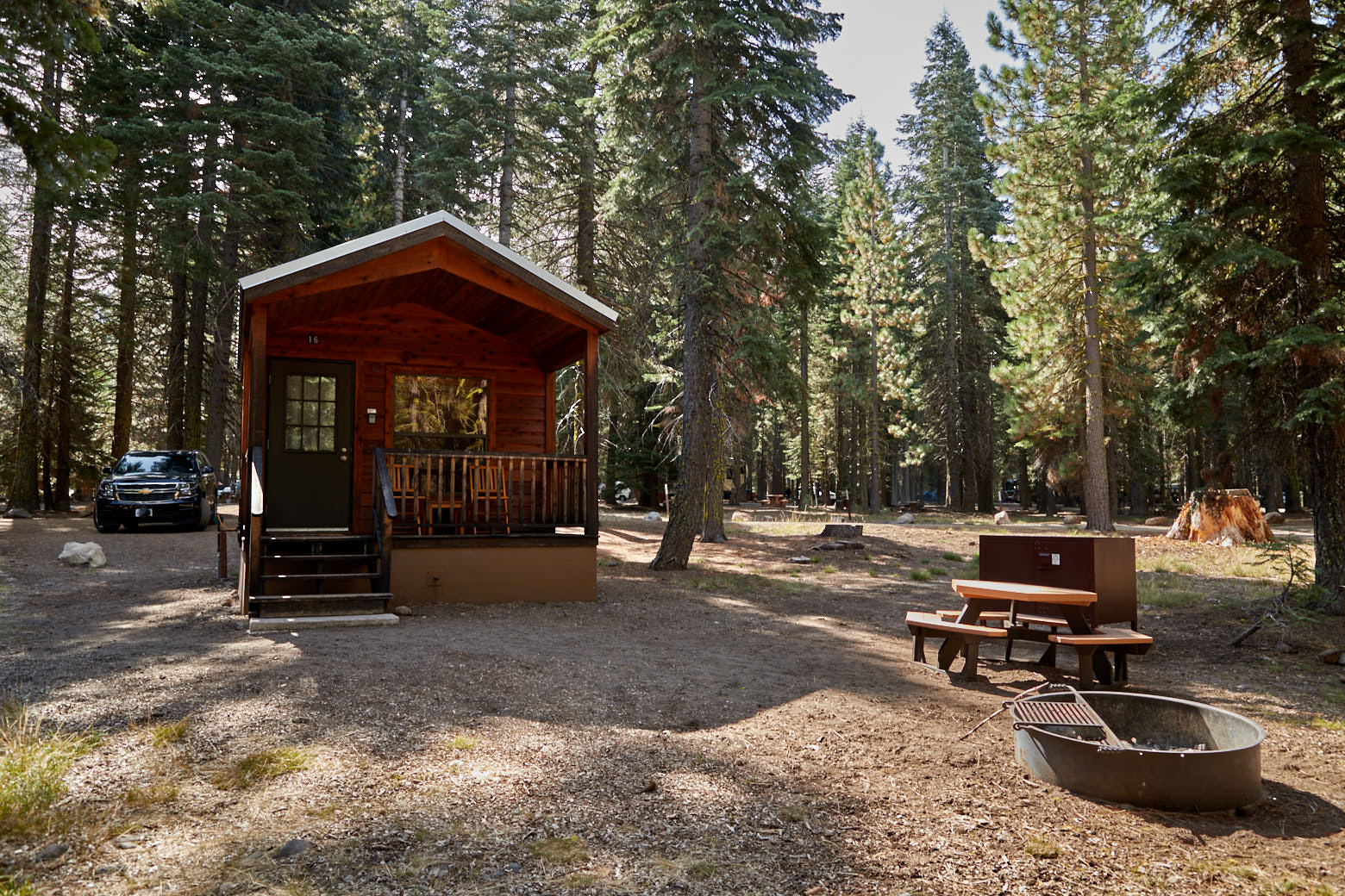
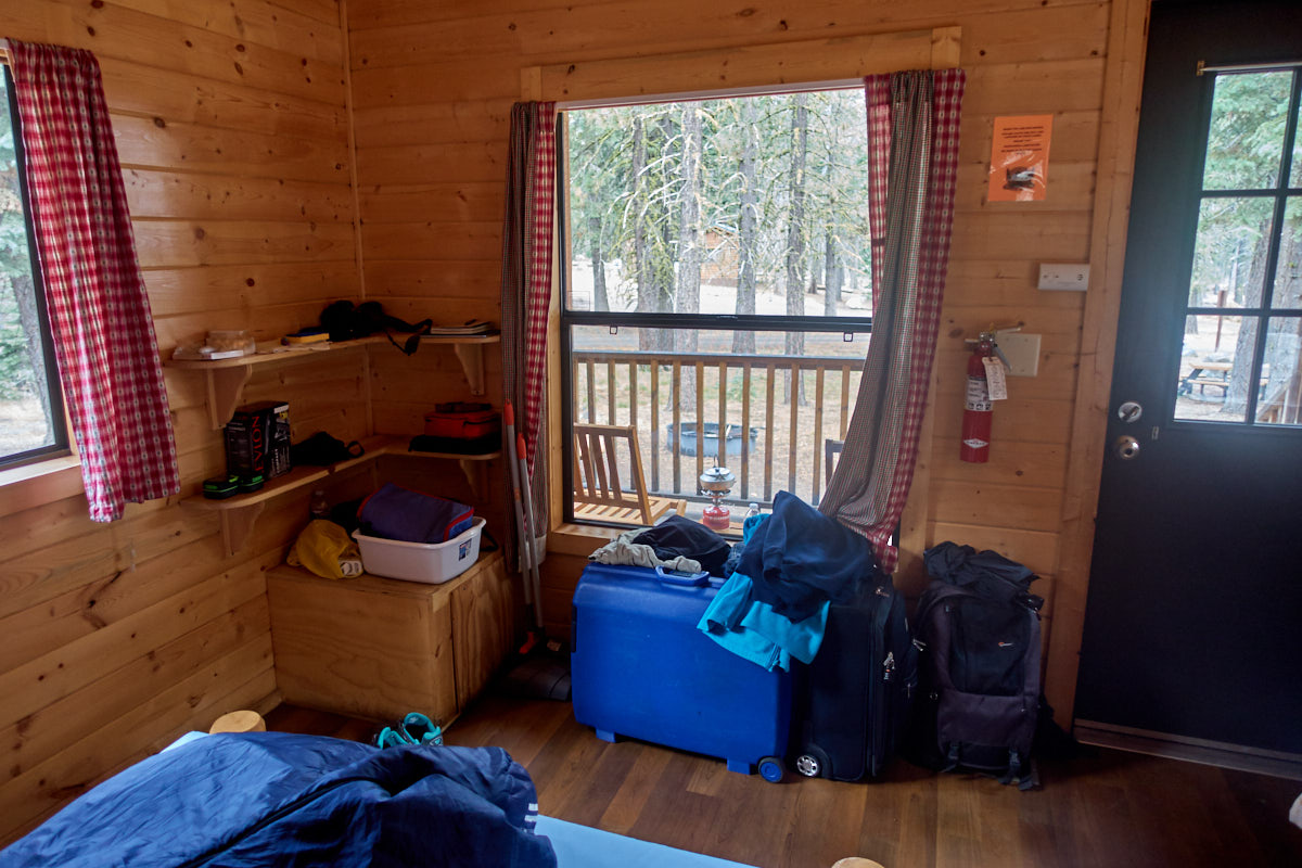
Manzanita Lake - Camping Cabins
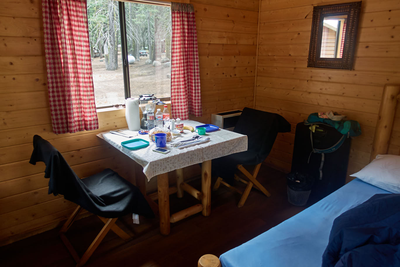
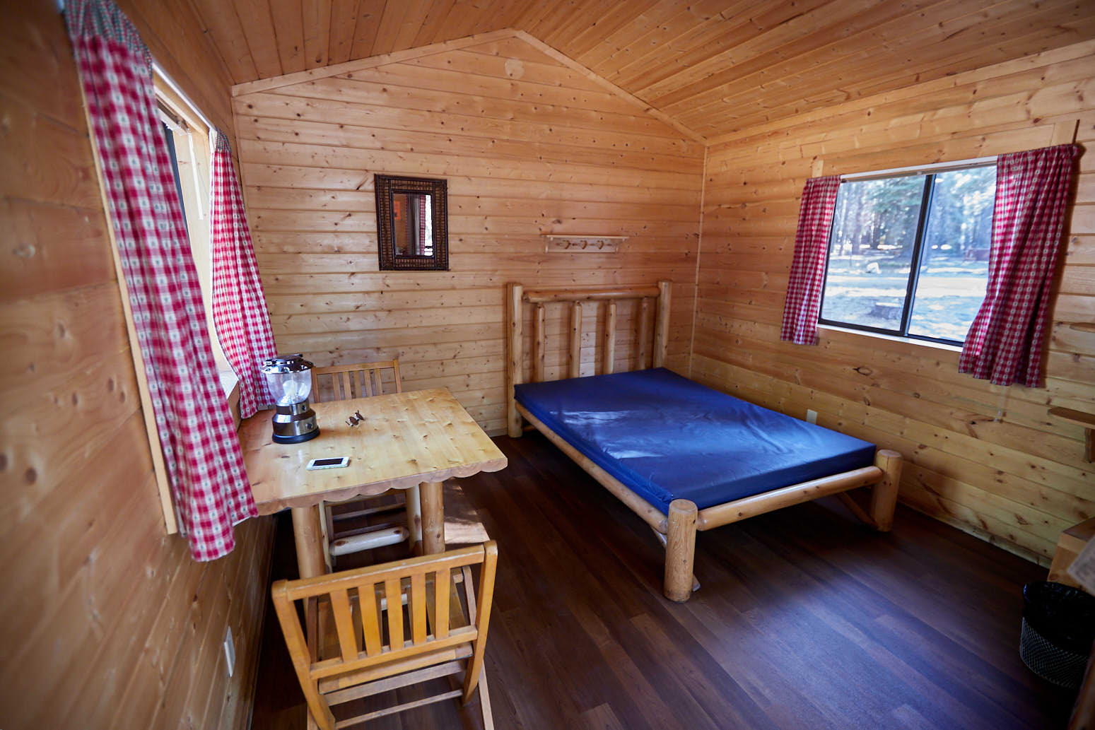
Description: The Camping Cabins are located on a portion of the campground at Manzanita Lake, just beyond the north entrance into Lassen Volcanic National Park. There are three different cabins that can accommodate 2-8 people.
We had a one room cabin with space for two people. There is a double bed with mattress, a table with two chairs, a gas-powered lamp and heater and a small shelf with storage space. Outside there is another table with two chairs on the porch and a fire place with a picnic bench. In addition, each cabin has its own bearlocker, where all food and cosmetics must go.
Our rating: Since we have not been camping for a very long time, this was somewhat of a small experiment, especially how it is to cope without a bathroom in the cabin. Ok compared to the tent, this was already a lot more comfortable, although the mattress was almost non-existent and therefore the bed was very very hard.
In the end, the lack of a bathroom was not a big problem just like the communal showers. Both were very clean and tidy throughout the campsite.
For European tourists, there is perhaps only one small disadvantage, because you have to bring your complete camping equipment, such as bedding and food. With today's limited suitcase sizes and weight on the plane, this can already bring a small packing problem, unless you buy all things locally new.
The cabins were very cozy and homey. We liked it very much and would spend a few nights here again anytime.
☆☆☆☆☆Rated 5 out of 5
Butte Lake Area
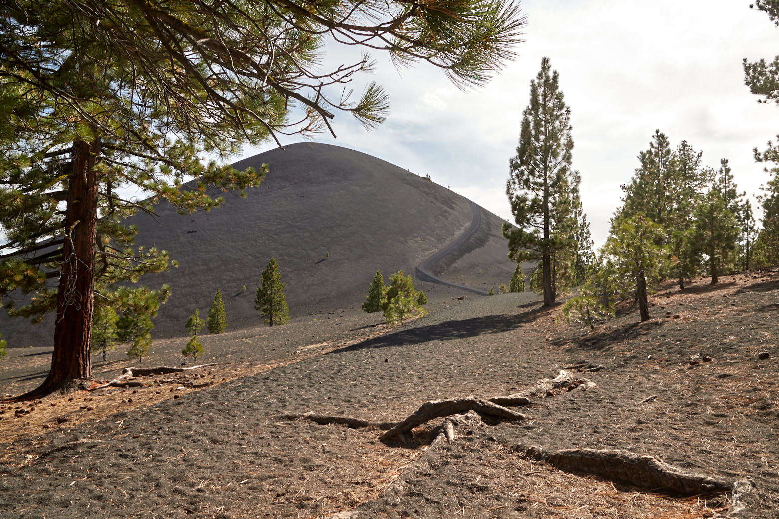
Cinder Cone
Cinder Cone Hike
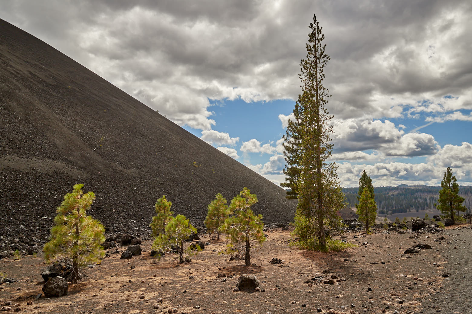
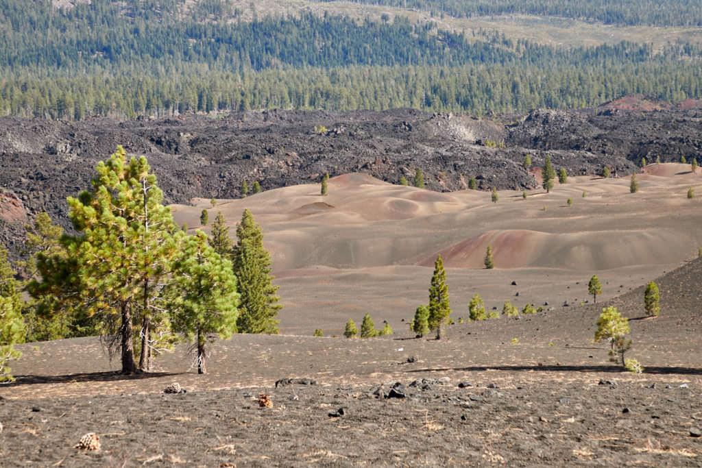
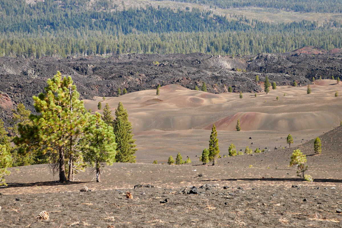
Description: Cinder Come is located in the Butte Lake area in the northeastern part of the national park. The trailhead is reached via Highway 89 and 44 and a 6mi unpaved back road. The trailhead is located at the far northwest end of the lake.
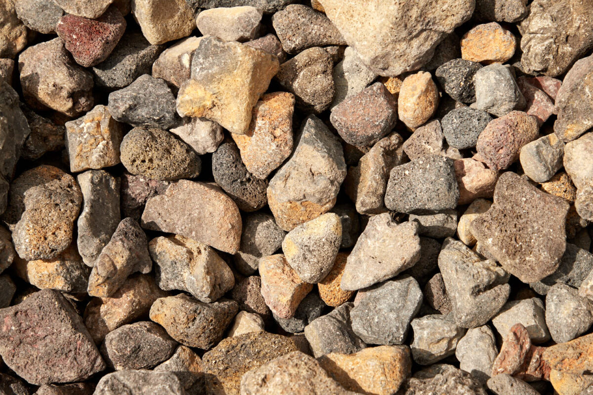
The hike starts moderately and proceeds through the forest. After a few hundred meters, a huge lava field rises next to the trail on the left. You continue to hike alongside it. The ground is slightly sandy and it constantly ascends. After a while it gets steeper and it becomes noticeably more sweaty, because the ground also becomes more and more sandy. After a little more than 1.24mi you reach the foot of the Cinder Cone.
Trail length: 5mi Altitude difference: 1214ft Time needed: 4-5 hours Difficulty level:strenuous - The trail is well developed and in general also good to walk on. However, since the ground is very sandy almost all the time, it is very strenuous, especially on the steep climb up Cinder Cone.
Our rating:In my imagination, the way to Cinder Cone was a more or less flat path through a coniferous forest. The reality was much more strenuous.
☆☆☆☆☆Rated 3 out of 5
Cinder Cone
Cinder Cone
Cinder Cone - The Direct Path
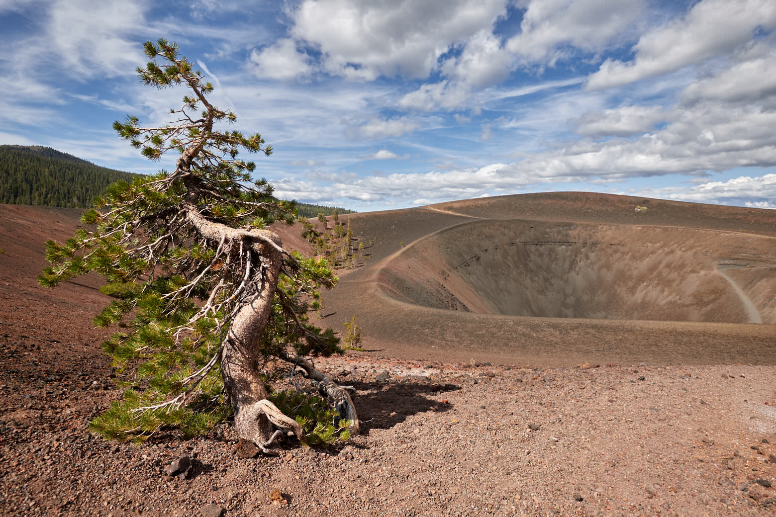
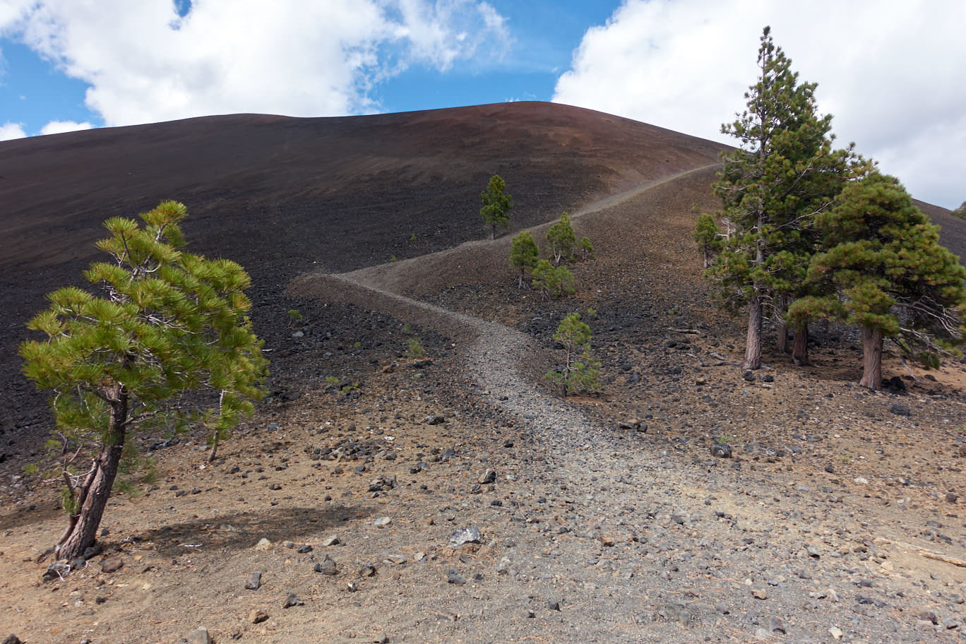
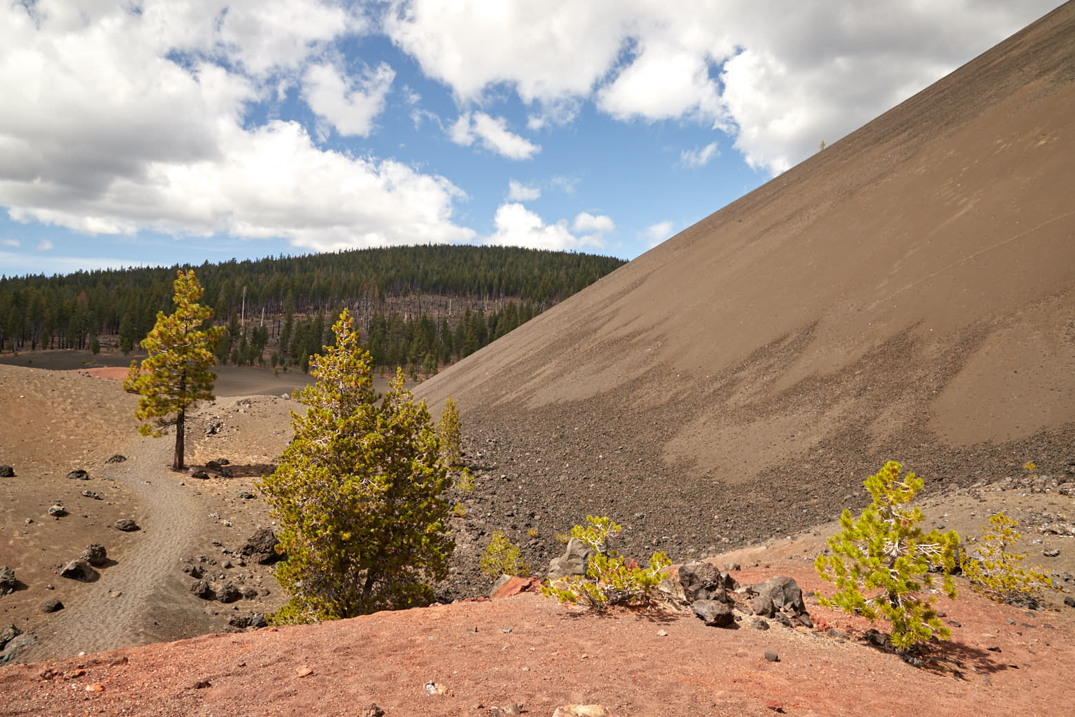
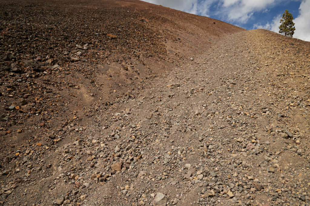
Description: Once you arrive at the base of Cinder Cone, there are two paths. One directly up and one to the right around the Cinder Cone. The way up is not far, you can basically see the end from below, but it is extremely steep and SANDY!!!!
Those who choose this path need fitness or a lot of time.
Our rating: Arrived at the foot of the cone, I first stood there with my mouth open. I was supposed to go up there? Impossible. Is that even possible without crawling on all fours? The pictures of the trail don't even give an idea of how high and steep the Cone is in reality... and not only that, the entire trail leads through sand and it's deep.
☆☆☆☆☆Rated 4 out of 5
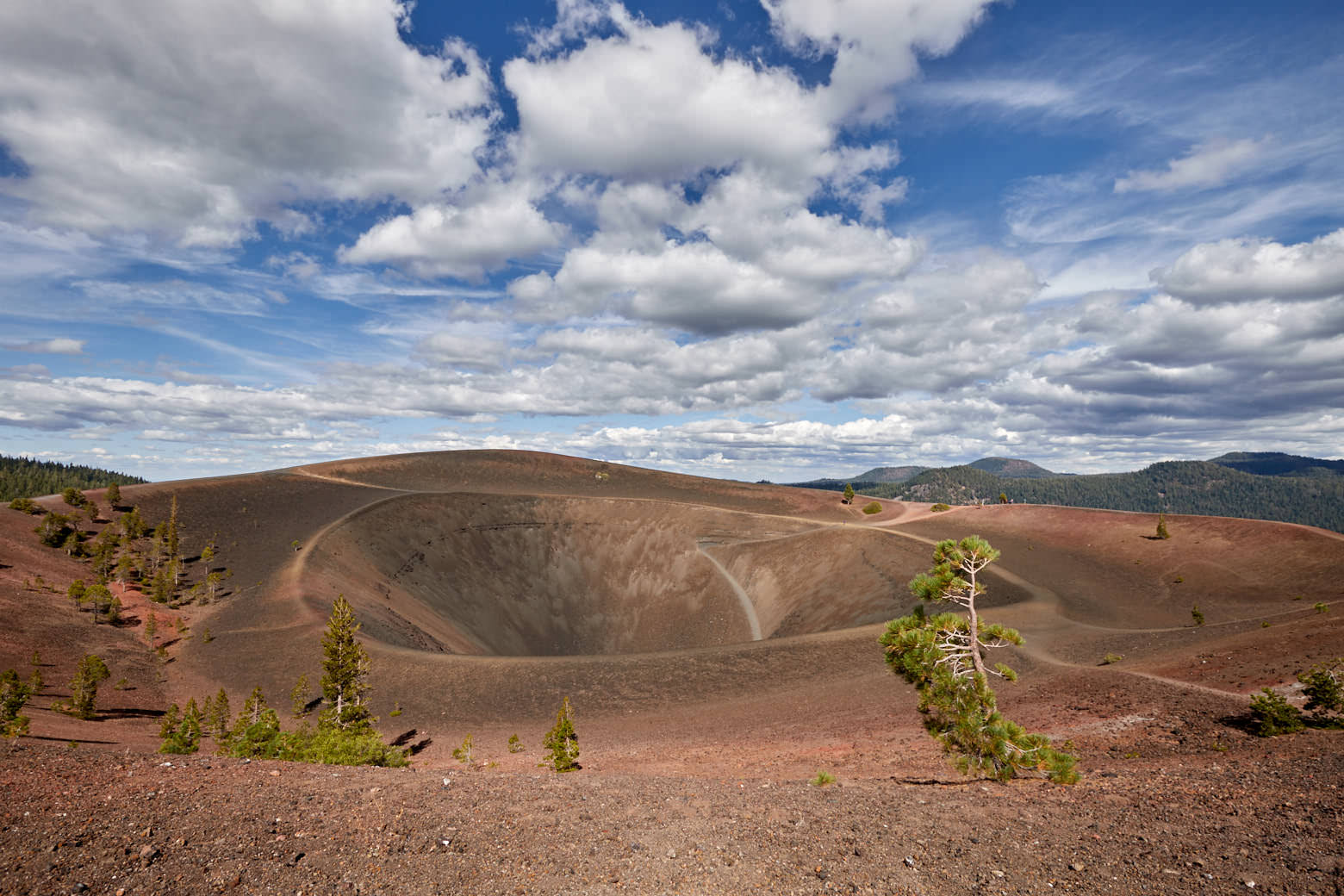
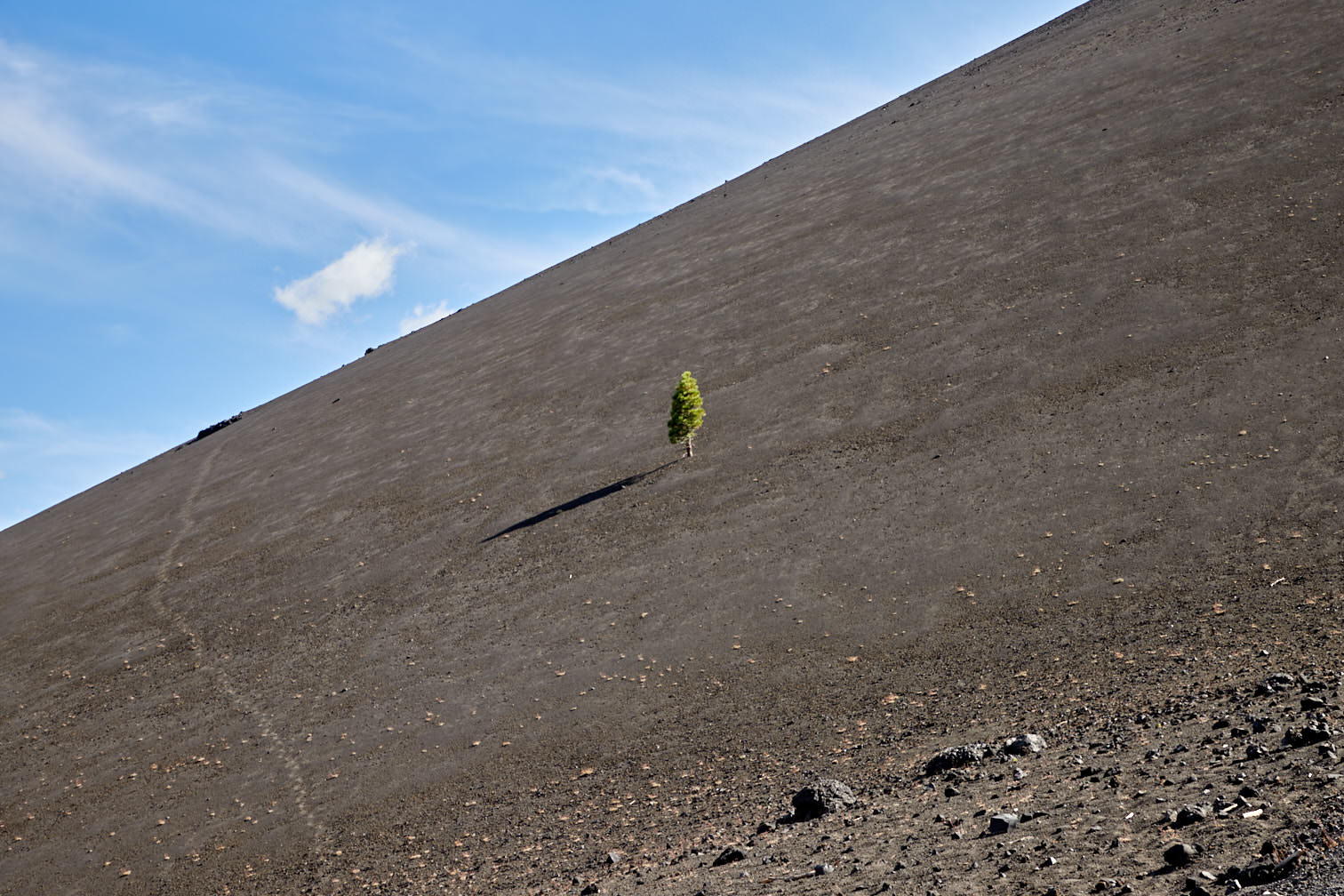
Cinder Cone Bypass
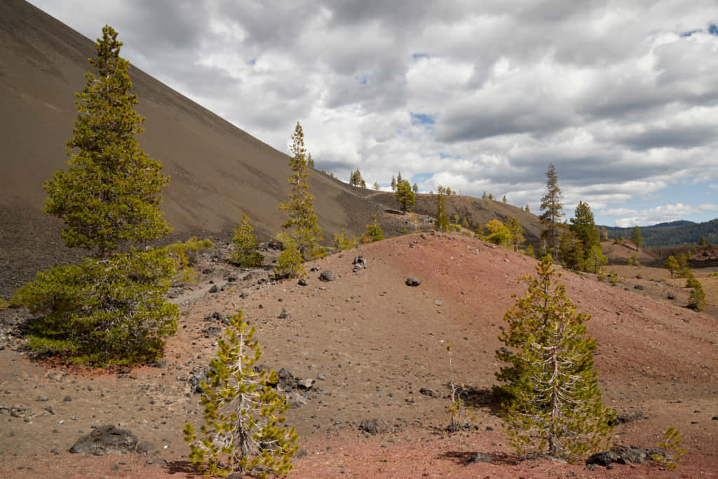
Description: You can also get to the top of Cinder Cone via the bypass. However, the path is longer, but not as steep.
First you hike in northwestern direction always past the foot of the Cinder Cone. The way first leads a little uphill and then down into a hollow. Actually you can't get lost, because you always walk along the foot of the cone. Also here the path is completely through sand. Even if the bypass is not as steep as the direct way, it is as well exhausting. Since you want to go up the Cone, this way also leads uphill at some point.
Our rating:The way around the Cone is certainly a lot more interesting because you see much more of the landscape around it. We were glad that we chose this path and can recommend it to everyone.
☆☆☆☆☆Rated 4 out of 5
Cinder Cone Bypass
Cinder Cone Bypass
Cinder Cone Bypass
Cinder Cone Bypass
Cinder Cone Bypass
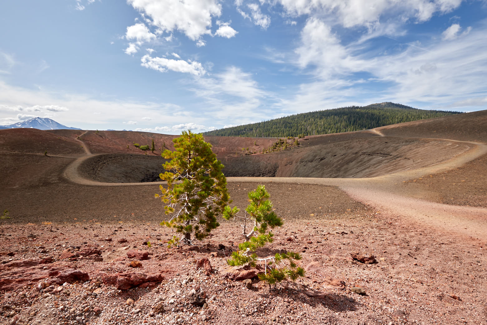
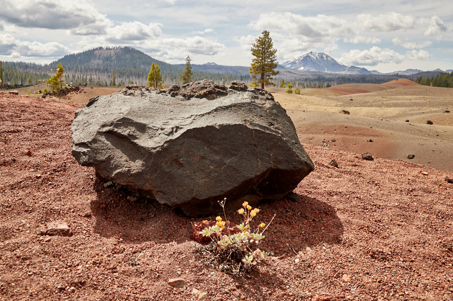
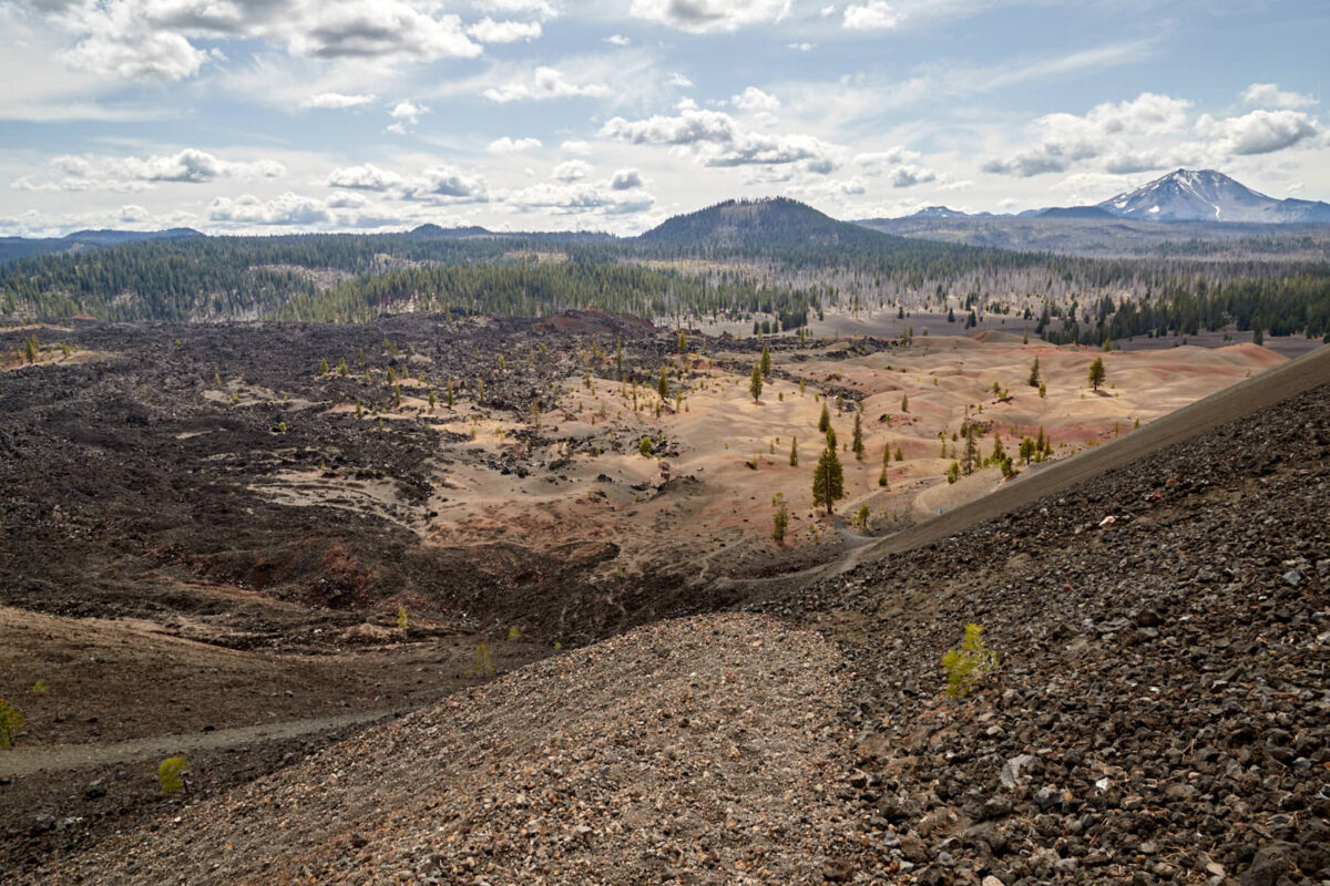
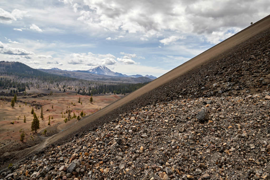
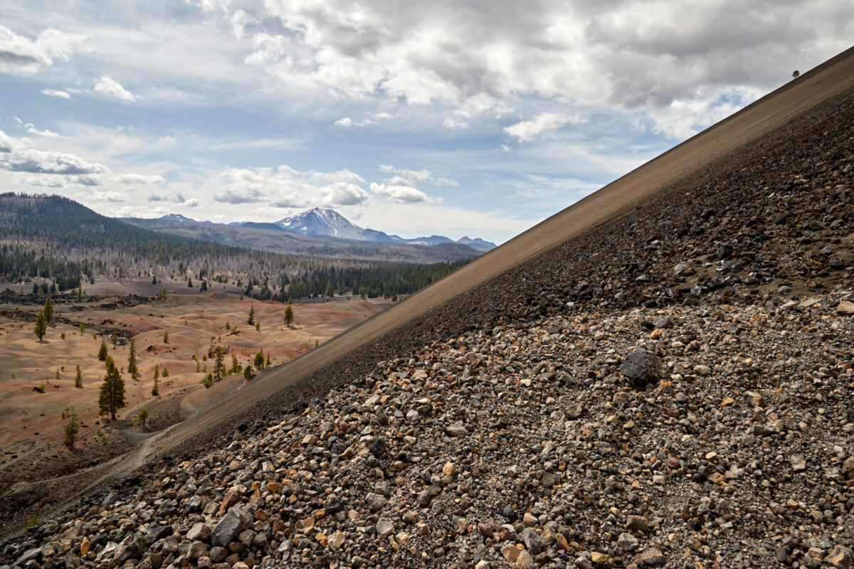
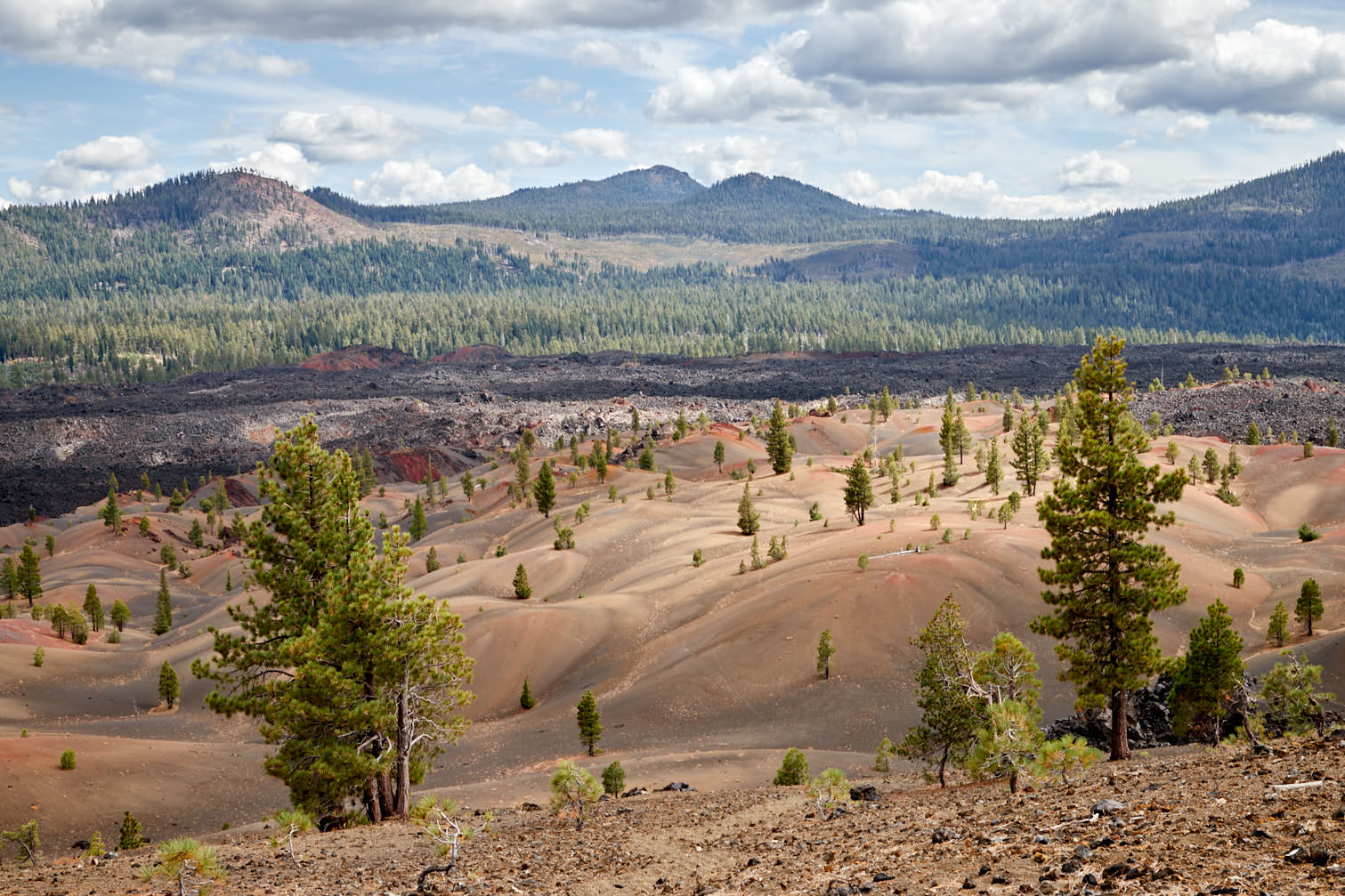
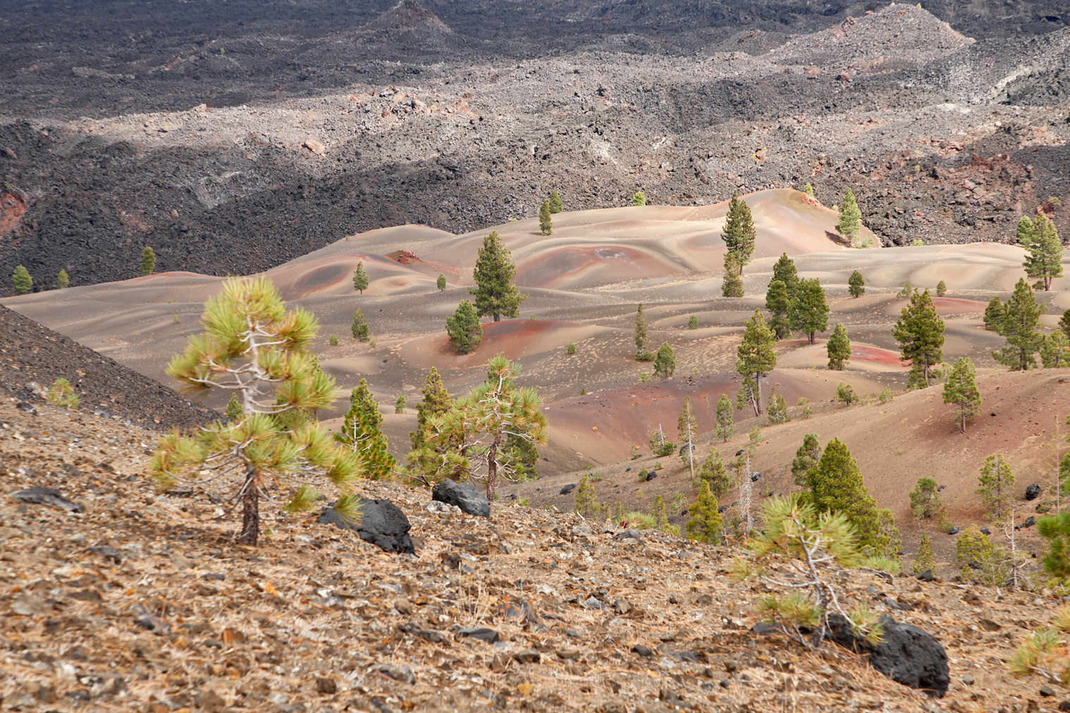
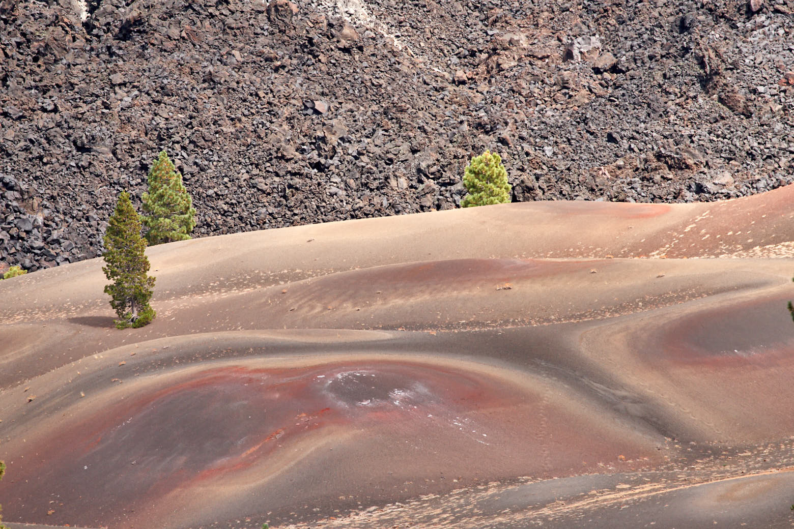
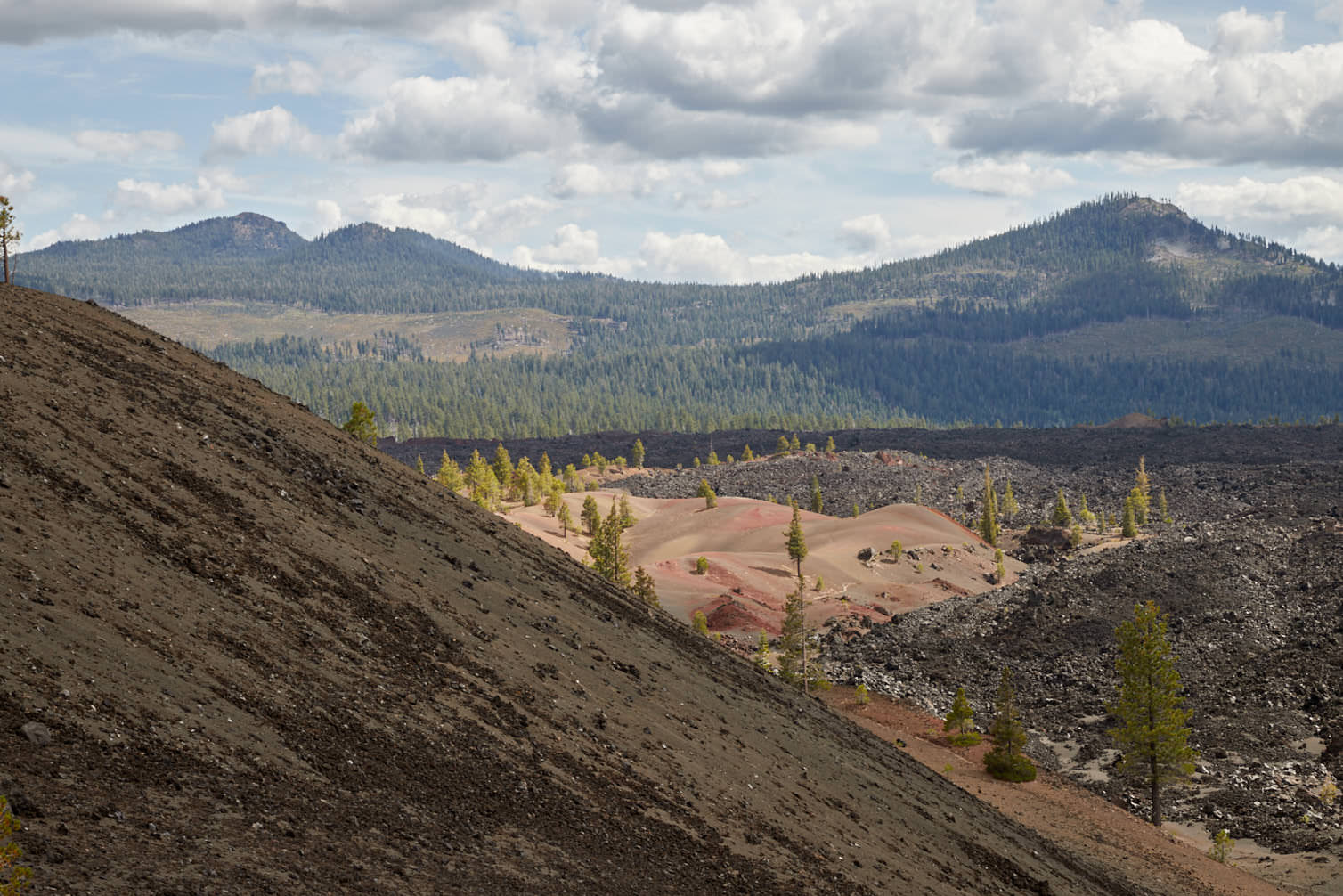
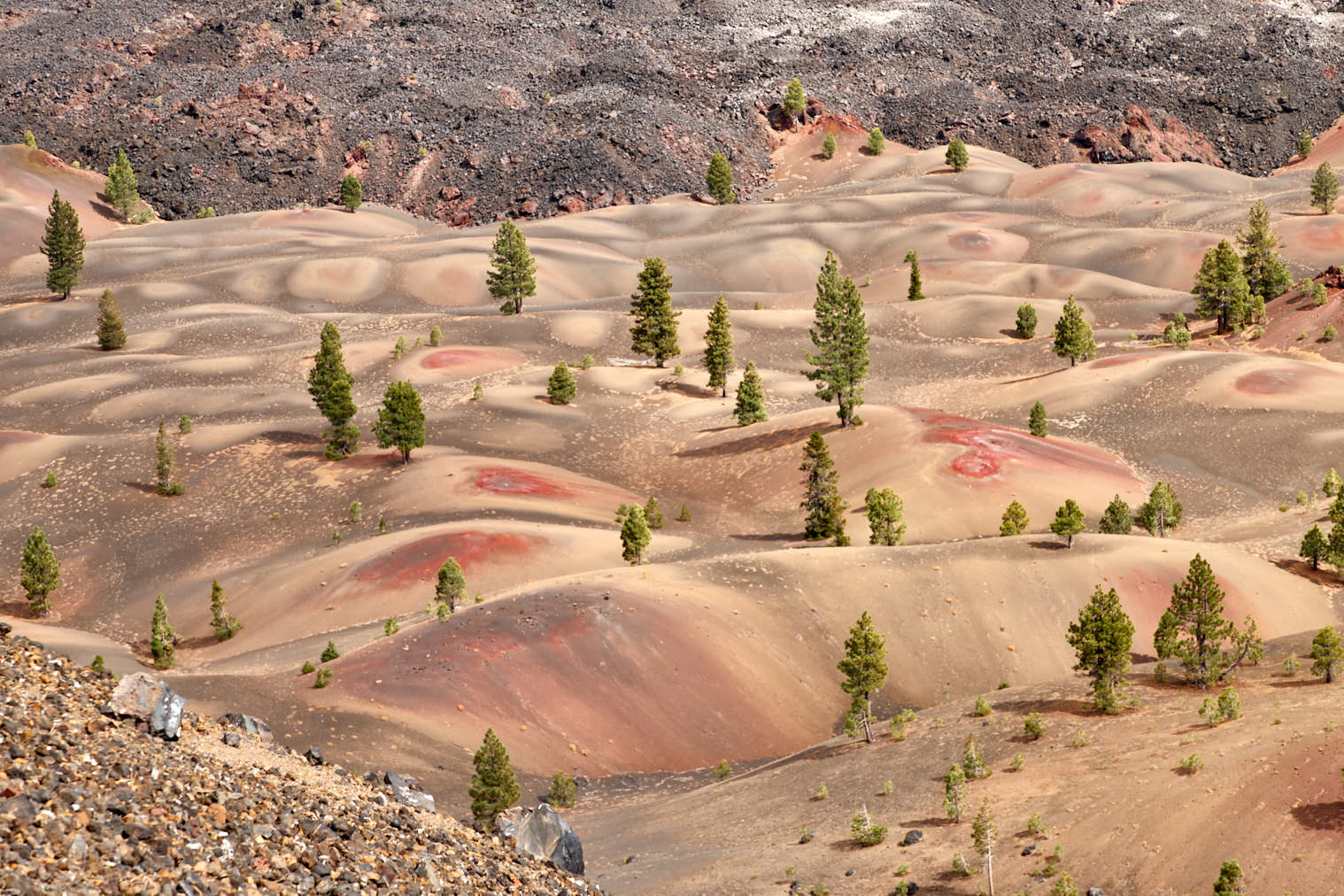
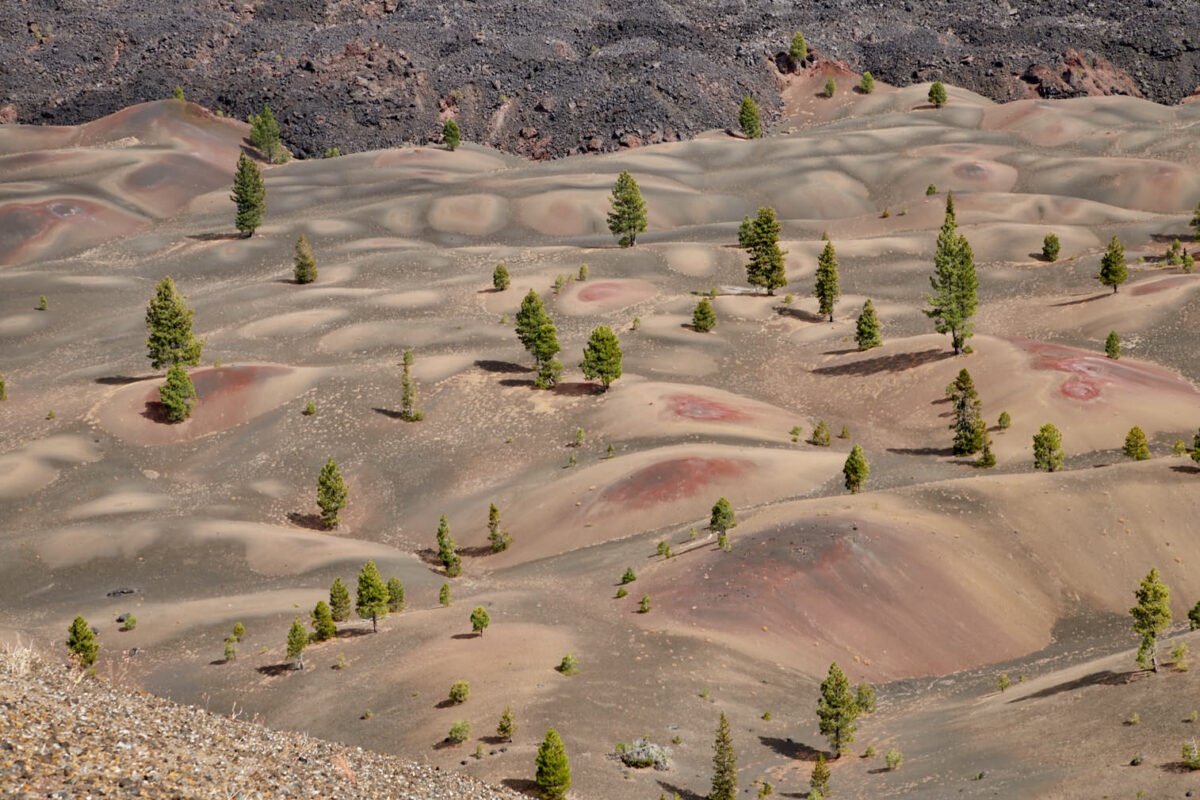
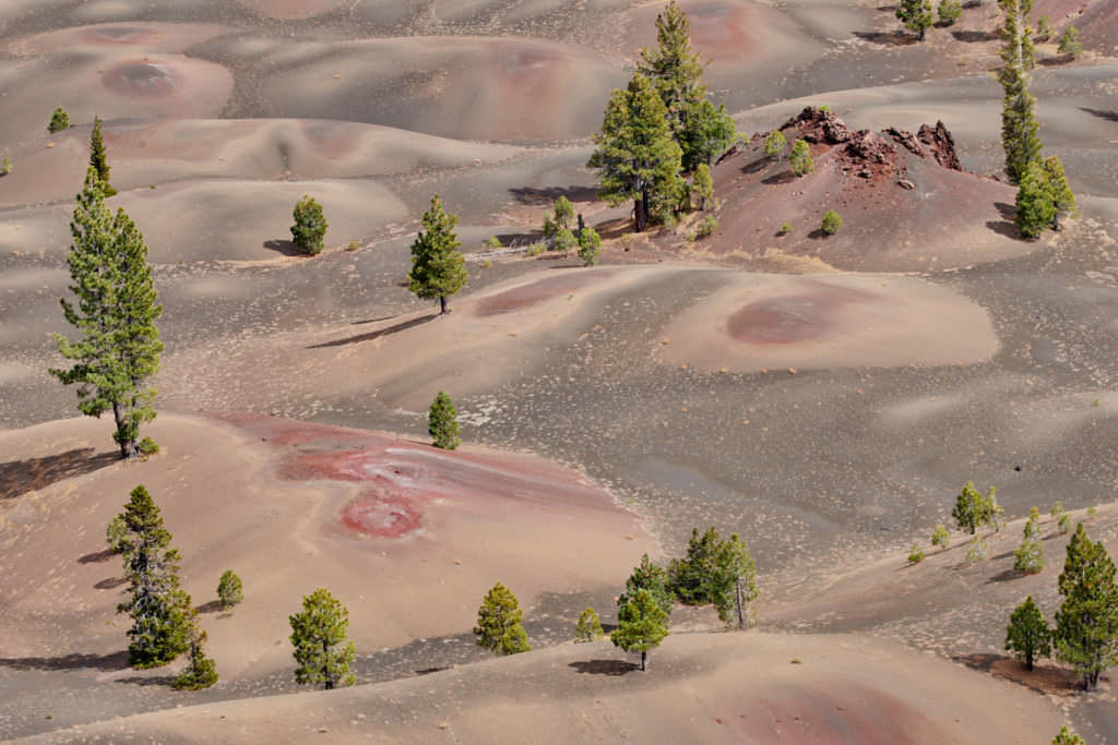
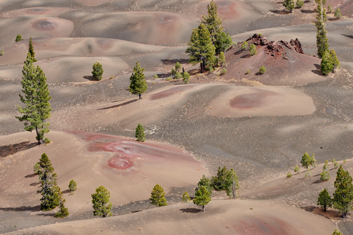
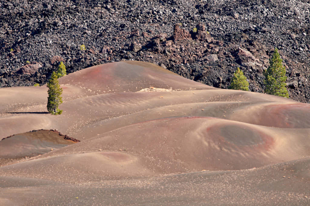
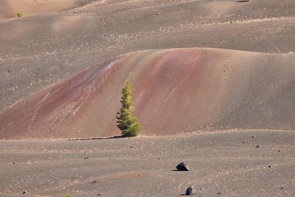
Painted Dunes
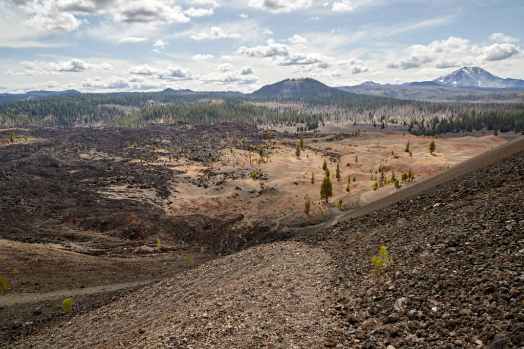
Description: After about 0.6mi on the bypass you reach a small plateau. Here you are about halfway up the cone. From here you have a great view of the wonderful Paninted Dunes. Another advantage of the bypass, because here you get much closer to the colorful dunes.
Our rating:The dunes were the real reason why we wanted to visit the Cinder Cone. Even if the pictures that we had seen ultimately do not have much to do with reality, the dunes are really great. We stood here for a long time, marveled and took pictures. A great place that we also did not have to share with crowds.
☆☆☆☆☆Rated 5 out of 5
Painted Dunes
Painted Dunes
Painted Dunes
Painted Dunes
Painted Dunes
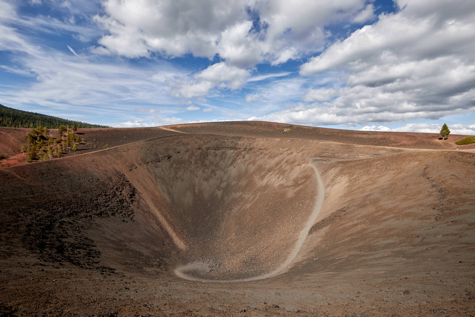
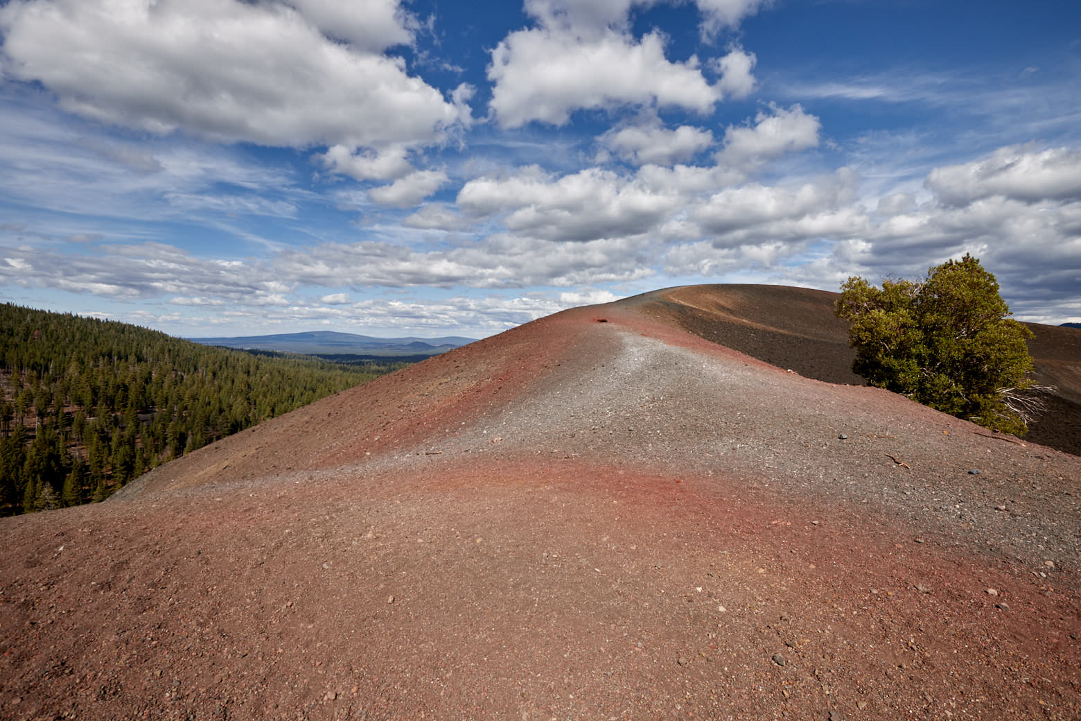
On the Cinder Cone
Description: From the overlook of the dunes, this alternative path also climbs steeply. The ground is stony, but no less difficult to hike, simply because it is very steep. Here, too, it is very strenuous, but the path is not very long and so this also passes at some point and finally you are standing on top of the Cinder Cone.
Up here there are several paths around the cone and one into the crater. So you can also take the steep way back down and thus you have completed a round trip around and up to the Cinder Cone.
Our rating: Up here it is also awesome, first the glimpse into the crater and then the great views all around. A very strenuous but very rewarding hike.
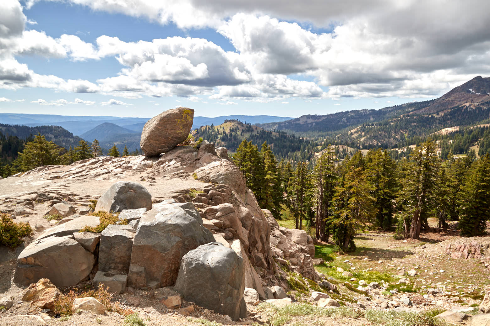
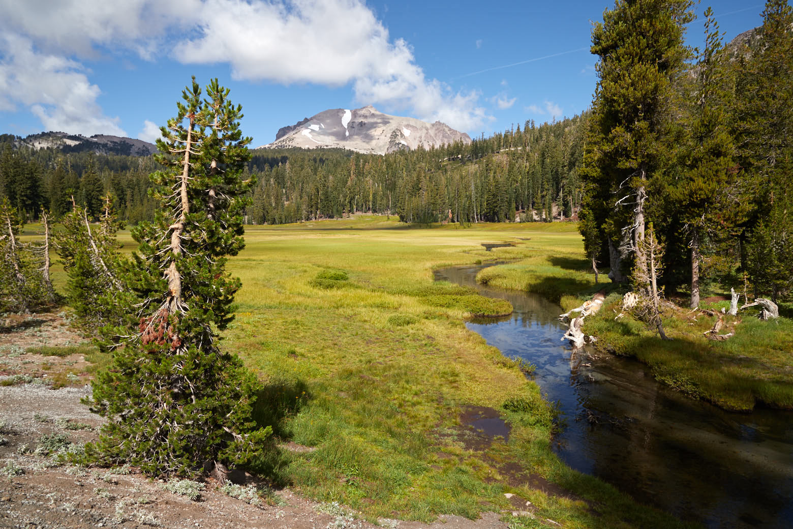
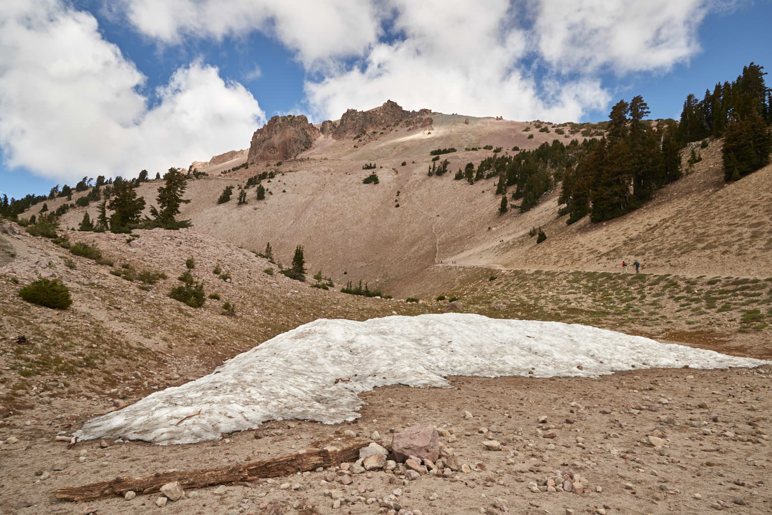
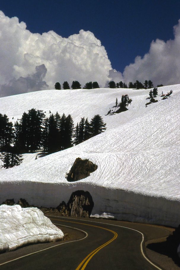
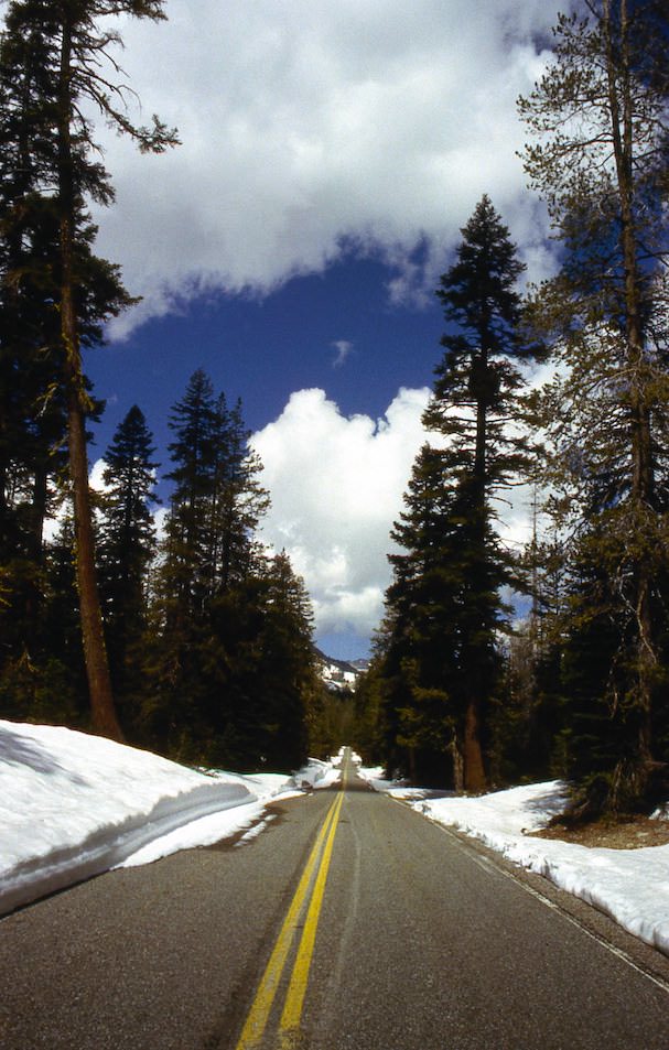
Description: The Scenic Drive leads in north-south direction through the park. In winter the road is closed and winter starts early and ends late here, as we experienced in 1998. When the road is open it offers great views especially at Mt. Lassen. The park road also provides access to many hikes and highlights of the park such as the volcanically active areas.
Our rating: Driving along the park road is definitely part of a national park visit to us. Here, too, you get an impression of what awaits you in the park. In our opinion a must see.
☆☆☆☆☆Rated 3.5 out of 5
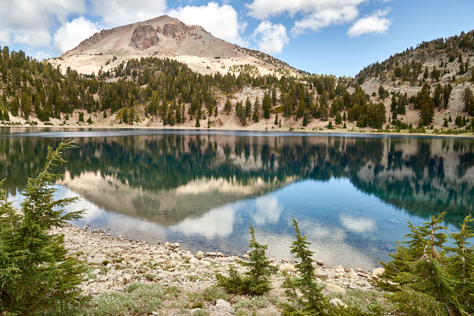
Lassen Peak and Lake Helen
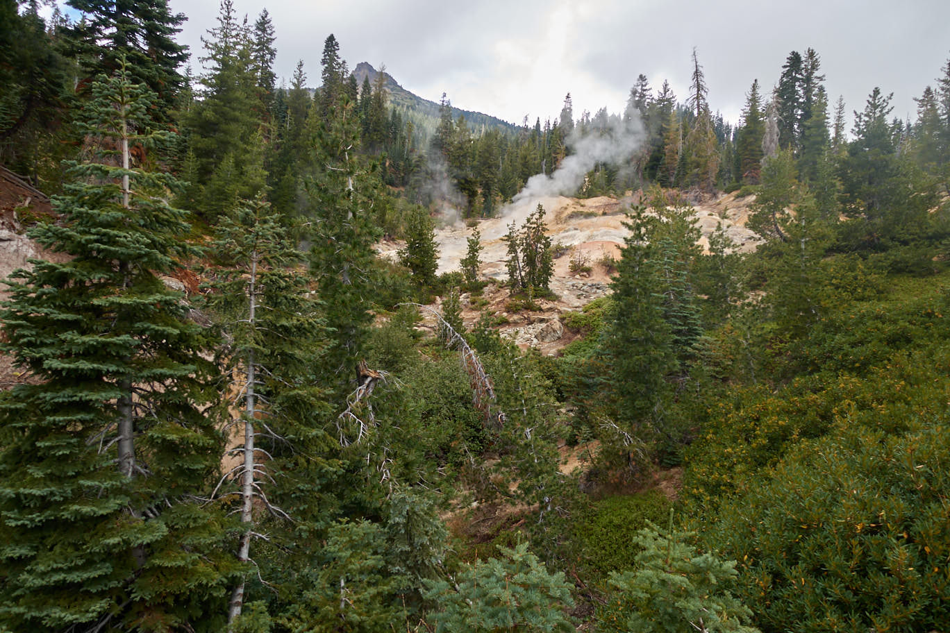
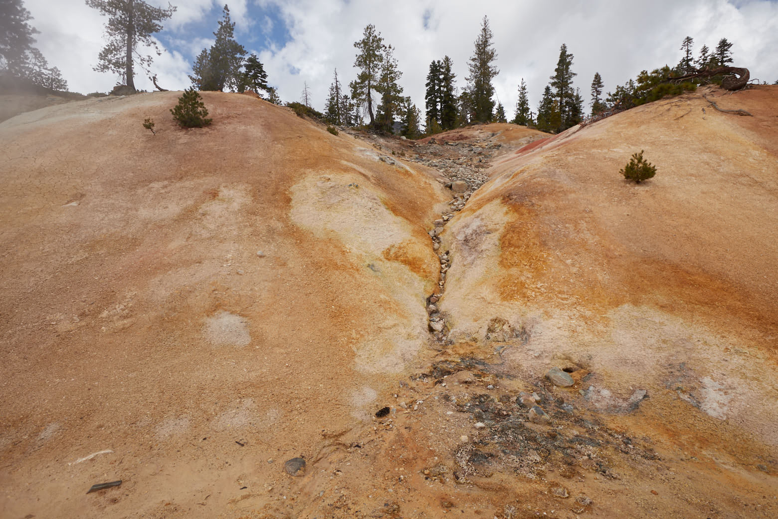
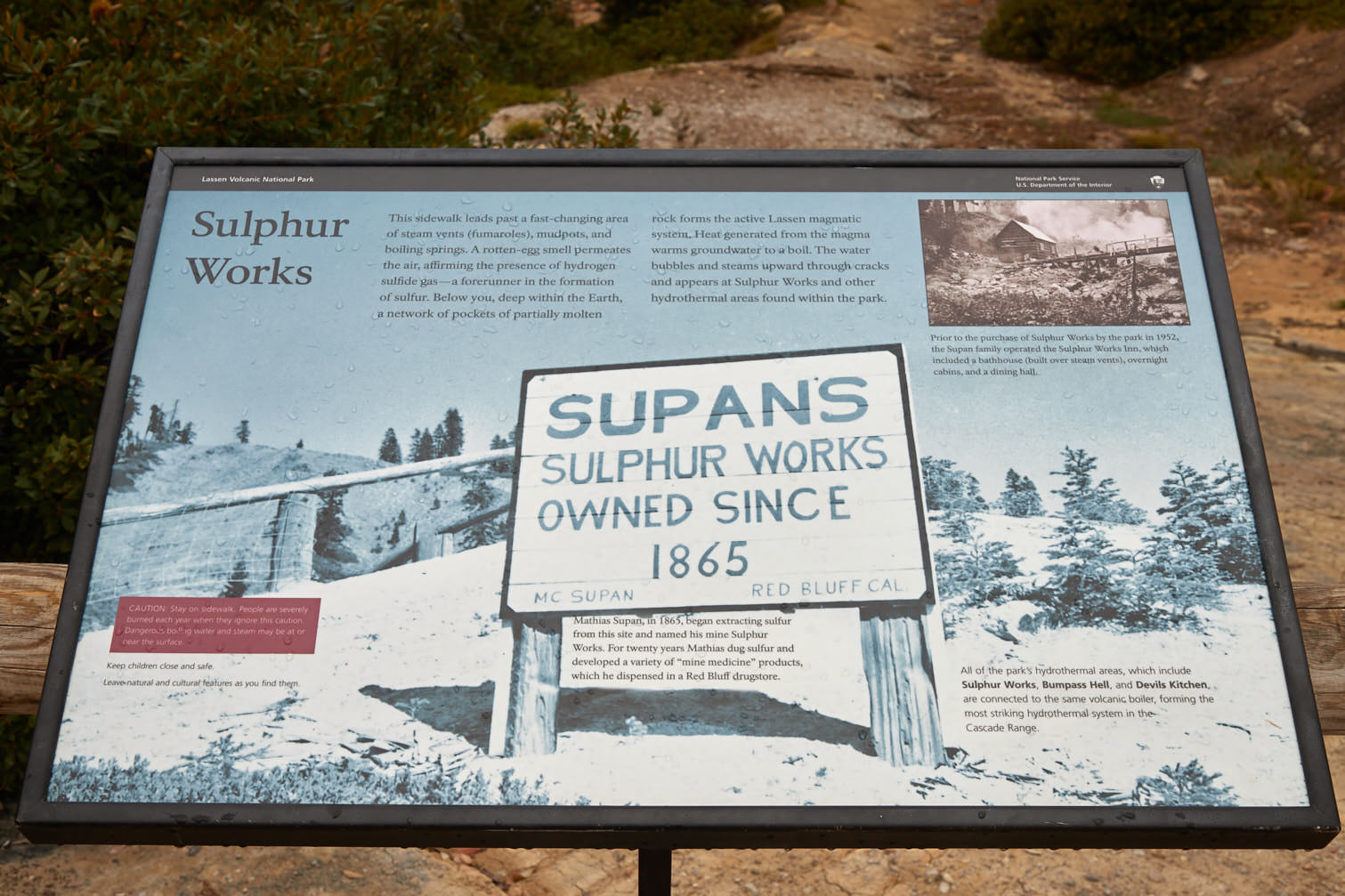
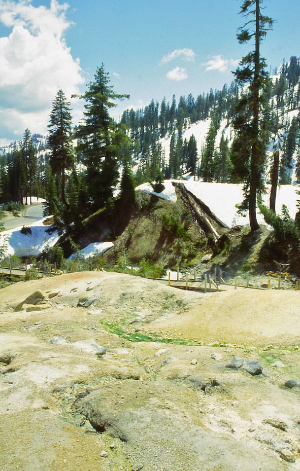
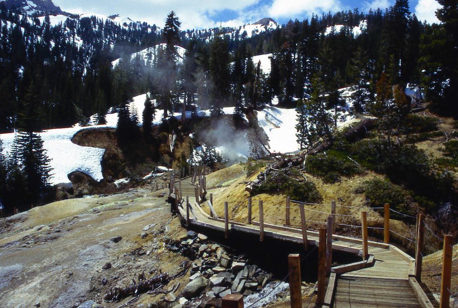
Sulfur Works
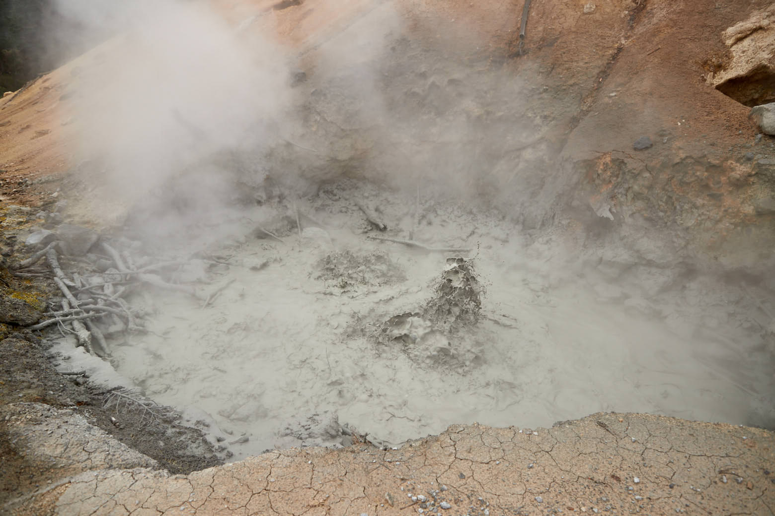
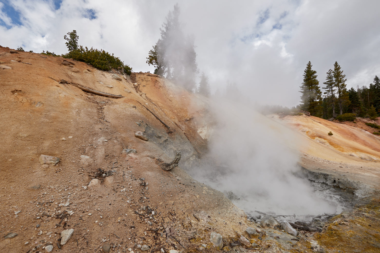
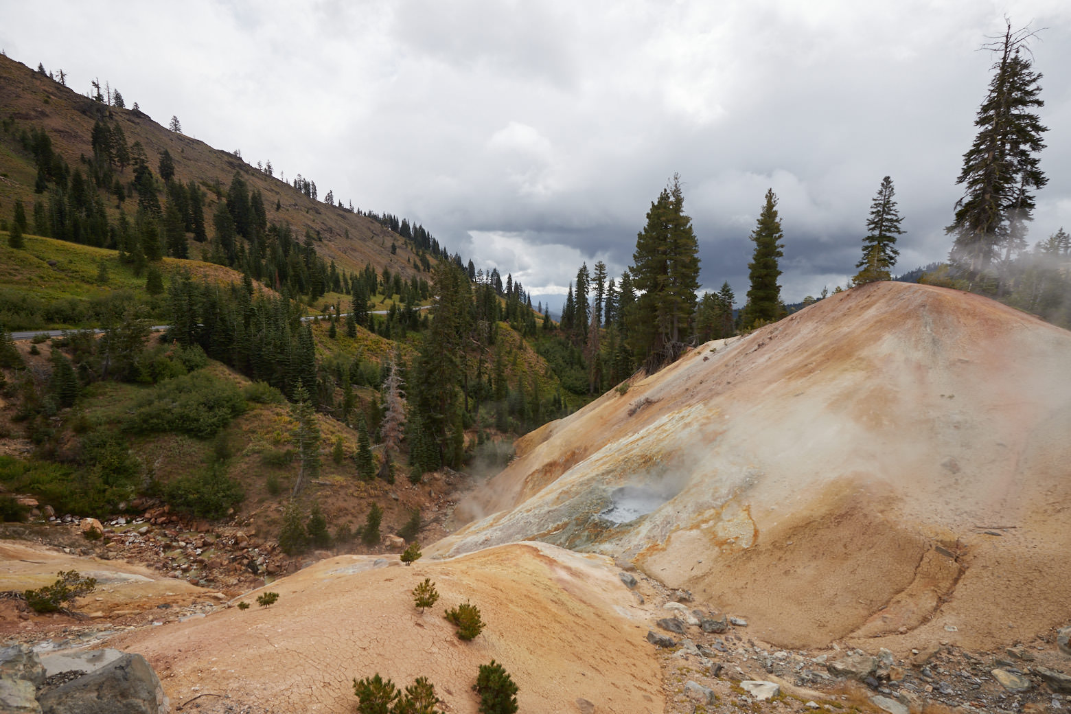
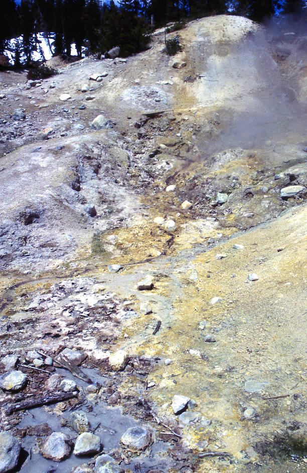
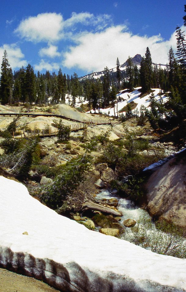
Description: Located just off the Scenic Drive, Sulfur Works is the most easily accessible hydrothermal area in the park. This makes it very easy for anyone to have a glimpse of the volcanic activity in the park.
Our rating: It smells like sulfur and bubbles out of the earth. Even though there are by far more interesting volcanically active areas in the USA, we always enjoy these places. You should definitely make a small stop here.
☆☆☆☆☆Rated 2.5 out of 5
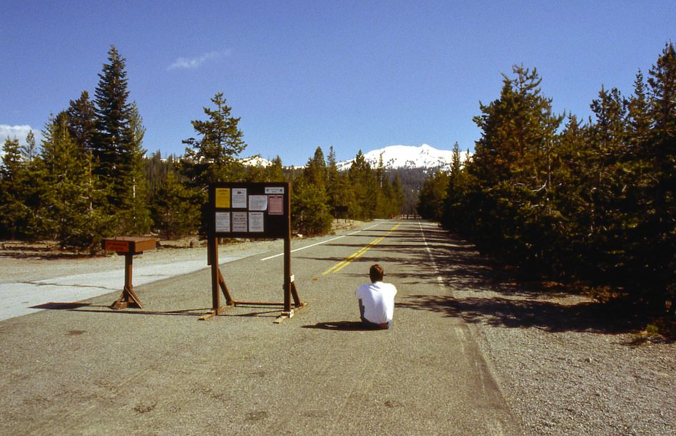
Lassen Volcanic NP South - 1998
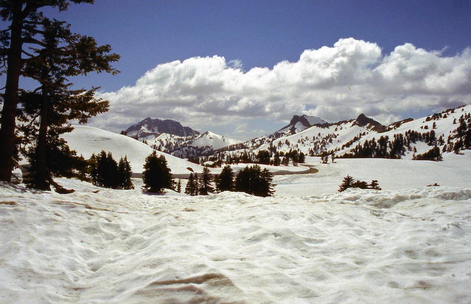
Description: In 1998, during our first visit, on July 4th, the park road was not yet passable throughout. To visit the southern part of the park, we had to drive all the way around. On Highway 17 that's about 62mi. In the southern part of the park were even more snow and also here the road was cleared only a few kilometers. So we had no choice, we had to explore the park road again on foot.
Our rating: As far as we could tell, we also liked the southern part very much. Especially the huge snow towers impressed us very much.
☆☆☆☆☆Rated 4 out of 5
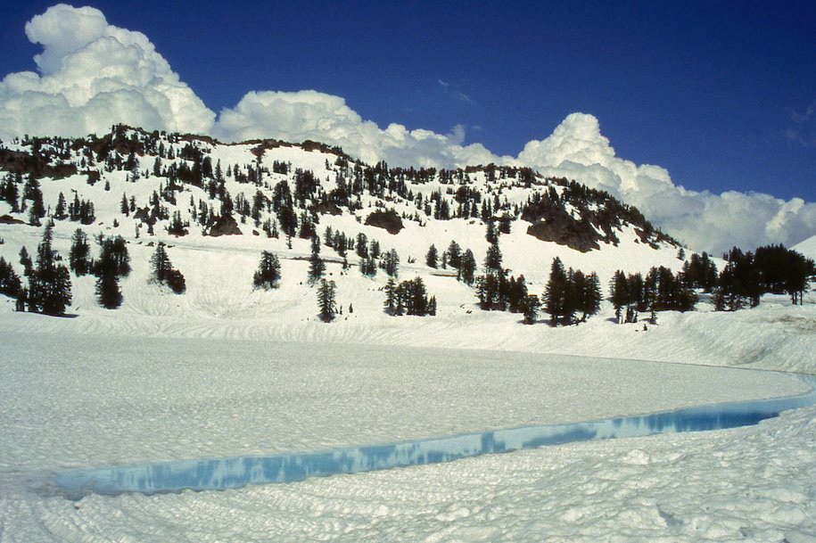
Altitude above sea level Lake Helen - Lassen Volcanic NP
8186ft
Lake Helen, shortly ahead the road was closed for vehicles


