General information about Sleeping Giant Provincial Park
Sleeping Giant Provincial Park was established in 1944 and is located on the Sibley Peninsula in northwestern Ontario, east of Thunder Bay. The park is recognizable from afar due to the distinctive shape of its highest elevation, Sleeping Giant. The best view of Sleeping Giant is from Thunder Bay. The eastern part of the park consists of lowlands, while the western half is characterized by cliffs and valleys.
Visitor number 2020
0
Number of visitors
Best time to visit:From spring to fall Our visits: So far 1 visit: October 2025
Covered by the Provincial Park Day-Use Vehicle Pass*
Open year-round, many of the facilities are open from mid-May to the end of October.
*The Day-Use Vehicle Pass is a “flat-rate” pass for all provincial parks in Ontario. You can choose from an Annual Pass (full calendar year – CAD 99), a Summer Pass (April 1 to November 30 – CAD 75), and a Winter Pass (December 1 to March 31 – CAD 60).
Our visits: So far 1 visit in October 2025
Activities and hikes in Sleeping Giant Provincial Park
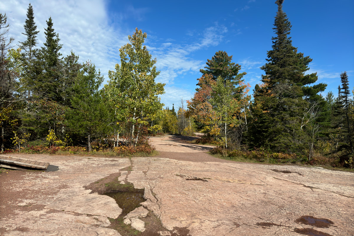
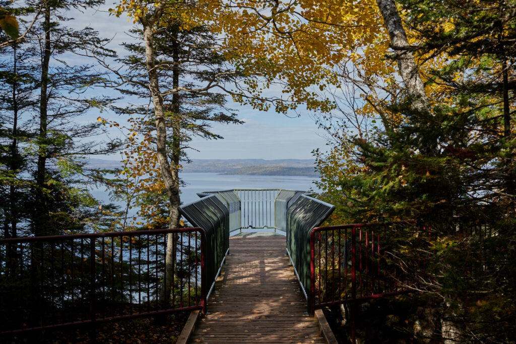
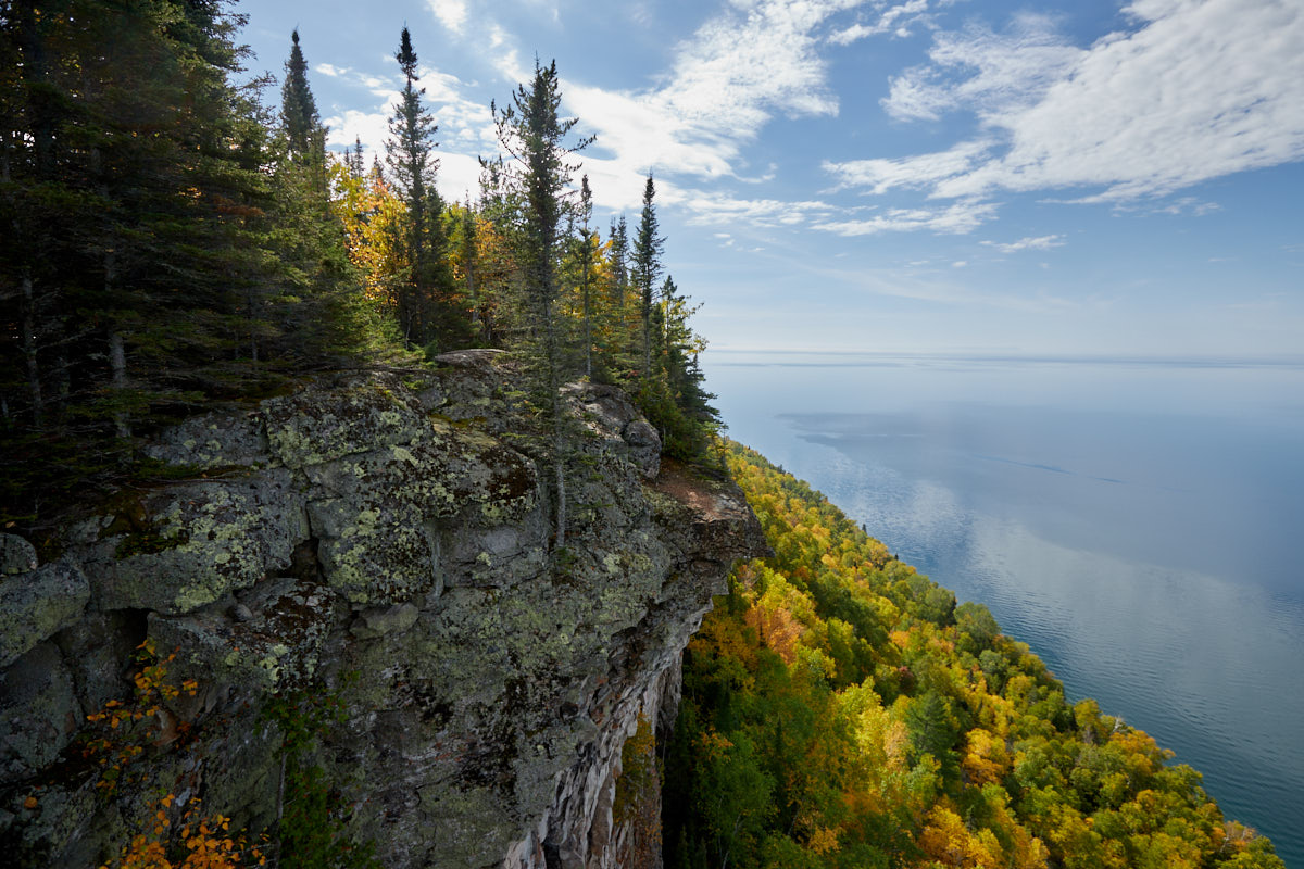
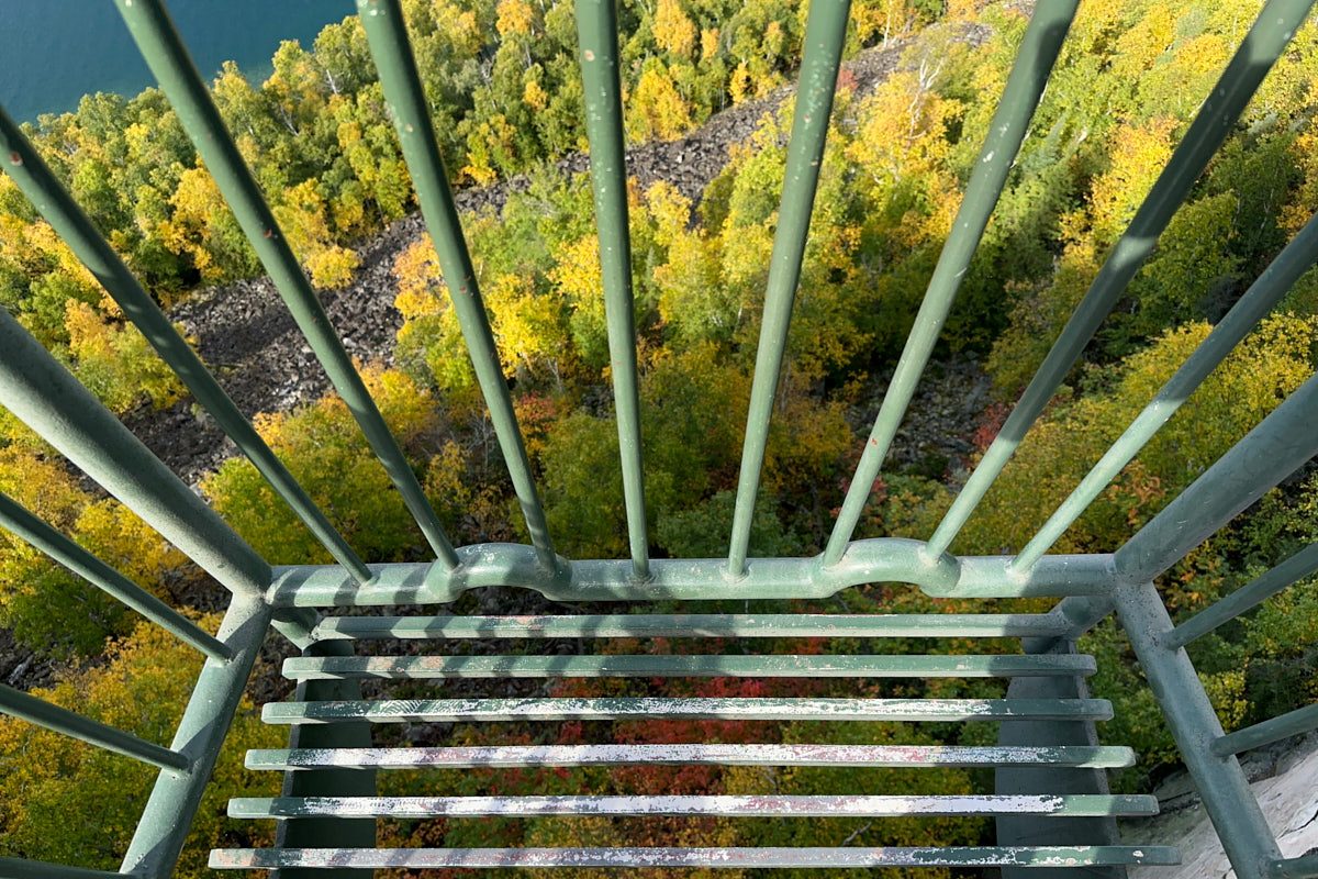
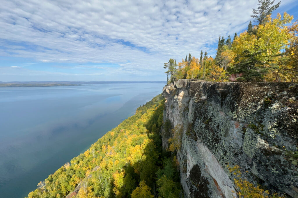
Description: The Thunder Bay Lookout is located near Pass Lake. It can be reached via a 9.2 km dirt road. There is a wooden platform that extends out over the side of the 100 m high cliff. From here, you have a great view of Thunder Bay and Lake Superior. On clear days, you can even see as far as Isle Royale National Park in Michigan.
Our rating: The lookout is impressive. When you walk onto the platform, you don't know what to expect at first. Only when you reach the edge of the cliffs and continue walking do you see how deep it is down here and that the platform is suspended in the air. The view is spectacular, but not for people who are afraid of heights.
☆☆☆☆☆Rated 4 out of 5
Sleeping Giant PP
Sleeping Giant PP
Sleeping Giant PP
Sleeping Giant PP
Sleeping Giant PP
Sleeping Giant PP
Sleeping Giant PP
Sleeping Giant PP
´
Sleeping Giant PP
Sleeping Giant PP
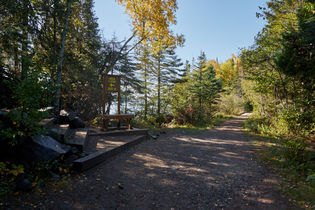
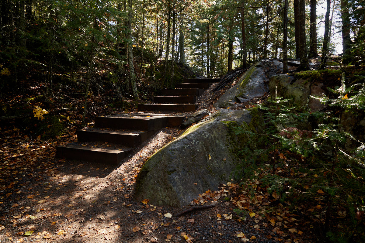
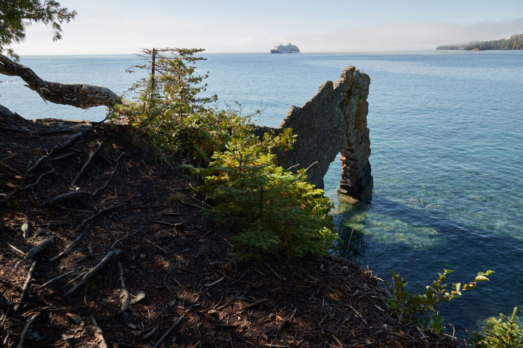
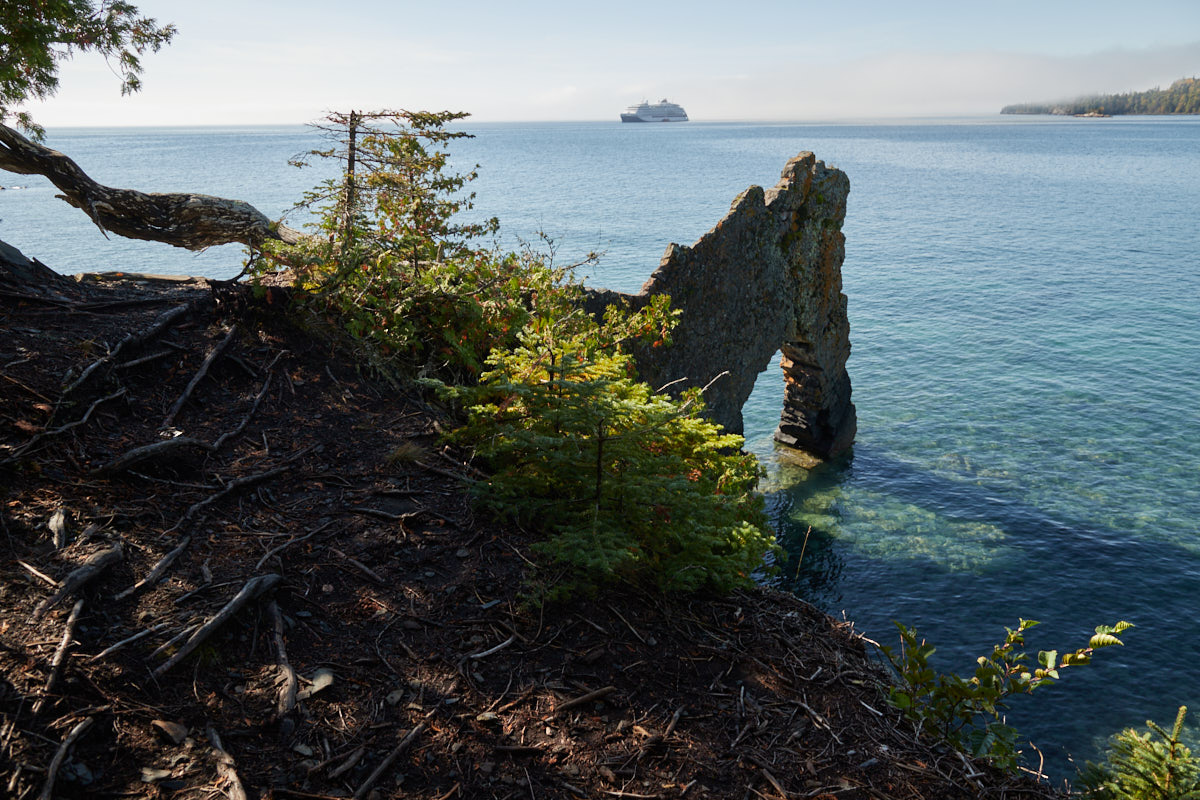
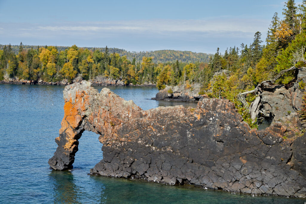
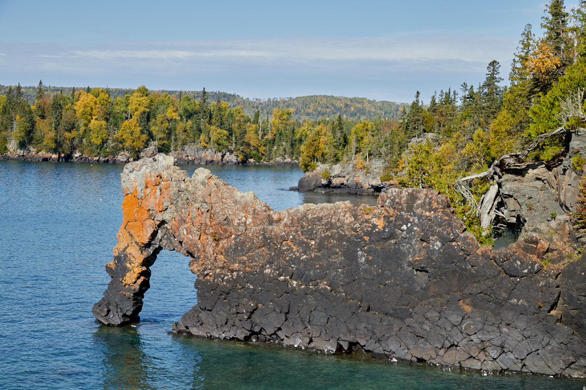
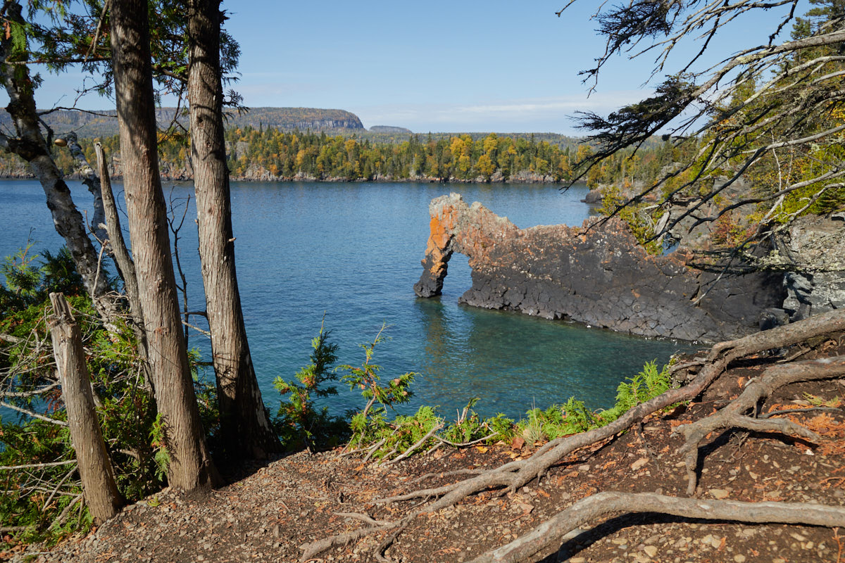
Sea Lion Trail
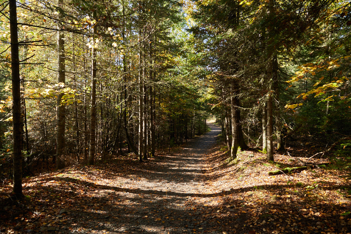
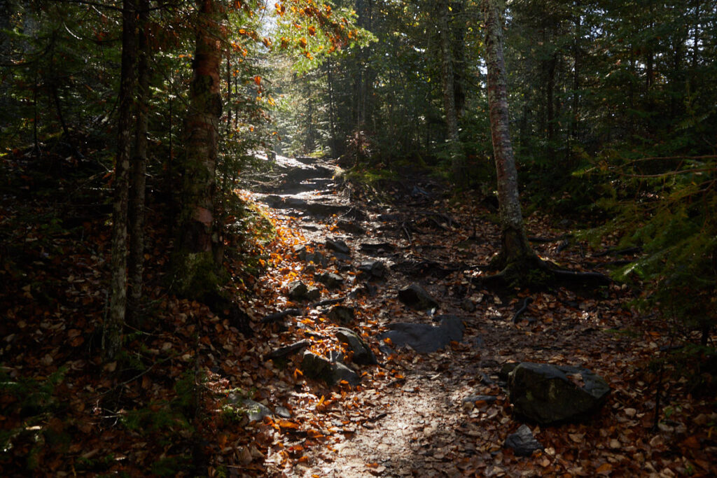
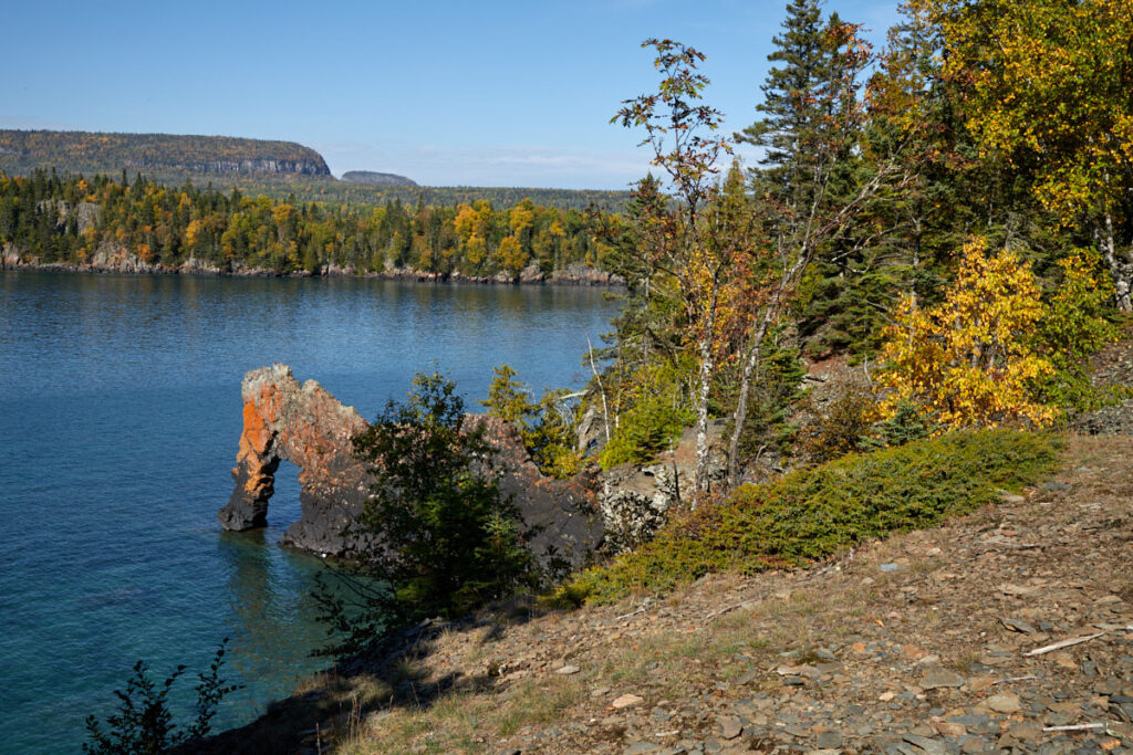
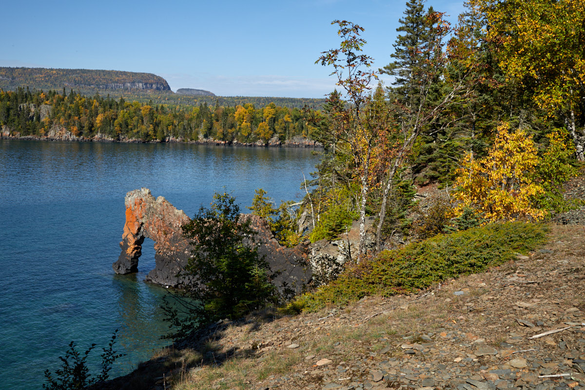
Description: The Sea Lion itself is a wall that remained after the sedimentary rocks in which it was crystallized eroded. It sticks out 15 meters into Lake Superior at Perry Bay, northwest of Silver Islet. The waves of the lake have carved a small tunnel into the formation. Before the 1900s, when the Sea Lion got its name, it resembled a seated sea lion. The lion's head has long since eroded, but the name has remained. The trail starts at the South Kabeyun Trailhead. Follow this trail for about 0.8 km until you reach the turnoff towards Sea Lion. From here, it is about 500 m to your destination. The trail is not technically difficult. However, it does go up and down on uneven ground from time to time.
Trail length: 2.4 km round trip Altitude difference: 50m Time needed: 1 – 2h Difficulty level:moderate
Our rating: The trail itself is not particularly spectacular in the usual sense. You basically walk through the forest. For someone like me, who loves walking through forests, there is definitely a lot to enjoy here. Objectively speaking, the destination is probably the highlight for most people. Before my vacation, I was most looking forward to this hike and seeing the sea lion, among other things. I was not disappointed. The short hike and the sea lion are definitely worth the trip.
☆☆☆☆☆Rated 4 out of 5
Sleeping Giant PP
Sleeping Giant PP
Sleeping Giant PP
Sleeping Giant PP
Sleeping Giant PP
Sleeping Giant PP
Sea Lion
Sleeping Giant PP
Sea Lion
Sleeping Giant PP
Sea Lion
Sleeping Giant PP
Sea Lion
Sleeping Giant PP
Sea Lion
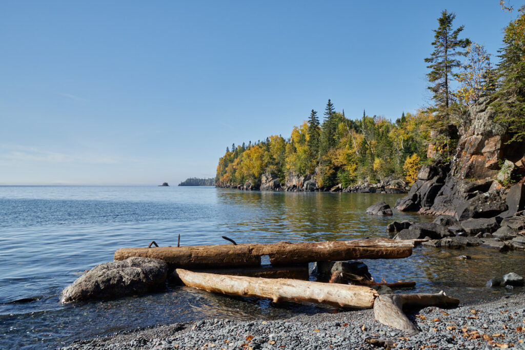
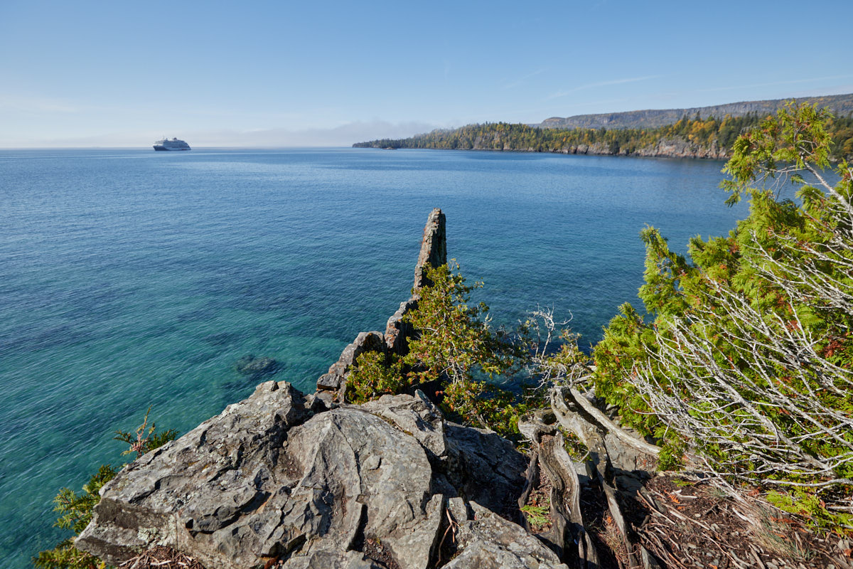
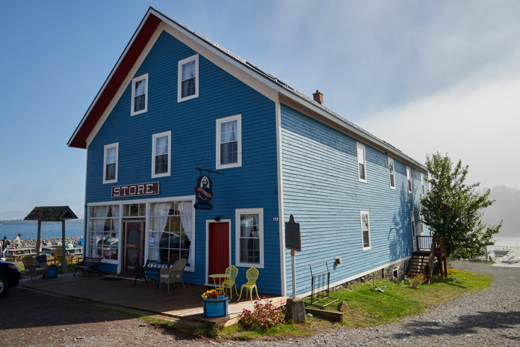
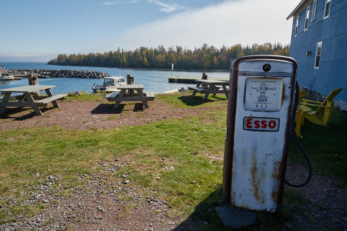
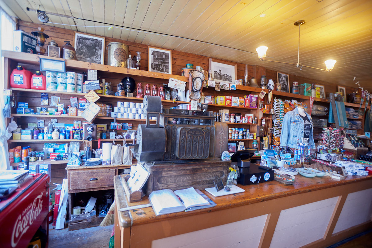
Silver Islet
Description: Silver Islet is a community at the tip of the Sibley Peninsula, right next to Sleeping Giant Provincial Park. The place got its name in 1868 when the Montreal Mining Company discovered a vein of almost pure silver on the small island. Once all the silver had been mined, the workers left and the mine was closed. Most of the former miners' houses are now vacation homes. The general store has been restored and is now a tourist attraction. In addition to lots of knick-knacks, you can enjoy a coffee here with a great view of Lake Superior.
Our rating: The small town is picturesquely nestled in a small bay. When we were there to take a look at the historic general store, the place was bustling with activity. We could hardly believe our eyes, but a cruise ship was anchored off the coast, disgorging its passengers. Of course, this put an end to the idyllic atmosphere of the small town, but you could still see the appeal of settling here.
☆☆☆☆☆Rated 4 out of 5
Silver Islet
General Store
Silver Islet
General Store
Silver Islet
General Store
Silver Islet
General Store
Silver Islet
General Store
Silver Islet
Silver Islet
Silver Islet
Silver Islet
Silver Islet
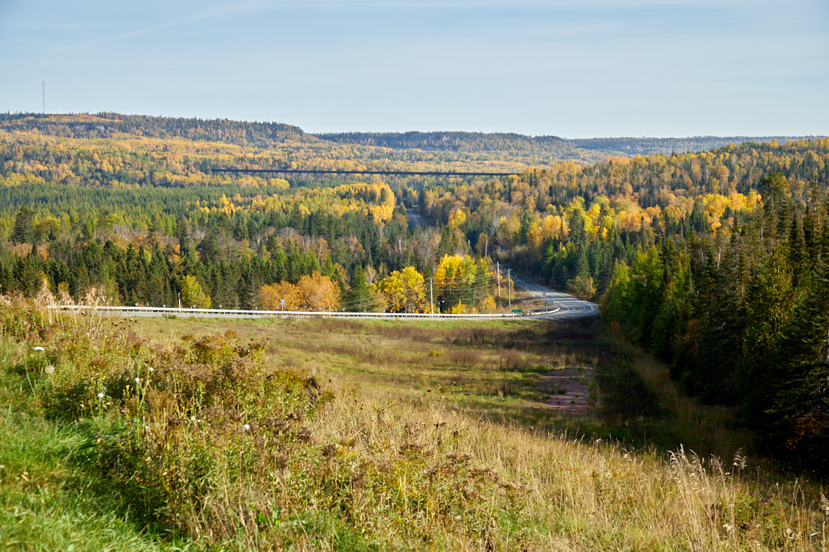
Blende River Viaduct
Description: You can see the huge viaduct immediately after turning off the Trans-Canada Highway towards Sleeping Giant Provincial Park. It was built in 1912 by the Canadian Northern Railway and completed in just eight months. It was located at mile 173.1 of what later became the Canadian National Railway. With a length of 668 m and a height of 40 m, it is the largest railway viaduct in central Canada. The last regular train ran there in May 2005.
Our rating: For us, the viaduct was a quick photo stop on the way to Sleeping Giant PP. Surrounded by a sea of yellow leaves, it was a pretty sight. With a little effort, you can probably climb onto the viaduct to take a closer look. However, we were content with the view from below.


