Lake Superior Provincial Park is one of the largest provincial parks in Ontario, covering an area of approximately 1550 km² along the northeastern shore of Lake Superior. The landscape is extremely rugged. A vast wilderness on the edge of wooded hills, crystal-clear lakes, rushing streams, and a rocky coastline. The Trans-Canada Highway crosses the park for 83 km, providing access to hiking trails, canoe routes, and great views.
Visitor number 2020
0
Number of visitors
Best time to visit:From spring to fall Our visits: So far 1 visit: September 2025
Covered by the Provincial Park Day-Use Vehicle Pass*
Open year-round, visitor center, campgrounds, and other public facilities are open from early May to late October.
*The Day-Use Vehicle Pass is a “flat-rate” pass for all provincial parks in Ontario. You can choose from an Annual Pass (full calendar year – CAD 99), a Summer Pass (April 1 to November 30 – CAD 75), and a Winter Pass (December 1 to March 31 – CAD 60).
Our visits: So far 1 visit in October 2025
Activities and hikes in Lake Superior Provincial Park
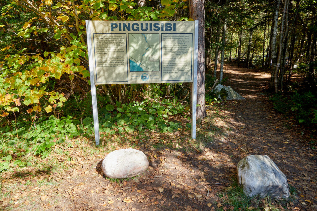
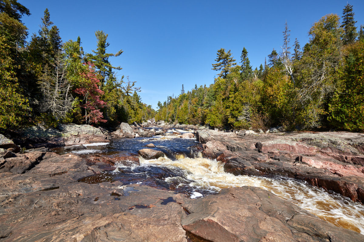
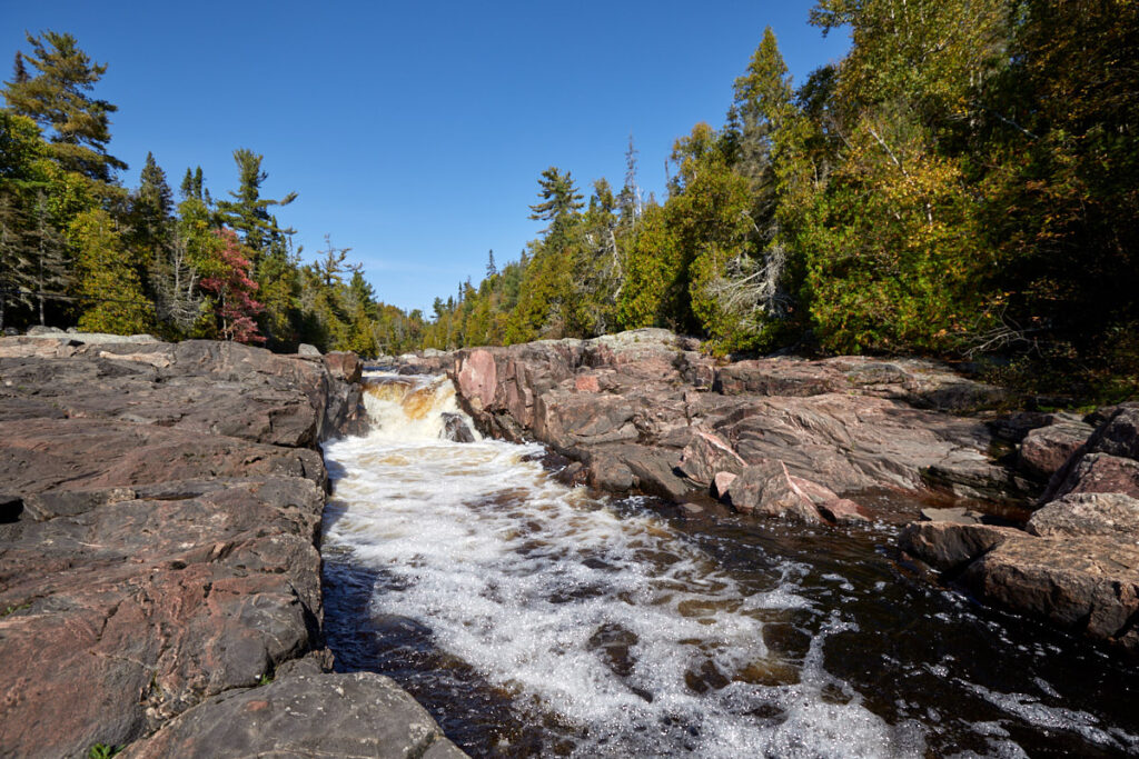
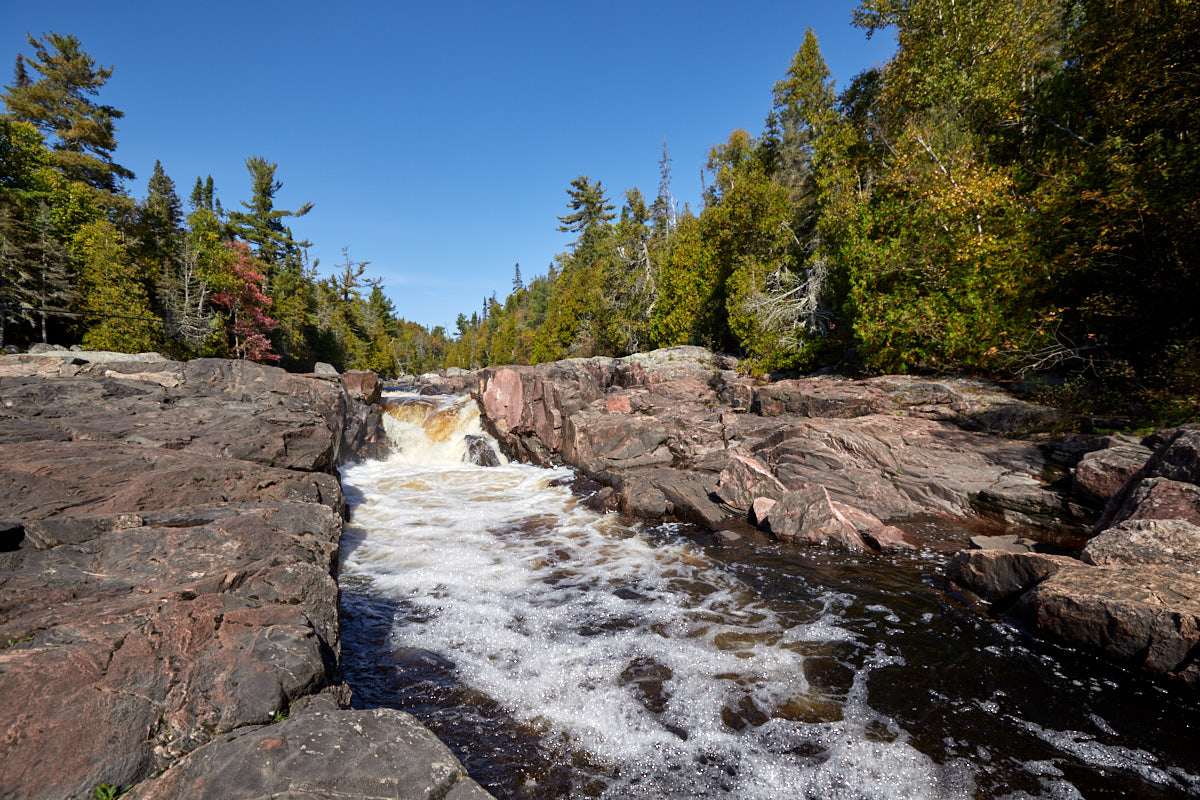
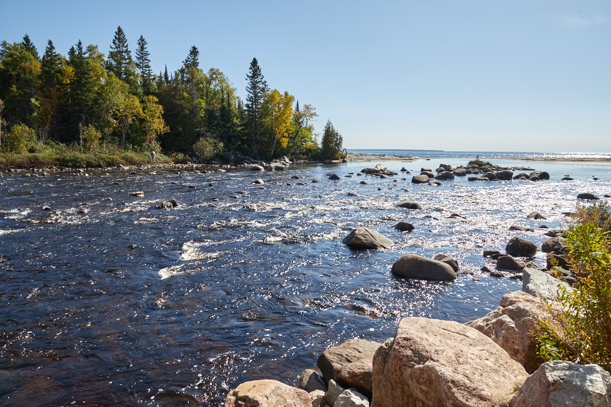
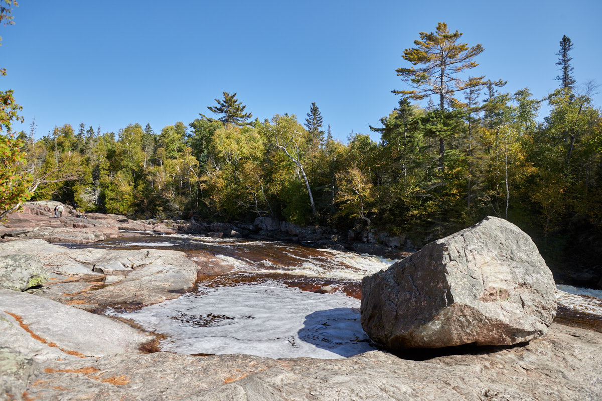
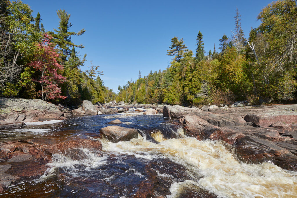
Description: A picturesque river that flows from the northeastern edge of the park to Lake Superior. As the river drops about 185 m in elevation from Sand Lake to Lake Superior, there are several sections with rapids and waterfalls. You can basically hike up the Sand River as far as you want. Every 2 km or so, you will see new rapids and small waterfalls.
Trail length: as far as you like Altitude difference: max.185m Time needed: 1-2 hours depending on the distance Difficulty level:moderate
Our rating: Due to time constraints, we only walked as far as the first rapids, but even that was very nice and a good opportunity to stretch our legs.
☆☆☆☆☆Bewertet mit 3.5 von 5
Sand River Falls
Sand River Falls
Sand River Falls
Sand River Falls
Sand River Falls
Sand River Falls
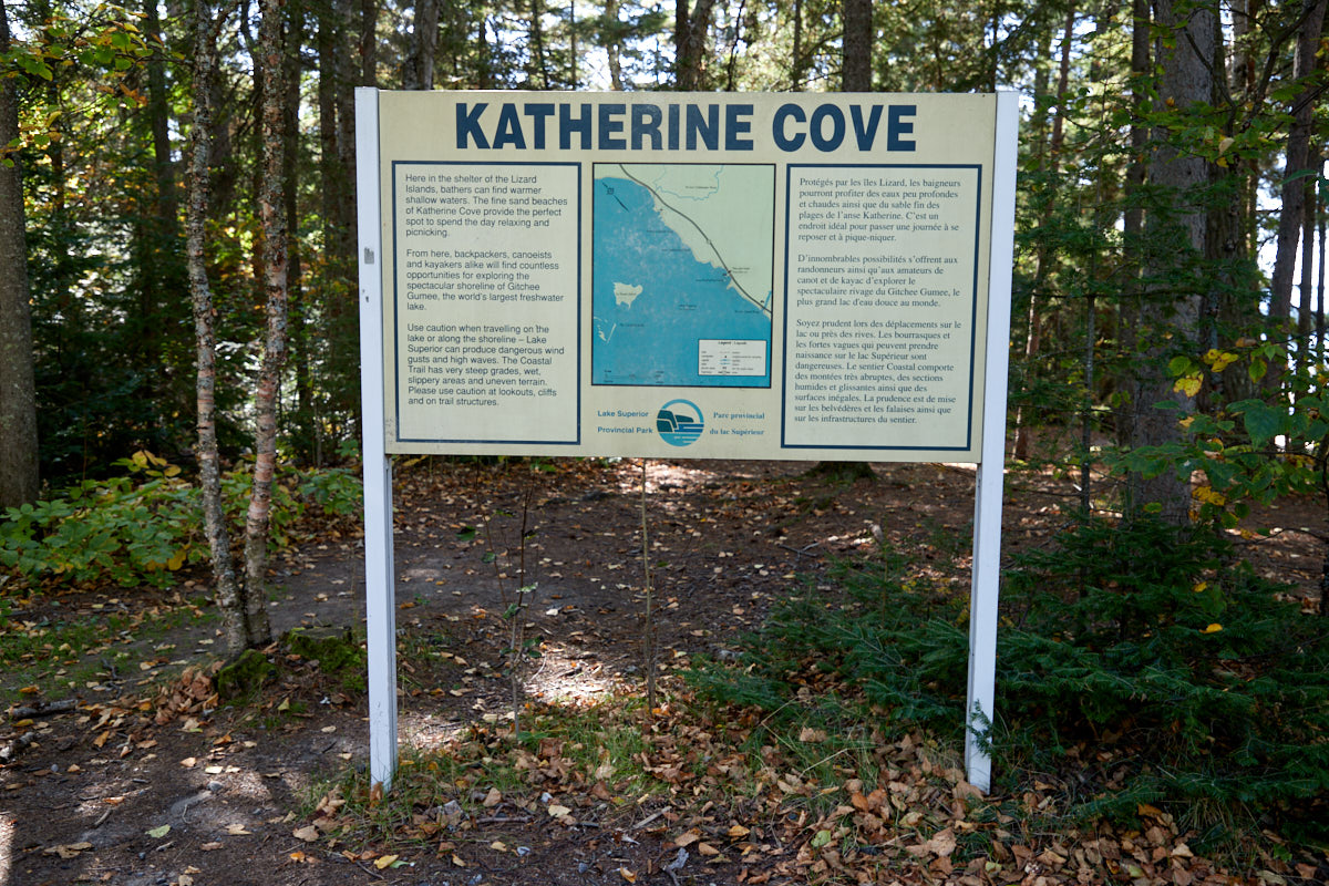
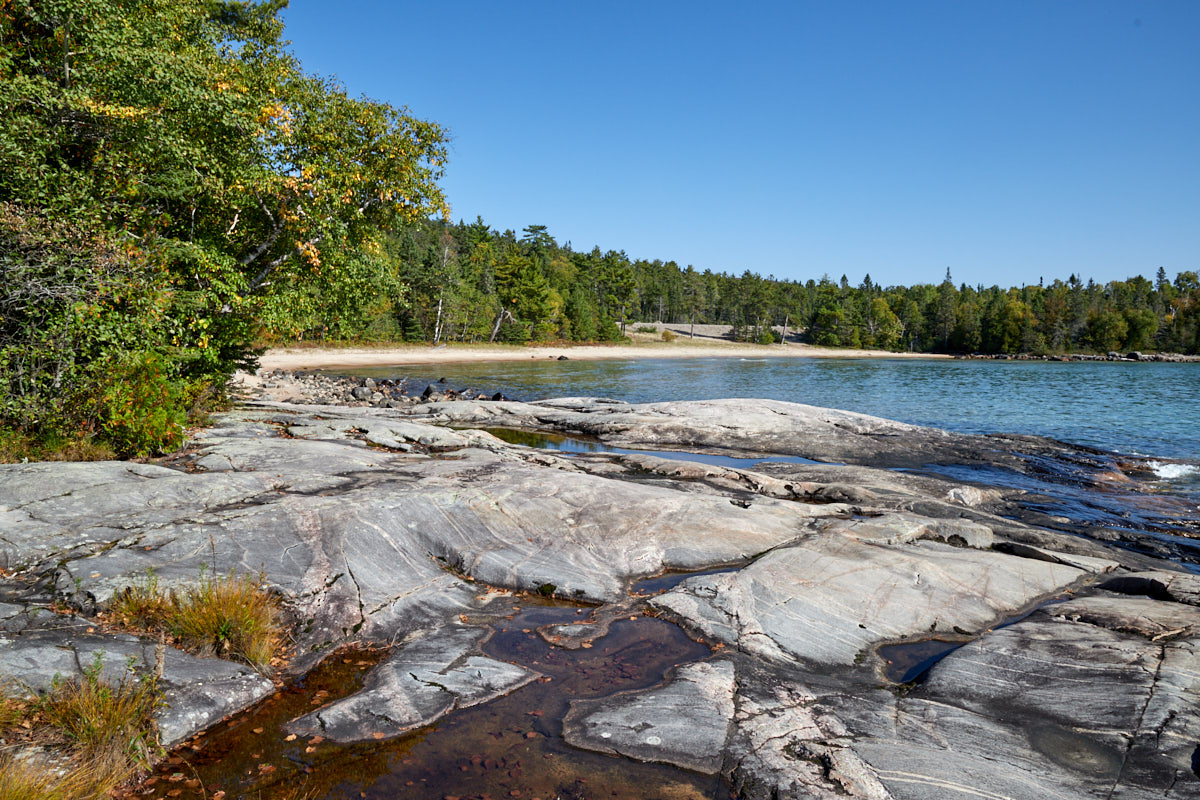
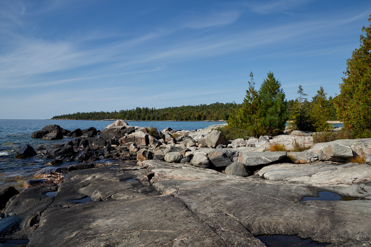
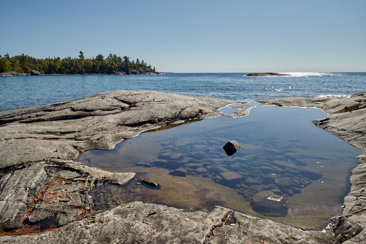
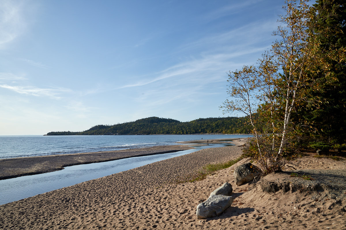
Katherine Cove
Description: Katherine Cove ist einer der Buchten die der Lake Superior hier im Provincial Park bildet. Man findet hier unter anderem einen schönen Sandstrand der im Sommer sicher zum Baden einläd.
Our rating: Netter Halt mit einem malerischen Strand.
☆☆☆☆☆Bewertet mit 3 von 5
Katherine Cove
Katherine Cove
Katherine Cove
Katherine Cove
Mist Fantasy 1922, J.E.H. McDonald
Katherine Cove
Katherine Cove
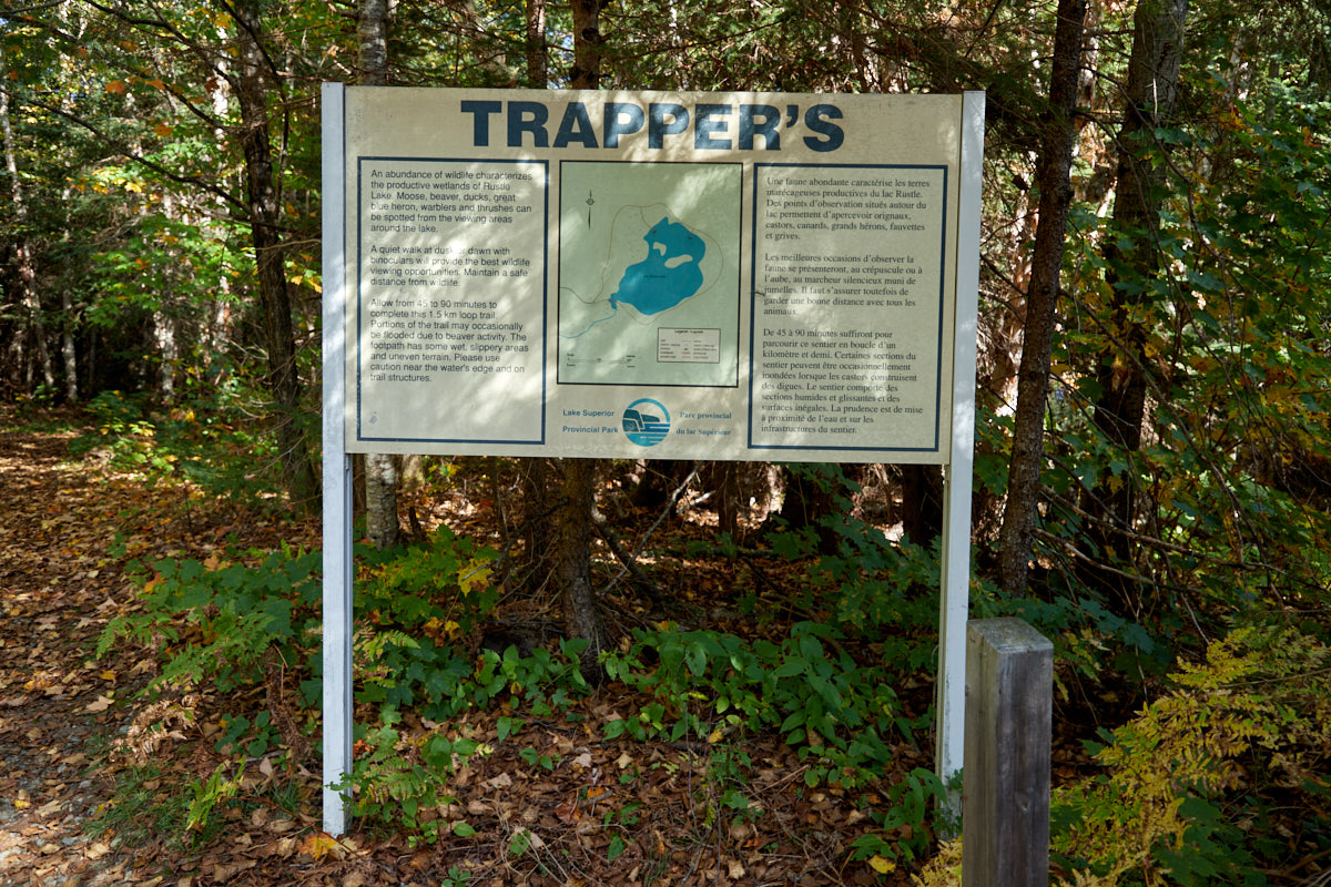
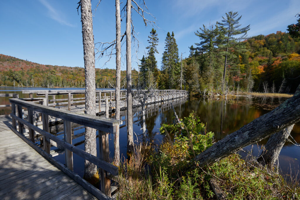
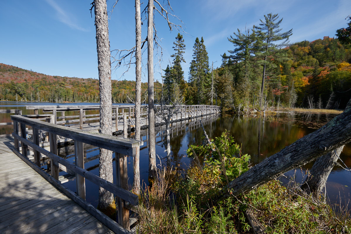
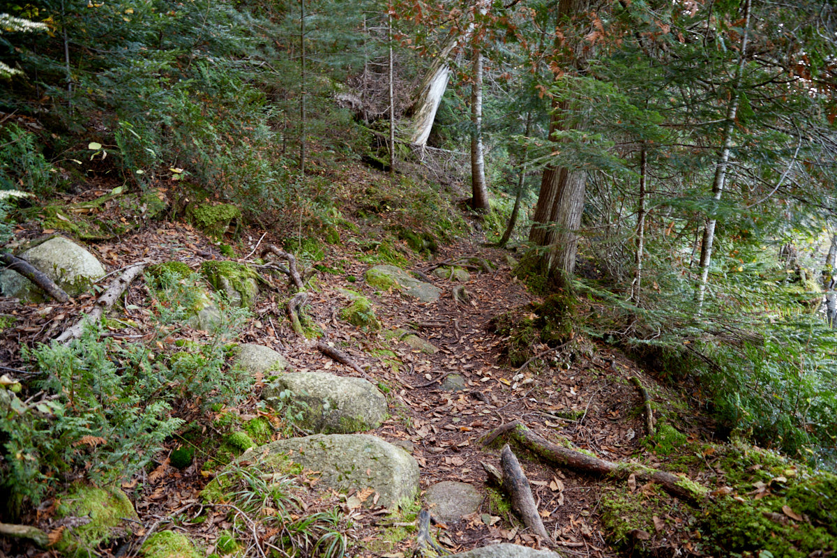
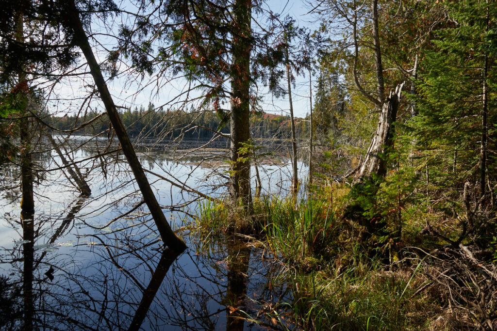
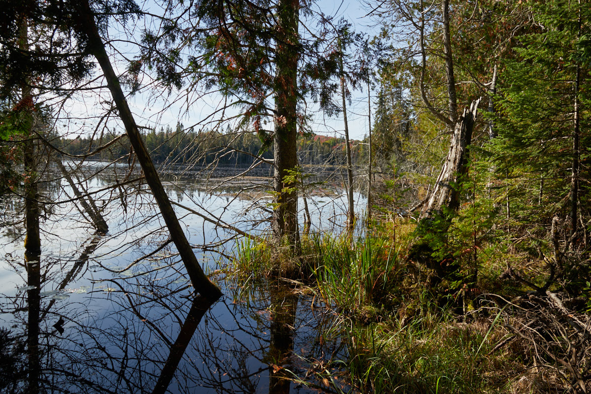
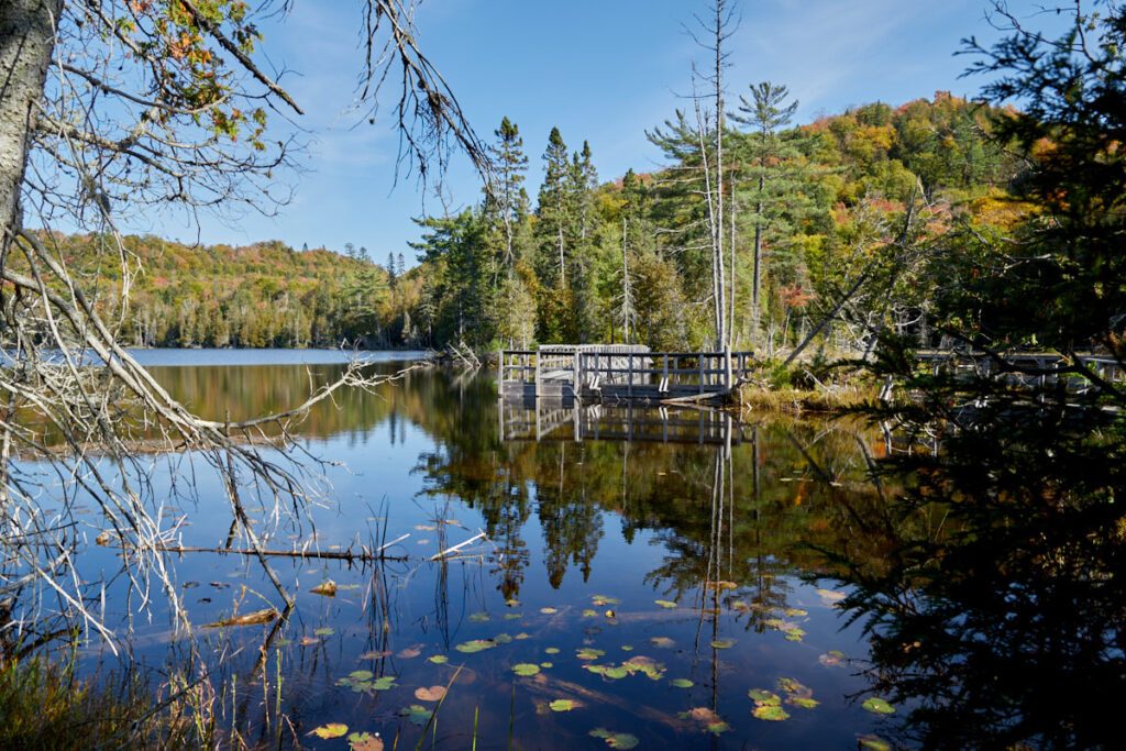
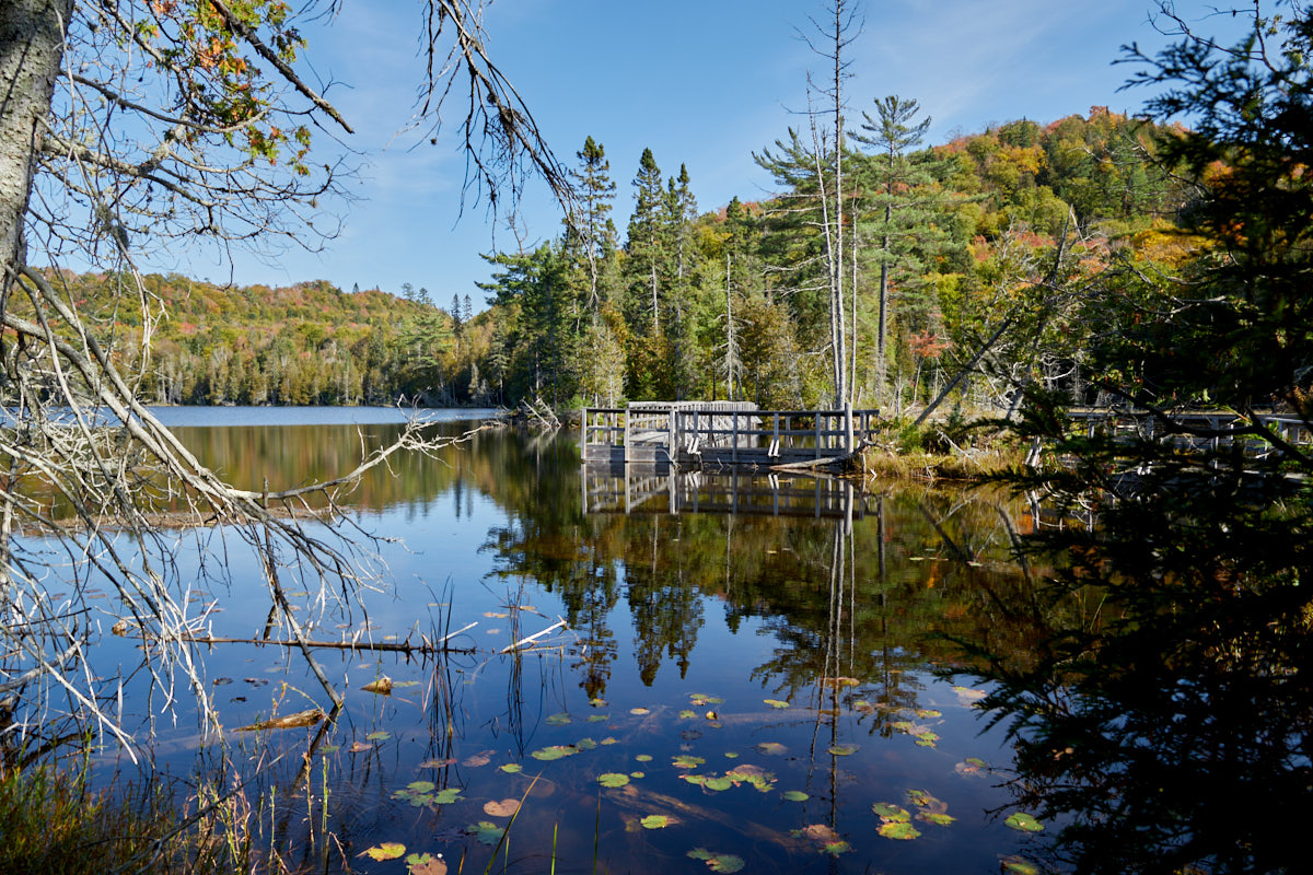
Trapper´s Trail
Description: The hiking trail follows the shore of Rustle Lake and includes two viewing platforms and a floating wooden walkway, from which you can theoretically observe various wildlife such as beavers, otters, martens, gray herons, and moose. The forest trail was easy to walk on, but because it had rained in the days before, some areas were flooded and very muddy.
Trail length: 1.5 km round trip Altitude difference: – Time needed: 1h Difficulty level:easy
Our rating: A forest path around a lake, nothing more, nothing less. Quite nice for a short walk. We didn't see any animals.
☆☆☆☆☆Bewertet mit 3 von 5
Trapper´s Trail
Trapper´s Trail
Trapper´s Trail
Trapper´s Trail
Trapper´s Trail
Trapper´s Trail
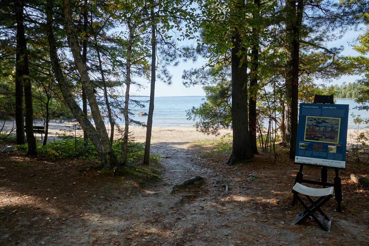
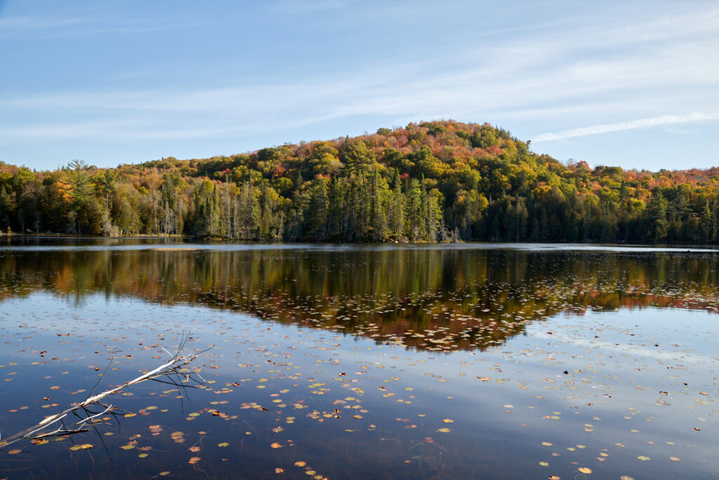
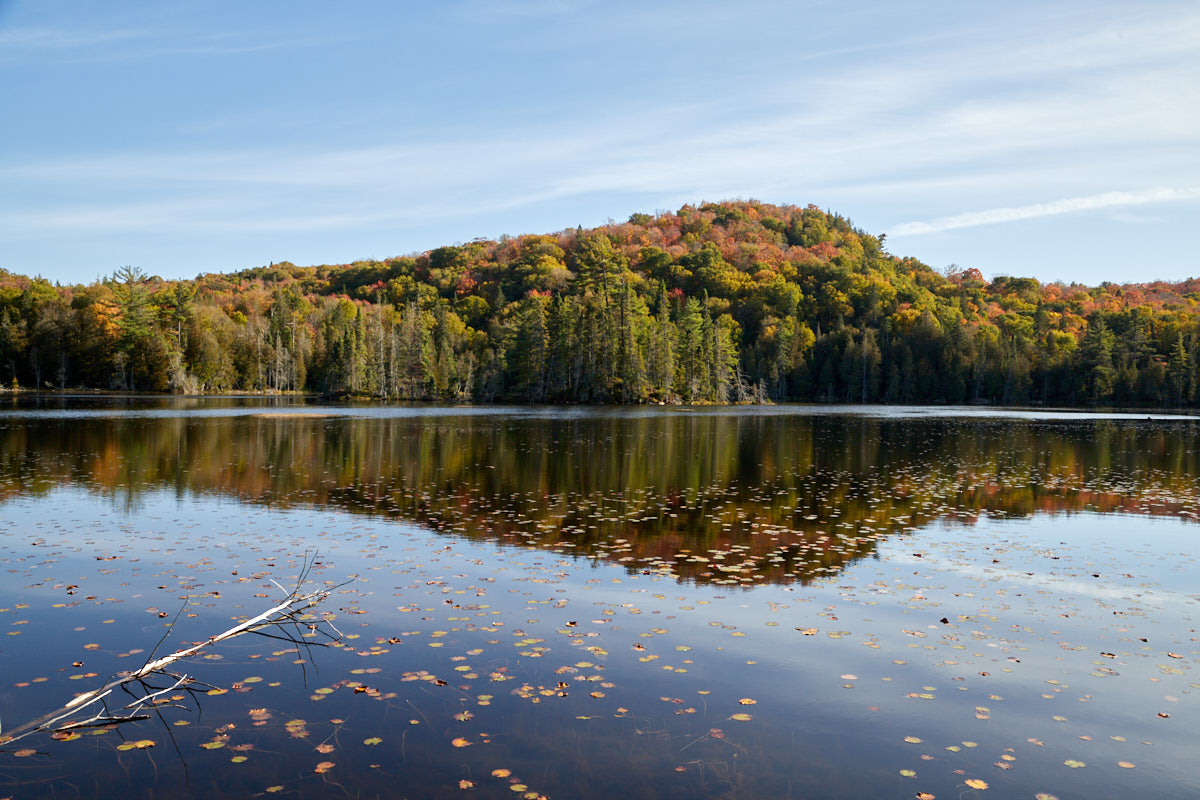
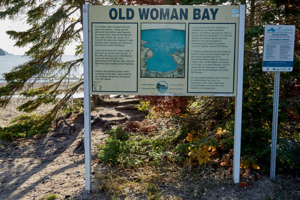
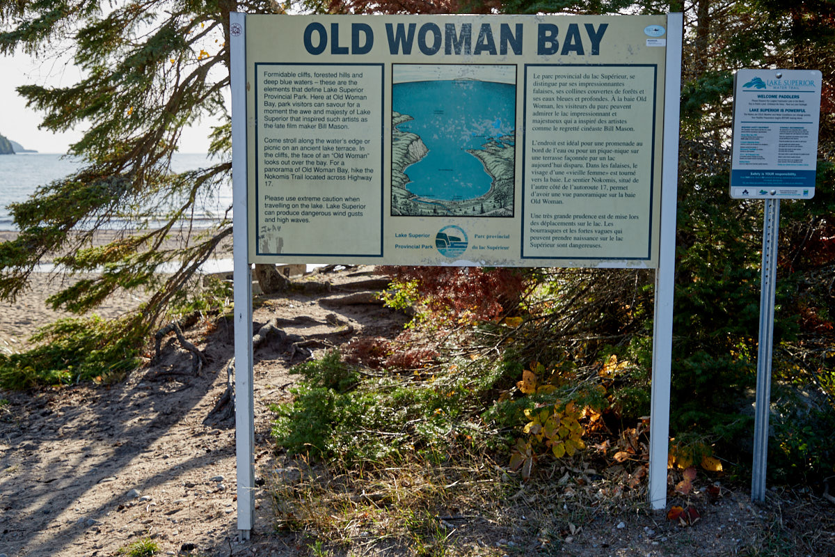
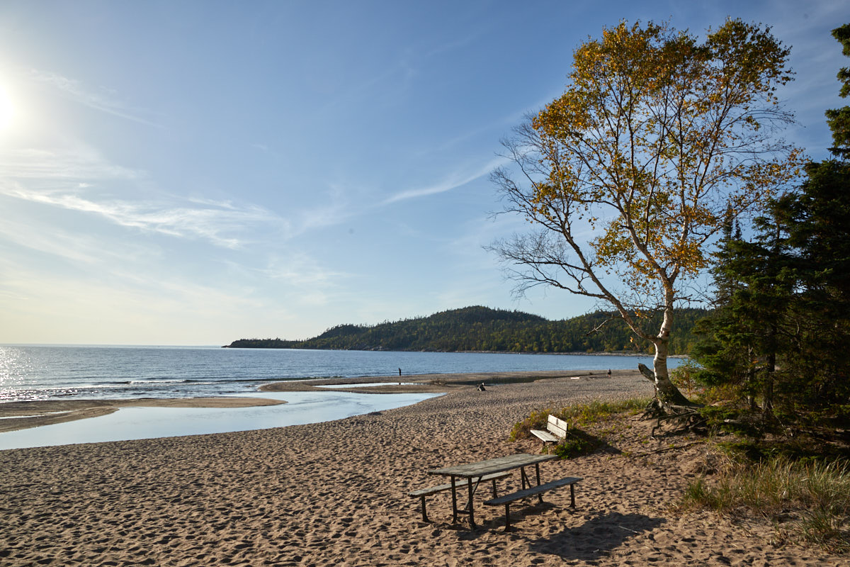
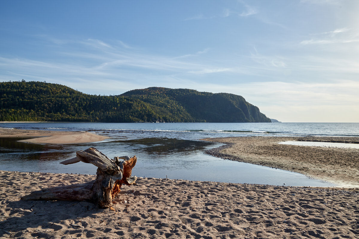
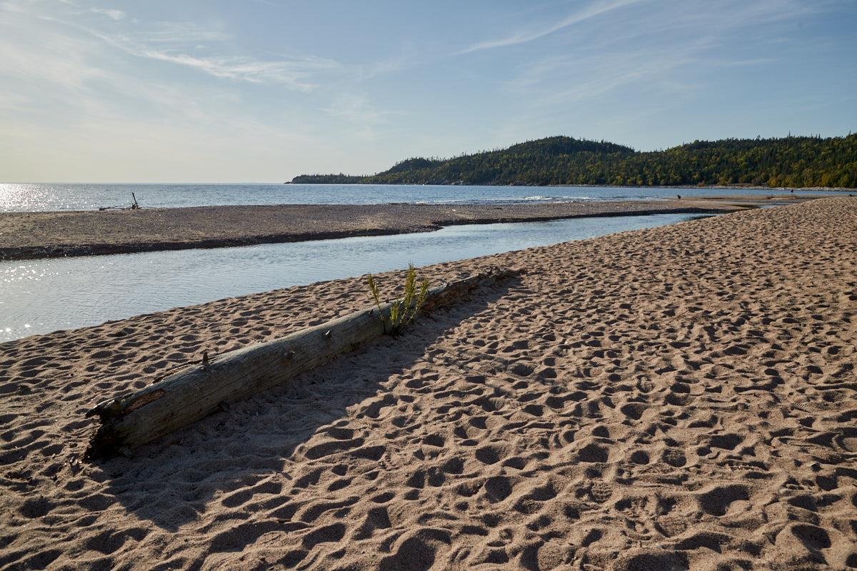
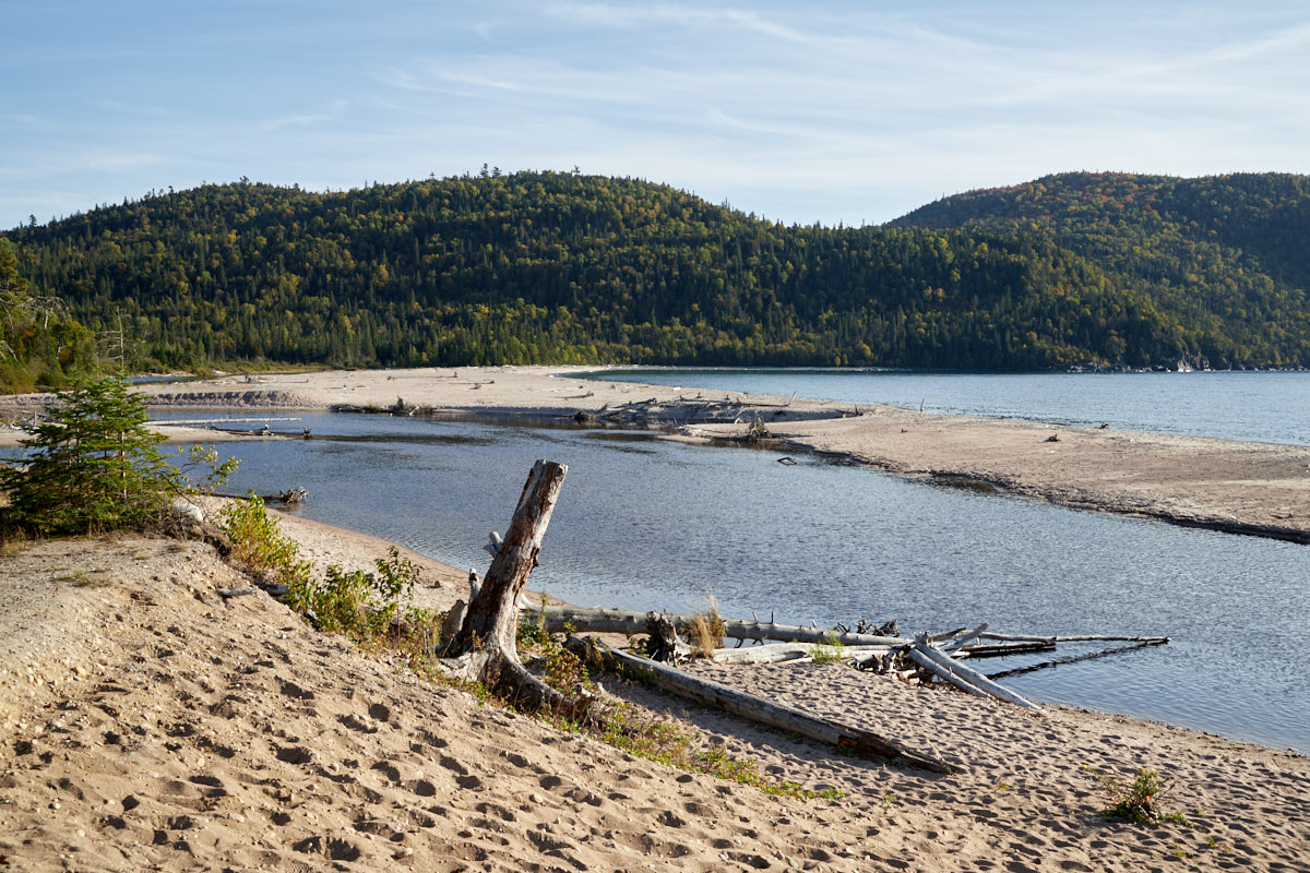
Old Woman Bay
Description: One of the highlights of the park. A picturesque bay framed by the typical high cliffs of northern Lake Superior. The beautiful sandy beach is a magnet for swimmers and campers in summer.
Our rating: A beautiful place to relax and let your eyes wander over the lake. Definitely worth a stop.


